Trek difficulty
Moderate - Difficult
Trek duration
7 Days
Trek altitude
13,325 ft
Group size
6-12
Trek distance
50 km
Basecamp
Chandimarh
Best Time
July to September
Pickup Point
Srinagar
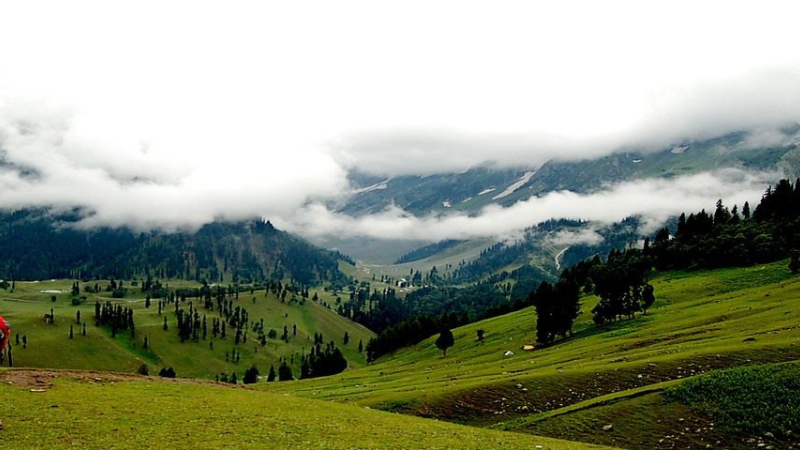
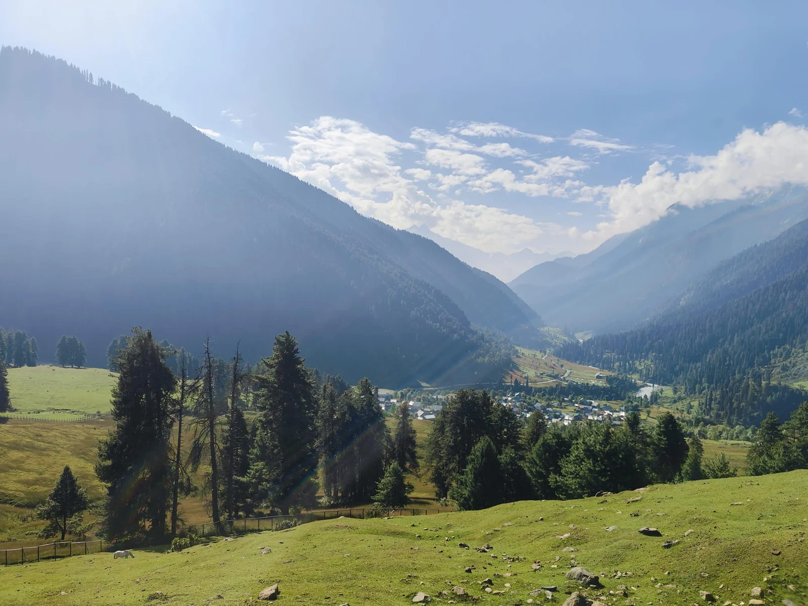
Pir Panjal Lakes, hidden gem in the remote regions of Jammu and Kashmir, India, is an important destination for trekkers and outdoor lovers. These serene and scenic lakes, which are part of the larger Himalayas, have a breathtaking natural beauty that creates a beautiful backdrop of soaring peaks and rich greenery. Surrounded by a prominent mountain range named Pir Panjal, in the Himalayas, is a part of the pristine Himalayan ecosystem and a home to diverse wildlife. Witnessing rare flora and stunning landscapes here is a dream for many nature lovers.
This blog contains the complete guide to the best hiking destination in Kashmir. Hope it is helpful for your upcoming trek.
A background on Pir Panjal
The Pir Panjal range forms the southwestern boundary of the Kashmir Valley, separating it from the hills of the Jammu region, forming a divide between the Jhelum and Chenab rivers.
Deo Tibba (6,001 m (19,688 ft)) and Indrasan (6,221 m (20,410 ft)) are two important peaks at the eastern end of the mountain range.
The Mughal Road links Rajouri and Poonch with the Kashmir valley through the Pir Panjal Pass, commonly known as Peer Ki Gali. Situated southwest of the Kashmir Valley, at 3,490 meters (11,450 feet), it is the highest point on the Mughal Road. Shopian is the town closest to the pass in the Kashmir valley.
The Munawar Pass (altitude 3,600 m (11,800 ft)) is a pass north of Peer Ki Gali, overlooking Rajouri.
Location: Chandimarh, Rajori at Noori chasm, Mughal Road, Kashmir.
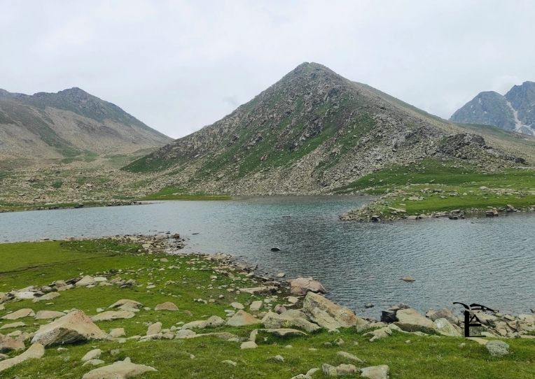
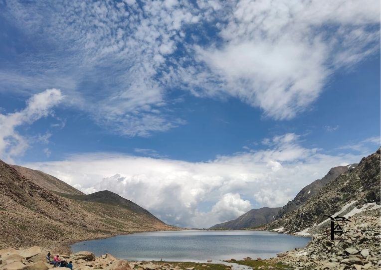
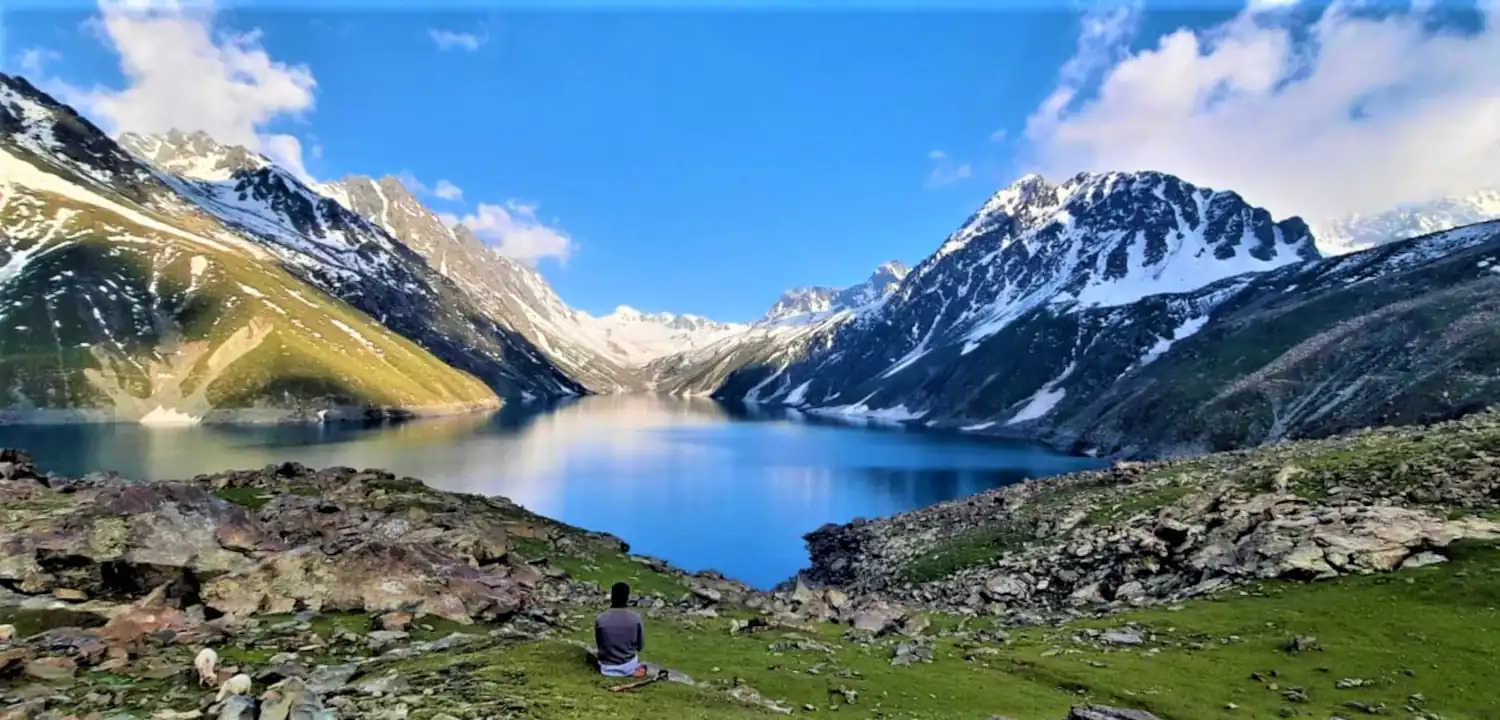
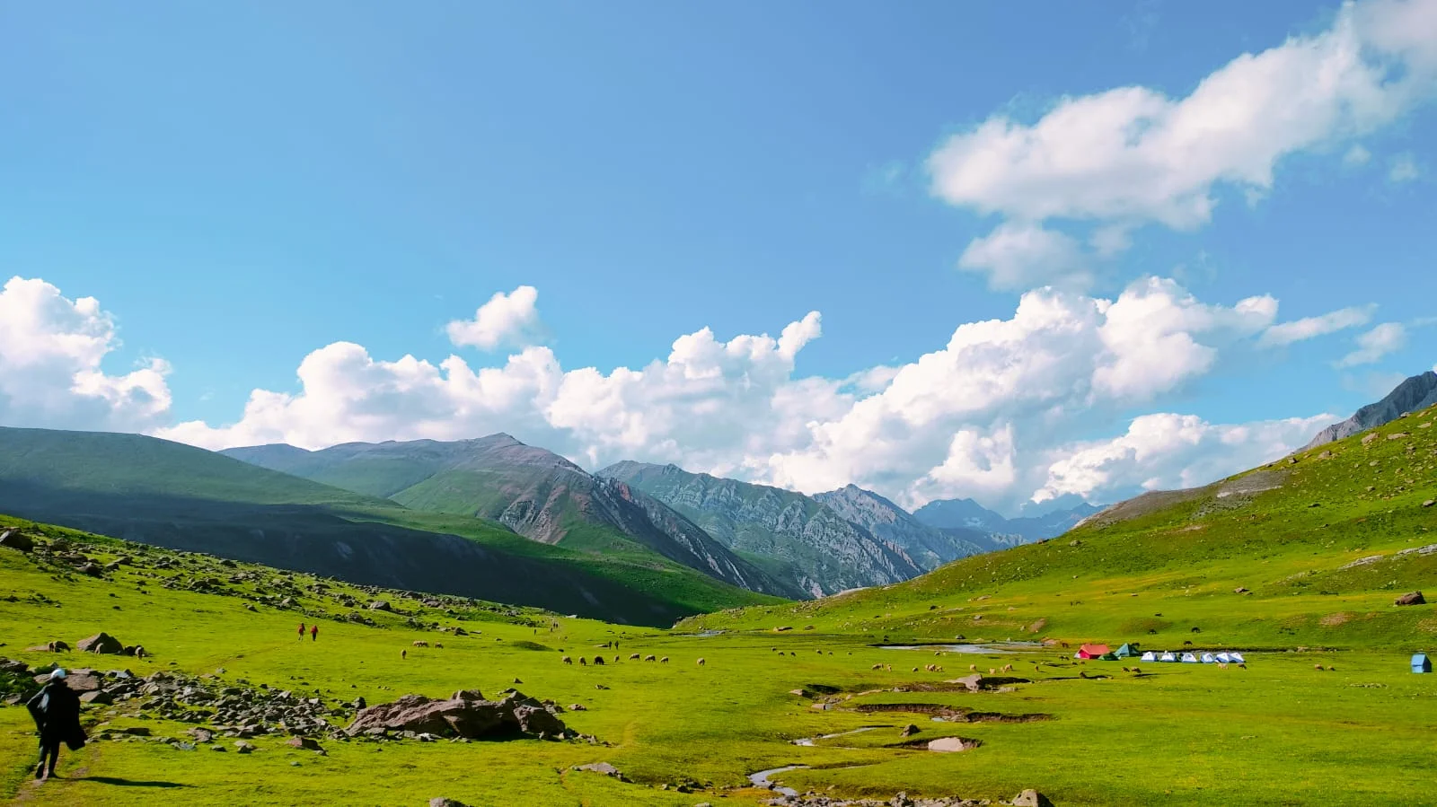
Talking about the Pir Panjal trek, there are around 21 lakes in this range, including some of the most prominent lakes, like, Neel Sar, Bag Sar, Katoria Sar, Nandan Sar, Gunn Sar, Sukh Sar, and Kaldashni Sar.
Key Highlights-Pir Panjal Trek
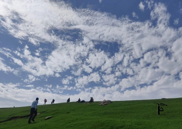
· It is a passage to famous high-altitude passes once taken by Emperors, offering trekkers a chance to traversing through living history.Visit some hidden network of lakes that offer little to sustain life, including the sectors of Poonch and Budhal. The lakes here mirror the sky deep on their crystalline-blue water. Trek through expansive, untouched high-altitude grassland (meadows) that serve as a lush, flora-carpeted shift between dense forest and the jagged terrain.
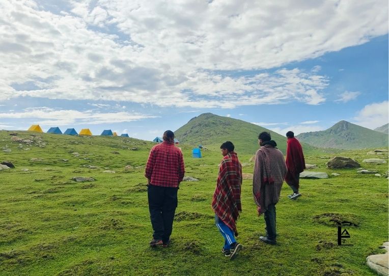
· Experience a theatrical contrast standing on both sides of the ridge serving as unique vantage point- Kashmir Valley on one side and barren peaks of the Greater Himalayas on the other.Enter the livelihood of nomads from Bakarwal and Gujjar tribes who change location on the season change-centuries old tradition tied to the land.
· Walk the trail carpeted with Deodar and Blue Pine needles where the air is filled with strong mountain resin scent.Get the intimate exposure to amphitheater-like basin where headwaters (Jhelum and Chenab rivers) are fed by hanging glaciers.
Passes at Pir Panjal Lakes Trek
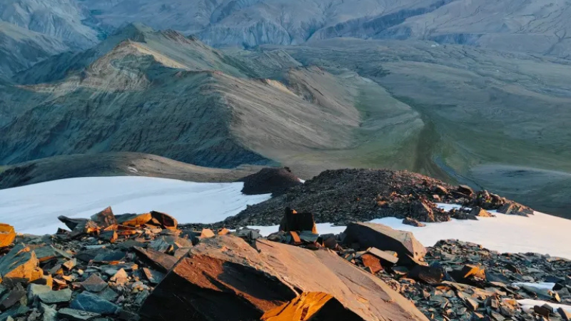
The Pir Panjal Trek covers numerous high-altitude passes, offering amazing panoramas of the surrounding mountains, valleys, and alpine lakes. A few of the notable passes of this trek are Kalihani pass, Bagsarai pass, Darmani pass and Rathian pass.
Crossing the passes of the Pir Panjal Trek is going to be difficult for your breath, but if you have been acclimatized properly for the high elevation, this is going to be a rewarding journey, providing you some of the most stunning views of the Pir Panjal mountain range.
Flora and Fauna
The Pir Panjal Lakes Trek, located in Jammu and Kashmir's Pir Panjal mountain range, is home to a diverse range of flora and fauna where alpine meadows include wildflowers such as bluebells, asters, poppies, primulas and rhododendrons. You will also encounter high-altitude shrubs and grasses, like broom and juniper.
In lower forested areas you will see Himalayan trees, such as Deodar, Pine and Chir Pine trees. As you ascend to the slightly higher altitude, Maple and Oak trees will be visible.
The incredibly diverse fauna of Pir Panjal Trek offers nature lovers the chance to experience the wildlife of the area. Himalayan brown bear, Monal, musk deer and mountain goat are few to name.
Weather at Pir Panjal Trek
Weather in mountain regions can surprise you suddenly, so, regardless of the peak season, it is always a good idea to be ready for rapid changes in temperature.
Tips and Precautions-Pir Panjal Trek
· Acclimatize well before the trek journey to avoid altitude sickness.
· At high altitudes, the weather changes quickly-be prepared for the sudden snowfall, heavy winds and rainfall.
· For difficult terrain like Pir Panjal lake trek, it is advisable to be physically fit, especially while crossing the passes.
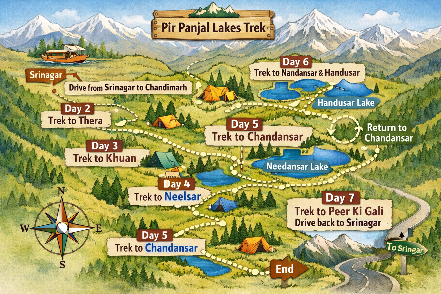
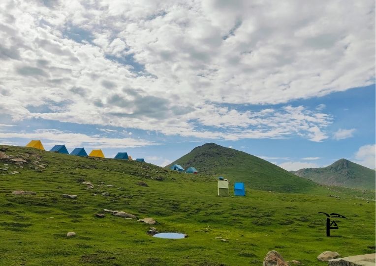
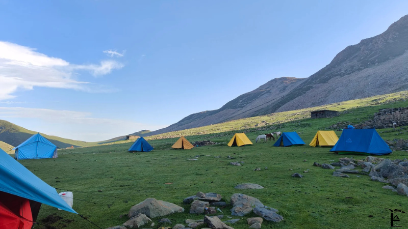
Day 1- Drive from Srinagar to Chandimarh
Day 2- Trek from Chandimarh to Thera
Day 3 - Trek from Thera to Khuan
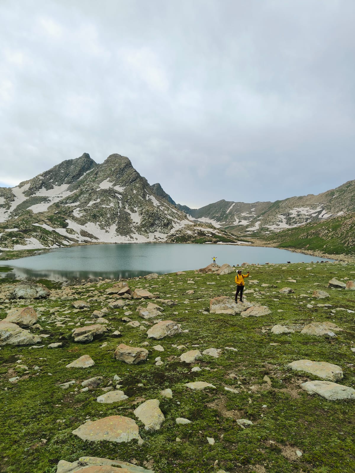
Day 4 - Trek from Khuan to Neelsar
Day 5 - Trek from Neelsar to Chandansar
Day 6 - Trek from Chandansar to Nandansar via Handusar and back to Chandansar
Day 7 - Trek from Chandansar to Peer Ki Gali. Drive back to Srinagar.
Best hiking in Jammu and Kashmir- The journey begins here.
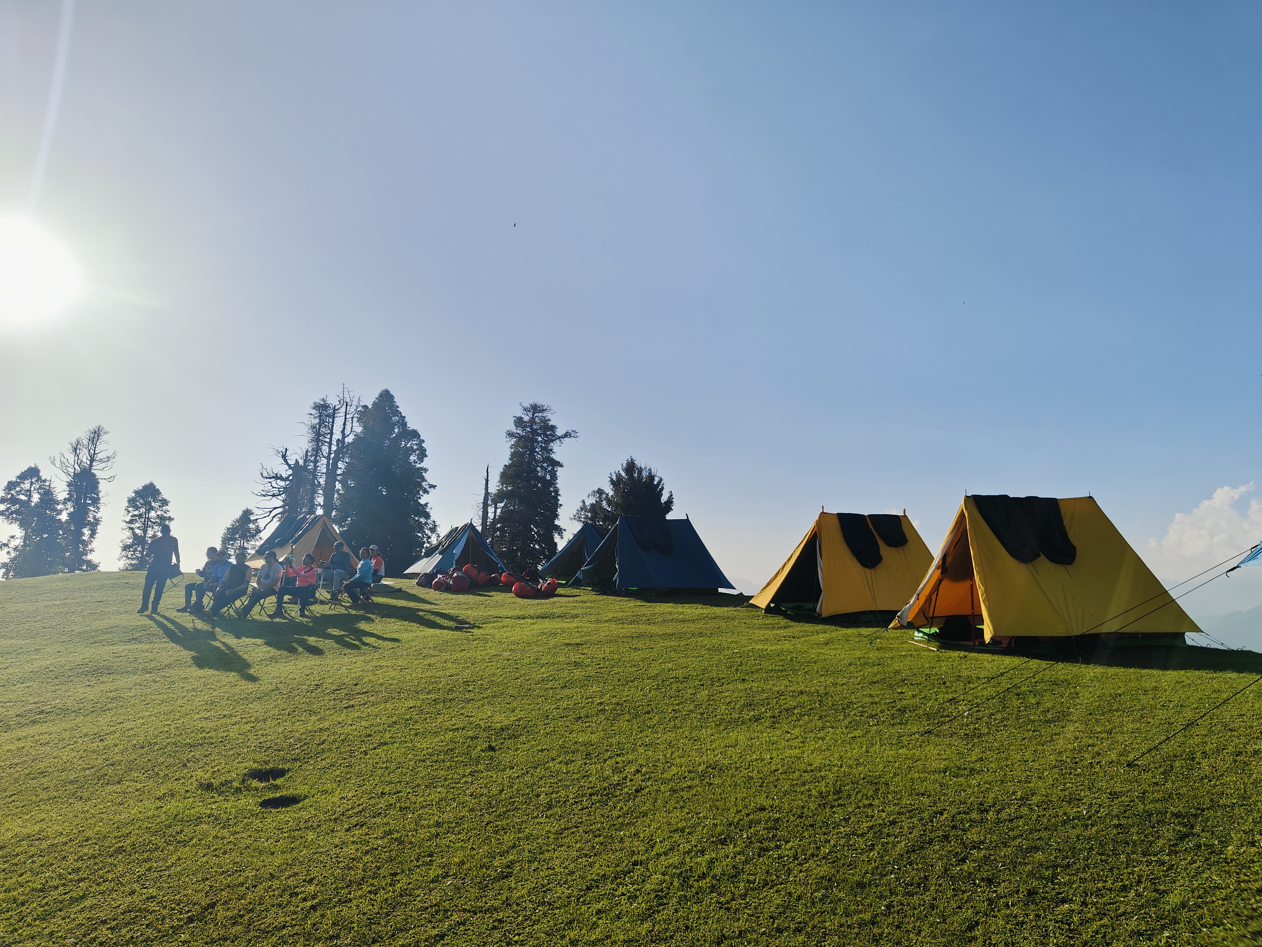
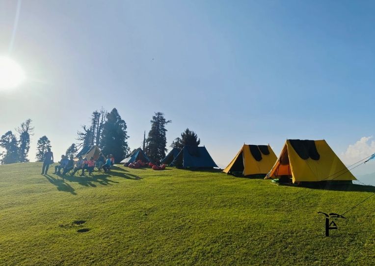
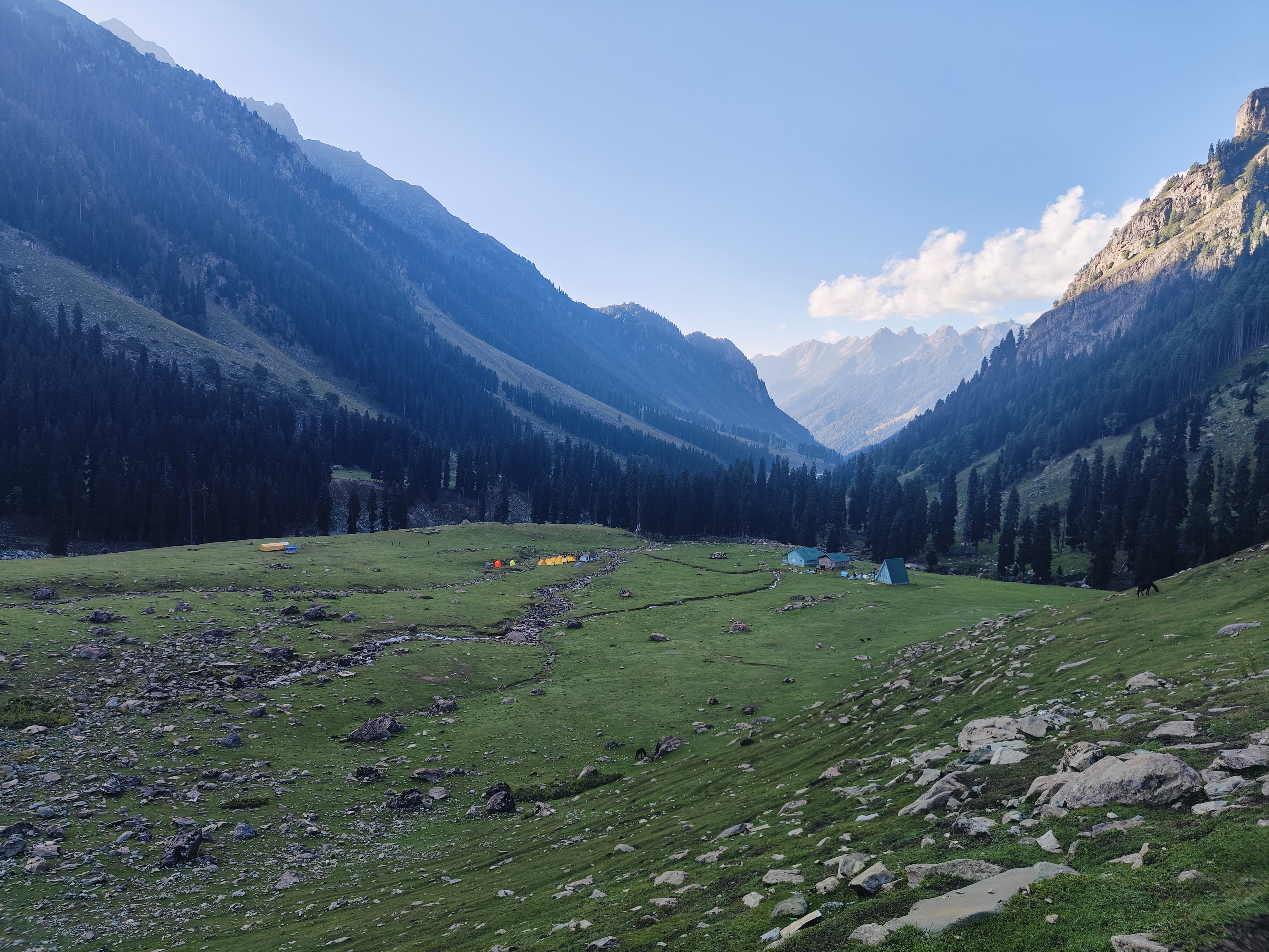
Chandimarh is a remote place not well-known among travelers, has a decent guest house which also serves fresh home-made food. The property is looked after by the locals. This is going to be your first stay.
Treks are never meant to be luxurious; in fact, they bring you out of your comfort zone, pushing your mental and physical limits to the level where you will start appreciating nature.
During your Chandimarh stay, you can visit Noori Chaam (chaam stands for source of water in Kashmir), waterfall. This waterfall is pretty famous among locals, making it a great escape for your family and friends. From Chandimarh, the Pir Panjal lakes trek trail will start and end at Pir ki Galli, Mughal Road.
The best time to visit Pir Panjal Lakes is from late June to September, with each month offering a unique experience:
Ideal Trekking Window
July to September is the best time, bringing pleasant weather in summer and monsoon, with chilly winds during early autumn in September, and temperatures ranging between 20°C to 25°C during daytime and 2°C to 10°C at night .
Why This Season?
While most treks in Uttarakhand and Himachal Pradesh become risky during monsoon, Jammu and Kashmir offers the best trekking conditions during this season because Pir Panjal Lakes lie on the leeward side of the mountain, receiving less rainfall with dry and warm winds . The Pir Panjal range prevents most rain clouds from reaching the valley, making for a comfortable trekking experience.
Month-by-Month Breakdown
Late June to Early July: You can expect to see remnants of snow by the highest lake Nandansar, and may even see melting ice floating in the lake, offering a fleeting glimpse of the landscape that remains buried under snow for the rest of the year. Ice floats in larger lakes during June and July, which enhances their beauty .
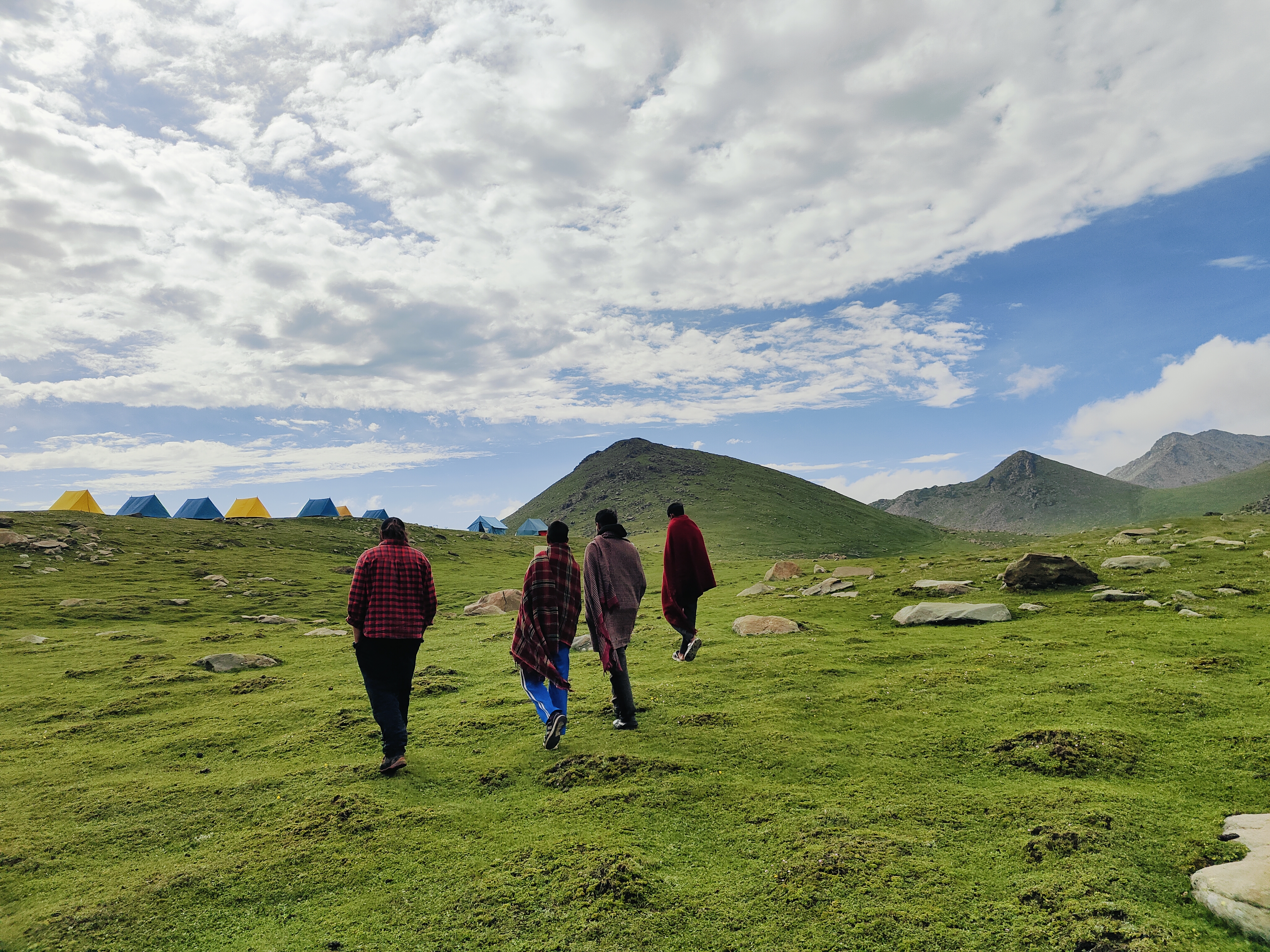
Mid-July to August: The snow has almost melted and the trail is carpeted with bright green meadows in contrast with rugged grey mountains, with meadows densely dotted with wildflowers, and the Pir Panjal Lakes Trek starts revealing itself in full glory after mid-July . This is when you can experience shepherds' huts, with shepherds accompanying you on trails, and you can stay at their Dhoks as they take their livestock to meadows for grazing during summer and monsoons .
September: Shepherds start moving downhill in the last week of August , and early autumn brings chilly winds with changing colors in the landscape.
The Pir Panjal Trek is rated as moderate to difficult, making it ideal for experienced trekkers with good fitness levels and endurance. Here's a detailed breakdown:
Difficulty Rating
The trek is moderate to difficult in terms of walking difficulty, ideal for experienced trekkers with optimum fitness levels and endurance. It's a level 4 trek on the Bikat Rating Scale, making it mandatory to have high-altitude experience of preferably multiple treks marked at level 5.
What Makes It Challenging
Steep Terrain: The trek becomes difficult because 90% of its trail is on ascents, descents, passes, and boulder fields . You can gain between 2,500 and 3,000 feet of altitude every day .
Rocky and Rugged Terrain: One of the biggest factors is the rocky and rugged terrain, with unmarked trail sections featuring expansive boulder fields and moraine that include scree and loose gravel which may topple and knock the person behind you, becoming muddy and slippery when it rains.
Altitude Concerns: You must be cautious because you may experience AMS (Acute Mountain Sickness) as the altitude gain increases, and there's risk if you shorten the itinerary by skipping camping at one of the campgrounds . The trek reaches a maximum altitude of 13,330-13,730 feet.
Long Daily Distances: The real difficulty comes from the long distances, with almost every day trekking 8 to 10 km, sometimes even 12 to 13 km. With an average of 8-9 kilometers of trekking per day, the trek usually covers a total distance of 52 kilometers over 7 days .
Multiple Pass Crossings: Be cautious on the steep climb and descent to and from Nandansar, which is lengthy and challenging, especially if there is a whiteout on the trek or you are descending during the rain .
Here's how to reach the Pir Panjal Lakes trek base camp:
The best way to reach Chandimarh is to hire a taxi from Srinagar. The phone reception will start getting weaker as you progress. This is the time to connect with nature. After crossing Sophian, you will witness one of the best views of the higher mountains at Pir ke Galli. If time allows, you can visit Sarayee to see how Mughals used to live in the ancient days.
Two Main Gateway Cities
There are two ways to reach the Pir Panjal Lake basecamp - one is from Jammu and another is from Srinagar via Pulwama, however reaching basecamp via Srinagar is the best option.
Srinagar to Chandimarh Base Camp (Recommended)
Distance & Time: 127 km drive that takes approximately 4 hours from Srinagar.
Route: Srinagar → Pampore → Ratnipora → Pulwama → Rajpora → Hirpora → Shopian → Chandimarh . While traveling from Srinagar to Chandimarh, you will cross the historic Mughal Road, which is the same route followed by Mughal rulers to reach Srinagar from Agra via New Delhi .
Due to the sensitive and strategic border location, the Indian government requires a trek permit.
To get the permit for Pir Panjal Lake you will need to submit 3 documents:
· ID (Aadhar/ Passport) original. Trekkers must carry this document with them all the time.
· Trek insurance from recognized trek insurance providers, such as Bajaj Finserv or ASC36. Trekkers are advised to read the policies carefully.
· Medical Fitness Certificate (signed by any recognized doctor).
Visit the nearest DC or SDM office with all the required documents. Get the assistance of local guides or trail experts for all the paperwork. Make sure you have all the local documents at the time of renting a horse for the trek. Once the documents are verified, they will be transferred to the higher authorities stationed in the Pir Panjal mountain range. Once verified, you will receive your permit. Trekkers will need to show their permit to the local police at the army checkpoint and other details if requested.
Chandimarh is one of the checkpoints where you will be asked to show a copy of your permit. A few more check posts you will encounter during the beginning of the journey where a copy of the permit along with a day-wise itinerary will be submitted.
Inclusion
During The Trek-Exclusion
As you are aware, security issues and government orders might result in the cancelation of Pir Panjal Lake Trek due to safety concerns. Our trekkers are given the option to choose any different trek in the same location as most treks in Jammu and Kashmir have the same duration.
The best months to visit the Pir Panjal Lakes Trek are mid-July to mid-September. During this time, the snow usually melts, revealing lush meadows and gorgeous alpine lakes, making it excellent for hiking. Temperatures are normally mild around this time, and meteorological conditions are more predictable.
There are 2 ways to reach Pir Panjal Lake Basecamp. One is from Jammu and another is from Srinagar via Pulwama However, reaching basecamp via Srinagar is the best option.
The steep ascents, high altitude and rocky terrain make Pir Panjal Lake Trek moderate to difficult. However, it all depends upon one’s hiking experience and fitness level.
With an average of 8–9 kilometers of trekking per day, the Pir Panjal Lakes Trek distance usually covers a total distance of 52 kilometers over 7 days.
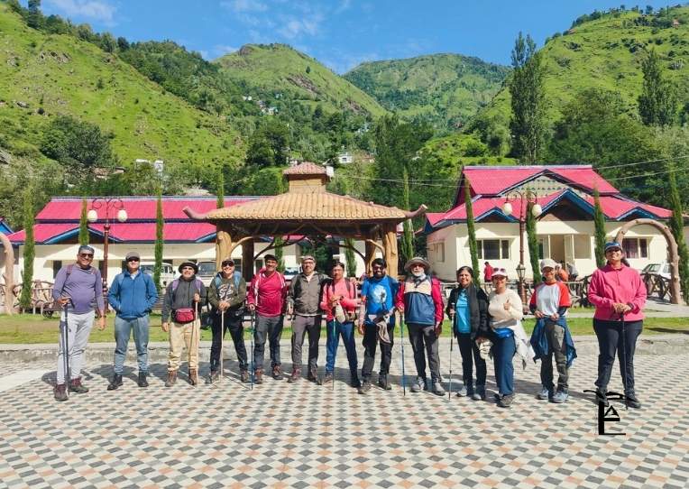
This was the complete guide to the best Trekking destination in Jammu and Kashmir. Our team of professional mountaineers has guided multiple batches in the Pir Panjal Lakes in Rajori, Kashmir. Our responsible team will ensure the overall safety, enjoyment and make your trek successful. We have been managing small to big groups for the past 6+ years and helping trekkers from all around the globe complete their expeditions while handling unexpected adventures coming along the way and turning them into beautiful memories.
₹22000 | $240
7 Days
Kashmir
72
June to September
₹25000 | $261
9 Days
Ladakh
65Km
July to September
₹28000 | $306
7 Days
Kashmir
56 Km
June to October
₹22000 | $218
7 Days
Kashmir
50 km
July to September
₹18000 | $300
7 Days
kashmir
48 KM
June-Sep
₹23000 | $251
7 Days
Kashmir
68 Km
June to October
₹20000 | $218
9 Days
Ladakh
40 Km
July to September
₹20000 | $219
7 Days
Kashmir
48 Km
June to September
₹15000 | $164
7 Days
Kashmir
30 Km
July to October
₹16000 | $175
5 Days
Kashmir
32 Km
June to September
Testimonials

Rakesh dulams
Nice experience with the thinAir expedition and accommodation and hospitality and safty such as taken personal care and well experienced guide and such a cool guy

Aditi 99
I had an amazing experience with thin air expeditions. The food, the hospitality, and the preparedness of the staff for all sorts of scenarios was commendable. The location of camps was perfect. Even though i was a female solo traveller , i felt very safe and comfortable. Couldn’t have asked for a better team.

Radandi Shashank
“You are not just a mountain trek guides, but a true guardian of the journey. Your unwavering loyalty to our team, the mountains, and safety itself is extraordinary. Every step felt secure because of your dedication, integrity. And stayed committed to every trekker, through every challenge, with patience, care, and honesty. Huge respect to Subodh Jii n Aditi Mam!! Thank youu @thinairexpedition It was wonderful experience!!❤️❤️

67D3_KALYAN
Completing the Kedarkantha trek at an altitude of around 12,500 feet was not just a trek for us, it was a life-long memory, and a major reason for this unforgettable experience is our guide Shubhod Sir. From the very first day till the summit, Shubhod Sir guided us with immense patience, discipline, and genuine care. At every difficult patch, when our legs were tired and breathing became hard, his calm words, constant motivation, and confident leadership gave us the strength to keep moving forward. He never rushed anyone and always made sure that every member of the group was safe, comfortable, and mentally strong. Shubhod Sir’s knowledge of the mountains, weather, and high-altitude conditions was truly impressive. More than a guide, he felt like a protector and mentor who treated everyone like family. His positive attitude and humble nature created a sense of trust and confidence among all of us. We are also thankful to Atidhi Madam for her support and cooperation during the trek, which added to the smooth experience. Because of Shubhod Sir’s guidance and dedication, we successfully reached the summit with confidence and joy. We will always remember this trek with gratitude and respect. Truly blessed to have a guide like him. 🙏⛰️

Arvind Sahu
Wonderful experience totally worth it. At those price they provided services that no one could provides really enjoyed ❤️🎉

Kolanu Anirudh
This is my first trek in Uttarakhand(Kedharkanta) and Thin Air Expedition made it a memorable one Thanks for everything subodh bro you made it so special.

kanica kandpal
Completed the Gaumukh–Tapovan trek with Thin Air Expedition, and it was an exceptional experience from beginning to end. Instead of opting for a fixed-departure model, we chose a personally curated itinerary, as this was our first trek—and it turned out to be the perfect decision. The team was extremely thoughtful in planning each day’s distance, ensuring we were comfortably challenged without ever feeling overtired or exhausted upon reaching the campsites. Every campsite was carefully selected, offering not just safety and comfort but also breathtaking views that made each halt truly memorable. What stood out most was the level of personalization. The itinerary was clearly tailored to our pace and comfort, and the trek leader constantly shared insightful facts about the region, its geography, and cultural significance, adding depth and meaning to the journey. Overall, Thin Air Expedition delivers a highly personalized, well-paced, and enriching trekking experience. I would highly recommend them, especially for first-time trekkers looking for a safe, informative, and thoughtfully curated adventure.Sen

Raj Bahadur
I booked my trek with Thin Air Expedition on a friend’s recommendation, and it turned out to be a great decision. They managed travel and accommodation very smoothly, and everything was well organized throughout the journey. The team stayed in regular coordination, ensuring that stays and drivers were properly arranged each day. The entire trip was timely, hassle-free, and also pocket-friendly. I would definitely recommend Thin Air Expedition—you can trust them completely with your travel and trekking plans.

sachin aulakh
I recently completed the Kedarkantha Trek with ThinAirExpedition, and the entire experience was outstanding. The coordination, communication, and arrangements were excellent. The trek leaders were experienced and friendly, the support staff was humble, the stay was comfortable, and the food quality in such high altitude conditions was truly impressive. Their focus on safety and responsible trekking made the journey even better. I would definitely choose them again for my next Himalayan adventure! 🏔️✨

Aman rai
I recently completed a trek with the help of ThinAirExpedition, and the entire experience was very comfortable. From stay arrangements to travel from Rishikesh to Rishikesh, everything was well managed. The driver was extremely polite, supportive, and made the journey smooth and stress-free. Overall, a great experience and I would definitely recommend them.

Nitya Jaiswal
Kedarkantha was not just a trek, it was an experience that helped me reconnect with myself. Thanks to Thin air expeditions , I felt safe, cared for and encouraged at every step. The sunrise at the summit, the laughter around the campfire and the kindness of the guides will stay with me forever. If you're looking for a company that treats you like family on the mountains, this is the one.

Biswajit Sahoo
Subodh Sir making the trek so much of fun and intresting .. Awesome Experience with Subodh Sir

Anmol Verma
Overall trekking and accommodation was a very smooth experience. Our trek leader Mr. Ramesh was amazing and very helpful. He managed to make the trek look easy. Overall experience was 10/10. Would highly recommend.

Rishabh Singh Rana
Trek Guide Mr. Ramesh Ji is a very cool & good person. Trek journey became beautiful with the group and overall it became my one of the best experience.

aditi vaidya
I recently went on a trek with Thin Air Expeditions, and I can't get over the experience I had! I did the Phulara Ridge trek with Subodh sir, and it was an incredible experience. What made it even more special was that Subodh sir made sure I could bring my dog, Flake, a toy pom. His team and him took such great care of us, and it was clear that they truly care about their guests, human or canine! The group was amazing too. I met some wonderful people along the way, and we formed lifelong bonds. The whole experience was beautiful – from the breathtaking views to the friendly, supportive environment. I’ll cherish these memories forever! If you're looking for a SAFE, well-organized, fun, and caring trekking company, Thin Air Expeditions and Subodh sir are the ones to go with!

Anuja Vaidya
It was a wonderful experience with TAE on Phulara ridge trek, everything was on point the gears, food, trek guides and Subodh sir himself was an amazing leader who is the founder of TAE, he made sure the experience was amazing even for the first timers keeping safety the first priority. Also I took my Dog, Flake along with me for the trek and it was a great experience for her as well and her food and safety was well taken care of . 🐾 Would love to go back again with Thin air expedition. Thank you so much 🤗

Simran Samal
Phulara Ridge Trek – A Memorable Experience for me !!! Someone once told me, “Trips aren’t just about travel — they become a part of you.” I never really believed it, but this time, Phulara Ridge became exactly that for me. Our first campsite — the forest trail, the tents, the whole setting — gave me the first taste of what was to come. Everything was so thoughtfully arranged, it felt like nature itself had prepared that space for us. All thanks to our trek leader, Subodh bhai 🙌🏻. The next stop was magical in its own way. The campsite was picture-perfect, and we even ended up learning a bit of the local Uttarakhandi dance from Dev bhaiya (well… I tried to! 😄). In the evenings, we played games and spent such a good time that we forgot the weight of city life for a while. And finally, the Ridge: Honestly, we thought the weather would block the views, but Subodh bhai timed it so perfectly that the skies cleared for us. Walking on the ridge — one valley on the right, another on the left, clouds passing beneath us — felt surreal. We sat there for hours, just soaking it all in. It was pure peace. And yes, we even made tea there!!! 🫶🏻 (Of course, we made no mess, cleaned it all up, and left the space exactly the way it should be 😌). For me personally, trekking has always been like meditation — a way to quiet the noise and reconnect with myself. This trek with Subodh bhai and the team gave me exactly that: peace, perspective, memories for a lifetime, and inspiration. #SoGrateful 🙏🏻 Thank you, Subodh bhai and team, for making this such a soulful and unforgettable journey! Lastly Just one note for all: “In the end, we don’t conquer mountains; they help us discover who we truly are.” To anyone even considering it: please go with #ThinAir Expeditions to experience the rawness of trekking, the beauty of nature, and the joy of escaping city life for a while. You’ll come back not just with pictures, but with stories, stillness, and a piece of the mountains in your heart. All the best !!! ✌🏻

Netra Sharma
It was a wonderful experience with ThinAir Expedition. I went on my first trek to Phulara Ridge, and it was truly amazing. Our guide, Subodh ji, managed everything so well and remained patient throughout the trek. I enjoyed every moment and every spot. The place, the cook, and the helpers were all wonderful. The food and camps were awesome. I highly recommend joining ThinAir Expedition to experience the best of “pahadi” life!

Vaibhav Srivastava
Thin Air Expedition gave us the best experience while trekking. Everything was finely arranged and properly taken care of whether it was travel, food. Staff availablity. But the best part was free hand while trekking. Subodh led us beautifully taking in note that everyone reaches the base camp and everyone is doing well. Consulting our next phase keeping in mind the safety and gears. It was collectively very amazing. He gave us full free hand additionally it is our responsibility as well to take care of each other. We did so many activities had games and fun and he even taught us how to camp. How to set up it was fun. If it would've given me option I'll rate it 10. Thanks subodh and team and thin air expedition for such a memorable trip.

Somya Chaturvedi
I recently did the Phulara Ridge Trek with Thin Air Expedition, and it was my first trek ever truly an unforgettable experience! Everything was so well managed from safety arrangements and equipment to food and stay, I never had to worry about a thing. Our trek leader, Subodh, was extremely supportive, patient, and motivating, which made a huge difference for a first-timer like me. The food was simple, homely, and very satisfying after long trekking hours. Most importantly, safety was always the top priority. For anyone planning their first or next trek, I’d highly recommend Thin Air Expedition. Professional, caring, and passionate about making the experience memorable!
We're always ready for adventure
Trekking comes with uncertainty. Weather, terrain, and setbacks are part of the journey. We embrace them with resilience and openness—each challenge makes us stronger and more appreciative of nature's beauty.
We embrace low-noise trekking
We blend into nature, not the other way around. We avoid shouting, loud music, and noisy games. In silence, we hear birdsong, streams, and the wind—inviting peace, reflection, and a deeper connection with nature.
We protect the environment
We protect the environment by minimising waste, reusing resources, and picking up litter. We carry eco-bags, segregate waste, and inspire others to preserve trails. Sustainable trekking ensures these mountains remain beautiful for future generations.
We are self-sufficient
We carry our load as much as possible, manage our gear, and stay prepared for all situations. Self-sufficiency builds confidence, independence, and respect for fellow trekkers, support staff, and the trail itself.
We support each other
Trekking is not a solo act. We wait for each other, share burdens, and uplift teammates. By putting the group first, we build strong bonds and help everyone complete the trek joyfully.
We are fit and prepared
We train well before our treks. This helps us walk longer, handle emergencies, and contribute to the team. Fitness ensures we are never a burden and always ready to help when needed.


