Trek difficulty
Easy - Moderate
Trek duration
15 Days Days
Trek altitude
16,005 ft
Group size
1-5
Trek distance
125vKM
Basecamp
Uttarakhand
Best Time
All season
Pickup Point
Dehradun
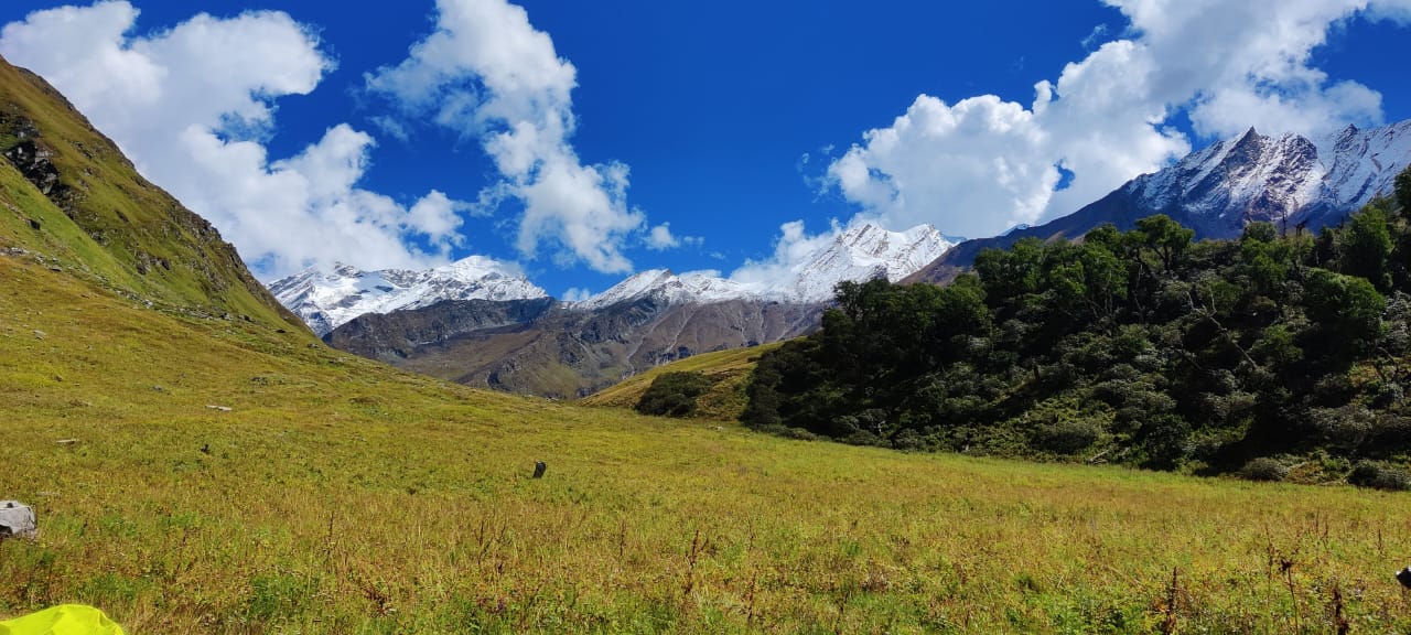
The Great Himalayan Trail (GHT) is a universal network of alpine routes that goes along the spine of the Himalayas across India , Nepal, Bhutan, Tibet and Pakistan. In Uttarakhand, the GHT kind of weaves through sacred river sources, old high-altitude trade paths, and glacier-cut valleys across the Garhwal and Kumaon areas. And there is a big crown jewel of Uttarakhand’s GHT web that sits inside the protected limits of Govind Pashu Vihar National Park & Sanctuary, in the Uttarkashi district. Running from the calm base village of Sankri (6,400 ft), this grouping provides four different alpine routes, and each one shows the remarkable range of Himalayan landforms, without any dull moments.
Kedarkantha – A winter summit climb.
Phulara Ridge – A crest-line ridge crossing, almost like a long ridge drift.
Har Ki Dun – A valley walk with ancient heritage that you can feel everywhere.
Bali Pass – A technical high-altitude pass crossing that is not for casual strolling.
Pickup Location: Dehradun
Base City: Sankri (Overall)
Trekking Distance: 115 - 125 Km
Maximum Altitude: 16,240 ft.
Difficulty Grade: Overall Moderate to Difficult
|
Trek |
Max Altitude |
Trek Distance |
Grade |
Ideal Month |
|
Kedarkantha |
12,500 ft. |
20 Km |
Easy |
December to March |
|
Phulara Ridge |
12,350 ft. |
26 Km |
Easy to Moderate |
May - June & September to October |
|
Har Ki Dun |
11,800 ft. |
47 Km |
Moderate |
March - June & September to November |
|
Bali Pass |
16,240 ft. |
66 Km |
Moderate to Difficult |
May - June & September to October |
Kedarkantha stands out as one of India's most loved beginner friendly summit climbs, even though a lot of Himalayan treks usually end at some high pass or a big alpine lake. Here it feels different when Kedarkantha finishes on its own standalone, pyramid shaped peak and at the top there is a small stone shrine dedicated to Lord Shiva.
● Elevation & trail: You gain up to 12,500 ft. along a fairly compact 20 Km round trip from Sankri, not too long but still enough to feel like a proper ascent.
● The experience: The path sort of winds upward through dense pine, oak, and rhododendron woodland, then later it opens out toward Juda Ka Talab, a forest clearing around a high altitude lake that by mid winter becomes a solid sheet of ice.
● Summit view: The early morning push pays off quickly, with a big panorama across well known Garhwal peaks like Swargarohini, Black Peak (Kalanag) Bandarpoonch , plus the pretty far off Gangotri ranges.
While most Himalayan routes tend to climb up a valley and then just drop down after reaching the pass, Phulara Ridge feels a bit different, this rare ridge-line traverse, where you end up spending hours just walking along a mountain crest, elevated above the nearby valleys.
● Elevation & Trail: The max altitude goes up to 12,345 ft.over about 26 km circuit. You can start near Sankri or Kotgaon, then keep moving along the high line.
● The Experience: The real highlight is that 4–5 km stretch of continuous walking along a narrow, open crest line. The ridge gives you open horizon-to-horizon views, with no clutter, and still it does not require technical climbing skills or anything too demanding.
● Flora & Fauna: After the ridge portion, the descent brings you into Pushtara Bugyal, those vast rolling alpine meadows, where wildflowers show up in spring and summer. Lower along the canopy, you pass through native Bhojpatra (silver birch) trees, and that is where the Himalayan Monal tends to hang around.
Har Ki Dun is kind of like a cradle- shaped glacier valley, and it’s soaked in Garhwali culture plus Mahabharata lore. People locally say that the Pandava brothers climbed Mount Swargarohini through this valley on their last climb up, toward heaven. But, you know, it’s also one of those places where the story feels half lived half told, like it never fully commits, but it still has that extra shimmer.
● Elevation and trail: it climbs to around 11,670 ft on a moderate route of roughly 47 km round trip, basically tracking the Supin River the whole way. The pace feels even, steady enough, not overly punishing ,yet the trail can still turn difficult if the weather gets moody.
● Cultural heritage: Along the way you pass through older and more isolated wooden villages such as Osla and Gangar. These hamlets have Kath-Khuni architecture, with those detailed multi-tiered wooden and stone builds, designed to handle seismic shocks and sudden tremors, so it’s not just pretty, it's practical.
● Valley landscape: The valley is held in place by the massive, sheer snow wall of Swargarohini I, II, and III. On the ground level, the scenery keeps trading places—dense walnut groves, then pine forests, and later the alpine river flats, all sort of alternating like they’re on a quiet cycle.
Connecting the Har Ki Dun valley straight through to the most sacred Yamunotri shrine, the Bali Pass cross over trek comes off like a pretty punishing interlink trail, sort of harsh and, honestly, best suited for seasoned alpine trekkers who have solid physical endurance and can keep a calm steady tempo.
● Technical Aspect: It climbs up to a demanding high point around 16,240 ft over roughly 56 Km , and in early summer those snow sections can turn into real slippery passages, so microspikes, gaiters, or even crampons start to feel pretty essential , not “nice to have” like sure you could skip them, but that would be the wrong call.
● Alpine glacial lakes: the trail kind of settles at Ruinsara Tal, a calm high-altitude water basin set below the Kalanag (Black Peak) and Swargarohini mountain ranges where the air feels thin but your eyes still keep noticing everything.
● The traverse: people push through moraine fields, then they have to negotiate the pass’s knife edge ridge, right after that comes a steep drop over snow, or scree into the Yamunotri valley, and it finishes near the source areas of the revered Yamuna River.
Uttarakhand is a place people often call Devbhoomi - The Land of the Gods, is mostly considered India’s top trekking location. Whether you’re a first timer who’s just taking your first steps on a mountain trail or you’ve already been through a few alpine routes, trekkers still end up choosing Uttarakhand again and again for reasons that feel hard to ignore.
Uttarakhand has some of the more well known mountain names in the Indian Himalayas, like Nanda Devi, Trishul, Chaukhamba, Shivling, Panchachuli and Kamet. On treks such as Kuari Pass, or Chandrashila, you might end up with these huge 360 degree panoramas, where it feels like you can spot more than a dozen big Himalayan peaks all lined up in a row straight ahead of your eyes.
Unlike many other regions where the trail is mostly rock and dry ground, Uttarakhand is a bit different. It has huge, easy to walk through alpine grasslands, they’re locally called Bugyals.
Some of the largest alpine meadows across Asia, green and lively in summer, then basically blanketed in snow in winter. Wide stretches that let you do ridge walks, with front row views of higher Himalayan belts and ranges and still somehow feel unreal in real life.
Trekking here is rarely just about getting to the top, it’s more like every little valley holds centuries of history, myth and traditions. The paths through places like Har Ki Dun wind past ancient, far off villages such as Osla and Seema, where traditional wooden architecture and everyday customs stayed steady for generations. Then there’s Sacred Origins, because many treks feel almost like spiritual pilgrimages. Trails like Gaumukh-Tapovan go straight into the icy, glacial birthplace of the holy river Ganges, and others drift past sacred alpine ponds, like Deoriatal-Kedartal and Hemkund.
The huge geographic spread means you can pick a trek that fits what you’ve done before. Beginner plus Winter trekking: routes like Kedarkantha, Kuari Pass and Deoriatal-Chandrashila work well for first-timers, and in winter they sort of become real snow treks too. Moderate Alpine trekking: Har Ki Dun, Valley of Flowers and Brahmatal. Extreme Expedition Passes: for people chasing high altitude mountaineering, technical passes like Kalindi Khal (5,950m), Auden’s Col (5,490m), and Bali Pass (4,950m) include glacier crossings, plus crevasse fields where you really notice the landscape.
Uttarakhand also has UNESCO World Heritage Sites, specially the Valley of Flowers National Park, it sort of becomes like a living blanket, with over 500 kinds of alpine wildflowers that are kind of rare and uncommon, between July and September. You might see hidden gems like the Brahmakamal or the Blue Poppy and somehow it’s easy to lose track of time while you’re there and just wander around. Plus the state’s forest paths guide you past dense oak and pine stands and then straight into those vivid pink and red rhododendron forests, so it feels like the air itself changes tone just a little as you walk.
Doing this 14 day traverse across Western Garhwal makes the Himalayas feel most authentic, raw and shifting.. It’s one of those unforgettable things that you can’t really put into words, even if you try. You’re not just ticking off four well known treks in your way; you’re kind of stitching them together into one large, sweeping journey, and it keeps carrying you from quiet pine groves and old wooden hamlets up toward wind-scraped ridges and freezing mountain gaps.
And if you’ve got the stamina, the proper gear, plus that stubborn little spark for adventure, then this route will stay in your mind long after the mud finally slides off your boots. Just pack smart, be respectful with the mountains, and step onto the trail, before you start overthinking it.
Day 1: Dehradun to Sankri
Day 2: Sankri to Juda Ka Talab
Day 3: Juda Ka Talab to Kedarkantha Basecamp
Day 4: Kedarkantha Basecamp to Kedarkantha Summit and Bhojgadi Camp
Day 5: Bhojgadi Camp to Pushtara via Phulara Ridge
Day 6: Pushtara to Gangad Village / Chillurgarh Camp
Day 7: Chillurgarh Camp to Boslo
Day 8: Boslo to Har Ki Dun and back to Boslo
Day 9: Boslo to Waterfall
Day 10: Waterfall to Ruinsara Lake
Day 11: Ruinsara Lake to Odari Camp
Day 12: Odari Camp to Balipass Basecamp
Day 13: Balipass Basecamp to Balipass Summit and Lower Damini Camp
Day 14: Lower Damini Camp to Janki Chatti and drive back to Dehradun
For the full 14-day nonstop route (Kedarkantha → Phulara Ridge → Har Ki Dun → Bali Pass), the timing is basically set by the highest technical trek , which is Bali Pass at 16,240 ft. So according to the technicality we have mentioned the best time to explore the trails.
● Bali Pass: With the larger snowpack still around, the crossing can feel a bit safer, snow bridges are usually intact , and sliding down the snow slopes is far easier than trying to pick a route over loose rock.
● Landscape: You’ll notice rhododendrons in the lower pockets, while the upper camps still keep snow patches.
● Pro Tip: I’d try to wrap it up by June 20 , before the monsoon rains really begin , because once that happens landslide risk starts going up fast.
● Bali Pass: At that point most of the snow has moved on, so you’re looking at exposure over rocky moraines and scree chutes, still you’ll want careful steps.
● Landscape: Crisp, cloudless weather, visibility gets really sharp for Swargarohini and Black Peak , and the meadows shift into a warm golden tone.
● Pro Tip: Pack heavier winter layers, since at night the temperature can drop under 0°C, even down to -8°C.
Avoid November to April: The pass becomes heavily snow loaded and not walkable for a continuous traverse. Also avoid July–August, since landslides and sudden flash floods are a known problem.
During The Trek
Exclusion
Testimonials

Rakesh dulams
Nice experience with the thinAir expedition and accommodation and hospitality and safty such as taken personal care and well experienced guide and such a cool guy

Aditi 99
I had an amazing experience with thin air expeditions. The food, the hospitality, and the preparedness of the staff for all sorts of scenarios was commendable. The location of camps was perfect. Even though i was a female solo traveller , i felt very safe and comfortable. Couldn’t have asked for a better team.

Radandi Shashank
“You are not just a mountain trek guides, but a true guardian of the journey. Your unwavering loyalty to our team, the mountains, and safety itself is extraordinary. Every step felt secure because of your dedication, integrity. And stayed committed to every trekker, through every challenge, with patience, care, and honesty. Huge respect to Subodh Jii n Aditi Mam!! Thank youu @thinairexpedition It was wonderful experience!!❤️❤️

67D3_KALYAN
Completing the Kedarkantha trek at an altitude of around 12,500 feet was not just a trek for us, it was a life-long memory, and a major reason for this unforgettable experience is our guide Shubhod Sir. From the very first day till the summit, Shubhod Sir guided us with immense patience, discipline, and genuine care. At every difficult patch, when our legs were tired and breathing became hard, his calm words, constant motivation, and confident leadership gave us the strength to keep moving forward. He never rushed anyone and always made sure that every member of the group was safe, comfortable, and mentally strong. Shubhod Sir’s knowledge of the mountains, weather, and high-altitude conditions was truly impressive. More than a guide, he felt like a protector and mentor who treated everyone like family. His positive attitude and humble nature created a sense of trust and confidence among all of us. We are also thankful to Atidhi Madam for her support and cooperation during the trek, which added to the smooth experience. Because of Shubhod Sir’s guidance and dedication, we successfully reached the summit with confidence and joy. We will always remember this trek with gratitude and respect. Truly blessed to have a guide like him. 🙏⛰️

Arvind Sahu
Wonderful experience totally worth it. At those price they provided services that no one could provides really enjoyed ❤️🎉

Kolanu Anirudh
This is my first trek in Uttarakhand(Kedharkanta) and Thin Air Expedition made it a memorable one Thanks for everything subodh bro you made it so special.

kanica kandpal
Completed the Gaumukh–Tapovan trek with Thin Air Expedition, and it was an exceptional experience from beginning to end. Instead of opting for a fixed-departure model, we chose a personally curated itinerary, as this was our first trek—and it turned out to be the perfect decision. The team was extremely thoughtful in planning each day’s distance, ensuring we were comfortably challenged without ever feeling overtired or exhausted upon reaching the campsites. Every campsite was carefully selected, offering not just safety and comfort but also breathtaking views that made each halt truly memorable. What stood out most was the level of personalization. The itinerary was clearly tailored to our pace and comfort, and the trek leader constantly shared insightful facts about the region, its geography, and cultural significance, adding depth and meaning to the journey. Overall, Thin Air Expedition delivers a highly personalized, well-paced, and enriching trekking experience. I would highly recommend them, especially for first-time trekkers looking for a safe, informative, and thoughtfully curated adventure.Sen

Raj Bahadur
I booked my trek with Thin Air Expedition on a friend’s recommendation, and it turned out to be a great decision. They managed travel and accommodation very smoothly, and everything was well organized throughout the journey. The team stayed in regular coordination, ensuring that stays and drivers were properly arranged each day. The entire trip was timely, hassle-free, and also pocket-friendly. I would definitely recommend Thin Air Expedition—you can trust them completely with your travel and trekking plans.

sachin aulakh
I recently completed the Kedarkantha Trek with ThinAirExpedition, and the entire experience was outstanding. The coordination, communication, and arrangements were excellent. The trek leaders were experienced and friendly, the support staff was humble, the stay was comfortable, and the food quality in such high altitude conditions was truly impressive. Their focus on safety and responsible trekking made the journey even better. I would definitely choose them again for my next Himalayan adventure! 🏔️✨

Aman rai
I recently completed a trek with the help of ThinAirExpedition, and the entire experience was very comfortable. From stay arrangements to travel from Rishikesh to Rishikesh, everything was well managed. The driver was extremely polite, supportive, and made the journey smooth and stress-free. Overall, a great experience and I would definitely recommend them.

Nitya Jaiswal
Kedarkantha was not just a trek, it was an experience that helped me reconnect with myself. Thanks to Thin air expeditions , I felt safe, cared for and encouraged at every step. The sunrise at the summit, the laughter around the campfire and the kindness of the guides will stay with me forever. If you're looking for a company that treats you like family on the mountains, this is the one.

Biswajit Sahoo
Subodh Sir making the trek so much of fun and intresting .. Awesome Experience with Subodh Sir

Anmol Verma
Overall trekking and accommodation was a very smooth experience. Our trek leader Mr. Ramesh was amazing and very helpful. He managed to make the trek look easy. Overall experience was 10/10. Would highly recommend.

Rishabh Singh Rana
Trek Guide Mr. Ramesh Ji is a very cool & good person. Trek journey became beautiful with the group and overall it became my one of the best experience.

aditi vaidya
I recently went on a trek with Thin Air Expeditions, and I can't get over the experience I had! I did the Phulara Ridge trek with Subodh sir, and it was an incredible experience. What made it even more special was that Subodh sir made sure I could bring my dog, Flake, a toy pom. His team and him took such great care of us, and it was clear that they truly care about their guests, human or canine! The group was amazing too. I met some wonderful people along the way, and we formed lifelong bonds. The whole experience was beautiful – from the breathtaking views to the friendly, supportive environment. I’ll cherish these memories forever! If you're looking for a SAFE, well-organized, fun, and caring trekking company, Thin Air Expeditions and Subodh sir are the ones to go with!

Anuja Vaidya
It was a wonderful experience with TAE on Phulara ridge trek, everything was on point the gears, food, trek guides and Subodh sir himself was an amazing leader who is the founder of TAE, he made sure the experience was amazing even for the first timers keeping safety the first priority. Also I took my Dog, Flake along with me for the trek and it was a great experience for her as well and her food and safety was well taken care of . 🐾 Would love to go back again with Thin air expedition. Thank you so much 🤗

Simran Samal
Phulara Ridge Trek – A Memorable Experience for me !!! Someone once told me, “Trips aren’t just about travel — they become a part of you.” I never really believed it, but this time, Phulara Ridge became exactly that for me. Our first campsite — the forest trail, the tents, the whole setting — gave me the first taste of what was to come. Everything was so thoughtfully arranged, it felt like nature itself had prepared that space for us. All thanks to our trek leader, Subodh bhai 🙌🏻. The next stop was magical in its own way. The campsite was picture-perfect, and we even ended up learning a bit of the local Uttarakhandi dance from Dev bhaiya (well… I tried to! 😄). In the evenings, we played games and spent such a good time that we forgot the weight of city life for a while. And finally, the Ridge: Honestly, we thought the weather would block the views, but Subodh bhai timed it so perfectly that the skies cleared for us. Walking on the ridge — one valley on the right, another on the left, clouds passing beneath us — felt surreal. We sat there for hours, just soaking it all in. It was pure peace. And yes, we even made tea there!!! 🫶🏻 (Of course, we made no mess, cleaned it all up, and left the space exactly the way it should be 😌). For me personally, trekking has always been like meditation — a way to quiet the noise and reconnect with myself. This trek with Subodh bhai and the team gave me exactly that: peace, perspective, memories for a lifetime, and inspiration. #SoGrateful 🙏🏻 Thank you, Subodh bhai and team, for making this such a soulful and unforgettable journey! Lastly Just one note for all: “In the end, we don’t conquer mountains; they help us discover who we truly are.” To anyone even considering it: please go with #ThinAir Expeditions to experience the rawness of trekking, the beauty of nature, and the joy of escaping city life for a while. You’ll come back not just with pictures, but with stories, stillness, and a piece of the mountains in your heart. All the best !!! ✌🏻

Netra Sharma
It was a wonderful experience with ThinAir Expedition. I went on my first trek to Phulara Ridge, and it was truly amazing. Our guide, Subodh ji, managed everything so well and remained patient throughout the trek. I enjoyed every moment and every spot. The place, the cook, and the helpers were all wonderful. The food and camps were awesome. I highly recommend joining ThinAir Expedition to experience the best of “pahadi” life!

Vaibhav Srivastava
Thin Air Expedition gave us the best experience while trekking. Everything was finely arranged and properly taken care of whether it was travel, food. Staff availablity. But the best part was free hand while trekking. Subodh led us beautifully taking in note that everyone reaches the base camp and everyone is doing well. Consulting our next phase keeping in mind the safety and gears. It was collectively very amazing. He gave us full free hand additionally it is our responsibility as well to take care of each other. We did so many activities had games and fun and he even taught us how to camp. How to set up it was fun. If it would've given me option I'll rate it 10. Thanks subodh and team and thin air expedition for such a memorable trip.

Somya Chaturvedi
I recently did the Phulara Ridge Trek with Thin Air Expedition, and it was my first trek ever truly an unforgettable experience! Everything was so well managed from safety arrangements and equipment to food and stay, I never had to worry about a thing. Our trek leader, Subodh, was extremely supportive, patient, and motivating, which made a huge difference for a first-timer like me. The food was simple, homely, and very satisfying after long trekking hours. Most importantly, safety was always the top priority. For anyone planning their first or next trek, I’d highly recommend Thin Air Expedition. Professional, caring, and passionate about making the experience memorable!
We're always ready for adventure
Trekking comes with uncertainty. Weather, terrain, and setbacks are part of the journey. We embrace them with resilience and openness—each challenge makes us stronger and more appreciative of nature's beauty.
We embrace low-noise trekking
We blend into nature, not the other way around. We avoid shouting, loud music, and noisy games. In silence, we hear birdsong, streams, and the wind—inviting peace, reflection, and a deeper connection with nature.
We protect the environment
We protect the environment by minimising waste, reusing resources, and picking up litter. We carry eco-bags, segregate waste, and inspire others to preserve trails. Sustainable trekking ensures these mountains remain beautiful for future generations.
We are self-sufficient
We carry our load as much as possible, manage our gear, and stay prepared for all situations. Self-sufficiency builds confidence, independence, and respect for fellow trekkers, support staff, and the trail itself.
We support each other
Trekking is not a solo act. We wait for each other, share burdens, and uplift teammates. By putting the group first, we build strong bonds and help everyone complete the trek joyfully.
We are fit and prepared
We train well before our treks. This helps us walk longer, handle emergencies, and contribute to the team. Fitness ensures we are never a burden and always ready to help when needed.


