Day 1- Dehradun To Ranachatti
Drive distance: 160 km, around 7 to 8 hours
Altitude covered: 7000 ft (approximately)
Meals: Dinner
Accommodation: Homestay/guesthouse at Ranachatti
How does your day 1 look? A private vehicle (sharing basis) picks you up at 7:00 AM. Expect to reach Ranachatti by late afternoon. After one hour of drive, you enter the beautiful city Mussoorie. As you drive ahead, at Bhediyan, see the first glimpse of Yamuna River. The river divides lush forest and deep valleys.
Drive along the Yamuna valley to reach Barkot. After Barkot, NH 134 starts which leads towards Yamunotri. On pleasant weather days you get to see Bandarpooonch, and as you are few km away from Ranachatti (basecamp), sight of Dinnala Bugyal and with its two peaks come into view-Jhandi Top and Ancha Top.
Thin Air Expedition welcomes you at their Ranachatti homestay/guesthouse. Meet your trek leaders and other local staff, freshen up, and get ready for the briefing. If time allows, take a stroll in the village and get to know the culture. Do not miss wooden temple of Someshwar Mahadev. Enjoy the hot meal and call it a day.
Day 2- Ranachatti To Bamsingh
Trek distance: 4 km, around 3 hours
Altitude covered: 9200 ft
Meals: Breakfast, Lunch, Evening Snacks, and Dinner
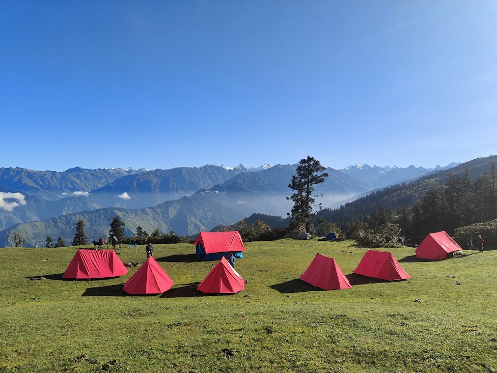
Accommodation: Sharing tents
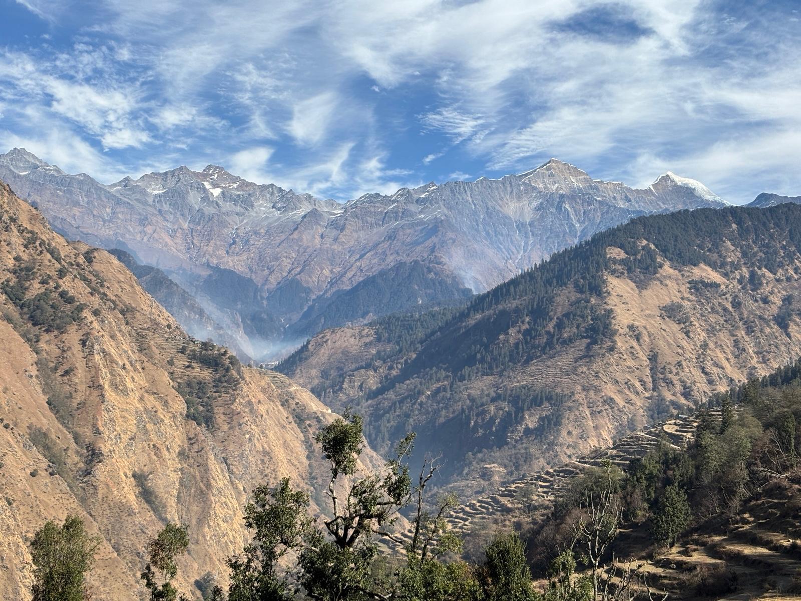
How does your day 2 look? Your day 1 starts with an ascent, passing village and few small patches of forest snuggled between the fields. Along the way you will encounter multiple Shepherd huts. After 1.5 km trek the actual adventure begins; rocky and steep sections challenges you on your first day. Look at left to see Bandarpoonch peak comes into sight over the horizon.
Just a 300 meter rocky section and you will reach a flat rest stop. Take a pause and get charged for another 1 km climb. From here, the Bandarpoonch massif is much clearer. Next you pass through forest of old oak trees to reach clearing. Here completes your 50% trek of the day- Ganga Ram Ji’s Channi (Shepherd huts). After this, the trail enters a dense forest and the terrain gets easy for 600 km before you reach Coin Tree. From here, the clear view of Dinnala Bugyal with its two points appears - Jhandi Top (right side) and Aancha Top (left side). The trail gets steep yet again after Coin Tree. For 200 meters the steepness remains same. After that the terrain gives some relaxation as you walk through the forest of old oaks. Keep waking for another 100 meters where a small clearing opens up from where you can see rising slope of Dinnala. Follow the marked trail for another 30 minutes, enter the last dense forest section of the day and reach your campsite-Bamsingh. There is a big water source available flowing right next to your campsite.
Day 3- Bamsingh To Dinnala Camp
Trek distance: 4 km, around, hours
Altitude covered: 10, 750 ft
Meals: Breakfast, Lunch, Evening Snacks, and Dinner
Accommodation: Sharing tents
How does your day 3 look?
The day begins with a 150-meter decline into a re-entrant, or valley, from Bamsingh. Expect water if you are trekking in the monsoon season. As you progress, trail enters a thick tree section where ascend of the day begins. Come to a little clearing before the thick woodland section continues.
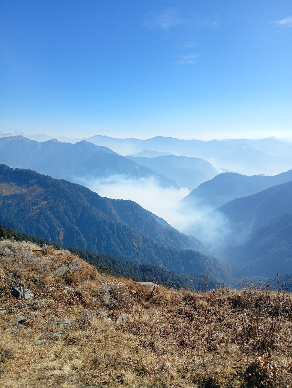
Keep walking and turn right to reach Daloti Gad, which joins Yamuna River eventually. A steep climb waits after you cross the stream. Walk into the lush forest for about an hour before flat walk eases your knees. Once more you have to cross a stream to reach Sannodi (big clearing). Congratulations, 50% of today’s trek has completed here. Take a much desired pause in the tree line which now has become thin.
Now giant mountains come into view on the horizon where Bandarpoonch appears clearly. The pointed summit of Swargarohini massif also comes into sight. To your left, Kedarkantha Peak and Phulara Ridge also start revealing.
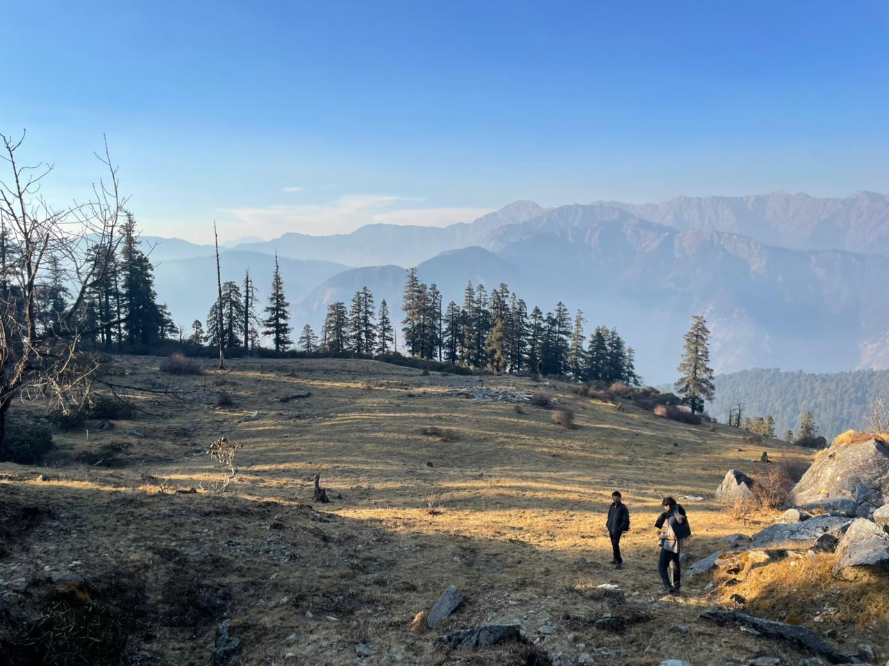
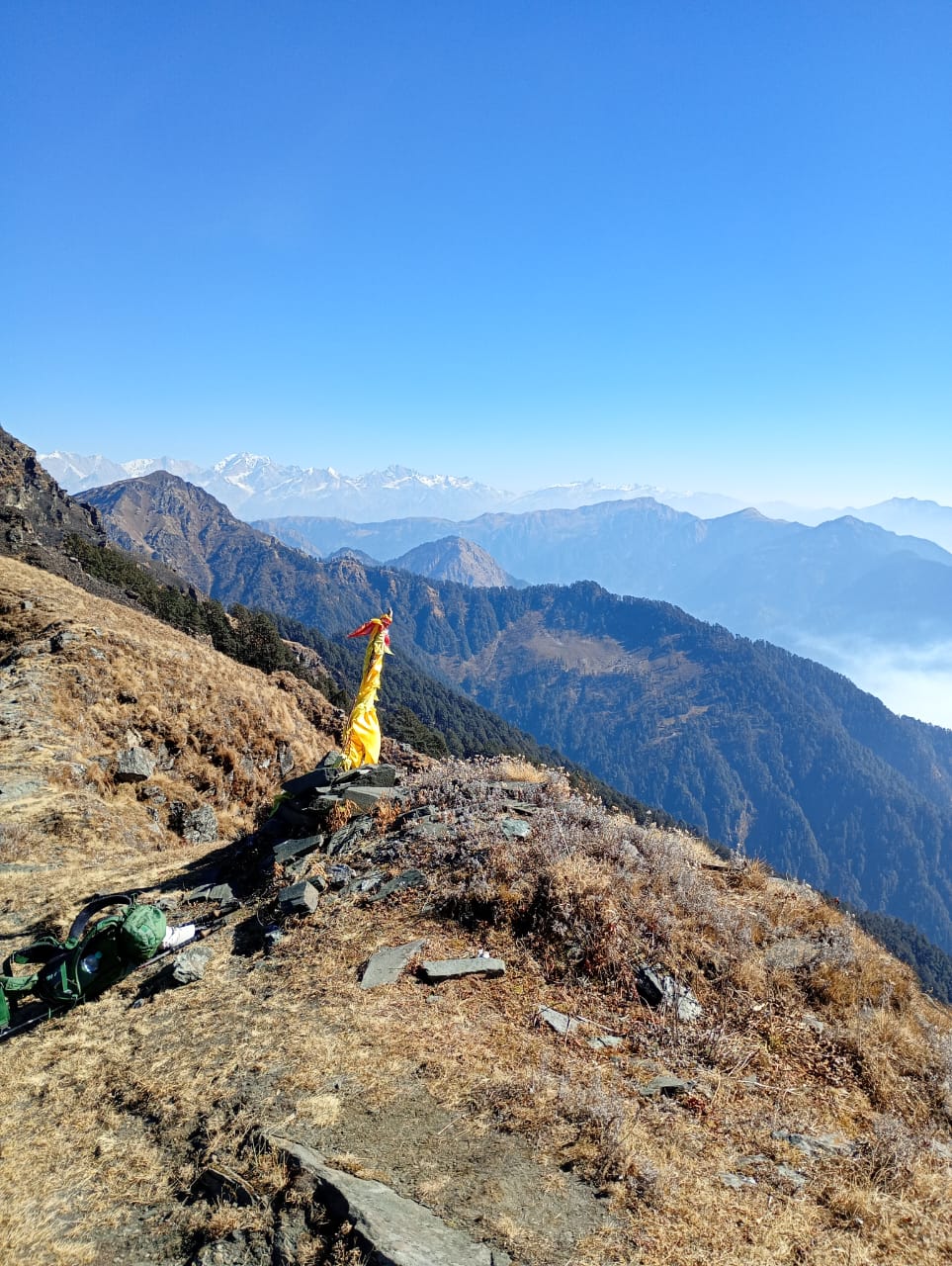
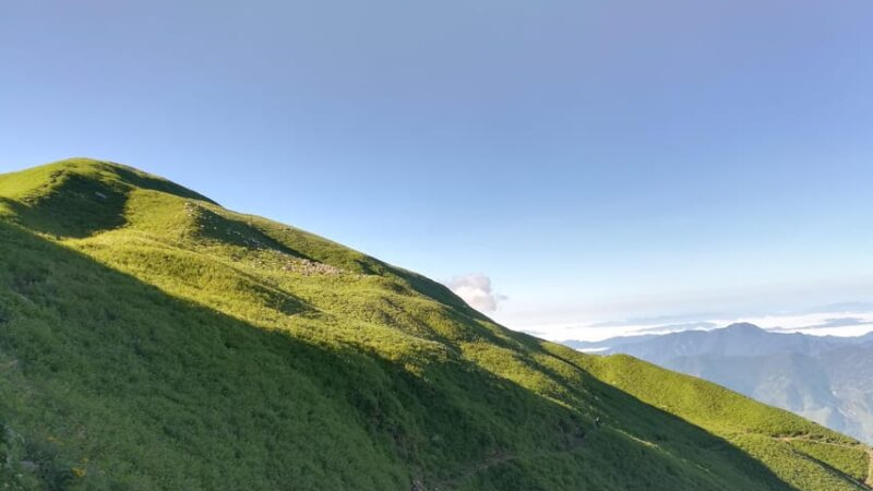
Continue a gradual ascent from Sannodi for another 1 km. As the tree line starts fading clear meadows of Dinnala Bugyal appear. Look behind to see much clearer view of the Swargarohini peaks. You are standing under skyline that witnesses rugged ridges of Garhwal region’s lesser-known summits.
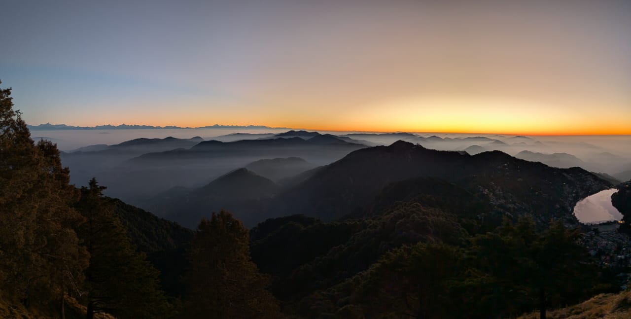
There is a channi within 500 meters reach, where camps are installed. Due to multiple water sources across Dinnala Bugyal, it becomes a flexible spot for camping. Rest, enjoy hot food, and soak in the mountains as magical orange hues light up the peaks.
Day 4- Dinnala camp To Aancha Top and Aancha Camp
Trek distance: 8 km, around 7 hours
Altitude covered: 11,400 to 12, 525 ft
Meals: Breakfast, Lunch, Evening Snacks, and Dinner
Accommodation: Sharing Tents
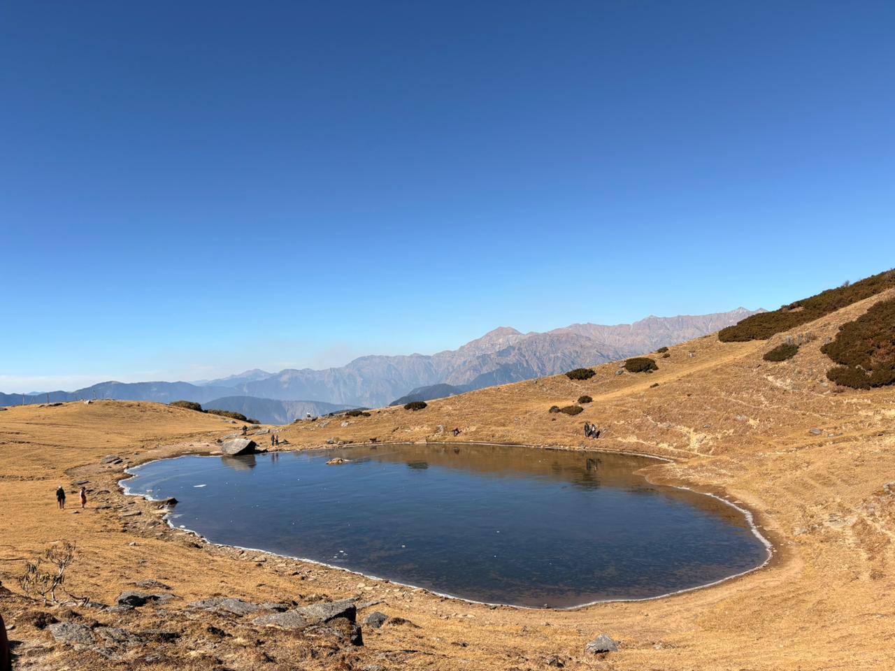
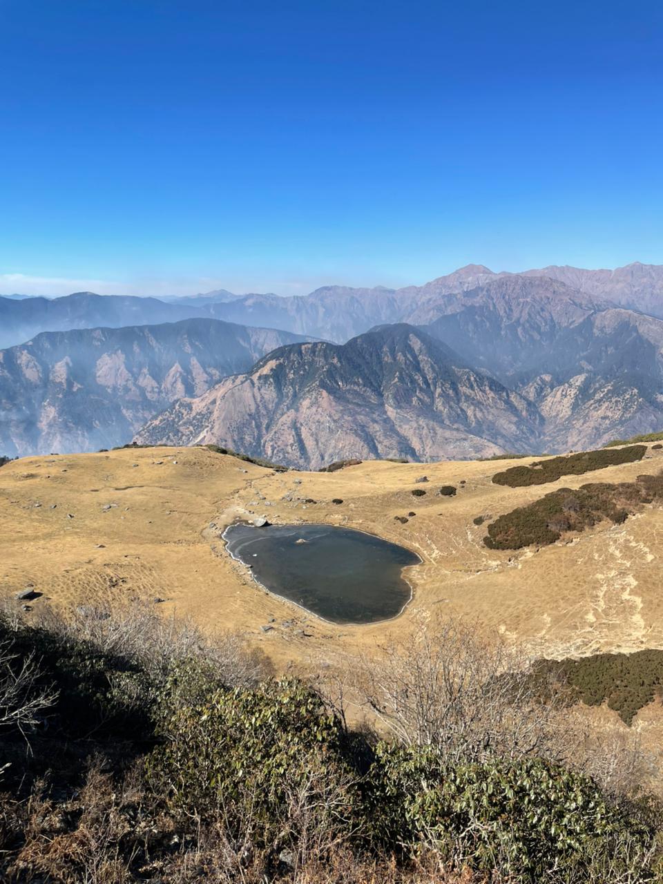
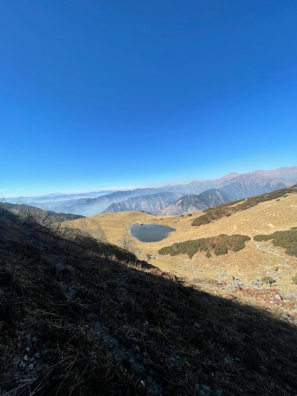
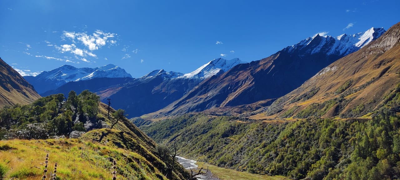
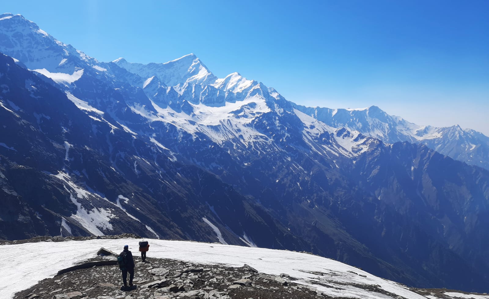
How does your day 4 look? Wake up amidst the snow-capped peaks. Enjoy the view while relishing over scrumptious plate of breakfast with hot tea/coffee. Get ready for the ascent as today you get to see the best view of Bandarpoonch and Swargarohini peaks. Start your today’s trek by ascending the meadows where tall trees start to fade but rhododendron shrubs. Bandarpoonch dominates the skyline as you climb further, whereas Swargarohini’s best view is yet to come. After 600 meters, turn right by ascending a re-entrant. Reach the first and largest glacial of Dinnala Bugyal after 1.5 km, where crown of Swargarohini perfectly reflects (on the clearer day).
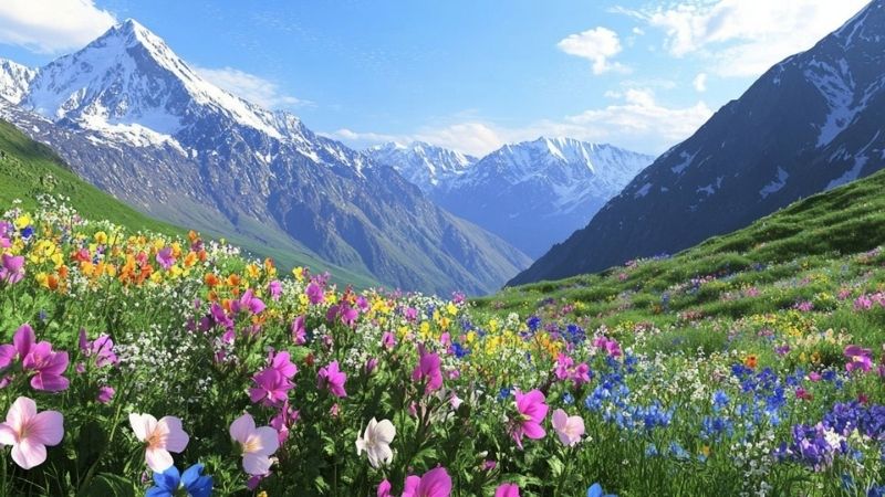
Two more glacial lakes come into sight after you turn left. These lakes are beautiful in any season, be it summer green, winter whites, or autumn red. After exploring all, return to the first lake from where trek actual begins.
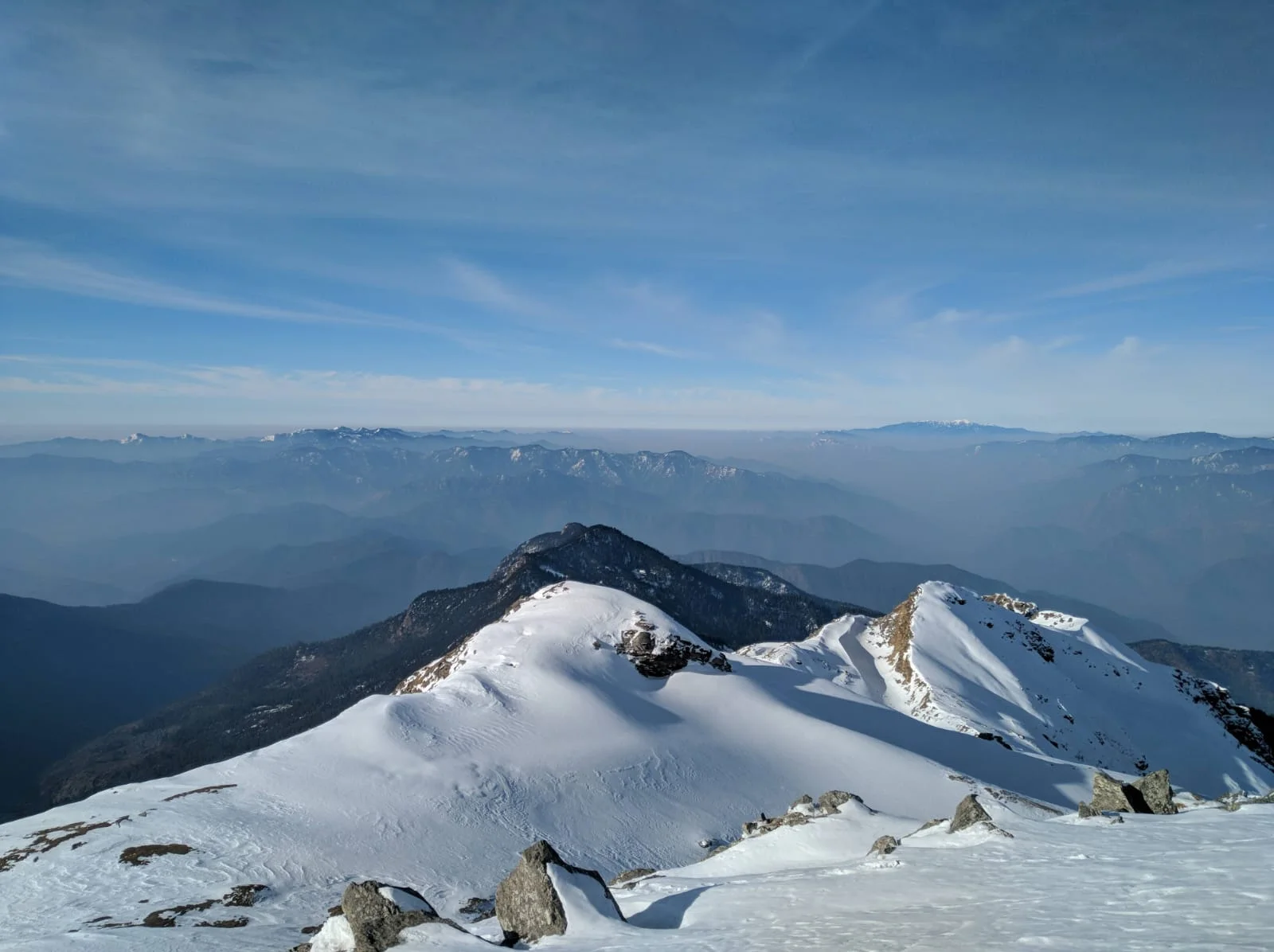
Move ahead towards right trail, from here climb for 200 meters towards a ridge. This is where rhododendrons completely disappear and Gangotri and Yamunotri ranges come into sight. These ranges are, Gangotri III, Jogin, Kedarnath, and the expansive meadows of Dayara and Gidara. Walk for 2 km on a ridge and reach your summit - Aancha Top. This is where you get the complete view of Bandarpoonch and other vistas like, Srikantha, Gangotri I, and Jaonli.
Stay here for a while, click pictures and prepare to descend back towards Aancha Camp. You will cross Jajar Gad to reach your campsite. Soak into the beautiful sunset that paints Swargarohini in orange. Reminisce the day’s struggle and reward both at the same time with your fellow trekker friends.
Day 5- Aancha Camp To Ranachatti
Trek distance: 6 km, 5 hours
Altitude covered: 7,000 ft
Meals: Breakfast, Lunch, Evening Snacks, and Dinner
Accommodation: Guesthouse/homestay
How does your day 5 look?
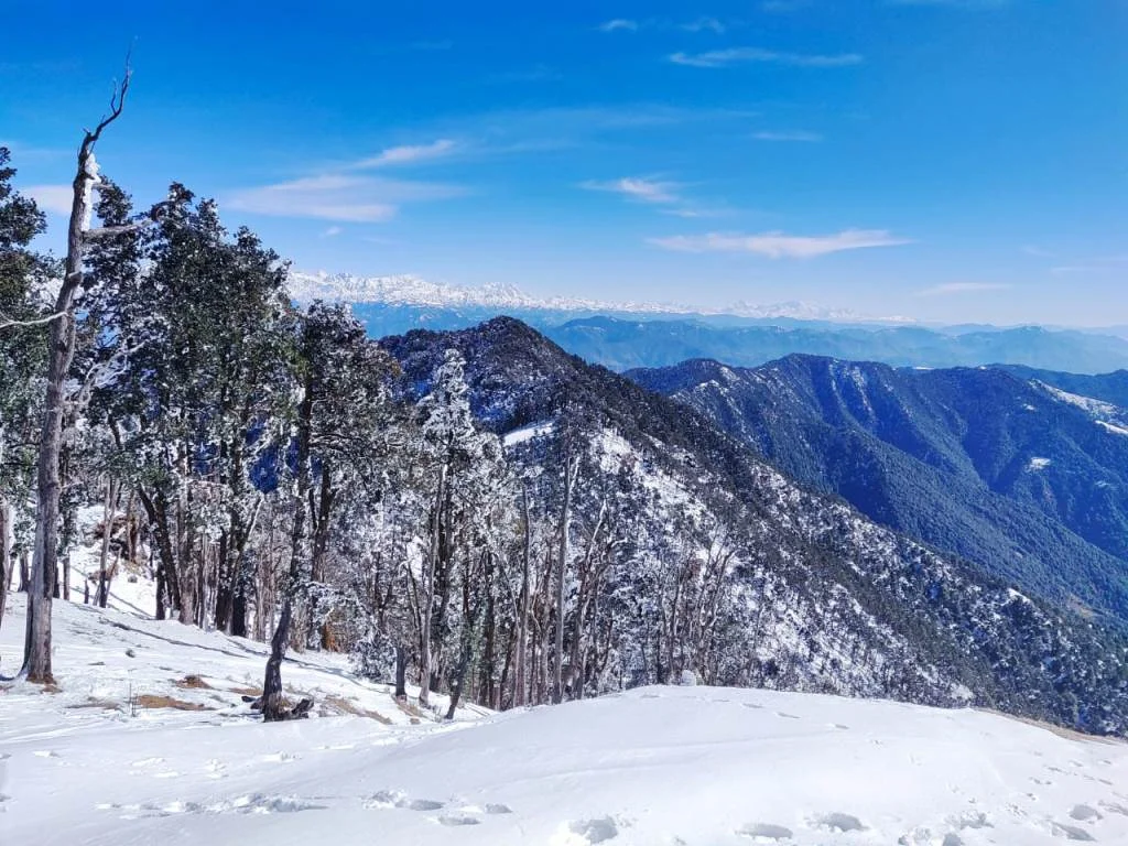
Gradually, start your decline from Aancha top by passing meadows. Once the altitude and Giant Mountains are left behind rhododendrons starts to reappear. You can still see peaks like Bandarpoonch II and a small glimpse of Swargarohini from afar.
Steep incline waits as you enter the pine and birches tree-line. Forest gets denser and gradient gets steeper. Keep walking for 1.5 km to reach meadow patch. Now, it is time to bid goodbye to the magnificent mountains as they completely vanish from the sight.
Now, only the vast expanse of Dinnala Bugyal dominates the horizon. The two ends of meadows, Aancha Top and Jhandi Top are still visible. After crossing the clearing, forest terrain comes again. Oak trees start to appear in mix as you cross a steep descent. You arrive at large clearing of Pokhari Thatar after a kilometer’s trek. From here, Bandarpoonch ridgeline rises up in full view again. Take a pause, soak in the views and resume your journey where the forest continues.
From here the mountain peaks come and go out of the sight. Keep descending for more 2 km and arrive at Ganga Ji Ka Chhani again. The forest section finally ends here and agricultural fields appear. Resume your trek on the same trail you took on Day 2. A sharp decline of 2 km through a mix of forest and civilization and you will reach Ranachatti.
Bandarpoonch stays visible until you reach Ranachatti. Get freshen up at base village (guesthouse/homestay), enjoy lunch and retire for the day. Get ready for the next day’s long drive-back to Dehradun.