Discover pir panjal
Discover pir panjal
27
May

The Pir Panjal Lakes Trek moves through one of the quieter mountain regions of Kashmir where large sections of the landscape still feel relatively untouched by heavy trekking traffic.
The route crosses rolling grasslands, shepherd valleys, alpine ridges, open lake basins, and long stretches of high-altitude terrain spread across the Pir Panjal range. Unlike more commercial Himalayan circuits where camps and trails remain constantly active through the season, many sections here feel still for hours at a time once the lower valleys disappear behind the trail.
The scenery changes slowly throughout the expedition.
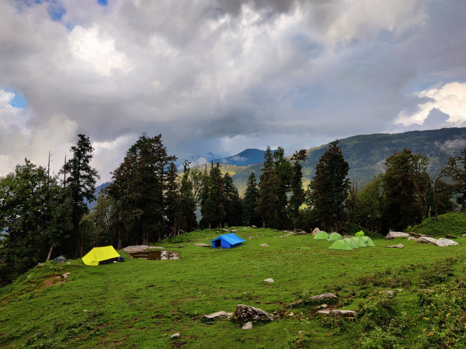
Dense green valley's gradually open into broader alpine landscapes where lakes begin appearing unexpectedly between wet meadows, ridgelines, and shepherd routes shaped by seasonal movement through the mountains. Some mornings feel calm and unusually open beneath clear skies. A few hours later, cloud shadows begin moving across the grasslands and entire sections of the valley disappear beneath fog.
What makes Pir Panjal memorable is not a single dramatic moment. It is the feeling of distance that slowly builds through the trek.
The valleys feel wider with every passing day. Camps become quieter. Roads and settlements start feeling strangely far away once multiple nights pass inside the upper lake regions.
The trek itself is not technically difficult, but the physical effort gradually compounds through:
Some evenings near the camps feel almost completely silent except for wind crossing the grasslands, distant water movement, or the occasional sound of grazing horses somewhere deeper inside the valley.
Pir Panjal does not feel overwhelming in one instant.
It feels larger and quieter the longer you stay inside it.
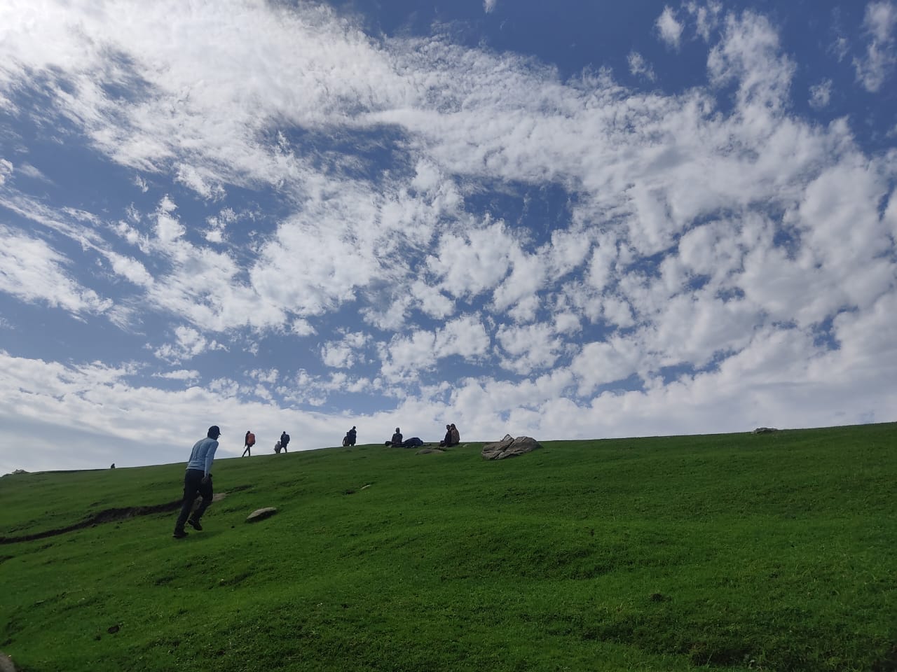
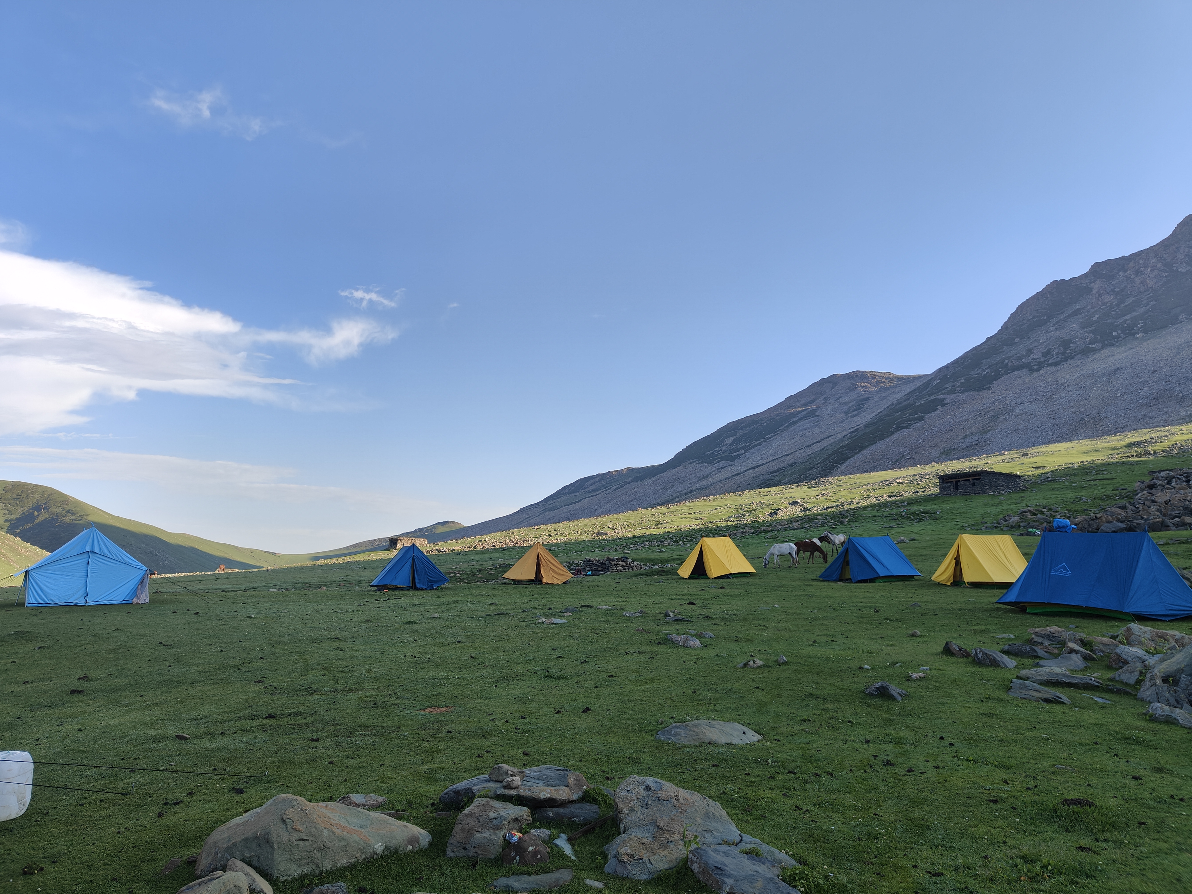
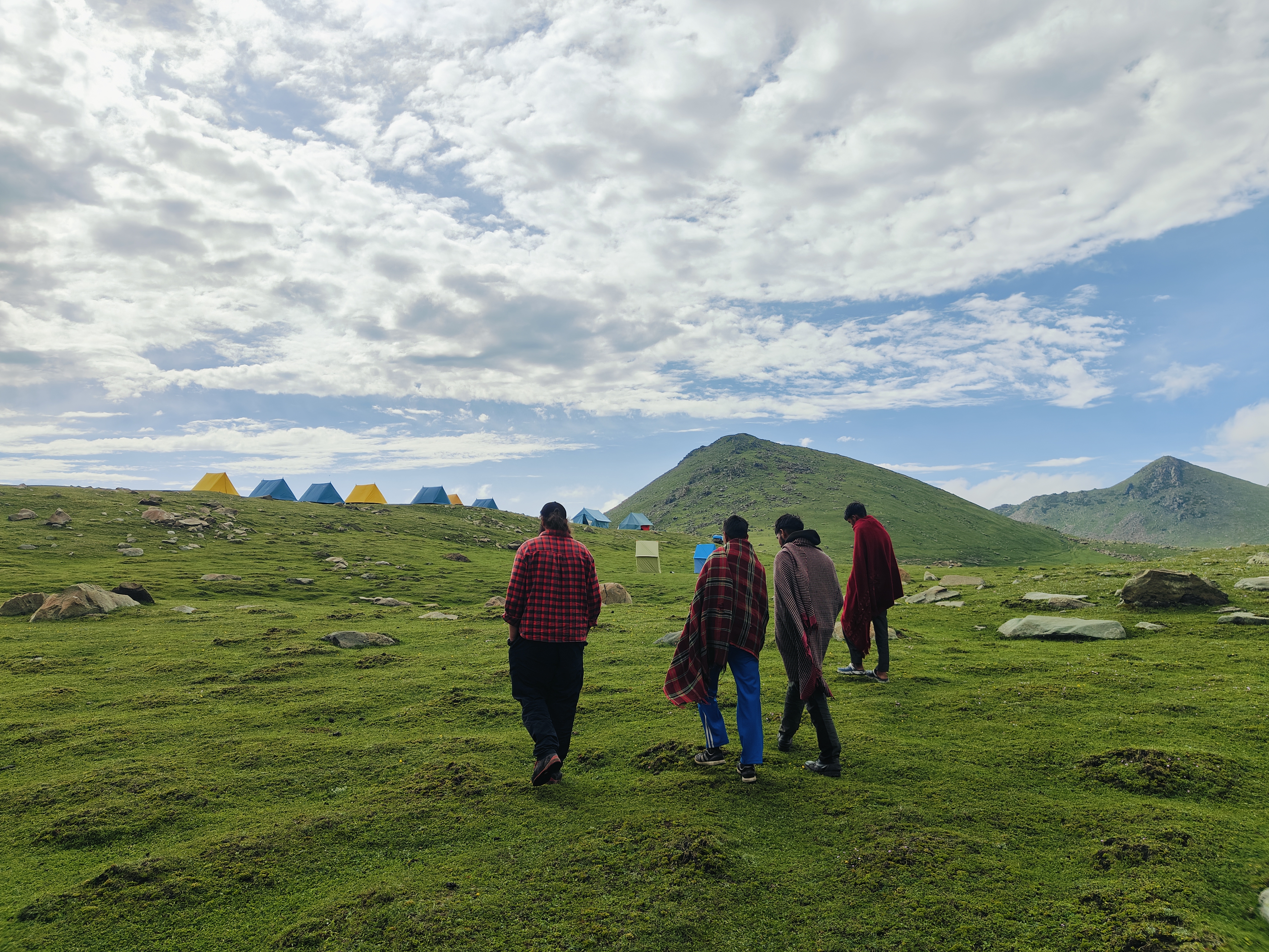
The Pir Panjal Lakes Trek gains altitude gradually through wide valleys, meadow systems, shepherd routes, and rolling alpine ridgelines spread across the Pir Panjal range.
Unlike routes dominated by repeated steep climbs, this trek feels physically longer because of sustained walking distances and constantly shifting terrain beneath changing weather conditions.
The lower sections usually feel softer and greener with open grasslands, riverside movement, and shepherd trails crossing through broad valley systems. As the trek progresses, the landscape becomes quieter, colder, and more exposed once the upper lake regions begin appearing across the route.
The terrain itself keeps changing throughout the expedition:
Nothing feels technically dangerous.
But the walking rarely becomes effortless either.
Several meadow sections remain damp for long periods after rainfall, especially near the higher valleys and lake basins. Even moderate distances begin feeling slower once shoes stay wet and recovery starts reducing over consecutive days.
Weather strongly affects the experience here.
Clear mornings can quickly shift into fog-covered valleys where nearby ridgelines suddenly begin feeling distant once visibility starts collapsing across the terrain.
Altitude usually becomes more noticeable after repeated nights near the upper camps where colder temperatures, thinner air, and reduced recovery gradually affect pacing and energy levels.
Pir Panjal rarely feels aggressive.
Instead, the physical challenge builds slowly through distance, exposure, weather, and time spent moving through open alpine terrain far from roads and settlements.
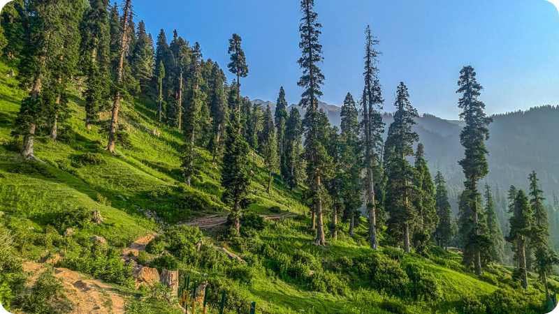
The drive from Srinagar toward Chandimarh gradually leaves behind busier Kashmir valleys and enters quieter mountain terrain shaped by forests, rivers, and scattered shepherd settlements.
The final stretch begins feeling noticeably more remote as the roads narrow and the Pir Panjal valleys slowly open ahead.
Reality Check:
Even the lower camps begin feeling cold quickly after sunset once the wind starts moving through the valley.
Photography Window:
Late evening light near Chandimarh usually creates soft contrast across the surrounding meadows and pine-covered slopes.
The trek begins gradually through rolling grasslands, streams, and long meadow sections used by shepherds during the summer season.
This is one of the calmer walking days and helps the body settle into a sustainable pace before the longer alpine sections begin later in the route.
Reality Check:
The terrain feels comfortable early on, which often makes trekkers walk faster than necessary during the first half of the day.
Photography Window:
Morning cloud movement near Thera creates layered light conditions across the grasslands and surrounding valleys.
The landscape gradually opens into broader alpine terrain as forests begin disappearing behind the trail. The route toward Khuan crosses long meadow systems, rocky sections, and scattered water crossings before reaching quieter high-altitude camps.
The sense of isolation begins increasing noticeably from this stage onward.
Reality Check:
Long walking distances and colder wind exposure begin affecting recovery more noticeably after reaching camp.
Photography Window:
Early mornings near Khuan usually provide calmer visibility before afternoon cloud build-up begins around the higher ridges.
This section introduces more exposed alpine terrain where valleys widen and the route gradually approaches the higher lake systems of the Pir Panjal range.
Weather movement becomes much more noticeable here.
Fog and cloud systems often move rapidly across the upper ridges during the afternoon, changing visibility across the valleys within minutes.
Reality Check:
The climbs remain manageable, but thinner air and open terrain begin slowing movement during the second half of the day.
Photography Window:
Post-rain conditions near Neelsar often create strong lake reflections beneath shifting cloud layers.
The route continues through quieter alpine terrain where smaller lakes, damp grasslands, and isolated valley sections begin appearing more frequently across the landscape.
Compared to the previous day, this section feels calmer visually but slower physically because uneven meadow terrain repeatedly interrupts walking rhythm.
Reality Check:
Wet shoes and cold evening temperatures become frustrating surprisingly quickly after reaching camp.
Photography Window:
Evening reflections near Chandansar usually become strongest once sunset winds begin reducing slightly around the lake basin.
Large sections of the trek feel unusually isolated once the lower valleys disappear behind the route.
The camps become quieter, villages grow sparse, and several walking sections pass through open terrain with almost no signs of roads or outside movement for hours at a time.
Even during peak season, some evenings near the upper valleys feel almost completely still once trekking movement stops for the day.
The silence here feels different from forest silence.
It feels wider.
Many trekkers only notice how disconnected the route feels after multiple days without reliable network access, traffic noise, or constant movement around them.
The Pir Panjal range holds moisture for long periods after rainfall.
Several meadow sections near Neelsar and Chandansar remain damp for hours even after the weather clears, especially during July and early August.
The terrain itself is rarely difficult in a technical sense.
But wet ground slowly affects:
Most trekkers feel the exhaustion more in their legs and ankles than in breathing.
What makes it deceptive is how visually soft the terrain appears from a distance. Open grasslands look comfortable until hours of uneven footing quietly begin slowing movement and draining energy.
Afternoons often feel comfortably warm while walking through the valleys. Then the sunlight disappears behind the ridges and the temperature suddenly changes.
Open lake basins allow wind to move freely across the camps, especially after sunset once body heat also begins dropping during inactivity.
Many trekkers spend the evening searching for dry layers, warm food, or hot tea far sooner than they expected earlier in the day.
Cold exposure here rarely feels dramatic.
It arrives gradually through damp clothing, reduced movement, and long evenings inside open alpine terrain.
Trekkers who avoid overheating during the day usually remain noticeably more comfortable after reaching camp.
One of the deceptive things about Pir Panjal is how manageable the first few days usually feel.
The exhaustion builds quietly through:
By the later lake sections, even moderate distances begin feeling slower than they did earlier in the expedition.
Not because the terrain suddenly becomes extreme.
The body simply stops recovering as efficiently after consecutive days inside cold open valleys.
Several trekkers notice this most after reaching camp, when removing backpacks suddenly feels far more relieving than it did during the first half of the trek.
Cloud movement across the Pir Panjal range constantly reshapes visibility through the day.
Valleys that feel open during the morning often disappear beneath moving fog by afternoon once unstable weather begins building near the ridgelines.
Distance perception changes quickly too.
Nearby lake basins suddenly begin feeling isolated once visibility starts collapsing across the grasslands and surrounding terrain.
Some mornings near the lakes feel completely clear and calm. Then clouds slowly move lower through the valleys until even nearby camps partially disappear behind shifting fog.
The landscape rarely looks identical for very long here.
That unpredictability becomes part of the atmosphere of the trek itself.
Cold weather and damp terrain affect almost everything during the trek:
Most comfort problems here begin small.
Damp socks after sunset. Wet gloves left outside too long. Moisture trapped inside layers after walking through fog or light rain.
Simple comfort systems usually matter far more than carrying excessive equipment. Dry socks before sleep make a bigger difference than most trekkers initially expect.
July gives the Pir Panjal range its freshest appearance of the season.
The meadows become intensely green while lingering snow patches occasionally remain visible near the higher ridges and lake basins. Fog, cloud movement, and changing light constantly reshape the atmosphere across the valleys throughout the day.
• Deep green meadows
• Active cloud movement
• Occasional rain exposure
• Fresh alpine vegetation
• Dramatic weather conditions
• Fewer trekkers compared to peak season
Trail Feel
Raw, misty, and immersive.
Some mornings begin completely clear before clouds gradually begin swallowing the ridgelines by afternoon, changing the mood of the valley within hours.
August is usually the most stable month for the trek.
The grasslands remain fully green, mornings feel calmer, and lake reflections become much clearer during stable weather windows. Wildflowers spread across several sections of the valleys while shepherd movement makes the alpine terrain feel more alive.
Trail Feel
Balanced, vibrant, and expansive.
This is usually when the valleys feel visually fullest — greener terrain, calmer lakes, softer evening light, and more stable movement conditions across the route.
September slowly changes the atmosphere of the trek.
The grasslands begin turning softer and more golden while mornings and nights become noticeably colder. Visibility also sharpens significantly once monsoon moisture begins reducing across the range.
• Golden alpine valleys
• Sharper ridgeline visibility
• Cleaner photography conditions
• Colder mornings and nights
• Lower crowd density
• Quieter campsite atmosphere
Trail Feel
Silent, colder, and calmer.
Several trekkers prefer September because the valleys begin feeling slower and more isolated once the seasonal rush starts fading.
Pir Panjal rarely feels aggressively steep or technically difficult, but the route gradually becomes physically demanding because of:
Preparation should focus more on endurance and recovery than aggressive gym training.
Trekkers usually adapt comfortably if they are already capable of:
One common mistake is underestimating the trek because the terrain appears visually softer online than it actually feels after multiple days inside exposed valleys.
The exhaustion builds slowly here.
That is what catches many trekkers off guard.
Yes.
But preparation matters significantly more compared to shorter beginner treks. Even though the route avoids technical climbing, beginners still need to handle:
Trekkers with prior hiking exposure or consistent cardio preparation usually adapt much more comfortably throughout the expedition.
You are usually in a comfortable range for Pir Panjal if you can:
Trekkers who push too aggressively during the first few days usually begin struggling later once colder camps, longer valley traverses, and reduced recovery start affecting energy levels.
Steady pacing almost always feels better than rushing through the valleys.
Several experienced trekkers finish strong not because they move fastest early on — but because they conserve energy consistently through the expedition.
Pir Panjal rarely punishes trekkers through technical terrain.
Instead, discomfort gradually builds through repeated smaller issues:
Comfort on this trek depends far more on practical gear management than carrying excessive equipment.
Large sections of the route pass through damp meadows, wet grasslands, and lake basin terrain where shoes remain exposed to moisture for long periods.
Even light rainfall changes trail conditions quickly because the valleys hold water long after the weather clears.
Most trekkers begin slowing down noticeably once shoes remain wet over consecutive walking days.
Good waterproofing matters less during the rain itself and much more afterward once temperatures begin dropping near evening camps.
Cold mornings and sunny afternoons create confusing layering conditions throughout the trek.
Trekkers who overdress early during movement often begin sweating heavily, which later becomes uncomfortable once wind exposure increases near the lakes and ridgelines.
The most comfortable trekkers usually:
The terrain itself is rarely dangerous, but uneven meadow sections and repeated long walking days continuously stress feet and ankles.
Reliable waterproof trekking shoes with decent grip improve:
Several trekkers underestimate how exhausting wet feet become after repeated days inside damp open valleys.
People commonly carry:
At the same time, they underestimate:
Lighter and more practical systems usually perform much better on long valley-based treks like Pir Panjal.
Usually the smallest things improve the experience the most:
Wet socks ruin evenings here surprisingly quickly.
The trek is usually considered moderate.
It is not technically difficult, but long walking distances, weather exposure, damp terrain, and repeated movement through alpine valleys gradually make it physically demanding.
Yes.
Beginners with decent preparation and endurance can complete the trek comfortably, although prior hiking experience helps significantly.
Usually not steep climbs.
Most trekkers feel tired because of:
Most sections remain gradual compared to aggressive Himalayan climbs.
The fatigue usually comes more from sustained distance and exposure than steepness itself.
The standard itinerary is usually completed in 7 days including the Srinagar drive sections.
The highest sections usually reach around 13,000–13,500 ft depending on the exact route variation.
Yes.
Fog, rain, cloud build-up, and changing visibility are common throughout the Pir Panjal range.
Night temperatures near higher camps can approach freezing, especially during July and September.
Wind exposure near open valleys often makes the cold feel sharper after sunset.
August is usually considered the most balanced month because of:
Short rain spells and damp conditions are fairly common during July and August because the valleys hold moisture for long periods after rainfall.
The route includes:
Yes.
Wet ground slows movement more than many trekkers initially expect because footing becomes softer and less stable over long walking distances.
Very.
They help significantly during damp meadow crossings and longer descents where footing becomes less predictable.
Yes.
Certain valleys and ridgelines become partially hidden beneath moving cloud systems during unstable weather conditions.
15. Is the trek crowded?
Compared to more commercial Himalayan routes, Pir Panjal usually feels much quieter throughout the trekking season.
Trekkers should ideally feel comfortable:
Not entirely.
Walking stamina, endurance, and recovery matter significantly more than gym strength alone.
Because the terrain appears visually softer online than it actually feels after multiple long walking days through open alpine valleys.
Very important.
Trekkers who maintain a steady pace usually recover much better throughout the expedition compared to people who push aggressively during the first few days.
Usually the silence, changing weather, isolated lake systems, wide valleys, and the feeling of spending multiple days far away from roads, crowds, and constant outside noise.