Trek difficulty
Easy - Moderate
Trek duration
7 Days Days
Trek altitude
16,005 ft
Group size
6-12
Trek distance
49 Km
Basecamp
Yangpa, Himachal Pradesh
Best Time
July to September
Pickup Point
Simla
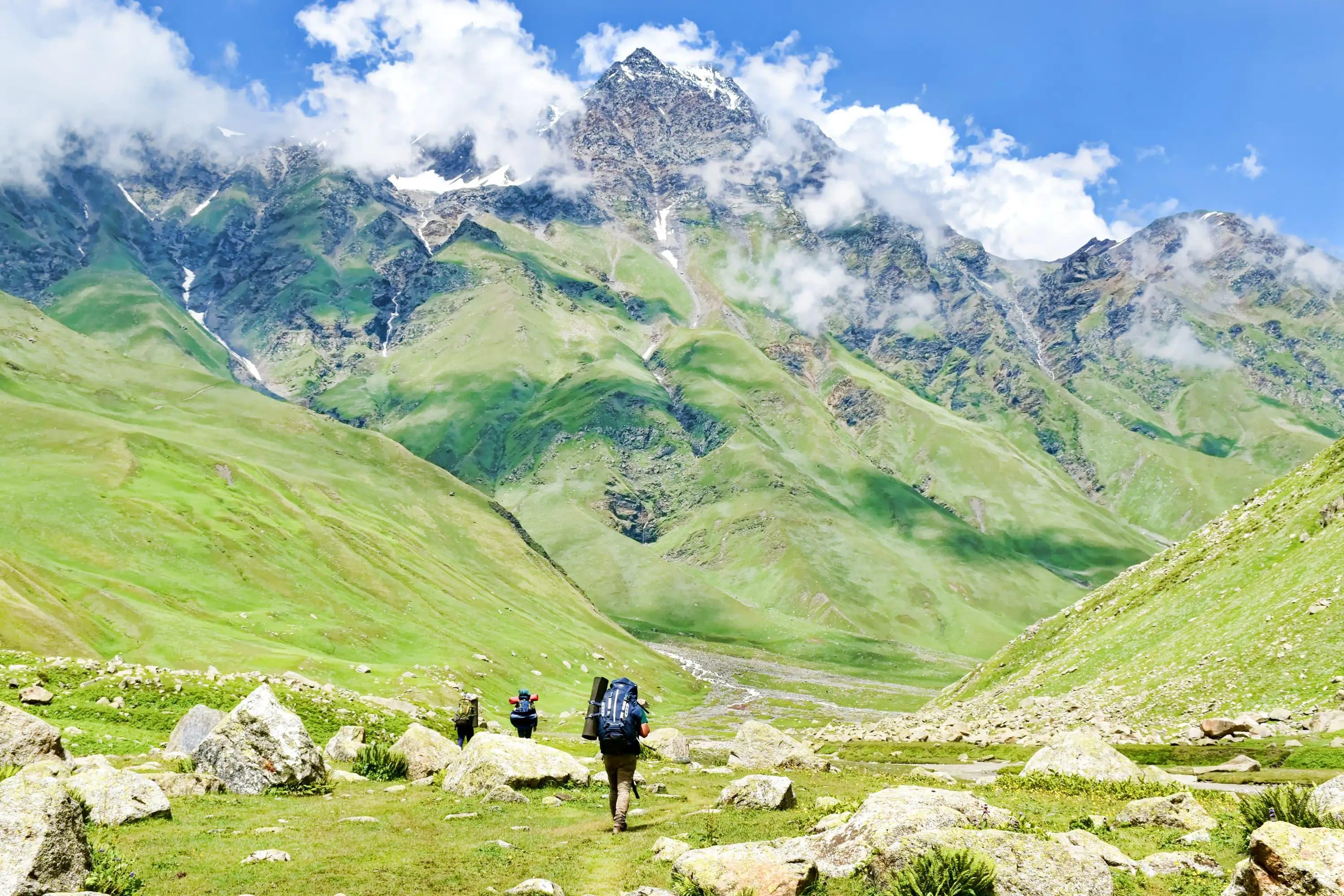
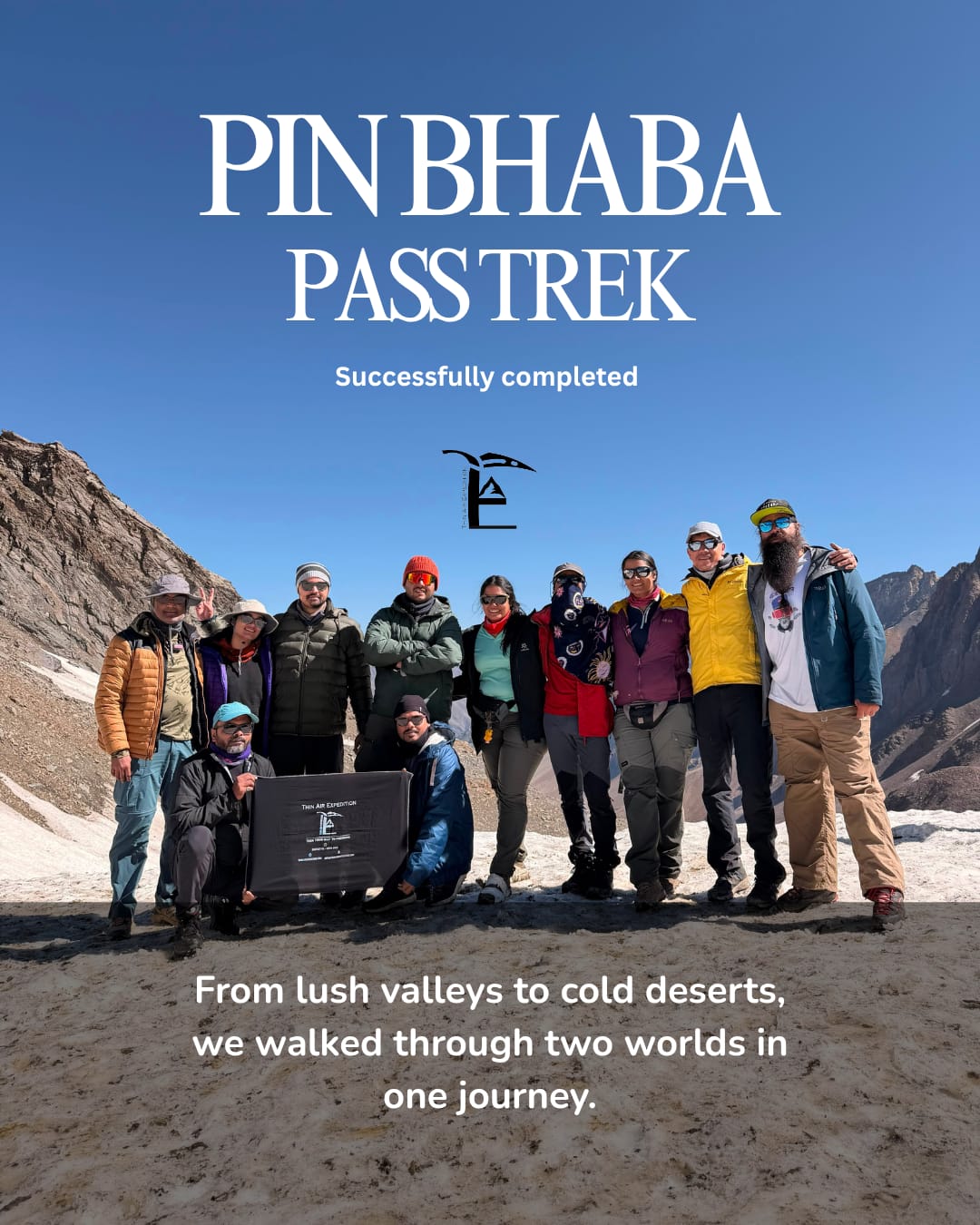
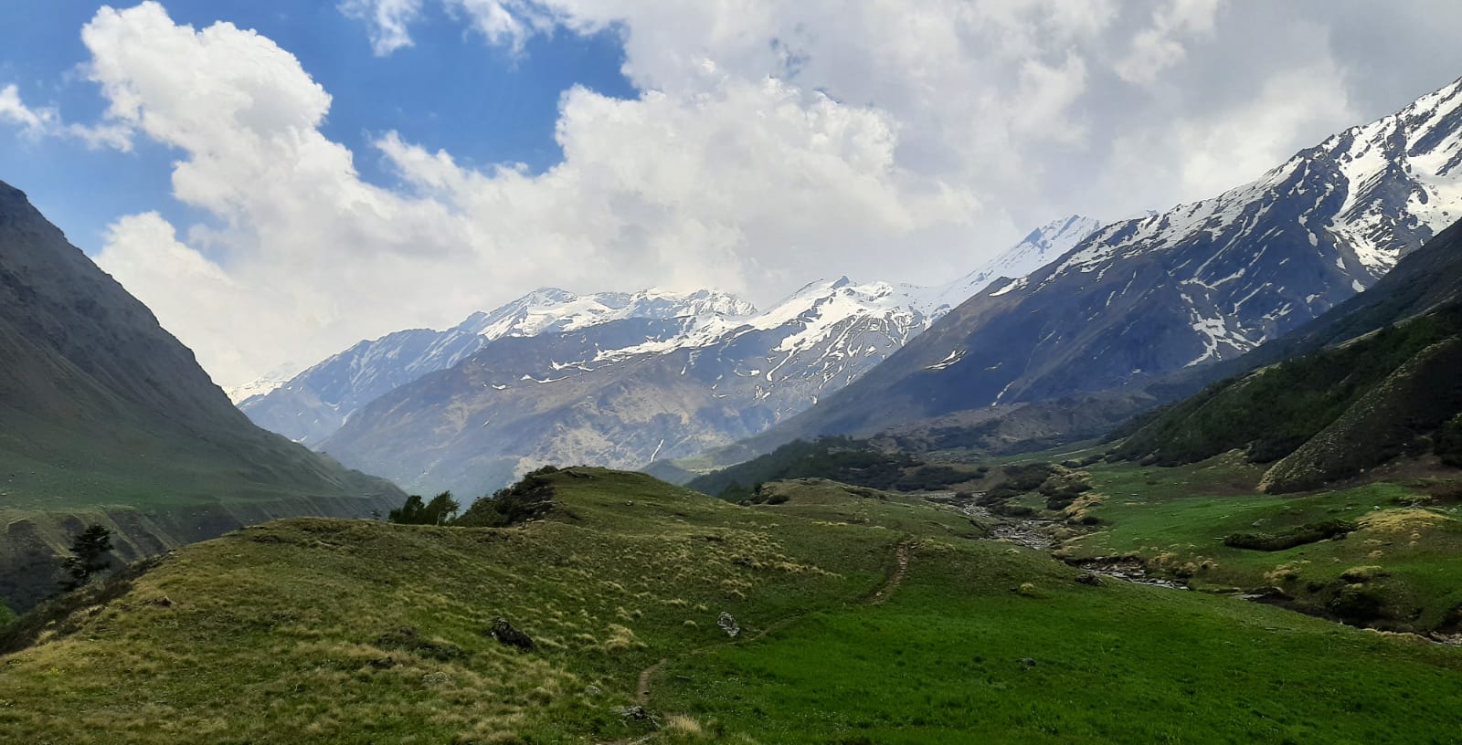
One of the most popular crossover trek Pin Bhaba Pass lies in the Indian Himalayas, which unites lush green Bhaba Valley of Kinnaur with the Spiti’s plain cold desert landscape in Himachal Pradesh.
The trek offers stunning transformation between two different ecosystems of Himalaya over just 7 days. Reaching an elevation of 4,900 meters creates an unforgettable experience for nature lovers, adventure seekers, and mountain lovers.
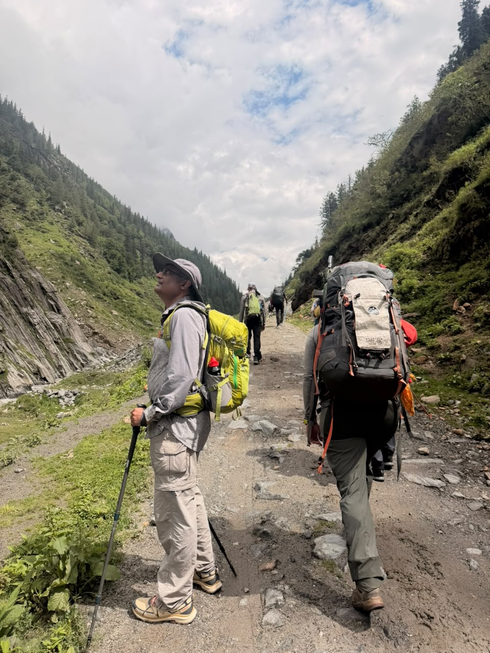
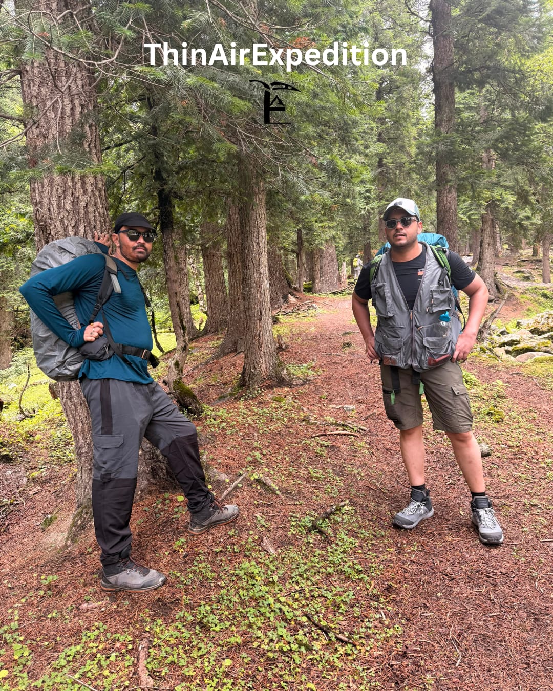
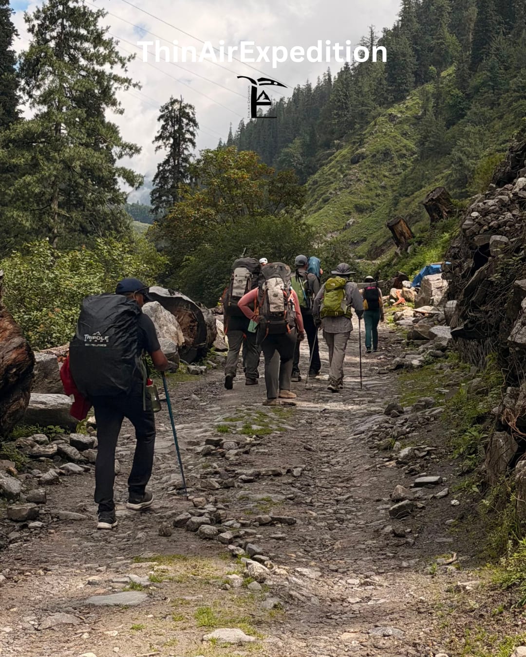
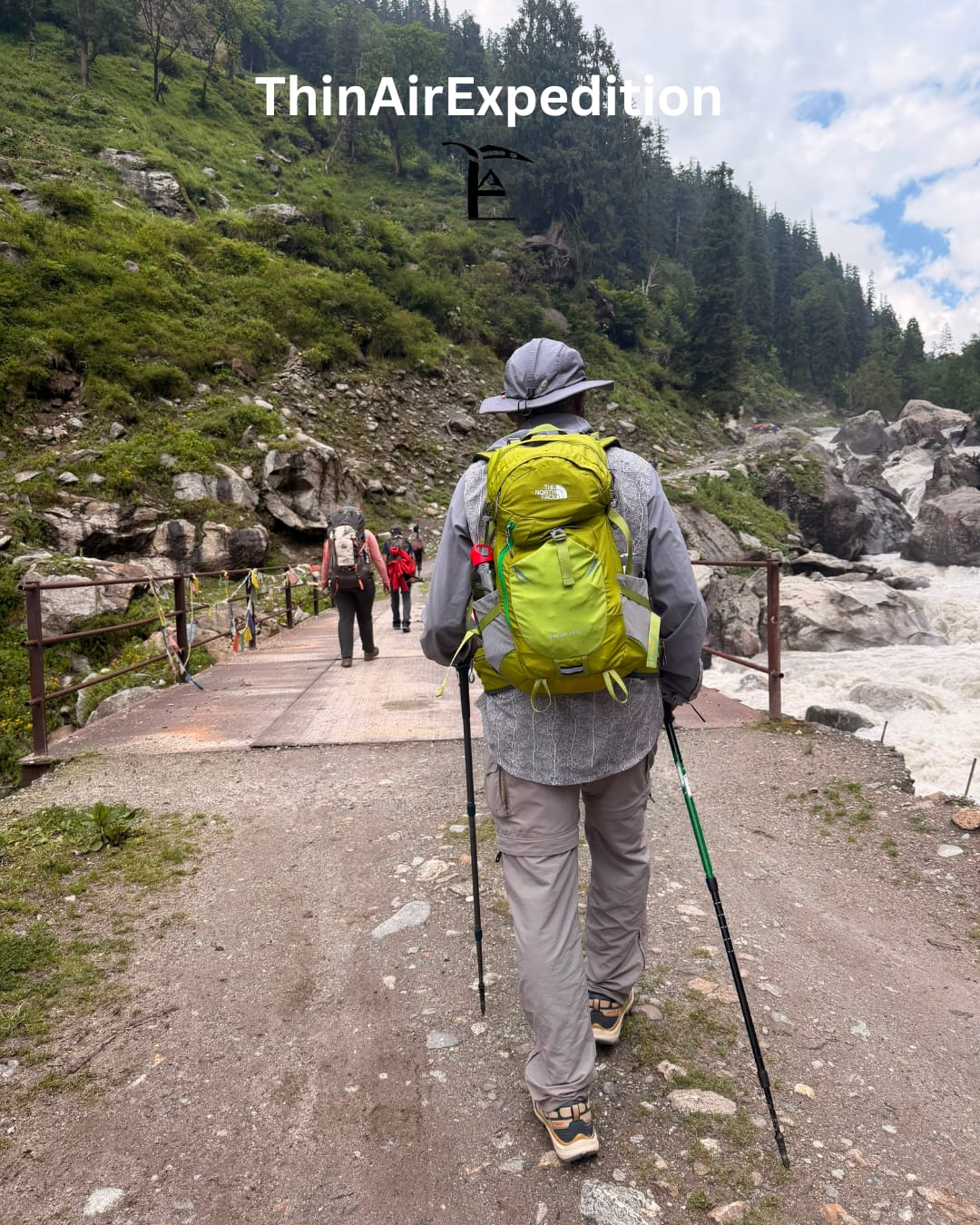
The trip begins from the small village, nestled in Kinnaur. The trip comes to an end at Kaza. In 7 days of course, participants come across every aspect of wilderness, including, dense forest of pine and oak, high-altitude pastures, glacial streams, river crossings, moraines, and alpine mountain landscapes. All these before arriving at the pass are not less than a rewarding experience.
The key highlight of the entre trek is the striking contrast between lush greenery and barren land.
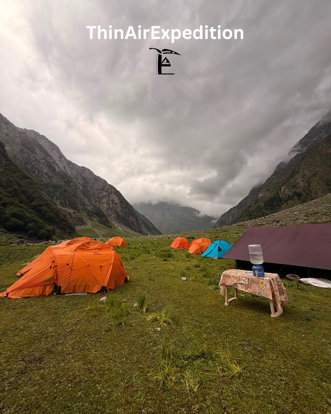
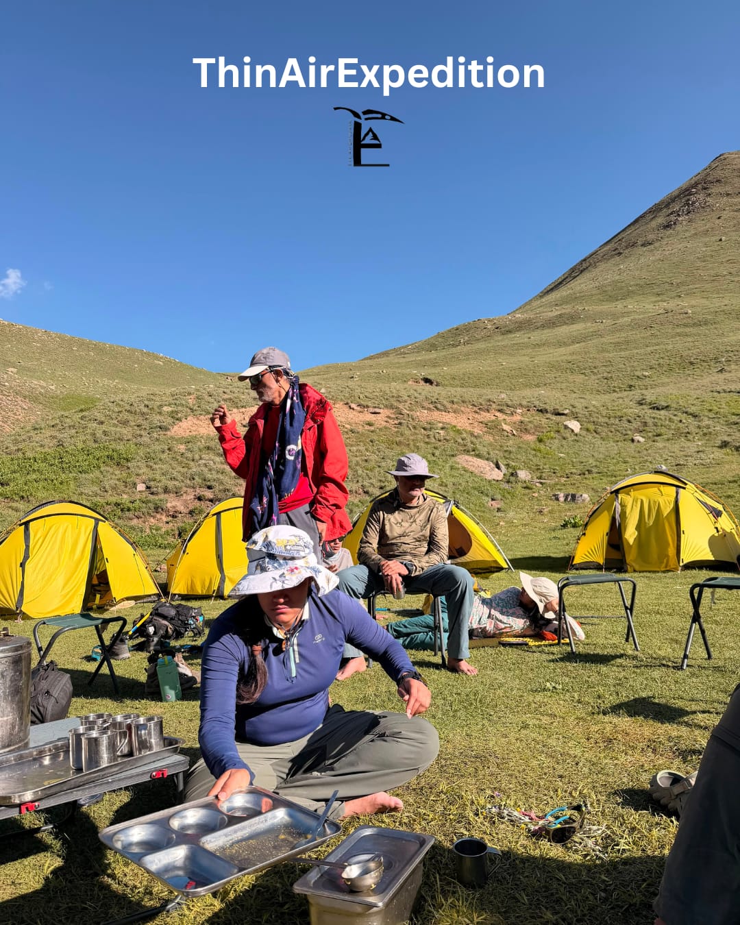
The trek is considered moderate to difficult and is ideal for participants who have prior trek experience and have good fitness level. The trail navigates through fairytale like campsites at Mulling, Karah, and esp. Phutsirang. Each of them holds unique charm.
Apart from this, trekkers get to learn culture of the nomadic lifestyle.
The Pin Bhaba Pass Trek is often regarded as one of India's most visually rewarding crossover treks because every day presents a completely different landscape. Some of the major highlights include:
· Dramatic Landscape Transition: Experience the striking difference between the lush Bhaba Valley and the stark, cold desert of Spiti as seen from the top of the pass. This change is one of the most remarkable in the Himalayas.
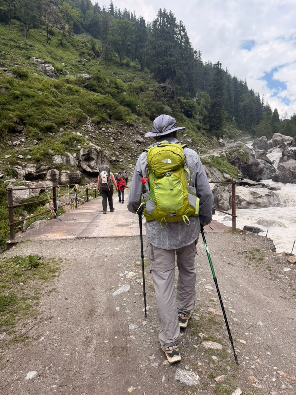
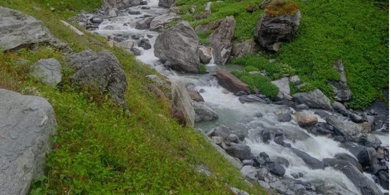
· Dense Forest Trails: In the early days, trekkers walk through magical forests filled with pine, oak, and conifer trees, with the sparkling turquoise waters of the Bhaba River nearby.
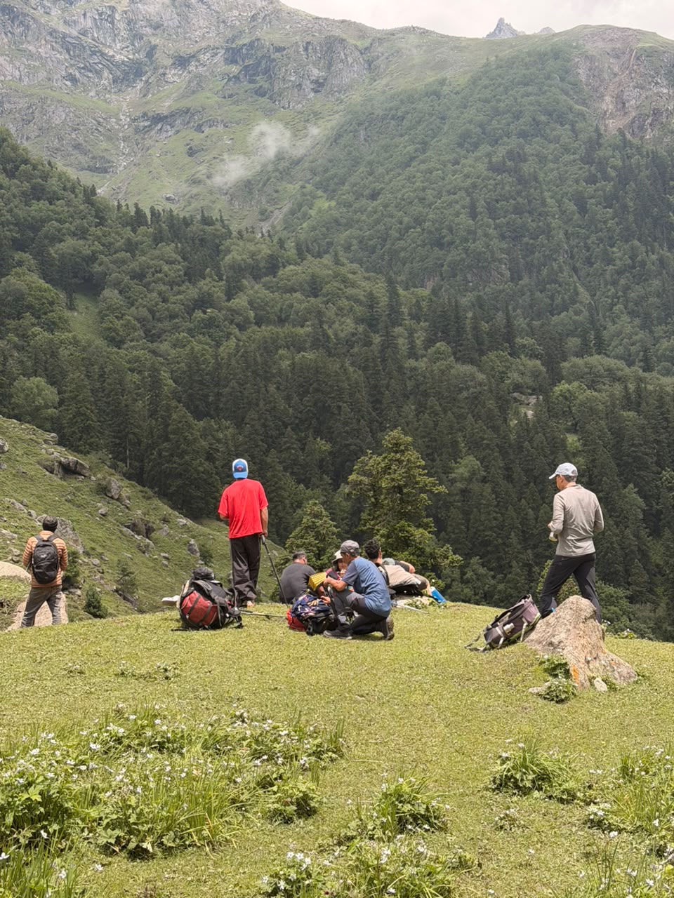
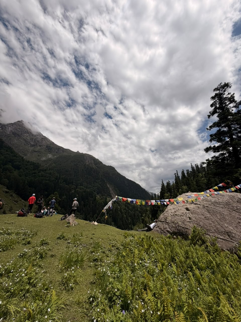
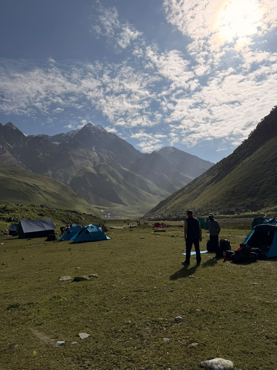
· Vast Alpine Meadows: Campsites such as Karah are nestled amidst wide-open grasslands, wildflowers, and gently sloping green hills that evoke the meadows of Kashmir.
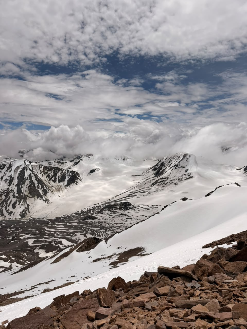
· High-Altitude Pass Crossing: Reaching the summit of Pin Bhaba Pass at about 4,900 meters provides expansive views of glaciers, snow-covered fields, dramatic peaks, and vibrant mountain ranges.
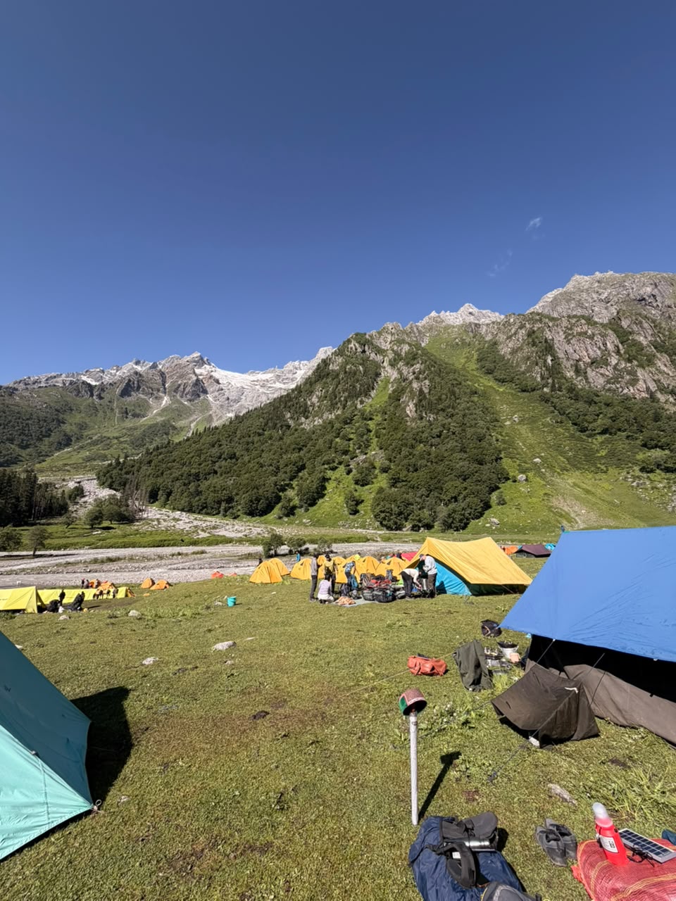
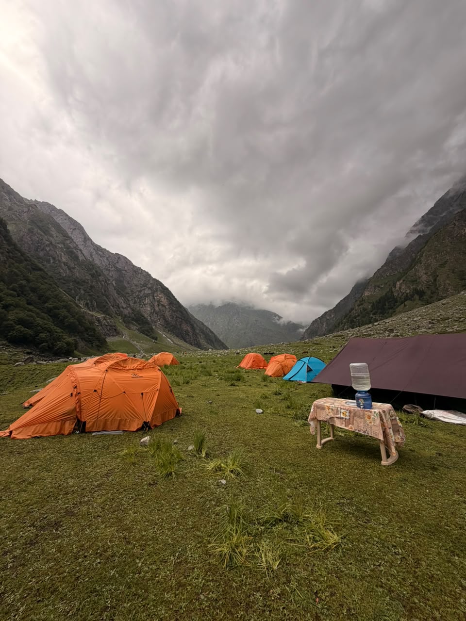
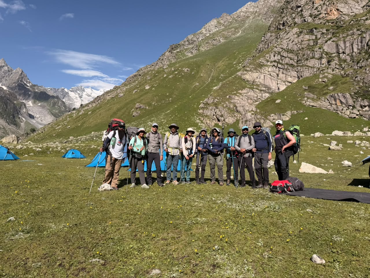
· Unique Campsites: Trekkers pitch their tents near rivers, highland meadows, and picturesque valleys, with each location providing a distinct mountain adventure.
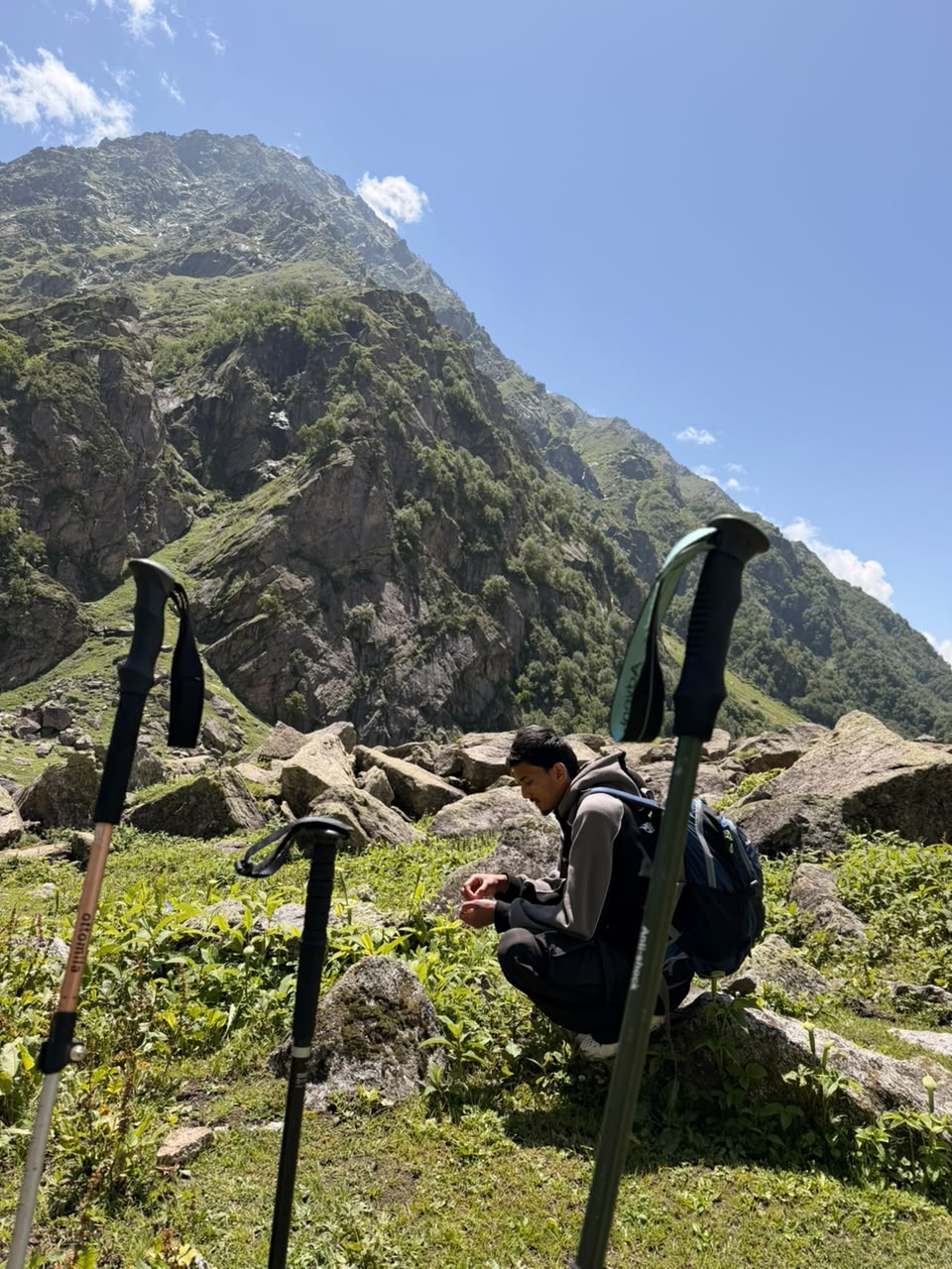
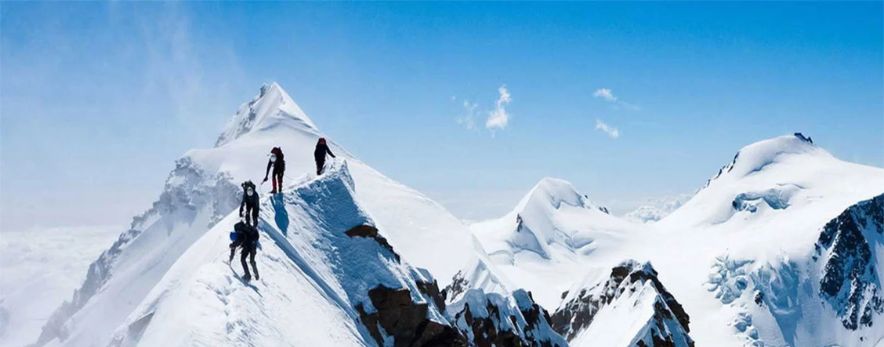
· Adventure Elements: River crossings, glacier sections, moraine walks, and steep ascents provide thrill and difficulty throughout the trek.
· Cultural Diversity: Witness the shift from the Hindu customs of Kinnaur to the Buddhist traditions of Spiti, evident in the villages, architecture, and everyday life.
· Exceptional Photography Opportunities: The shifting landscape, vibrant mountains, waterfalls, rivers, and striking skies offer limitless chances for landscape photography.
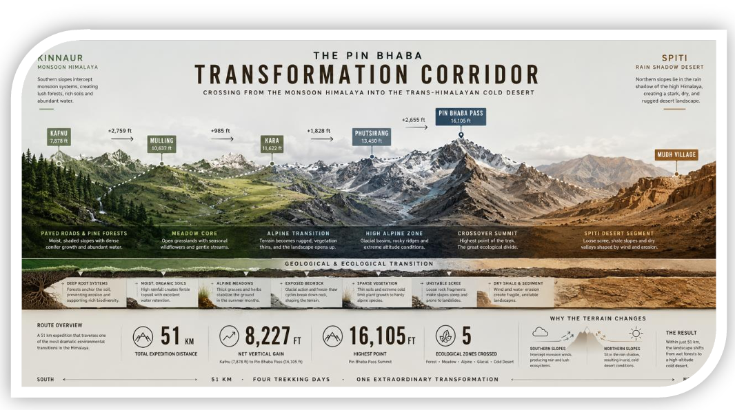
Day 1: Drive from Shimla to Kafnu
Day 2: Trek from Kafnu to Mulling
Day 3: Trek from Mulling to Kara
Day 4: Trek from Kara to Phutsirang
Day 5: Rest and Acclimatization at Phutsirang
Day 6: Trek from Phutsirang to Murtunga by Pin Bhaba Pass
Day 7: Trek from Bwaldar to Mudh and Drive to Kaza
It is important to obtain the permits for pin Bhaba Pass Trek since trail passes through protected area of forest. Several sections come under environmentally sensitive Himalayan region which require trekkers to obtain the permission from the authorities in advance before embarking on the trek.
Trekkers must pay the fees for camping as well. Most trekking agencies handle this process by adding the additional amount in the package and make necessary arrangements on your behalf so that you can focus on your journey.
Participants are required to carry their original government –issued photo id card, and foreign national must provide extra identification documents like, passport before commencing the trek.
For professional photography specific permissions will be required along with extra fees. Trekkers must inform their trekking agency about this beforehand.
✔ Pickup from Shimla
✔ Mountain transportation
✔ Homestay / Guesthouse stay
✔ Twin-sharing expedition tents
✔ Sleeping bags & mattresses
✔ Meals during trek (Veg with Eggs)
✔ Certified trek leader
✔ Local guides & support crew
✔ Oxygen support & first aid
✔ Forest permits & camping fees
✔ Mules/porters for common equipment
✘ Travel to Shimla
✘ Trek insurance
✘ Personal trekking gear
✘ Backpack offloading
✘ Personal expenses
✘ Buffer day expenses
✘ Anything not mentioned under inclusions
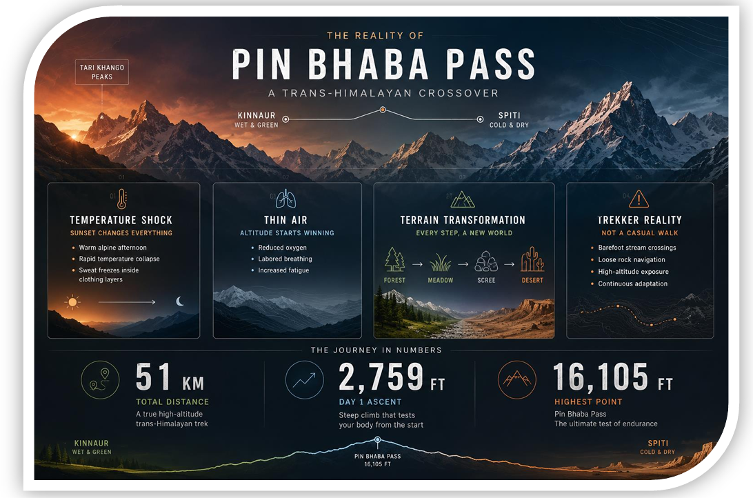
The Pin Bhaba Pass Trek is significantly more demanding than Hampta Pass. While Hampta Pass reaches an elevation of 14,035 ft over a 35 km trail with moderate elevation shifts, Pin Bhaba climbs to a much higher 16,105 ft over a 51 km route. Pin Bhaba features steeper ascents, longer daily walking distances, and a demanding summit crossing that requires excellent physical fitness and previous high-altitude trekking experience.
The ideal season runs from early July to mid-September. During these summer months, the high passes are generally clear of heavy winter snow blocks, and the dramatic contrast between the lush green valleys of Kinnaur and the dry rain-shadow landscapes of the Spiti desert is at its most striking.
Mudh Village is connected to the regional town of Kaza by a daily local HRTC bus service, and private four-wheel-drive taxis are also available. To travel toward Manali, you must drive from Mudh through Kaza and cross over the high Kunzum Pass. It is highly recommended to arrange a reliable private vehicle ahead of time to handle the rough road conditions along the Chandra River valley.
The mountains do not care about your fitness plans, your expensive gear, or the stories you want to tell when you get home. When you are standing on the loose rock slopes below the ridge at 15,000 feet, with the cold wind coming off the Spiti desert, the only things that matter are your breathing rhythm, the quality of your boots, and your mental determination. This trail rewards those who respect the altitude, prepare their bodies, and understand the technical realities of the terrain. The transition from the green forests of Kinnaur to the wide, bare desert plains of Spiti is an incredible experience—but you have to earn every single foot of the climb. Clean your gear, check your layers, and get ready for the trail.
Pin Bhaba Pass links green Bhaba valley in Kinnaur with the barren cold desert of Himachal’s Spiti Valley.
The pass rises at the height of around 4,915 meters (16,125 feet) above sea level.
The perfect season to book Pin Bhaba Trek is when weather conditions are stable. July to September is the ideal booking window to book your trek.
It is a moderately challenging trek due to its steep ascents and tricky declines. Longer trekking days and high-altitude make this trek difficult.
Usually itinerary takes 7 to 9 days to cover travel, trek, and acclimatization.
Yes, a previous moderate to difficult trek is recommended but not mandatory. If you have any kind of prior trekking experience and have good fitness level then you can take your passion to the next level.
Indians only require forest permissions and local registration; they don’t need any special permit. However, foreign nationals Indian nationals generally do not require a special permit, but forest nationals are requested to update themselves about current regulations before booking the Pin Bhaba Pass trek.
The dramatic shift from lush green pastures to forests, to rivers to plain desert in 7 days is a package of your dreams in one frame.
The trek begins from the small Himalayan village of Kafnu which lies in Kinnaur district.
Any summit that stands beyond the height of 3500 meters comes with AMS risk. Trekkers are requested to acclimatize properly, keep sipping water in regular intervals, climb at a steady pace and avoid rushing. All this practice will help them minimize the risk of Acute Mountain Sickness.
Network availability is patchy in the base village. However, expect zero network availability as you move further. The nature walks are meant for digital detox.
Beginners with good fitness level and proper preparation for increased endurance and acclimatization can embark of Pin Bhaba Pass trek.
Participants are offered the world class view of Spiti’s barren mountains. Second, the high-altitude crossing and river/waterfall crossing makes this trek even more satisfying and adventurous in all sense. You camp at the most beautiful sites like, Mulling and Kara.
Trekkers will have to walk several kilometers daily and carry a backpack while climbing uphill. They should be comfortable with such level of voyage and work on their fitness level at least 2 months in advance to undertake Pin Bhaba Pass Trek.
Yes, the campsite is pre-arranged and available as you reach the location. Not just campsite, your food menu, route, etc. are pre-planned before the trek commences.


₹On Demand | $On Demand
7 Days Days
Himachal Pradesh
60 Km
June to September
₹38000 | $500
8 Days
Himachal Pradesh
22 km
June to September
₹On Demand | $On Demand
8 Days
Himachal Pradesh
42 Km
July & August
₹28000 | $305
10 Days
Himachal Pradesh
110 Km
July to September.
Testimonials

Rakesh dulams
Nice experience with the thinAir expedition and accommodation and hospitality and safty such as taken personal care and well experienced guide and such a cool guy

Aditi 99
I had an amazing experience with thin air expeditions. The food, the hospitality, and the preparedness of the staff for all sorts of scenarios was commendable. The location of camps was perfect. Even though i was a female solo traveller , i felt very safe and comfortable. Couldn’t have asked for a better team.

Radandi Shashank
“You are not just a mountain trek guides, but a true guardian of the journey. Your unwavering loyalty to our team, the mountains, and safety itself is extraordinary. Every step felt secure because of your dedication, integrity. And stayed committed to every trekker, through every challenge, with patience, care, and honesty. Huge respect to Subodh Jii n Aditi Mam!! Thank youu @thinairexpedition It was wonderful experience!!❤️❤️

67D3_KALYAN
Completing the Kedarkantha trek at an altitude of around 12,500 feet was not just a trek for us, it was a life-long memory, and a major reason for this unforgettable experience is our guide Shubhod Sir. From the very first day till the summit, Shubhod Sir guided us with immense patience, discipline, and genuine care. At every difficult patch, when our legs were tired and breathing became hard, his calm words, constant motivation, and confident leadership gave us the strength to keep moving forward. He never rushed anyone and always made sure that every member of the group was safe, comfortable, and mentally strong. Shubhod Sir’s knowledge of the mountains, weather, and high-altitude conditions was truly impressive. More than a guide, he felt like a protector and mentor who treated everyone like family. His positive attitude and humble nature created a sense of trust and confidence among all of us. We are also thankful to Atidhi Madam for her support and cooperation during the trek, which added to the smooth experience. Because of Shubhod Sir’s guidance and dedication, we successfully reached the summit with confidence and joy. We will always remember this trek with gratitude and respect. Truly blessed to have a guide like him. 🙏⛰️

Arvind Sahu
Wonderful experience totally worth it. At those price they provided services that no one could provides really enjoyed ❤️🎉

Kolanu Anirudh
This is my first trek in Uttarakhand(Kedharkanta) and Thin Air Expedition made it a memorable one Thanks for everything subodh bro you made it so special.

kanica kandpal
Completed the Gaumukh–Tapovan trek with Thin Air Expedition, and it was an exceptional experience from beginning to end. Instead of opting for a fixed-departure model, we chose a personally curated itinerary, as this was our first trek—and it turned out to be the perfect decision. The team was extremely thoughtful in planning each day’s distance, ensuring we were comfortably challenged without ever feeling overtired or exhausted upon reaching the campsites. Every campsite was carefully selected, offering not just safety and comfort but also breathtaking views that made each halt truly memorable. What stood out most was the level of personalization. The itinerary was clearly tailored to our pace and comfort, and the trek leader constantly shared insightful facts about the region, its geography, and cultural significance, adding depth and meaning to the journey. Overall, Thin Air Expedition delivers a highly personalized, well-paced, and enriching trekking experience. I would highly recommend them, especially for first-time trekkers looking for a safe, informative, and thoughtfully curated adventure.Sen

Raj Bahadur
I booked my trek with Thin Air Expedition on a friend’s recommendation, and it turned out to be a great decision. They managed travel and accommodation very smoothly, and everything was well organized throughout the journey. The team stayed in regular coordination, ensuring that stays and drivers were properly arranged each day. The entire trip was timely, hassle-free, and also pocket-friendly. I would definitely recommend Thin Air Expedition—you can trust them completely with your travel and trekking plans.

sachin aulakh
I recently completed the Kedarkantha Trek with ThinAirExpedition, and the entire experience was outstanding. The coordination, communication, and arrangements were excellent. The trek leaders were experienced and friendly, the support staff was humble, the stay was comfortable, and the food quality in such high altitude conditions was truly impressive. Their focus on safety and responsible trekking made the journey even better. I would definitely choose them again for my next Himalayan adventure! 🏔️✨

Aman rai
I recently completed a trek with the help of ThinAirExpedition, and the entire experience was very comfortable. From stay arrangements to travel from Rishikesh to Rishikesh, everything was well managed. The driver was extremely polite, supportive, and made the journey smooth and stress-free. Overall, a great experience and I would definitely recommend them.

Nitya Jaiswal
Kedarkantha was not just a trek, it was an experience that helped me reconnect with myself. Thanks to Thin air expeditions , I felt safe, cared for and encouraged at every step. The sunrise at the summit, the laughter around the campfire and the kindness of the guides will stay with me forever. If you're looking for a company that treats you like family on the mountains, this is the one.

Biswajit Sahoo
Subodh Sir making the trek so much of fun and intresting .. Awesome Experience with Subodh Sir

Anmol Verma
Overall trekking and accommodation was a very smooth experience. Our trek leader Mr. Ramesh was amazing and very helpful. He managed to make the trek look easy. Overall experience was 10/10. Would highly recommend.

Rishabh Singh Rana
Trek Guide Mr. Ramesh Ji is a very cool & good person. Trek journey became beautiful with the group and overall it became my one of the best experience.

aditi vaidya
I recently went on a trek with Thin Air Expeditions, and I can't get over the experience I had! I did the Phulara Ridge trek with Subodh sir, and it was an incredible experience. What made it even more special was that Subodh sir made sure I could bring my dog, Flake, a toy pom. His team and him took such great care of us, and it was clear that they truly care about their guests, human or canine! The group was amazing too. I met some wonderful people along the way, and we formed lifelong bonds. The whole experience was beautiful – from the breathtaking views to the friendly, supportive environment. I’ll cherish these memories forever! If you're looking for a SAFE, well-organized, fun, and caring trekking company, Thin Air Expeditions and Subodh sir are the ones to go with!

Anuja Vaidya
It was a wonderful experience with TAE on Phulara ridge trek, everything was on point the gears, food, trek guides and Subodh sir himself was an amazing leader who is the founder of TAE, he made sure the experience was amazing even for the first timers keeping safety the first priority. Also I took my Dog, Flake along with me for the trek and it was a great experience for her as well and her food and safety was well taken care of . 🐾 Would love to go back again with Thin air expedition. Thank you so much 🤗

Simran Samal
Phulara Ridge Trek – A Memorable Experience for me !!! Someone once told me, “Trips aren’t just about travel — they become a part of you.” I never really believed it, but this time, Phulara Ridge became exactly that for me. Our first campsite — the forest trail, the tents, the whole setting — gave me the first taste of what was to come. Everything was so thoughtfully arranged, it felt like nature itself had prepared that space for us. All thanks to our trek leader, Subodh bhai 🙌🏻. The next stop was magical in its own way. The campsite was picture-perfect, and we even ended up learning a bit of the local Uttarakhandi dance from Dev bhaiya (well… I tried to! 😄). In the evenings, we played games and spent such a good time that we forgot the weight of city life for a while. And finally, the Ridge: Honestly, we thought the weather would block the views, but Subodh bhai timed it so perfectly that the skies cleared for us. Walking on the ridge — one valley on the right, another on the left, clouds passing beneath us — felt surreal. We sat there for hours, just soaking it all in. It was pure peace. And yes, we even made tea there!!! 🫶🏻 (Of course, we made no mess, cleaned it all up, and left the space exactly the way it should be 😌). For me personally, trekking has always been like meditation — a way to quiet the noise and reconnect with myself. This trek with Subodh bhai and the team gave me exactly that: peace, perspective, memories for a lifetime, and inspiration. #SoGrateful 🙏🏻 Thank you, Subodh bhai and team, for making this such a soulful and unforgettable journey! Lastly Just one note for all: “In the end, we don’t conquer mountains; they help us discover who we truly are.” To anyone even considering it: please go with #ThinAir Expeditions to experience the rawness of trekking, the beauty of nature, and the joy of escaping city life for a while. You’ll come back not just with pictures, but with stories, stillness, and a piece of the mountains in your heart. All the best !!! ✌🏻

Netra Sharma
It was a wonderful experience with ThinAir Expedition. I went on my first trek to Phulara Ridge, and it was truly amazing. Our guide, Subodh ji, managed everything so well and remained patient throughout the trek. I enjoyed every moment and every spot. The place, the cook, and the helpers were all wonderful. The food and camps were awesome. I highly recommend joining ThinAir Expedition to experience the best of “pahadi” life!

Vaibhav Srivastava
Thin Air Expedition gave us the best experience while trekking. Everything was finely arranged and properly taken care of whether it was travel, food. Staff availablity. But the best part was free hand while trekking. Subodh led us beautifully taking in note that everyone reaches the base camp and everyone is doing well. Consulting our next phase keeping in mind the safety and gears. It was collectively very amazing. He gave us full free hand additionally it is our responsibility as well to take care of each other. We did so many activities had games and fun and he even taught us how to camp. How to set up it was fun. If it would've given me option I'll rate it 10. Thanks subodh and team and thin air expedition for such a memorable trip.

Somya Chaturvedi
I recently did the Phulara Ridge Trek with Thin Air Expedition, and it was my first trek ever truly an unforgettable experience! Everything was so well managed from safety arrangements and equipment to food and stay, I never had to worry about a thing. Our trek leader, Subodh, was extremely supportive, patient, and motivating, which made a huge difference for a first-timer like me. The food was simple, homely, and very satisfying after long trekking hours. Most importantly, safety was always the top priority. For anyone planning their first or next trek, I’d highly recommend Thin Air Expedition. Professional, caring, and passionate about making the experience memorable!
We're always ready for adventure
Trekking comes with uncertainty. Weather, terrain, and setbacks are part of the journey. We embrace them with resilience and openness—each challenge makes us stronger and more appreciative of nature's beauty.
We embrace low-noise trekking
We blend into nature, not the other way around. We avoid shouting, loud music, and noisy games. In silence, we hear birdsong, streams, and the wind—inviting peace, reflection, and a deeper connection with nature.
We protect the environment
We protect the environment by minimising waste, reusing resources, and picking up litter. We carry eco-bags, segregate waste, and inspire others to preserve trails. Sustainable trekking ensures these mountains remain beautiful for future generations.
We are self-sufficient
We carry our load as much as possible, manage our gear, and stay prepared for all situations. Self-sufficiency builds confidence, independence, and respect for fellow trekkers, support staff, and the trail itself.
We support each other
Trekking is not a solo act. We wait for each other, share burdens, and uplift teammates. By putting the group first, we build strong bonds and help everyone complete the trek joyfully.
We are fit and prepared
We train well before our treks. This helps us walk longer, handle emergencies, and contribute to the team. Fitness ensures we are never a burden and always ready to help when needed.


