03
Feb

Ask seasoned trekkers about their most unforgettable Himalayan experience, and many will point to a hidden valley in Kashmir that remains largely unknown even to Kashmiris themselves. The Warwan Valley Trek is not just another beautiful trail in the mountains—it’s an odyssey that transforms your understanding of what trekking can be. This is Kashmir’s best-kept secret, and for those willing to embrace the challenge, it offers rewards that no other trek in India can match.
Starting Point: Panikhar, Kargil District
Ending Point: Inshan/Sukhnai, Warwan Valley
Trek Duration: 8-10 Days
Total Distance: 78 km (approx.)
Maximum Altitude: 14,500 ft (Lomvilad Pass)
Difficulty Level: Moderate to Difficult
Best Season: July to September
Trek Type: Trans-Himalayan Crossover
Most treks offer one type of landscape—alpine meadows in Kashmir, barren deserts in Ladakh, or forested trails in Uttarakhand. Warwan Valley delivers everything in a single journey: barren purple mountains, river deltas, vibrant meadows, massive glacial lakes, moraine sections, and the magnificent Bracken Glacier. This diversity is what makes the experience so extraordinary.
The trek begins in Trans-Himalayan terrain around Panikhar, characterized by stark, purplish barren mountains, and gradually transitions into the lush, vibrant greenery typical of Kashmir Valley. This dramatic shift from desert mountains to verdant paradise creates one of the most striking visual experiences in all of Himalayan trekking.
Imagine starting your journey in a landscape that resembles Mars—rocky, barren, and devoid of vegetation. Day by day, as you trek deeper into the route, subtle changes begin. A patch of grass here, a wildflower there. By the time you reach Warwan Valley proper, you’re surrounded by meadows so expansive and green that they seem to stretch into infinity. This transition alone is worth the entire trek.
1. Untouched Wilderness
Warwan Valley’s remoteness and isolation compound its beauty, offering a side of Kashmir that even most Kashmiris haven’t seen. There are no tea stalls, no mobile towers, no signs of commercialization—just pure, undisturbed wilderness.
2. The Bracken Glacier Experience
After a tricky climb to the pass, trekkers walk approximately 2 km on the magnificent Bracken Glacier, navigating its crevasses all the way to its snout where it cascades into moraines. Walking on a living glacier is an experience few trekkers ever have, and doing so in such a remote setting makes it even more profound.
3. Daily Distances and True Adventure
The trek involves covering approximately 20 kilometers daily through challenging terrain including hard moraine sections, narrow scree trails, narrow ridge walks, and steep descents. This isn’t a leisurely walk—it’s an adventure that demands respect, preparation, and determination.
4. Authentic Cultural Encounters
The trek offers a revelation of 19th-century Kashmiri culture, with opportunities to encounter Gujjar and Bakerwal shepherd communities living their traditional pastoral lifestyle in remote summer settlements.
5. Alpine Lakes and Warwan Waters
The Warwan Lakes are alpine lakes formed by melted glaciers, large and calm bodies of water surrounded by snow-capped peaks that provide a peaceful environment even in the heart of wilderness.
Altitude: 1,600m | Type: Arrival Day
Your journey begins in Srinagar, the summer capital of Jammu & Kashmir and the city of houseboats. Arrive at Sheikh ul-Alam International Airport, where you’ll be transferred to a houseboat on Dal Lake or a hotel. Spend the day exploring Srinagar’s Mughal gardens, floating vegetable markets, and the historic old city. This acclimatization day is crucial for adjusting to the altitude and preparing mentally for the adventure ahead.
Highlights:
Distance: 185 km | Drive Time: 7-8 hours | Altitude: 3,300m
The drive from Srinagar to Panikhar covers approximately 185 km and takes 6-7 hours of scenic driving. The journey takes you through Sonamarg, over the famous Zoji La Pass (11,575 ft), and into the completely different landscape of Ladakh. You’ll pass through Drass, the second coldest inhabited place on Earth, and then Kargil before reaching Panikhar in the Suru Valley.
Panikhar sits in a stark, beautiful valley dominated by views of the Nun-Kun massif. The village serves as a base for mountaineering expeditions and trekking routes. Spend the evening acclimatizing and meeting your trekking team.
What to Expect:
Distance: 12-14 km | Trek Time: 6-7 hours | Altitude Gain: ~500m | Camp Altitude: 3,650m
The trek officially begins! The day starts with a gentle walk through the barren landscape characteristic of Ladakh. You’ll encounter huge river delta basins and witness the stark beauty of Trans-Himalayan terrain. The trail follows river valleys, crosses small streams, and gradually gains elevation.
As you progress, you’ll start noticing subtle changes—small patches of green appearing in the otherwise brown landscape. These are the first hints that you’re transitioning toward Kashmir’s influence. The campsite at Denora sits in a wide valley with spectacular views of surrounding peaks.
Trail Features:
Activities: Short hikes, exploration, rest
Rest days are essential for allowing your body to acclimatize to high altitude and prevent exhaustion and altitude sickness. Use this day to explore the surrounding area with short walks, practice using your trekking poles on different terrain, and let your body adjust to the thinning air.
Many groups use this day to trek partway toward Kalapari and then return to Denora, effectively gaining altitude exposure without the stress of a full trekking day with loaded packs. This strategy significantly reduces the risk of altitude sickness in the days ahead.
Recommended Activities:
Distance: 8-10 km | Trek Time: 4-5 hours | Camp Altitude: 3,925m (12,875 ft)
The trek from Denora to Kalapari spans approximately 3 kilometers initially, then continues to the full campsite, taking around 4-5 hours total with a relatively easier, gentle ascent. The trail traverses through lush meadows interspersed with rocky sections, with possibilities of crossing pristine streams.
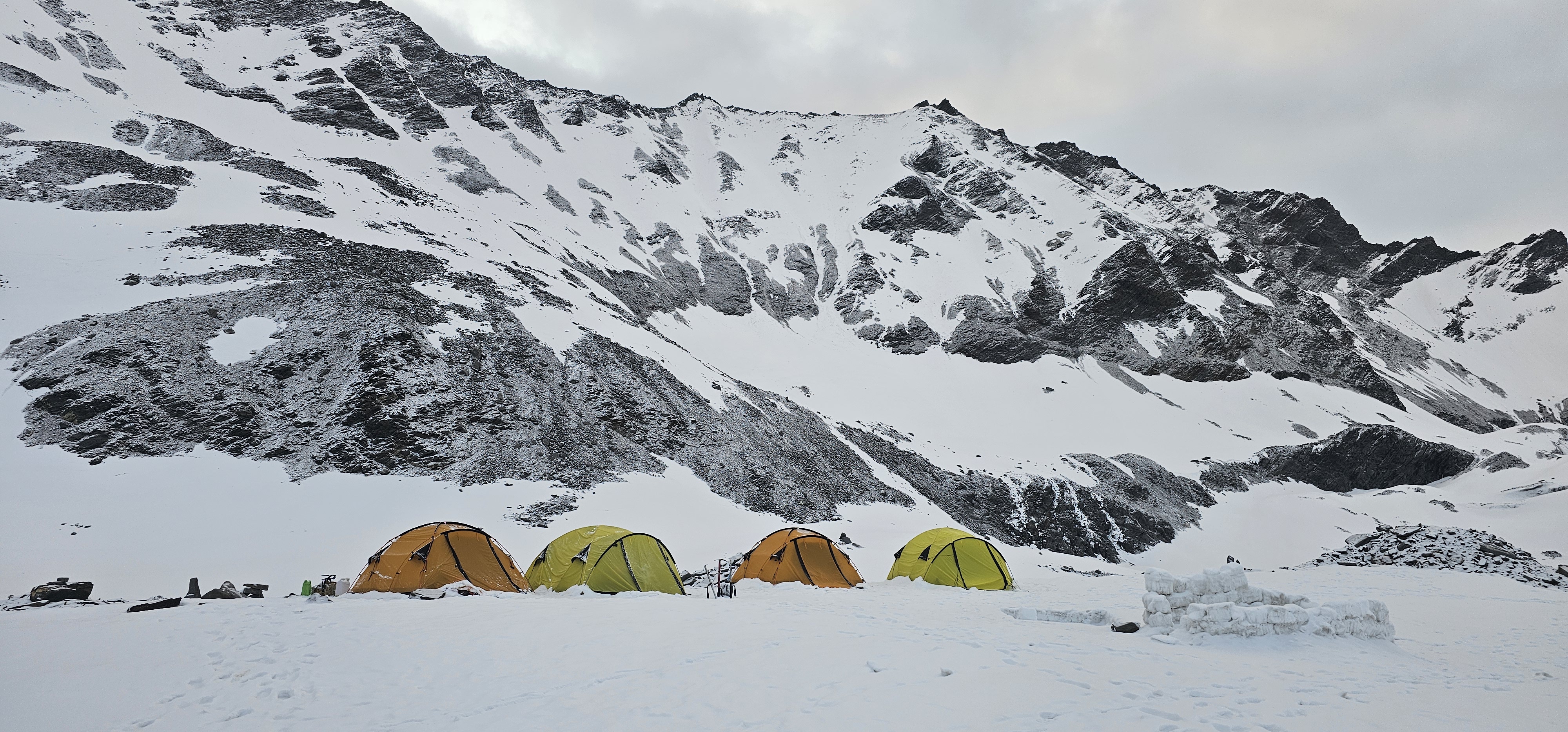
Kalapari Camp is situated at about 12,875 feet and offers a tranquil setting with mesmerizing views of the valley and towering mountains. This is your staging point for the most challenging day of the trek. Spend the evening mentally preparing for the pass crossing, checking your gear, and getting adequate rest.
What Makes This Day Special:
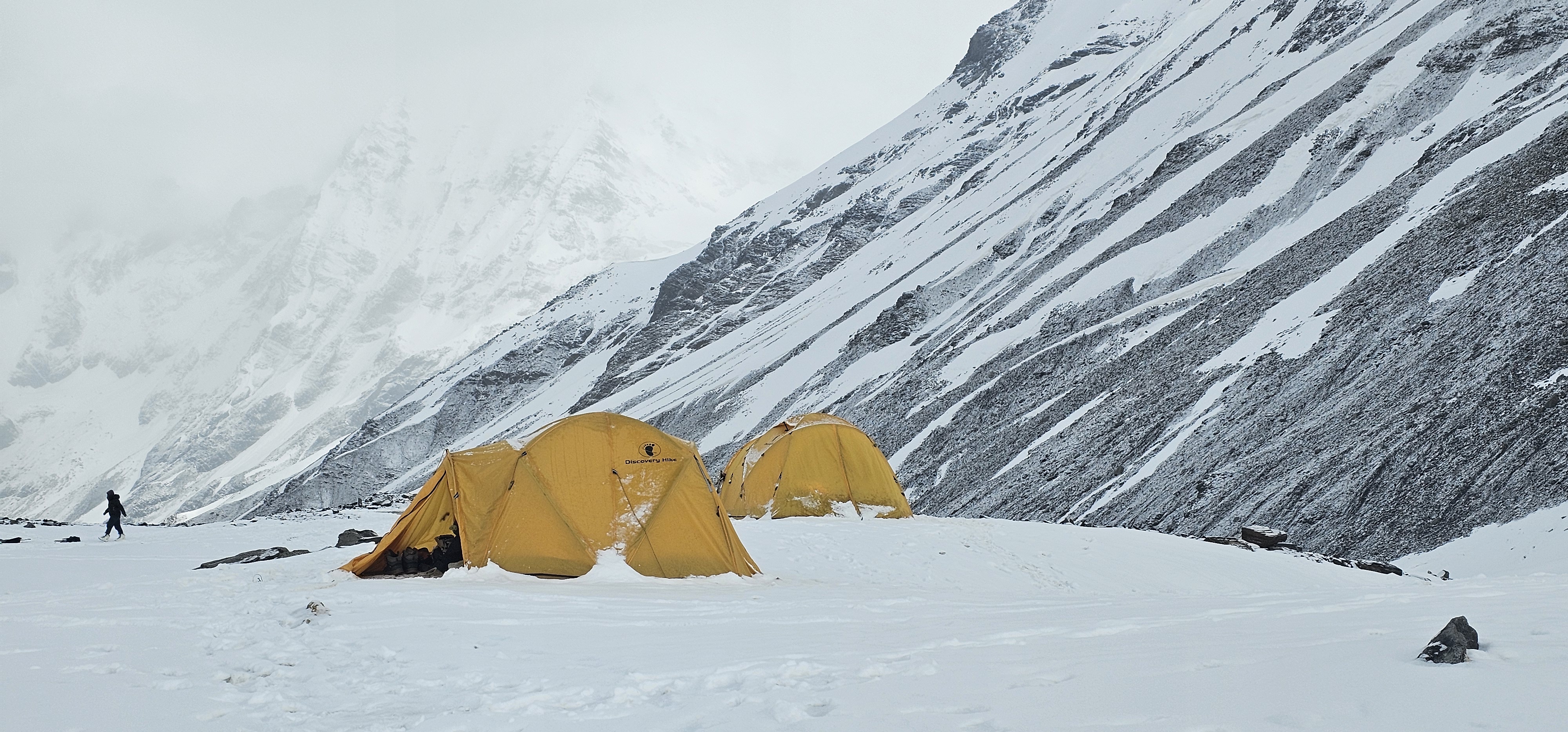
Distance: 16-18 km | Trek Time: 11-12 hours | Maximum Altitude: 14,500 ft | Camp Altitude: 4,200m
This is the day you’ve been training for—the longest, most challenging, and most rewarding day of the entire trek. The journey involves crossing Lomvilad Pass at approximately 14,495 feet, featuring a steep and rocky ascent that requires significant stamina and determination.
Morning: The Ascent (4-5 hours)
Start early, ideally by 5:30-6:00 AM. The initial climb is gradual but becomes progressively steeper. The trail zigzags up rocky terrain with loose scree in sections. Every step requires careful foot placement. As you gain altitude, breathing becomes more labored, and the pace naturally slows.
The final approach to the pass is the steepest section. Prayer flags marking the pass appear like a mirage, always seeming just a little farther than they actually are. When you finally reach the top, the sense of achievement is overwhelming.
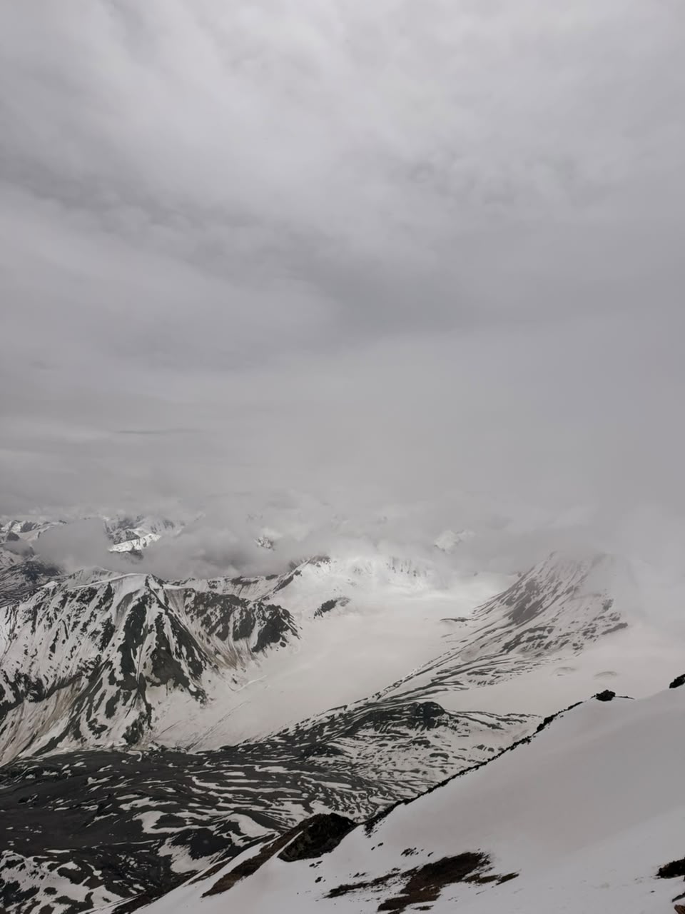
At the Pass (14,500 ft)
Take time to catch your breath, enjoy the 360-degree views, and capture photographs. On clear days, you can see peaks stretching in every direction. This is also where the real transition happens—looking back, you see the barren mountains of Ladakh; looking forward, hints of green announce Kashmir’s approach.
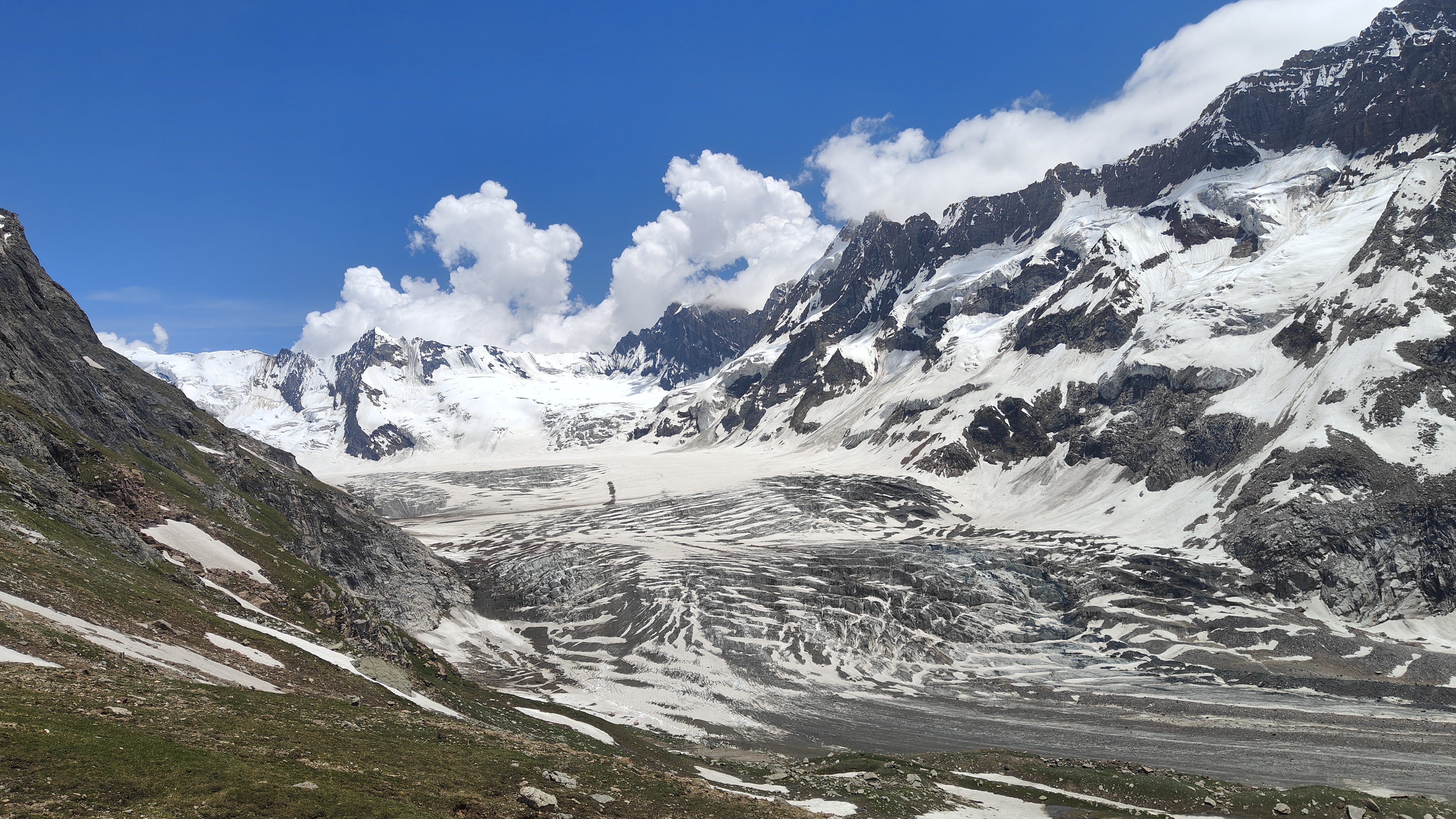
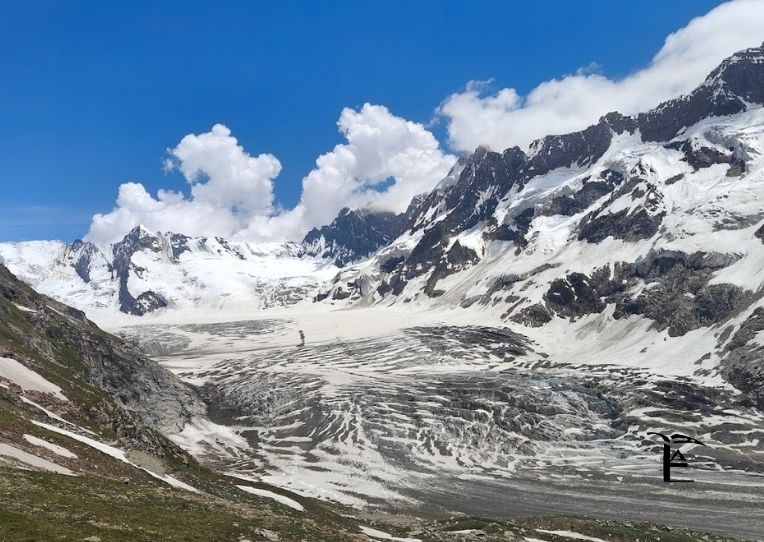
Afternoon: The Bracken Glacier (2-3 hours)
After conquering the pass, the trail leads to a 2 km walk on the magnificent Bracken Glacier, where trekkers must navigate crevasses all the way to the glacier’s snout. Your guide will rope you up and lead the way across the ice. This is technical terrain requiring focus and careful movement.
Crevasses—deep cracks in the glacier—are visible in places, serving as stark reminders of the glacier’s power and the importance of following your guide’s instructions exactly. The ice can be slippery even with crampons, and the altitude makes every movement more exhausting.
Evening: Descent to Kaintal (3-4 hours)
After crossing the glacier, the descent begins through moraines—loose rock and debris left behind by the glacier. This section is hard on the knees and requires concentration to avoid ankle rolls. Eventually, you’ll reach the Kaintal meadows, where your camp awaits.
By the time you reach camp, you’ll have been trekking for 11-12 hours. You’ll be exhausted, but also exhilarated. This is the day that defines the Warwan Valley Trek.
Safety Notes:
Distance: 13-15 km | Trek Time: 6-7 hours | Altitude: Gradual descent to ~3,600m
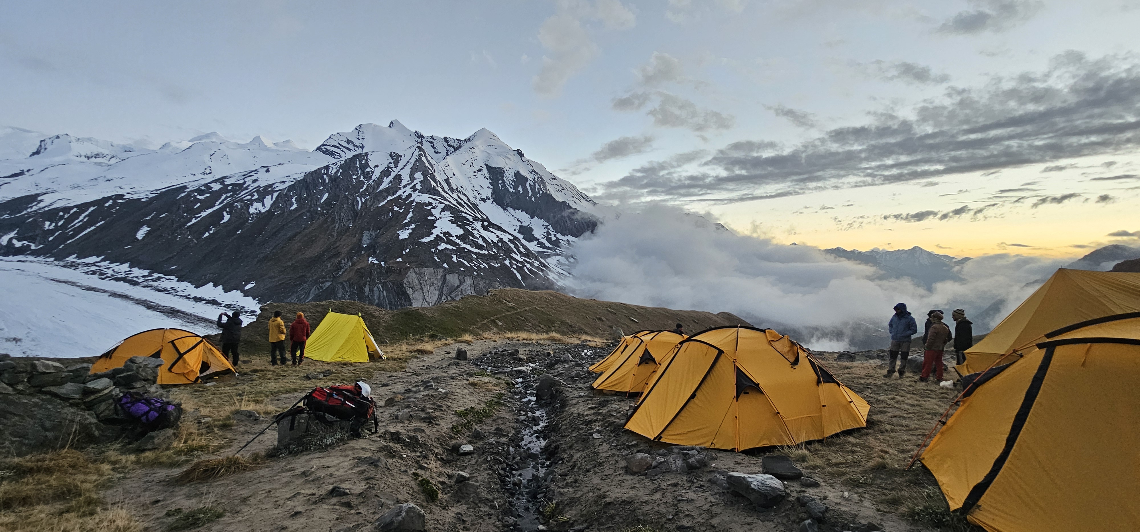
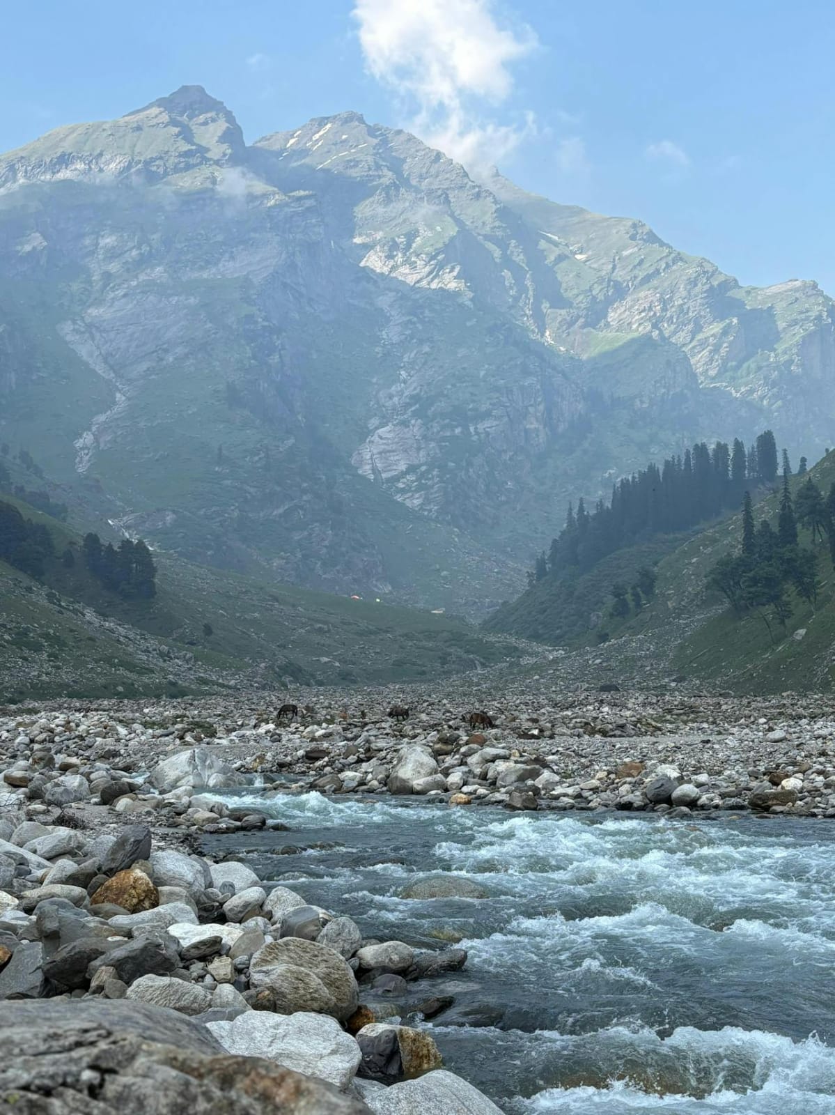
After yesterday’s marathon day, today feels comparatively relaxed. The trail passes through lush meadows and you’ll encounter nomadic Gujjar huts. This is where you truly enter Warwan Valley—the vegetation is thick, wildflowers bloom in profusion, and the landscape has completely transformed from the barren terrain where you started.
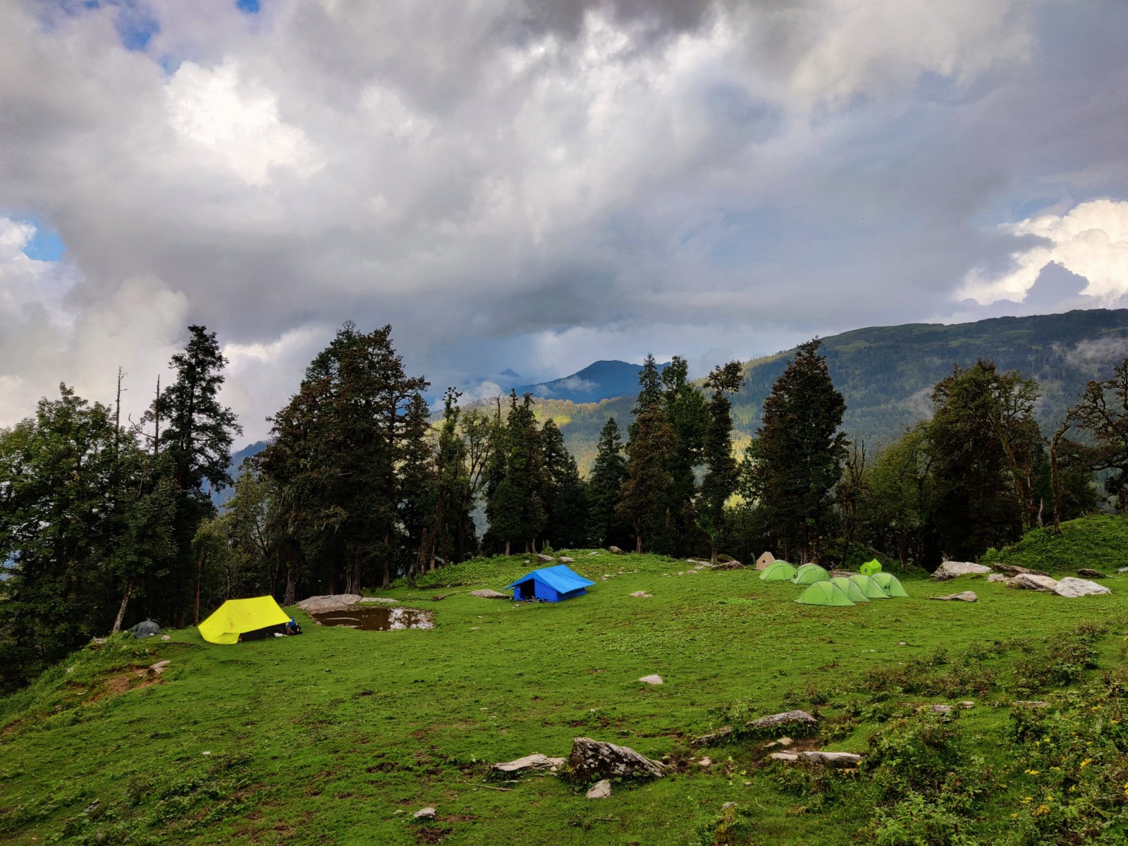
Humpet holds a massive expanse—imagine 10 golf courses together in a single space. The meadow seems to stretch endlessly, dotted with grazing cattle and horses. Silver birch trees line streams, and the entire setting feels like something from a fantasy novel.
This is an excellent day for photography, wildlife spotting, and simply soaking in the beauty of Warwan Valley. The camp at Humpet is one of the most scenic of the entire trek.
Highlights:
Distance: 12-14 km | Trek Time: 5-6 hours | Altitude: Continued gradual descent
The trek involves descending through diverse landscapes into the lush woodlands of Sukhnai, marking the entrance to Warwan Valley proper. The trail follows the Warwan River through increasingly dense forest. You’ll pass through small seasonal settlements where shepherds have established temporary homes for the summer grazing season.
The landscape continues to change, becoming more forested and green with each kilometer. By the time you reach Sukhnai, you’re firmly in Kashmir territory—the air feels different, vegetation is lush, and signs of permanent habitation appear.
What to Experience:
Distance: 8-10 km | Trek Time: 4-5 hours | Activities: Trek completion, drive preparation
This day involves a challenging trek through villages appearing every few kilometers, marking a relaxing descent back to civilization. The trail is well-defined now, passing through terraced fields, orchards, and permanent villages. Children wave from doorways, locals greet you with “Sat Sri Akal” or “Salaam,” and you’re reminded of the world you left behind.
The trek officially ends at Inshan or Basmina, where vehicles await. The transition from wilderness to civilization can feel jarring after over a week in the mountains. Take time to thank your guides, porters, and support staff—their expertise made your journey possible.
Distance: ~120 km | Drive Time: 4-5 hours
The drive back to Srinagar takes you through the scenic Mughal Road or the traditional route through Anantnag. You’ll pass through apple orchards, saffron fields, and traditional Kashmiri villages. Arrive in Srinagar by afternoon, where you’ll likely check back into a houseboat or hotel.
Most trekkers spend this final evening celebrating their achievement, shopping for souvenirs in local markets, and enjoying a proper meal after days of trail food. It’s also a time for reflection on the journey completed.
Transfer to the airport for your onward journey, carrying memories that will last a lifetime.
The ideal period is July and August, as the valley remains covered in snow during other months. Here’s why these months are optimal:
Avoid:
Warwan Valley Trek is classified as moderate to difficult. Let’s be honest about what this means:
1. Distance
Covering 16-20 km daily at high altitude is exhausting. Your pack weighs you down, the air is thin, and the trail is often rocky and uneven.
2. Altitude
You’ll spend multiple days above 12,000 ft, with the pass day reaching 14,500 ft. Altitude affects everyone differently, and even fit trekkers can struggle.
3. Technical Sections
The trek includes glacier walks, moraines, overhangs above rivers, and narrow scree sections that require careful navigation. While not requiring mountaineering skills, these sections demand concentration and confidence.
4. Long Days
The pass day can take 11-12 hours of continuous trekking. Mental endurance is as important as physical fitness.
5. Self-Sufficiency
You’re in remote wilderness with no rescue options for extended periods. Any medical emergency becomes a serious situation.
Ideal Candidates:
Not Suitable For:
Cardiovascular Endurance:
Strength Training:
Practical Preparation:
Altitude Preparation:
By Air (Recommended)
Fly to Srinagar International Airport (SXR), well-connected to Delhi, Mumbai, Bangalore, and other major cities. Multiple daily flights operate, with IndiGo, Air India, SpiceJet, and Vistara being primary carriers.
By Train
The nearest railway station is Jammu Tawi (290 km from Srinagar). From Jammu, hire a taxi or take a shared cab for the 7-8 hour journey to Srinagar.
By Road
Srinagar is connected to Jammu (270 km), Delhi (850 km), and other cities via well-maintained highways. However, the journey is long and not recommended if flying is an option.
Required Documents:
Important Notes:
Only postpaid mobile SIM cards work in Kashmir (Jio, Airtel, BSNL). Prepaid connections do not function due to security regulations.
Connectivity Overview:
Preparation Tips:
Clothing Layers
Base Layer:
Mid Layer:
Outer Layer:
Accessories:
Footwear
Backpack and Bags
Technical Equipment
Personal Items
Electronics
Optional but Recommended
Documents
Altitude Sickness Prevention
Acute Mountain Sickness (AMS) is a real risk. Symptoms include:
Prevention Strategies:
If Symptoms Occur:
Other Health Concerns
Sun Exposure: High-altitude sun is intense. Use sunscreen liberally, wear protective clothing, and use lip balm with SPF. Snow blindness is a real risk; wear proper sunglasses always.
Dehydration: At altitude, you lose more moisture through breathing. Drink even when not thirsty. Urine should be light colored; dark urine indicates dehydration.
Hypothermia: Temperatures can drop significantly, especially at high camps. Layer properly, stay dry, and change out of sweaty clothes promptly.
Blisters: Break in boots before trek. At first sign of hot spots, apply moleskin or blister pads. Don’t wait until blisters form.
Emergency Protocols
Your trek leader carries:
However, understand that rescue can take 12-24 hours in remote sections. The best safety measure is prevention through proper preparation and listening to your body.
With ThinAirExpedition: ₹24,000 – ₹28,000 per person (for groups of 8-12)
Private Group: ₹30,000 – ₹35,000 per person (4-6 people)
✓ Accommodation in Srinagar (first and last night)
✓ All transportation (Srinagar-Panikhar-Srinagar)
✓ Camping equipment (tents, sleeping bags, mattresses)
✓ All meals during trek (breakfast, lunch, dinner, evening snacks)
✓ Experienced trek leader and guides
✓ Support staff (porters, cooks, helpers)
✓ Safety equipment (oxygen, first aid, communication devices)
✓ All permits and forest fees
✓ Porter services for main luggage
✗ Personal trekking gear and clothing
✗ Travel insurance (highly recommended)
✗ Meals in Srinagar (except where specified)
✗ Any personal expenses
✗ Tips for trek staff
✗ Emergency evacuation costs
✗ Any expenses due to unforeseen circumstances (landslides, road blocks, etc.)
The region’s wildlife includes snow leopards, though sightings are extremely rare. More commonly observed are:
Mammals:
Birds:
Flora: The trek showcases distinct vegetation zones:
Ladakh Section (3,000-3,800m):
Transition Zone (3,800-4,000m):
Kashmir Section (3,500-4,000m):
The Warwan Valley Trek offers more than just natural beauty; it’s a cultural journey through communities that have maintained traditional lifestyles for centuries.
The Gujjars are semi-nomadic pastoral people who move to high-altitude meadows in summer with their livestock. Their temporary settlements dot the landscape, consisting of mud and stone huts with thatched roofs.
Cultural Practices:
Etiquette When Visiting:
The villages at the trek’s end offer glimpses into permanent Kashmiri mountain life. Traditional wooden houses with sloped roofs, terraced agriculture, and apple orchards characterize these settlements.
Local Cuisine You Might Encounter:
The Warwan Valley Trek is a photographer’s dream, but the conditions are challenging.
Camera Equipment:
Protection:
Sunrise/Sunset:
Landscapes:
Cultural:
Wildlife:
Warwan Valley’s pristine beauty is fragile. As responsible trekkers, we must ensure it remains unspoiled.
1. Plan Ahead and Prepare