02
Mar

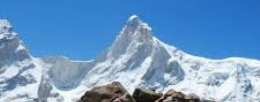
Mount Satopanth expedition is the highest peak in the Gangotri group of mountains , these mountains are in the Garhwal Himalayas of Uttarakhand.
The name "Satopanth" has two parts. Sato and Panth. Sato means truth, Panth means path. So Satopanth basically means the path to truth. Climbers from over the world love Mount Satopanth. It is one of Indias famous peaks.
Climbing Mount Satopanth involves using ice and snow climbing techniques. The climb is popular because it tests climbers skills on ice and snow. Mount Satopanth attracts climbers every year.
Satopanth has been a favorite among climbers in India since 1979.The Swiss team first climbed it in 1947.Indians first tried it in 1984.Lots of climbers love Satopanth now.Every year many come to the valley to try and climb it.
Expeditions
Climbing Satopanth takes around 25-30 days.
You need permission from various authorities like:
● The Indian Mountaineering Foundation
● The Uttarakhand Forest Department
● The Gangotri National Park authorities
Many Indian climbers use Satopanth as a practice climb.They want to get ready to climb the big mountains. The ones that are, over 8000 meters high.
The best time to climb Satopanth is:
● Before the rains. May and June
● After the rains. September and October every year.
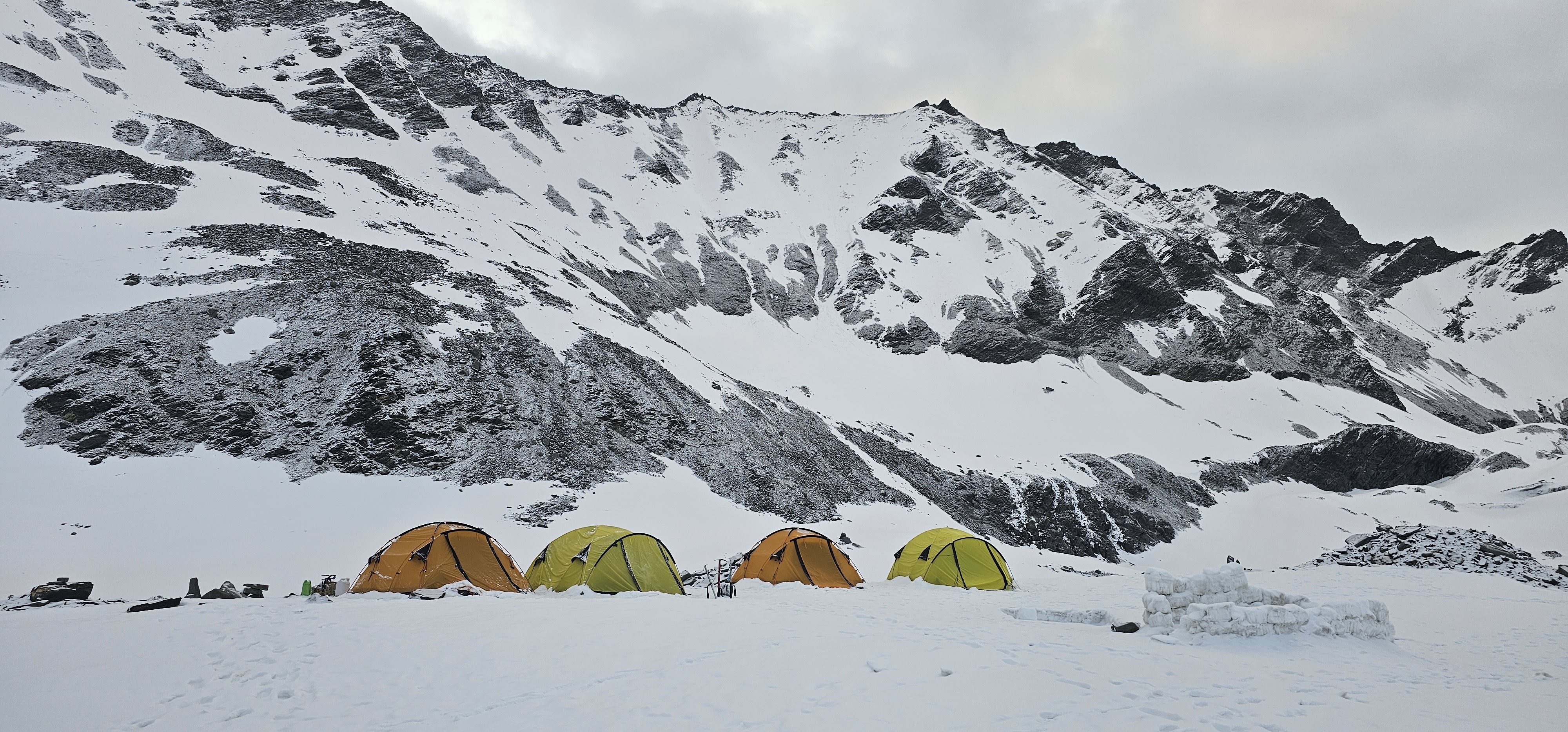
Base camp
Satopanth Base Camp, also known as Vasuki Tal has a lake. This makes it a great place for climbers to start their journey. The camp is at a height of 3950 meters. Climbers and their support teams walk for four days from Gangotri to get here.
High Climbing:
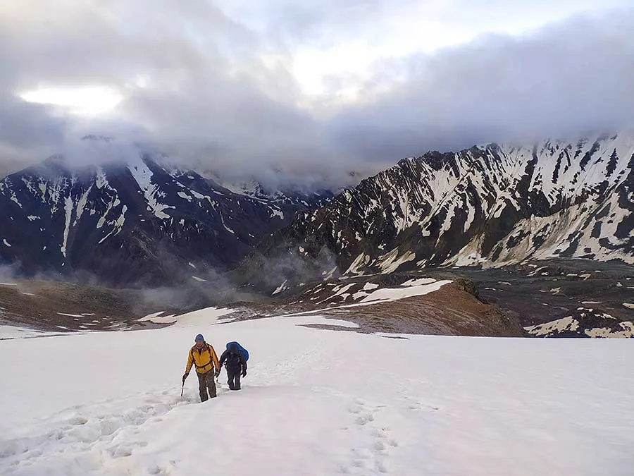
The climb after Base Camp's tough. It involves walking on rocks, climbing some rocks, climbing ice with special tools , climbing on icy slopes and walking and climbing on glaciers.
The weather in the valley can change quickly. This makes climbing difficult after Camp 2.
The Satopanth Base Camp is a place for climbers , they come here to prepare for the climb. The Satopanth mountain is very high and tough to climb. Climbers face challenges on the way. They have to be very careful and strong to reach the top.
Day 1: Dehradun to Gangotri (3,415 m) Drive – 240 km
The journey starts with a beautiful drive from Dehradun to Gangotri. Gangotri is a town in the Himalayas, it's where the Ganga River starts. The drive takes around 8 to 10 hours , going through valleys and winding roads in Uttarkashi district. Leaving early helps you arrive on time so you can. Get ready for the days ahead in the mountains.
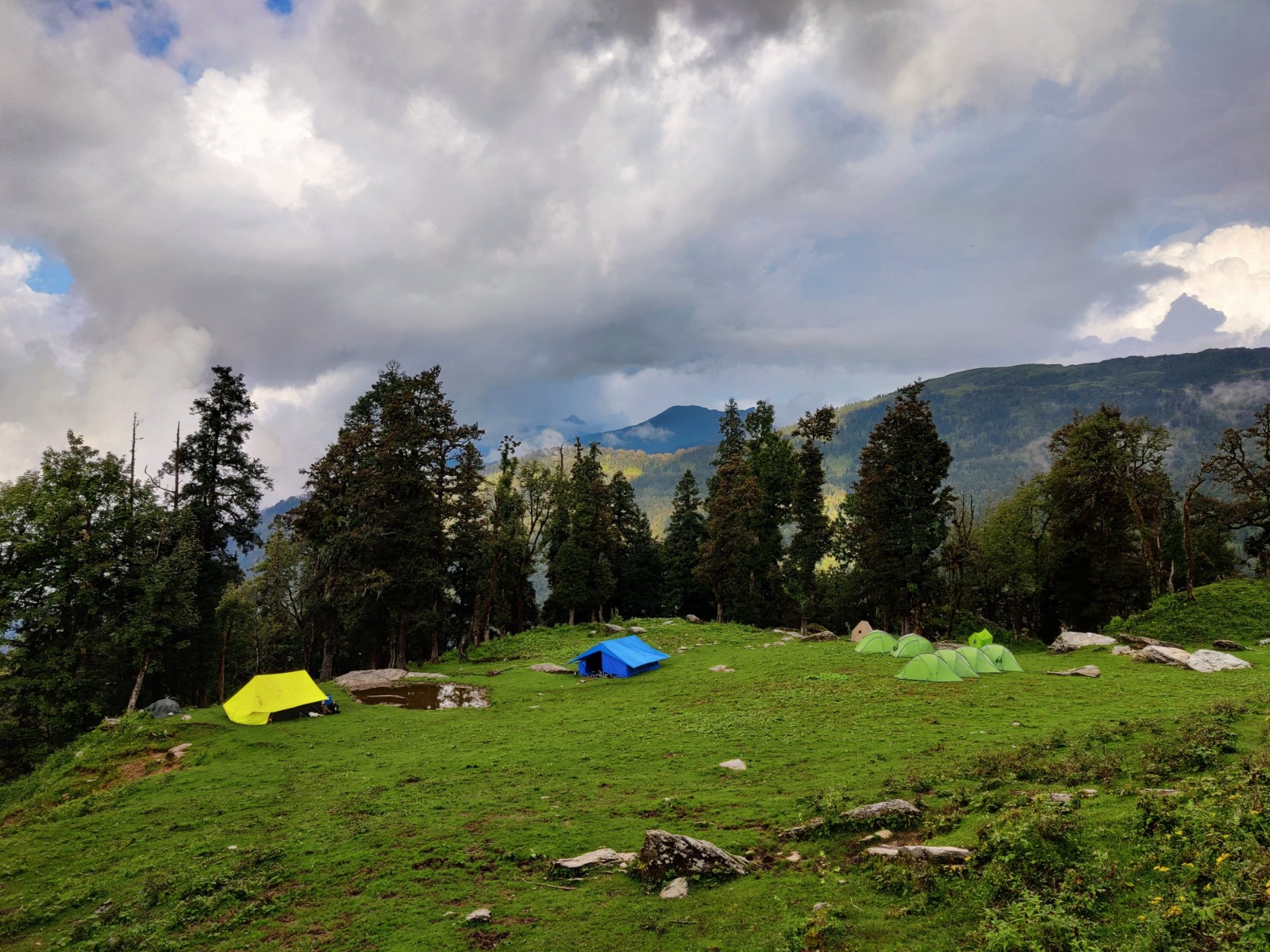
Day 2: Acclimatization at Gangotri
Today is for getting used to the height. You can explore the market visit temples or take short walks. There's a meeting to discuss trek plans, safety and how to behave in the mountains. Then you go for a walk in the evening to help your body adjust.
Day 3: Gangotri to Bhojwasa (3,775 m) | Trek – 14 km
The trek starts today. You follow the Bhagirathi River towards Gomukh. The path goes through Chirbasa, which has forests. Then it opens up to a Himalayan landscape. After lunch you continue to Bhojwasa, a campsite with great views of the Bhagirathi peaks and a beautiful sunset.
Day 4: Bhojwasa to Tapovan (4,460 m) | Trek – 13 km
After breakfast , you trek towards Gomukh which is the source of the Ganga. From there , the path climbs over rocks and ice towards Tapovan. Tapovan is an alpine meadow at the base of Mt. Shivling. It's surrounded by peaks, streams and bharal. Tapovan is known for its beauty and spiritual atmosphere.
Day 5: Tapovan to Nandanvan (4,800 m) | Trek – 8 km
Todays path crosses rocky and icy areas towards Nandanvan. Its located at the foot of the Bhagirathi massif. The terrain is rocky and icy so you need to be careful. When you arrive , you can see Shivling and the surrounding Himalayan giants from the campsite.
Day 6: Nandanvan to Vasuki Tal Base Camp (4,876 m) | Trek – 6 km
You slowly go up along the Chaturangi Glacier to Vasuki Tal. It's a high-altitude lake and the base camp for the expedition. The mountain surroundings are dramatic. Mark the start of the climbing phase.
Day 7: Acclimatization & Training at Base Camp
Today is, for rest getting used to the height and preparation. Climbers check their gear get training and practice on nearby icy slopes. This helps prepare for camps and trying to reach the summit.
Day 8–19: Expedition Phase – Mt. Satopanth
The climbing phase of the Mt. Satopanth expedition starts during these days. The team has to be ready for changing weather , snow conditions and team strength so the daily schedule is not fixed. The team uses a rotation plan. Climbing up going back to camps to rest and getting used to the higher altitude before trying to reach the summit.
Camp 1 (5,130 m)
The journey to Camp 1 is the big change from trekking to climbing. The route goes on a ridge with the big Chaturangi Glacier on one side and the slopes of Vasuki Parbat on the other. As the team moves on they see Mt. Satopanth for the time, which reminds them of the challenge ahead.
The trail goes down to the Sundar Glacier. Then across rocky and icy terrain. The team has to be careful. After hours of walking on different terrain , the team sets up Camp 1 surrounded by the Himalayan wilderness and tall ice formations.
Camp 2 (5,790 m)
The climb from Camp 1 to Camp 2 is harder and more technical. The team climbs over 600 meters up , which means they have to deal with slopes and mixed terrain like rocks, hard ice and snow.
The team uses fixed ropes on parts and special equipment to climb safely. Progress is slow because its hard to breathe at this height. The team has to save energy and focus on every step.
Camp 2 is set up in a place with great views of the surrounding glaciers and peaks. From here the expedition is in the high-altitude climbing zone.
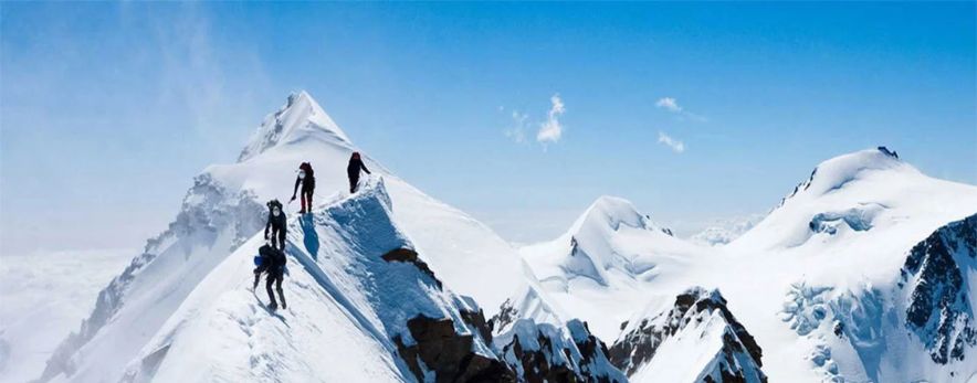
Camp 3 – Summit Camp (6,200 m)
The route to Camp 3 is another climb using fixed ropes. One of the parts of the expedition is here. A sharp ridge with steep drops on both sides. The team has to be very focused and move carefully.
After the ridge , there's an ice face to climb. The campsite is on a hanging glacier making it both amazing and challenging. At this height rest is hard. The team focuses on drinking water resting and getting ready for the summit.
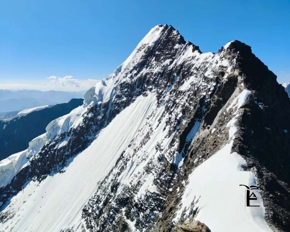
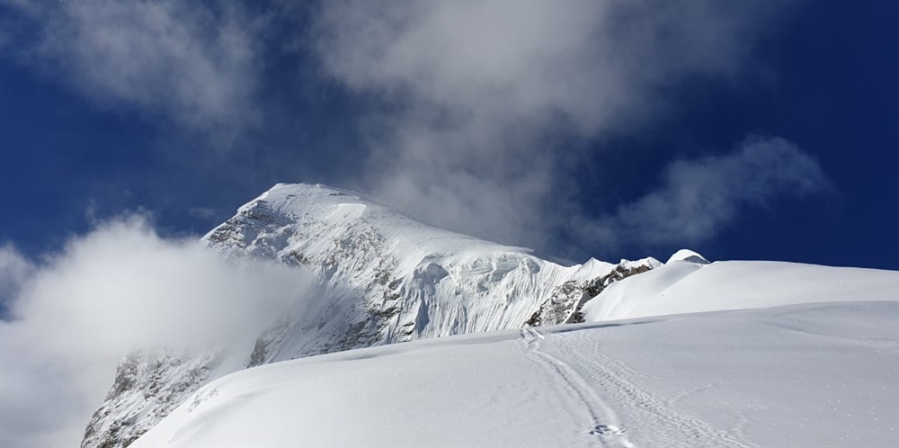
Summit Push – Mt. Satopanth (7,075 m)
The team usually starts the summit attempt at midnight when it's colder. Under the stars the team moves up saving energy and keeping a steady pace.
The climb follows the face of Mt. Satopanth. Some parts are easier. Others need technical climbing on rocks and glaciers. The team has to be careful on rocks while wearing special shoes.
One of the parts is crossing the exposed ridge around 6,500 meters. Mental strength is as important as strength here.
Reaching the summit gives the team views. The Garhwal Himalayas to the south and the Tibetan Plateau to the north. After a time at the top the team carefully starts going back down to Summit Camp.
Descent to Gangotri
After the summit, the team goes back through the camps and slowly descends to Gangotri over several days. The team has to be careful on the way too because they might be tired and the terrain can be tricky. Step by step the landscape changes from glaciers to rocky valleys and finally back, to Gangotri, where the journey started.