01
May

Weather is the state of the atmosphere at a particular place and time, to the degree that it is hot or cold, wet or dry, calm or stormy, clear or cloudy.
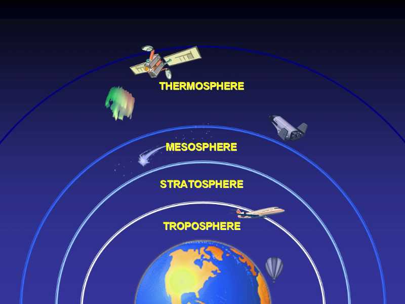
The atmosphere of the Earth is a layer of gases surrounding the planet that is retained by gravity. The common name given to the atmospheric gases, used in breathing and photosynthesis, is air. The Earth's atmosphere can be divided into five main layers
(a) Bad weather is a potential hazard in mountains.
(b) Weather predictions influence planning of expeditions.
(c) Weather conditions affect success of expeditions.
(d) Weather conditions may affect health.
(a) Weather generally refers to the state of atmosphere for a limited duration in a particular area, and is more dynamic in nature.
(b) Climate is the term for a more regular or long term pattern of atmospheric conditions based on statistical analyses over longer periods of time.
(c) The common weather phenomena include wind, cloud, rain, snow, fog and dust storms. Less common events include natural disasters such as tornadoes, hurricanes, typhoons and ice storms.
Almost all familiar weather phenomena occur in the Troposphere. Weather is driven by air pressure differences between one place and another. The main factors which affect weather are:-
(a) Temperature
(b) Atmospheric Pressure
(c) Wind conditions
(d) Humidity
(e) Cloud formation
Temperature is affected by:
The temperatures drop @ 6.5°C/Km or 2°C/1000 Ft, upto the Troposphere in normal conditions
(1) The tropics get the most heat because the Sun shines straight down on them, while the poles get the least heat because the Sun shines on them at a low angle. Same amount of sunlight over a larger area causes less heating compared to the same amount of sunlight over a smaller area.
(2) There is variation in the amount of energy absorbed or reflected by the earth's surface, depending on the type of surface:-
(3) Heating of the Earth.
The heating of the earth in turn heats the atmosphere which is responsible for the motions and movements of the air in the atmosphere. This air-circulating movement of warm and cold air, with mass of suspended fluids, is called Convection.
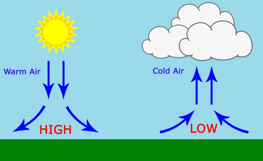
Atmospheric or air pressure is the force per unit of area exerted on the Earth's surface by the weight of the air above the surface. It is measured with a Barometer. Atmospheric pressure falls 34 millibars per 300 m of altitude in normal conditions. Atmospheric pressure is affected by three main factors:-
Atmospheric pressure reduces with altitude due to lesser gravity.
Humid air has lesser density than dry air and thus the atmospheric pressure will reduce with humidity.
Rise in temperature will result in lower air pressure and vice versa.
Unequal heating of Earth by the Sun creates large areas with low and high air pressure, which trigger movement of storms and winds. The Sun heats the Earth's tropics, the region on both sides of the equator, much more than places farther North and South. As the air rises, more air flows in to replace it, creating the tropical trade winds. This is the beginning of the global patterns of winds, and areas of high and low air pressure, that cause our ever-changing weather.
On the surface of the Earth, wind consists of the bulk movement of air. Wind is caused by differences in the atmospheric pressure. When a difference in atmospheric pressure exists, air moves from the higher to the lower pressure area, resulting in winds of various speeds. The different types of winds are:-
The air movements from poles toward the equator are called Trade Winds warm, steady breezes that blow almost continuously. The trade winds coming from the South and the North meet near the equator. On a rotating planet, air will also be deflected by the Coriolis effect, except exactly on the equator.
Between thirty and sixty degrees latitude, the winds that move toward the poles appear to curve to the east. Because winds are named from the direction in which they originate, these winds are called Westerlies.
The polar easterlies form when the atmosphere over the poles cools down. Again, because these winds begin in the East, they are called Easterlies.
In coastal regions, sea breezes and land breezes can be important factors in a location's prevailing winds. The sea is warmed by the sun more slowly compared to land. As the temperature of the surface of the land rises, the land heats the air above it by conduction. The cooler air above the sea, now with higher sea level pressure, flows inland into the lower pressure, creating a cooler breeze near the coast. At night, the land cools off more quickly than the ocean. When the temperature onshore cools below the temperature offshore, the pressure over the water will be lower than that of the land, establishing a land breeze.
A wind that carries high density air from a higher elevation down a slope under the force of gravity. Such winds are sometimes also called Fall Winds. They frequently occur at night.
An Anabatic Wind is a warm wind which blows up the slope or mountain side, driven by heating of the slope. These winds typically occur during the daytime in calm sunny weather.
A Föhn or Foehn is a type of dry, warm, down-slope wind that occurs in the leeward side of a mountain range. Foehn winds are caused by the subsidence of moist air after passing a high mountain ridge and descending along the leeside of the mountain, upon which the air becomes warmer. Temperature of drier air will rise even faster. This results in dry and hot winds.
Windchill results Watching Compari in drastic fall in temperature due to high speed winds. In extreme conditions it can cause drop of upto 30°, in one hour. It is a major cause of frost bite. When coupled with snow fall it can cause blizzards.
It is the quantity of moisture, in the form of vapour, in the surrounding air. It is higher at the equator. Increase in humidity warms the air and decreases air pressure. The effects of humidity can be visualised as under:-
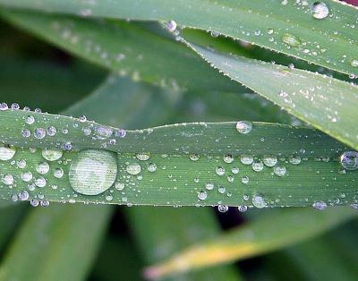
Deposition of water droplets on surface of objects, produced by the condensation of water vapour from the surrounding air.
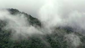
(i) Suspension of very small water droplets in air.
(ii) Horizontal visibility reduced to less than 1 km.
(iii) Thicker than mist.
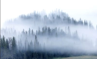
(i) Suspension of microscopic water droplets/ wet hygroscopic particles in air.
(ii) Horizontal visibility reduced to between 1 and 2 km.
In meteorology, a Cloud is a visible mass of liquid droplets or frozen crystals, made of water suspended in the atmosphere, above the surface of the earth.
Heat evaporates millions of tonnes of water into the air daily from the ocean, rivers, lakes, land and forest. As moist, warm air rises, it cools slowly, finally it cools so much, that its relative humidity reaches 100% to form clouds under certain conditions. Rain, bails or snow, pours down from these clouds. This eternal process of evaporation, condensation, and precipitation, is called the Water Cycle.
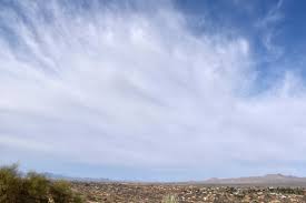
Thin, feathery, white, high altitude.
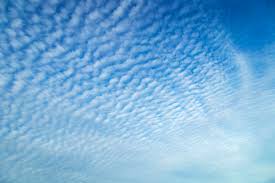
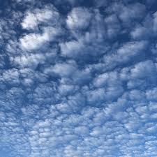
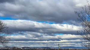
Layered, low altitude, horizontal motion, cover more area
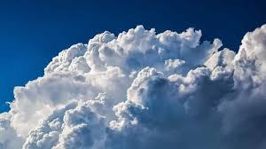
Puffy, white, with flat bottoms, rising vertically.
High clouds (18000-30000 ft). These can be further of three types.
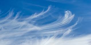
These are white, delicate filaments or patches of narrow band with hair like appearance. They form at very high altitudes. They are dry and rainless clouds.
These are thick, horizontal layers of clouds, almost completely covering the sky. A ring around the sun moon is visible. These clouds may result in a fine drizzle.
These are cirrus clouds with small blobs. They form wave like patterns and create a picturesque sky at sunset. They are very rarely seen.
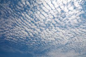
They are mid level clouds (8000-18000 ft). Further categories can include:-
These are uniform layers of clouds and resemble cirro-stratus. Sun/ Moon not have a halo, but appear as though looked at through a ground glass. When they lower and thicken, they become Nimbo-Stratus and produce rains.
They form a layer of clouds with large blobs. The layer may be quite thin or thick. Sun may produce a pale blue or yellow corona or a disc with a reddish ring outside.
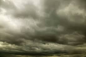
They are thick, dark grey-black clouds, spread evenly at very low height, sometimes even touching the ground. They bring continuous rains.
Low clouds (below 8000 feet). Further types are:-
Cumulus are wooly, bunchy cloudsm with sharp outline, and look likem floating cauliflowers. They have rounded tops with a flat base, developing vertically. They bring heavy showers and rumbles, with lightning and thunders.
These form a layer of bunchy clouds with a uniform base. They can be in the form of a continuous sheet or with some breaks. They do not bring rain, but may transform into Nimbo-stratus.
They form when Cumulus lower and thicken, and are dark grey in colour. These are most dangerous and a sign of bad weather. They produce severe thunderstorms, blizzards, snow fall, heavy rains. They precipitate hail or sleets.

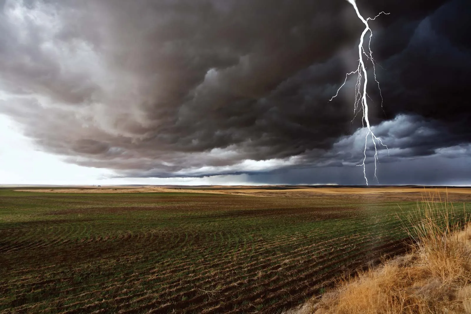
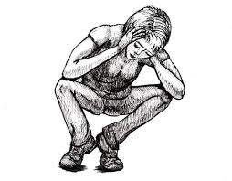
These are great hazards on the mountains and are usually associated with Cumulo-Nimbus clouds. Lightning bolts create more heat (30,000 to 50,000° F) than surface of sun and can cause burning, cardiac arrest, death. In case of lightning, please follow procedure as under
(a) Steel helmets, radio aerials, etc. should be removed.
(b) Keep away from the high peaks, tall trees etc.
(C) Crouch with the head down, feet together, and elbows on either side of the knees or ankles.
(d) Do not lie flat, especially if the ground is wet.
Weather forecasting is the application of science and technology, or experience, to predict the state of the atmosphere for a given location. The following are some of the ways of weather forecasting:-
Persistence forecasting is based on the concept that current weather conditions can reveal clues to tomorrow's forecast.
Synoptic or analogue forecasting is a method of predicting the weather, based on accepted theories and principles of meteorology. It's used for short term predictions.
Statistical or climatological forecasting allows meteorologists to make predictions based on historical trends.
This method relies on mathematical formulas that are designed to model atmospheric and weather conditions.
The larger the change in pressure the bigger the change in weather.
(a) Steadily falling barometric pressure at the same altitude indicates likely bad weather Steadily rising pressure indicates the likelihood of bad weather clearing up.
(b) Winds with clouds flowing from West/ NW direction indicate bad weather.
(c) Valley fog clearing before noon indicates fair weather.
(d) Thinning and lifting clouds indicate clearing weather
(e) Temperature will usually rise when wind is from the South, particularly with cloud cover al night or clear sky during day.
(f) Temperature will usually fall when:-
(i) Wind blows from North.
(ii) Night sky is clear and wind is light.