Satopanth Peak Expedition: A Journey to the Abode of the Trinity
Standing majestically at 7,075 meters (23,213 feet) in the Garhwal Himalayas of Uttarakhand, Satopanth Peak is one of India’s most revered and challenging mountaineering destinations. The name “Satopanth” translates to “the path of truth,” and according to Hindu mythology, this triangular peak represents the three peaks of the holy trinity – Brahma, Vishnu, and Shiva. This comprehensive guide will take you through everything you need to know about this spectacular expedition.
About Satopanth Peak
Geographic Location
Satopanth is located in the Chamoli district of Uttarakhand, part of the Gangotri group of peaks in the Central Garhwal Himalayas. The mountain overlooks the sacred Satopanth Tal, a glacial lake considered one of the holiest sites in Hindu mythology, where the trinity is believed to have bathed.
Technical Difficulty
- Grade: Alpine PD+ to AD (Moderately Difficult to Fairly Difficult)
- Altitude: 7,075 meters (23,213 feet)
- Climbing Season: May-June and September-October
- Skills Required: Previous high-altitude experience, basic mountaineering skills, glacier travel, use of technical equipment
- Physical Fitness: Excellent cardiovascular fitness and stamina required
Key Features
- Stunning views of Chaukhamba massif, Nilkantha, Balakun, and other Garhwal peaks
- Access through the spiritual town of Badrinath
- Relatively technical summit push with crevasse navigation
- Sacred Satopanth Lake at the base camp area
- Pristine glacial environment
Pre-Expedition Preparation
Physical Training (3-4 months prior)
Cardiovascular Endurance: Running, cycling, swimming – 5-6 days per week, gradually increasing to 2-3 hours per session
Strength Training: Focus on legs, core, and shoulders – 3-4 days per week with exercises like squats, lunges, deadlifts, and pull-ups
Altitude Simulation: If possible, train at higher elevations or use altitude training masks
Load Carrying: Practice hiking with a 15-20 kg backpack for extended periods
Technical Skills
- Ice axe and crampon techniques
- Rope management and knot tying
- Crevasse rescue procedures
- Fixed rope ascending and descending
- Glacier travel in roped teams
- Basic rock climbing skills
Permits and Documentation
- Indian Mountaineering Foundation (IMF) permit required
- Inner Line Permit for restricted areas
- Medical fitness certificate
- Valid ID proof and photographs
- Travel insurance with high-altitude coverage (up to 7,500m minimum)
Estimated Budget
- IMF permit and fees: ₹15,000-20,000 per person
- Guide/operator charges: ₹1,50,000-2,50,000 per person (varies by group size)
- Equipment rental (if needed): ₹20,000-30,000
- Travel to/from Dehradun: ₹5,000-10,000
- Total approximate cost: ₹2,00,000-3,50,000 per person
Complete Expedition Itinerary (21-23 Days)
Day 1: Arrival in Dehradun/Haridwar
- Arrive at Jolly Grant Airport, Dehradun or Haridwar railway station
- Transfer to hotel
- Team briefing and equipment check
- Rest and acclimatization preparation
- Altitude: 640m (Dehradun)
Day 2: Dehradun to Joshimath (250 km, 8-9 hours)
- Early morning departure by road
- Drive through Rishikesh, Devprayag, and Rudraprayag
- Witness confluence of rivers at various prayags
- Reach Joshimath by evening
- Check into hotel, rest
- Altitude: 1,890m
- Distance: 250 km by road
Day 3: Joshimath to Badrinath (45 km) to Mana Village (3 km)
- Drive to Badrinath temple town (2-3 hours)
- Visit Badrinath temple (optional, if time permits)
- Drive/walk to Mana village, last Indian village before Tibet border
- Explore local culture and prepare for trek
- Final equipment check and load distribution
- Altitude: Badrinath 3,133m, Mana 3,200m
- Distance: 45 km by road + 3 km
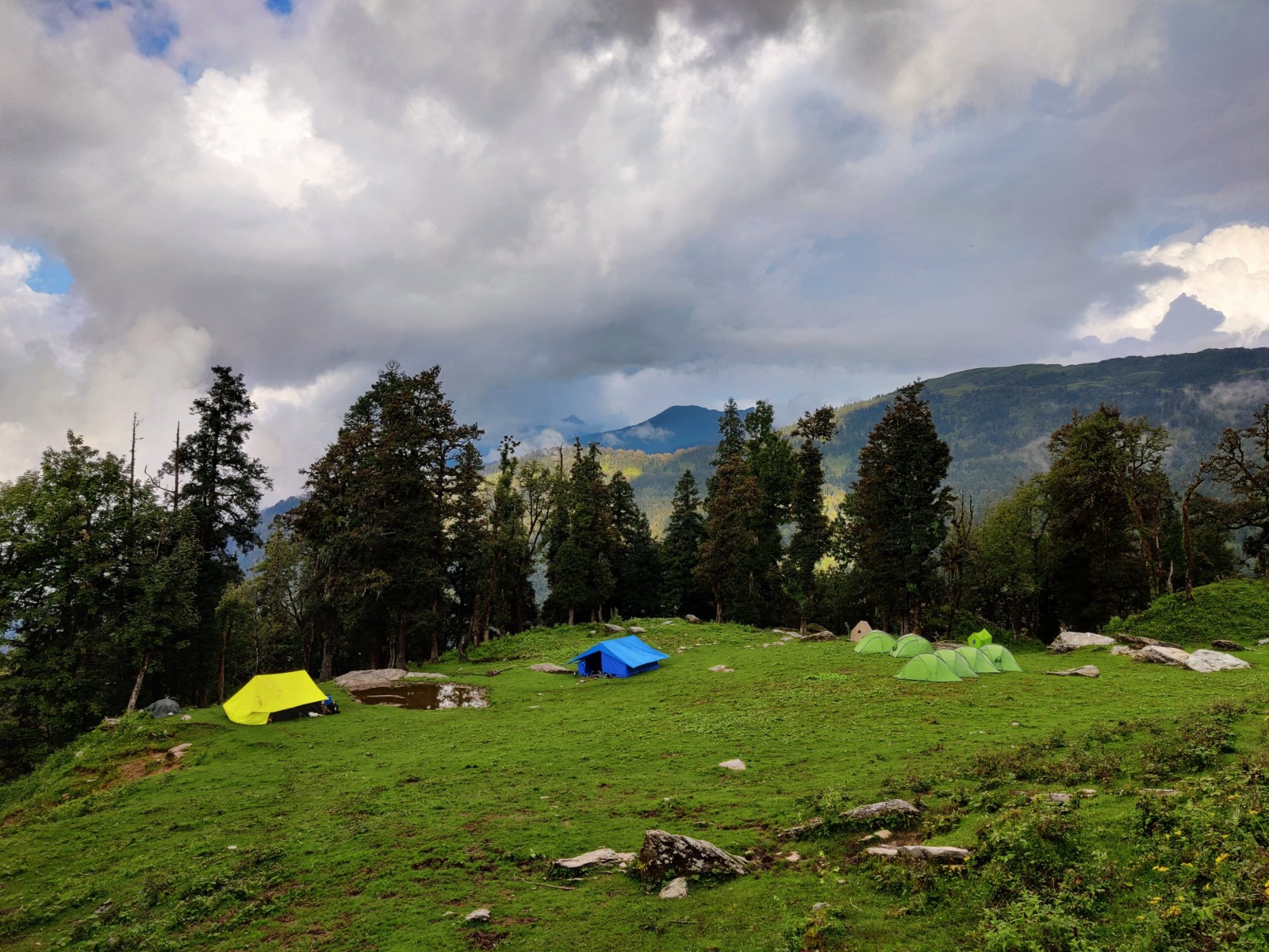
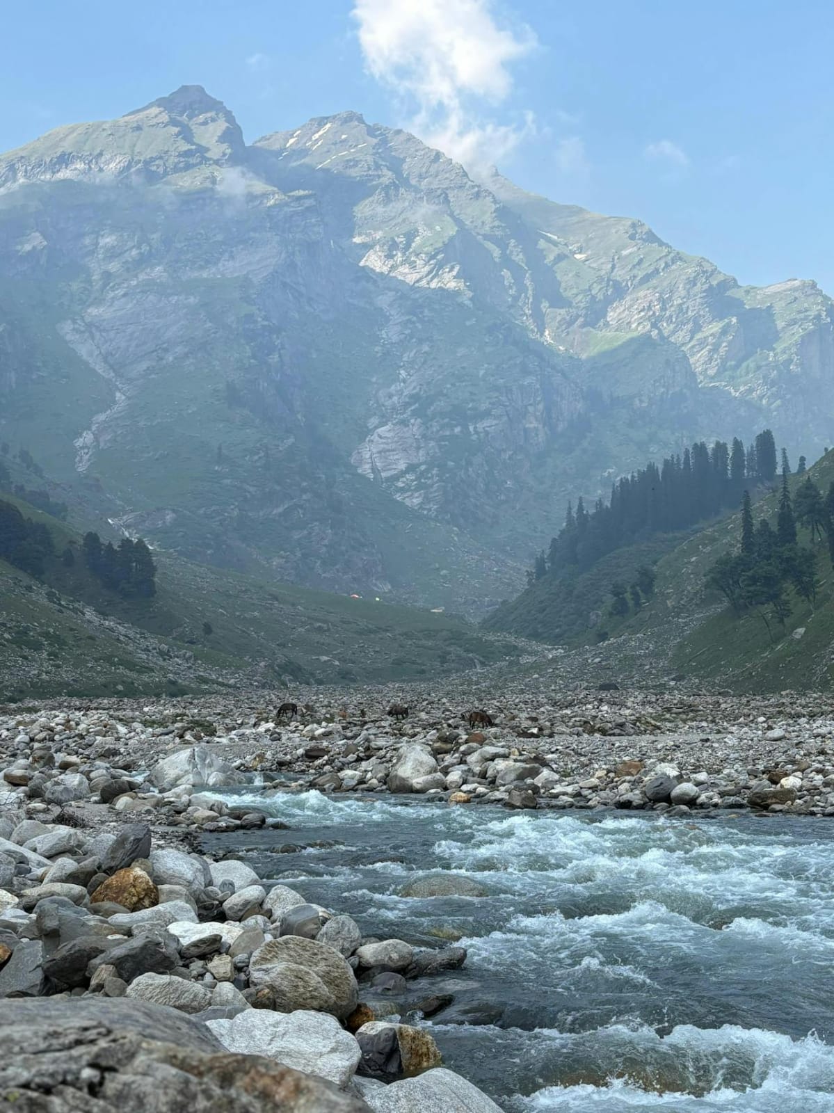
Day 4: Mana Village to Laxmivan (4-5 hours trek)
- Begin trekking through Vasudhara Valley
- Cross Saraswati River via bridge
- Gradual ascent through alpine meadows
- First glimpse of surrounding peaks
- Camp at Laxmivan
- Altitude Gain: 3,200m to 3,800m (600m gain)
- Distance: 8-9 km
- Trekking Time: 4-5 hours
Day 5: Laxmivan to Chakratirtha (5-6 hours)
- Continue ascending through the valley
- More rugged terrain with rocky sections
- Views of Satopanth massif and surrounding peaks
- Camp at Chakratirtha meadows
- Altitude Gain: 3,800m to 4,200m (400m gain)
- Distance: 10 km
- Trekking Time: 5-6 hours
Day 6: Chakratirtha to Satopanth Lake Base (4-5 hours)
- Trek across glacial terrain
- Navigate moraine sections
- Reach the sacred Satopanth Lake (triangular glacial lake)
- Set up base near the lake
- Rest and acclimatization
- Altitude Gain: 4,200m to 4,600m (400m gain)
- Distance: 7-8 km
- Trekking Time: 4-5 hours
Day 7: Rest and Acclimatization at Satopanth Lake
- Complete rest day
- Short acclimatization walks around lake
- Equipment preparation and briefing
- Practice technical skills if needed
- Photography and exploration
- Puja ceremony at the holy lake (optional)
- Altitude: 4,600m
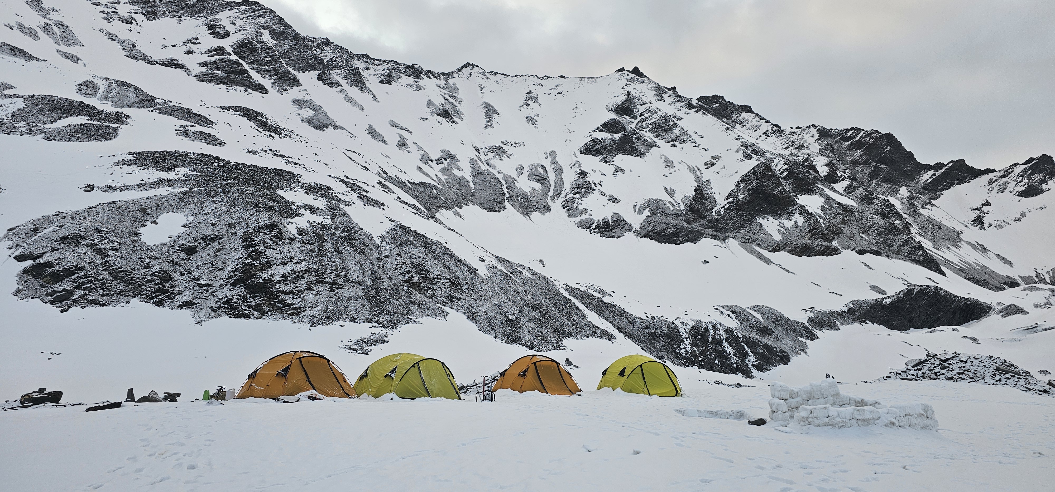
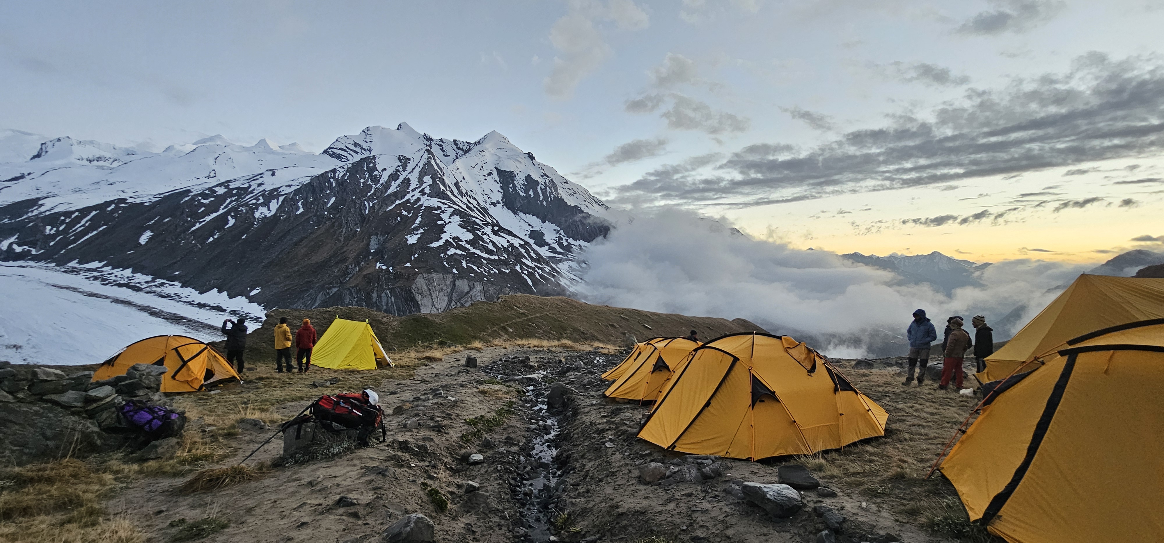
Day 8: Satopanth Lake to Base Camp (4-5 hours)
- Move to expedition base camp
- Establish proper base camp with kitchen, dining, and communication tents
- Further acclimatization
- Detailed briefing on route ahead
- Altitude Gain: 4,600m to 5,000m (400m gain)
- Distance: 4-5 km
- Trekking Time: 4-5 hours
Day 9-10: Base Camp – Acclimatization and Load Ferry
- Two days for acclimatization
- Load ferry to higher camps
- Practice ice climbing and crampon work
- Glacier training sessions
- Crevasse rescue practice
- Route reconnaissance
- Altitude: 5,000m
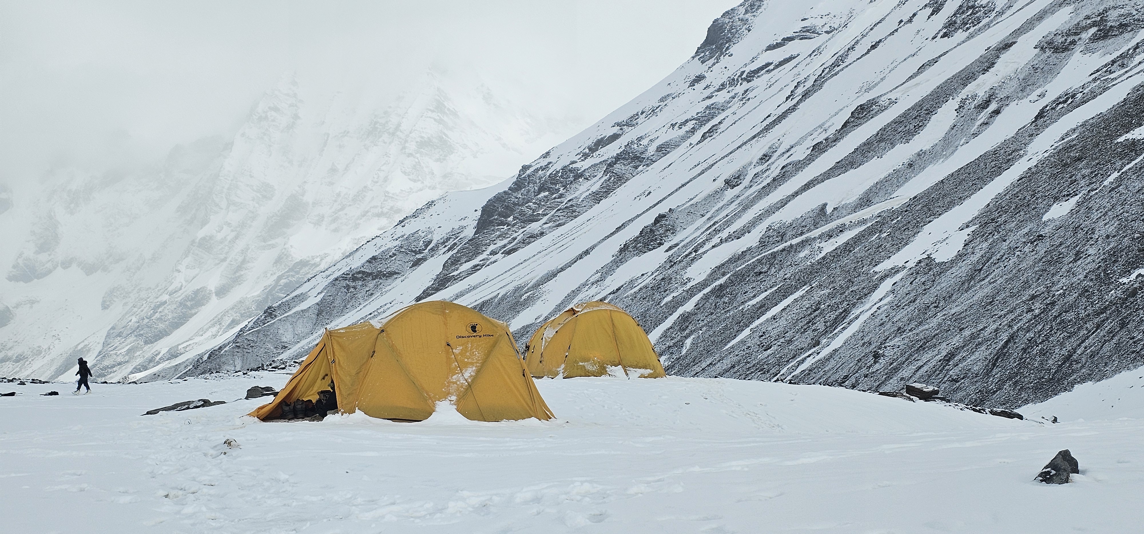
Day 11: Base Camp to Camp 1 (5-6 hours)
- Early morning start on glacier
- Navigate through crevasse zones
- Use of fixed ropes in technical sections
- Establish Camp 1
- Return to Base Camp for rotation
- Altitude: 5,000m to 5,700m (700m gain)
- Distance: 6-7 km on glacier
- Climbing Time: 5-6 hours
Day 12: Rest at Base Camp
- Recovery day at base camp
- Monitor weather conditions
- Equipment maintenance
- Light walks for active recovery
- Altitude: 5,000m
Day 13: Base Camp to Camp 1 (Sleep at Camp 1)
- Move to Camp 1 with full gear
- Overnight stay for acclimatization
- Prepare for higher rotation
- Altitude: 5,700m
- Climbing Time: 5-6 hours
Day 14: Camp 1 to Camp 2 (5-6 hours)
- Continue ascending on glacier
- Steeper sections with fixed ropes
- Navigate through ice walls and seracs
- Establish Camp 2
- Return to Camp 1 for sleep (or stay if acclimatized)
- Altitude: 5,700m to 6,300m (600m gain)
- Distance: 4-5 km
- Climbing Time: 5-6 hours
Day 15: Descend to Base Camp
- Return to base camp for rest
- Recovery and preparation for summit push
- Weather monitoring and final planning
- Altitude: Descend to 5,000m
Day 16: Rest Day at Base Camp
- Complete rest and recovery
- High-calorie nutrition
- Equipment check for summit push
- Weather window confirmation
- Final briefing
- Altitude: 5,000m
Day 17: Base Camp to Camp 1
- Move up to Camp 1
- Early night sleep
- Summit push preparation
- Altitude: 5,700m
Day 18: Camp 1 to Camp 2
- Reach Camp 2 by afternoon
- Rest, hydration, and light meal
- Final equipment check
- Sleep by 7-8 PM
- Altitude: 6,300m
Day 19: Summit Day – Camp 2 to Summit to Base Camp
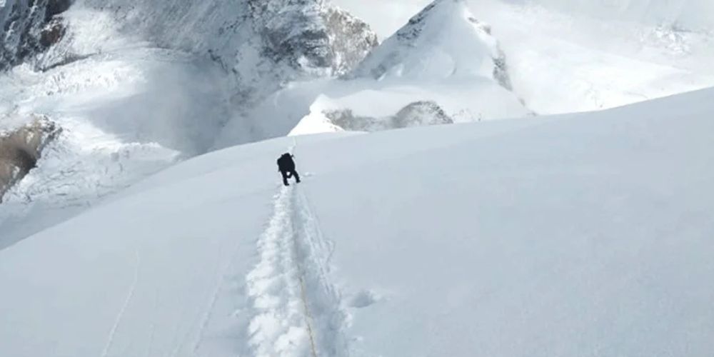
- Alpine start: 12:00 AM – 1:00 AM departure
- Climb through the night with headlamps
- Navigate technical sections with fixed ropes
- Cross crevasse zones in roped teams
- Steep ice sections near summit ridge
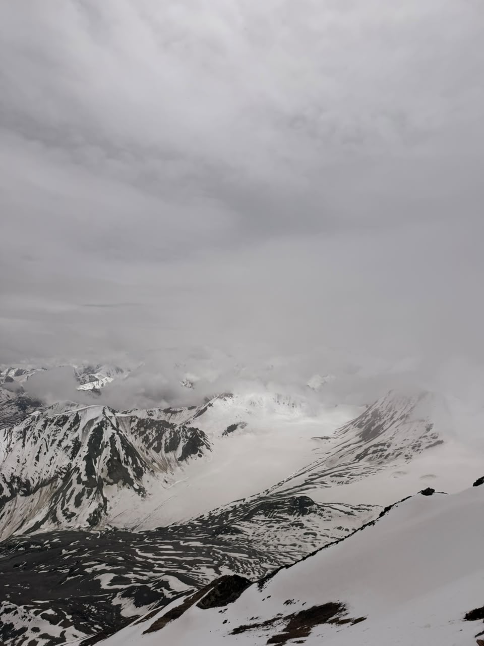
- Summit: 7,075m (sunrise timing, approximately 7-8 AM)
- Panoramic views: Chaukhamba, Nilkantha, Balakun, Kedarnath ranges
- Spend 15-30 minutes at summit
- Descent begins immediately to Camp 2
- Rest briefly at Camp 2, then continue to Camp 1 or Base Camp
- Altitude: 6,300m to 7,075m to 5,000m
- Total Climbing Time: 12-16 hours (summit and descent)
- Distance: Approximately 10 km round trip
Day 20: Reserve Day for Weather/Summit Attempt
- Weather contingency day
- Alternative summit attempt if Day 19 was unsuccessful
- If summit successful, rest at base camp
- Altitude: 5,000m or as per conditions
Day 21: Base Camp to Mana Village
- Begin descent from base camp
- Retrace route through Satopanth Lake, Chakratirtha, Laxmivan
- Can be completed in single long day or split over two days
- Reach Mana village
- Celebrate successful expedition
- Altitude: Descend to 3,200m
- Distance: 25-30 km total
- Trekking Time: 8-10 hours (or split over 2 days)
Day 22: Mana to Joshimath to Haridwar/Rishikesh
- Drive from Mana to Joshimath
- Continue to Haridwar or Rishikesh
- Check into hotel
- Celebration dinner
- Distance: 300 km by road
Day 23: Departure from Haridwar/Dehradun
- Morning departure to Dehradun airport or Haridwar station
- End of expedition
Essential Equipment Checklist
Personal Climbing Gear
- High-altitude mountaineering boots (double or triple layer)
- Crampons (12-point, compatible with boots)
- Ice axe and walking poles
- Climbing harness
- Helmet
- Carabiners (locking and non-locking)
- Prussik loops
- Jumar/ascender
- Figure-8 descender or ATC
Clothing Layers
Base Layers: Merino wool or synthetic thermal tops and bottoms (2-3 sets)
Mid Layers: Fleece jacket, down jacket (800+ fill)
Outer Layers: Waterproof and windproof jacket and pants (Gore-Tex)
Extremities:
- Liner gloves, fleece gloves, waterproof mittens
- Balaclava, woolen cap, sun hat
- Neck gaiter or buff
- High-altitude socks (4-5 pairs)
- Gaiters
Camping & Sleeping
- 4-season sleeping bag (-20°C to -30°C rating)
- Sleeping mat (insulated, R-value 5+)
- Down suit for high camps (optional but recommended)
Personal Items
- Sunglasses (Category 4, UV protection)
- Ski goggles
- Headlamp with extra batteries
- 1-liter insulated water bottle
- Thermos flask (1 liter)
- Personal medical kit
- High SPF sunscreen and lip balm
- Toiletries
- Personal documents in waterproof bag
Optional But Recommended
- GPS device or smartphone with GPS
- Camera with cold-weather protection
- Power bank and solar charger
- Book or entertainment for rest days
- Satellite phone (usually provided by expedition operator)
Health and Safety Considerations
Altitude Acclimatization
- Follow the “climb high, sleep low” principle
- Stay hydrated (4-5 liters per day at high altitude)
- Recognize symptoms of Acute Mountain Sickness (AMS): headache, nausea, dizziness, fatigue
- Immediate descent if symptoms worsen (HACE or HAPE)
Common High-Altitude Ailments
- Acute Mountain Sickness (AMS)
- High Altitude Cerebral Edema (HACE)
- High Altitude Pulmonary Edema (HAPE)
- Frostbite and hypothermia
- Snow blindness
Medical Kit Essentials
- Diamox (acetazolamide) for AMS prevention
- Dexamethasone for severe altitude sickness
- Pain relievers (ibuprofen, paracetamol)
- Antibiotics (as prescribed)
- Anti-diarrheal medication
- Antiseptic cream and bandages
- Moleskin for blisters
- Personal prescription medications
Safety Protocols
- Always climb in roped teams above Base Camp
- Regular oxygen saturation and pulse monitoring
- Weather forecasting and communication systems
- Emergency evacuation plan (helicopter rescue insurance essential)
- Experienced Sherpa/guide ratio (ideally 2:1 climber-to-guide ratio)
Nutrition During Expedition
Base Camp Meals
- Breakfast: Porridge, eggs, bread, tea/coffee
- Lunch: Rice/pasta, vegetables, soup
- Dinner: High-calorie meals with rice/roti, dal, vegetables, meat (if available)
- Snacks: Nuts, energy bars, chocolates
High Camp Meals
- Freeze-dried meals
- Instant noodles and soups
- Energy bars and gels
- Hot drinks (tea, coffee, hot chocolate)
- Aim for 4,000-5,000 calories per day at high altitude
Best Time to Climb
Pre-Monsoon Season (May-June)
Advantages: Stable weather, longer days, warmer temperatures
Disadvantages: More crowded, afternoon snow conditions can deteriorate
Post-Monsoon Season (September-October)
Advantages: Clear views, crisp weather, less crowded
Disadvantages: Colder temperatures, shorter days, early winter storms possible
Avoid: Monsoon season (July-August) due to heavy snowfall and avalanche risk
Environmental Considerations
Leave No Trace Principles
- Pack out all waste, including human waste from high camps
- Use designated toilet areas
- Minimize campfire impact (use stoves)
- Respect sacred sites, especially Satopanth Lake
- Stay on established trails to prevent erosion
Wildlife and Flora
- The region is home to Himalayan wildlife including snow leopards, brown bears, and bharal (blue sheep)
- Alpine flora includes rare medicinal plants
- Observe from distance, do not disturb
Cultural Significance
Satopanth holds deep spiritual meaning in Hindu mythology. The triangular Satopanth Lake represents the three gods of the Hindu trinity, and pilgrims visit this remote location as part of their spiritual journey. Climbers should show respect for:
- Sacred sites and perform or allow puja ceremonies
- Local customs and traditions in villages
- Environmental sanctity of the region
- Photography restrictions at religious sites
Why Climb Satopanth Peak?
For the Mountaineer
- Excellent preparation for higher 7,000m+ peaks in the Himalayas
- Technical challenge with glacier navigation and high-altitude climbing
- Less commercialized than popular peaks like Stok Kangri or Friendship Peak
- Opportunity to develop advanced mountaineering skills
For the Explorer
- Access to one of the most remote and pristine regions of Uttarakhand
- Spiritual journey combining adventure with cultural immersion
- Breathtaking views of the Garhwal Himalayan range
- Sense of achievement standing atop a 7,000m+ peak
For the Soul
- Connection with ancient pilgrimage routes
- Solitude and introspection in the lap of the Himalayas
- Experience of pushing physical and mental boundaries
- Memories and experiences that last a lifetime
Challenges You’ll Face
- Extreme Altitude: Operating above 7,000m where oxygen is approximately 40% of sea level
- Unpredictable Weather: Sudden storms can occur even during good season
- Technical Terrain: Crevassed glaciers, ice walls, and steep sections
- Physical Exhaustion: Multi-day effort with heavy loads
- Isolation: Remote location with limited rescue options
- Mental Fortitude: Dealing with discomfort, fear, and self-doubt
Success Tips
- Train Seriously: This cannot be overstated – physical fitness is crucial
- Climb Smart: Listen to your body and guides
- Stay Positive: Mental strength is as important as physical
- Acclimatize Properly: Don’t rush the process
- Team Spirit: Support fellow climbers
- Respect the Mountain: Know when to turn back
- Stay Hydrated and Nourished: Even when you don’t feel like eating
- Communicate: Share how you’re feeling with guides and teammates
Conclusion
The Satopanth Peak expedition is a transformative adventure that combines technical mountaineering with spiritual exploration in one of India’s most spectacular high-altitude environments. Standing at 7,075 meters, you’ll not only test your limits but also connect with the ancient traditions and raw beauty of the Garhwal Himalayas.
This expedition requires serious preparation, respect for the mountain, and humility in the face of nature’s power. But for those who are properly prepared and fortunate enough to reach the summit, the experience of standing atop Satopanth, surrounded by the giants of the Himalayas as the sun paints the peaks in gold, is truly unforgettable.
The path of truth – Satopanth – awaits those brave enough to walk it. Will you answer the call?
Remember: Mountains will always be there. It’s more important to come back safely than to reach the summit. Summit is optional, return is mandatory.
Contact a certified expedition operator for bookings and more detailed information. Never attempt this climb without proper training, equipment, and experienced guides.