29
Mar

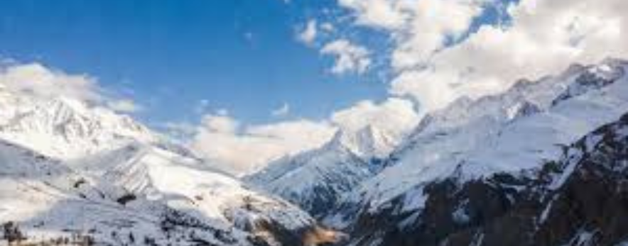
The Indian Himalaya is home to some of the most spectacular, challenging, and spiritually resonant mountaineering terrain on Earth. Stretching across the states of Uttarakhand, Himachal Pradesh, and Ladakh, the range encompasses peaks from gentle introductory summits to elite expedition-grade objectives above 7,700 metres. This guide covers twelve landmark expeditions offered by ThinAirExpedition — providing climbers and trekkers with everything they need to plan their Himalayan journey: detailed route descriptions, accurate cost breakdowns, optimal timing windows, and practical tips drawn from decades of high-altitude experience.
Whether you are stepping onto your first glaciated peak or targeting a serious 7,000-metre ascent, this guide will help you choose the right objective, budget your expedition accurately, and arrive at Base Camp fully prepared.
|
# |
Expedition |
Altitude |
Region |
Grade |
Days |
Best Time |
|
01 |
Mt Shivling |
6,543 m |
Garhwal, UK |
Technical |
18–22d |
May–Jun / Sep–Oct |
|
02 |
Panpatia Col |
5,947 m |
Garhwal, UK |
Moderate |
14–18d |
May–Jun / Sep–Oct |
|
03 |
Auden's Col |
5,490 m |
Garhwal, UK |
Challenging |
16–20d |
May–Jun / Sep–Oct |
|
04 |
Mt Yunam Peak |
6,111 m |
Lahaul-Spiti, HP |
Moderate |
10–14d |
Jun–Sep |
|
05 |
Mt Satopanth |
7,075 m |
Garhwal, UK |
Technical |
20–24d |
May–Jun / Sep–Oct |
|
06 |
Reo Purgyil |
6,816 m |
Kinnaur, HP |
Technical |
18–22d |
Jun / Sep–Oct |
|
07 |
Neelkanth Peak |
6,596 m |
Garhwal, UK |
Technical |
20–25d |
May–Jun / Sep–Oct |
|
08 |
Mt Trishul |
7,120 m |
Kumaon, UK |
Technical |
22–26d |
May–Jun / Sep–Oct |
|
09 |
Kamet Peak |
7,756 m |
Garhwal, UK |
Expedition |
30–36d |
May–Jun |
|
10 |
Kang Yatse II |
6,535 m |
Ladakh |
Mod–Tech |
14–18d |
Jun–Oct |
|
11 |
Black Peak |
6,387 m |
Gangotri, UK |
Moderate |
14–17d |
May–Jun / Sep–Oct |
|
12 |
Friendship Peak |
5,289 m |
Kullu, HP |
Beginner |
8–12d |
May–Jun / Oct |
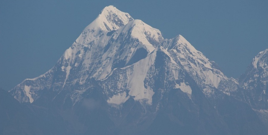
6,543 m (21,467 ft) · Garhwal Himalaya, Uttarakhand · Grade: Alpine TD+ (Technical)
|
Altitude |
6,543 m (21,467 ft) |
|
Region |
Garhwal Himalaya, Uttarakhand |
|
Grade / Difficulty |
Alpine TD+ (Technical) |
|
Duration |
18–22 Days |
|
Best Time |
May–June & September–October |
|
IMF Permit Required |
Yes — IMF Mountaineering Permit required |
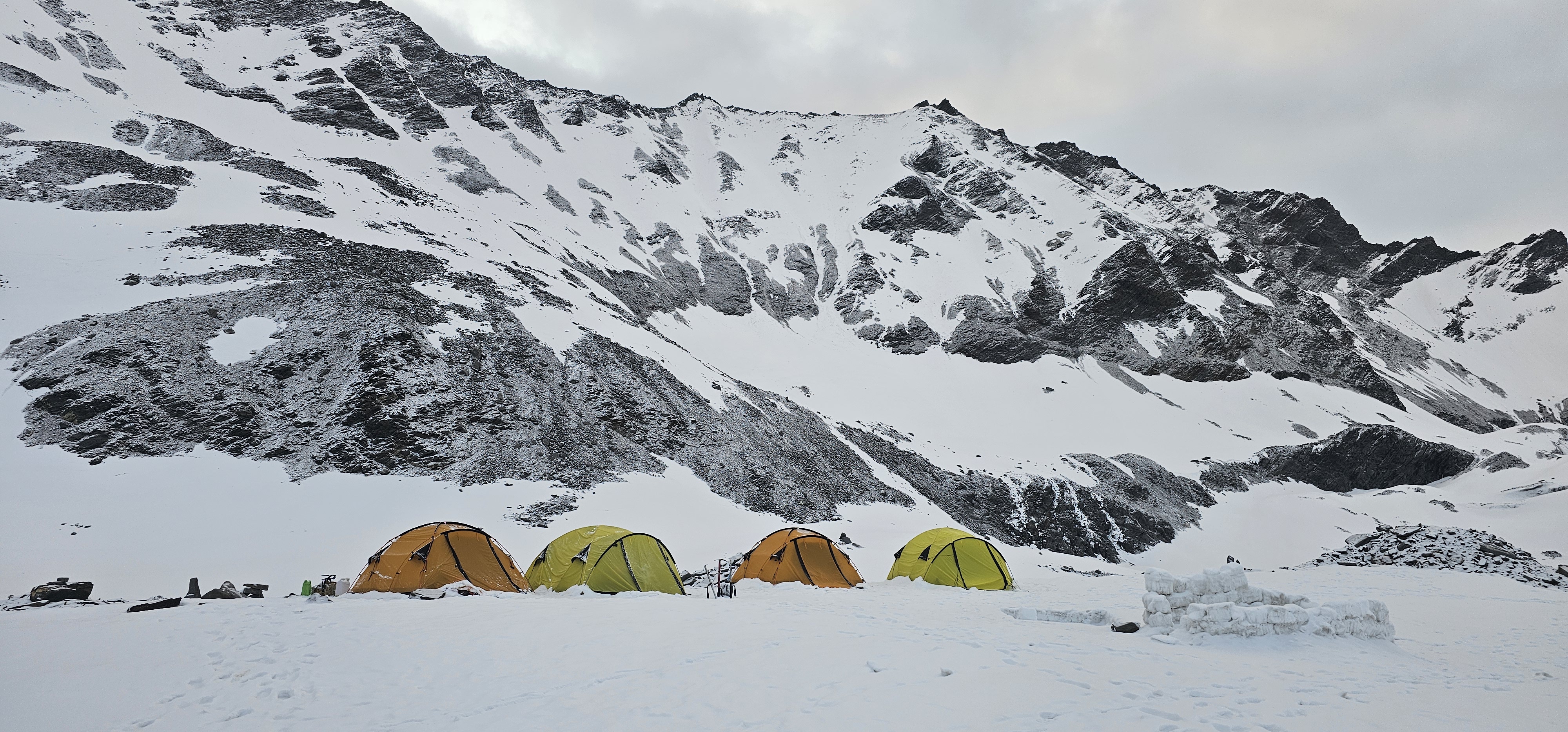
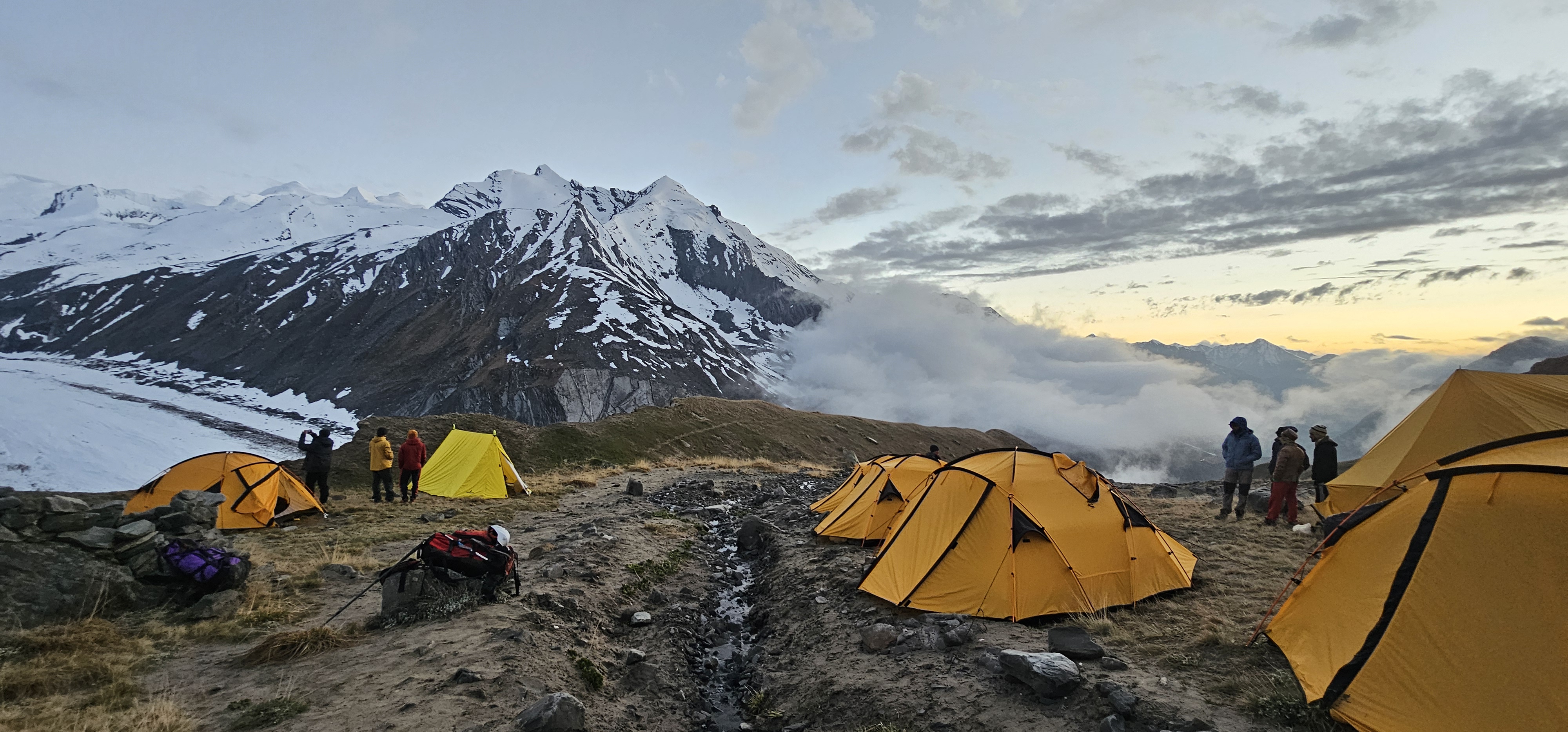
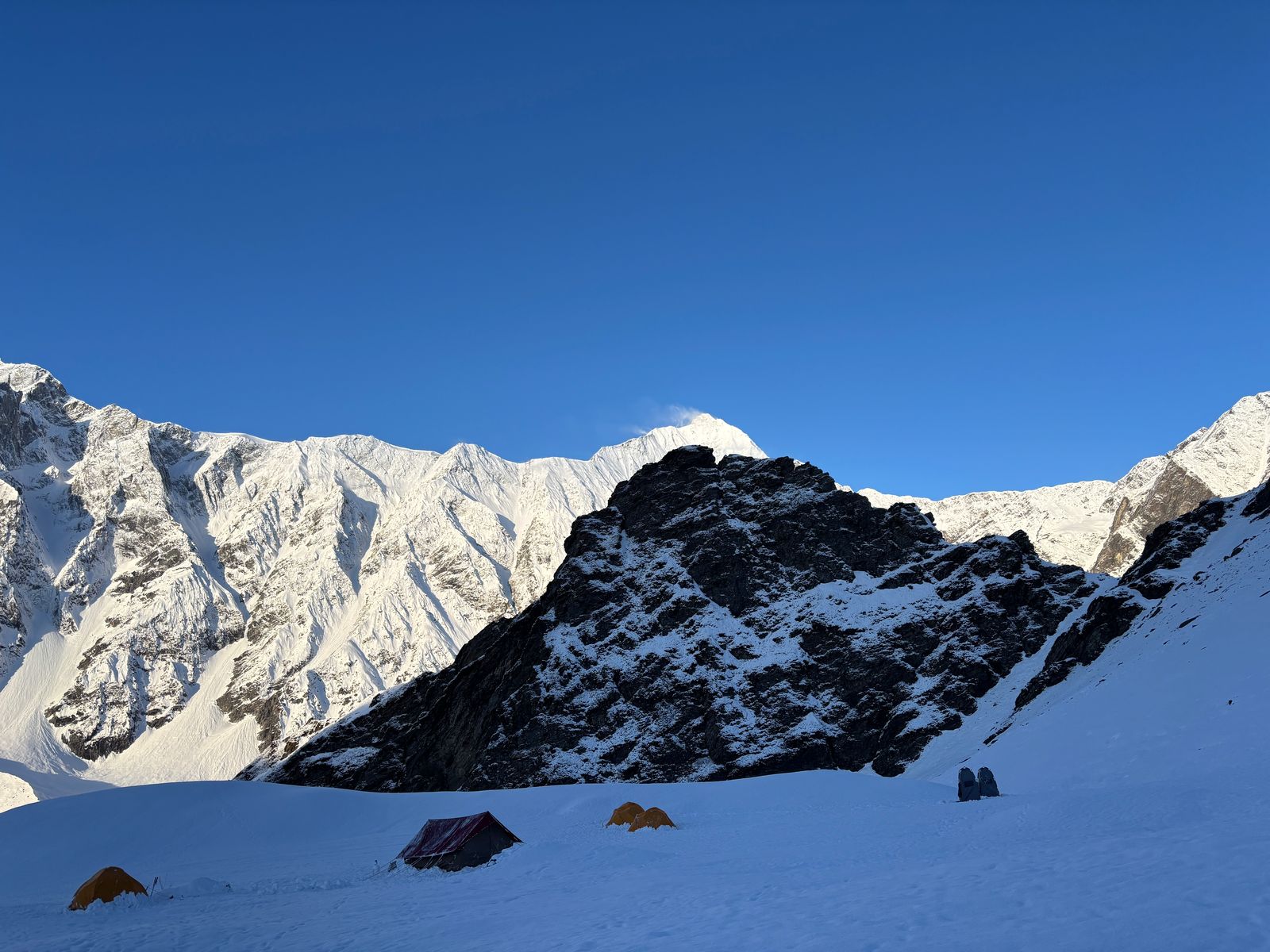
Route Description
The approach begins at Gangotri (3,048 m), the famous pilgrimage town and starting point of the Bhagirathi River. Trekkers follow the Gangotri Glacier trail through Chirbasa and Bhojbasa (3,792 m) to the Gangotri Glacier Base Camp (4,200 m). The standard route for Shivling is the Southeast Ridge, first climbed in 1974.
From Base Camp, climbers establish Camp 1 (~4,900 m) on the glacial shelf below the SE Ridge, then Camp 2 (~5,500 m) on the ridge proper. The upper section involves steep mixed terrain — rock and ice — rising to the summit pyramid. The final push to the summit (6,543 m) negotiates exposed rock slabs, ice gullies and a narrow summit ridge demanding high technical competence.
Alternative routes include the North Ridge (harder, more committing) and the Southwest Pillar — a serious rock climbing objective for elite alpinists. The Southeast Ridge remains the most frequented and best-supported route.
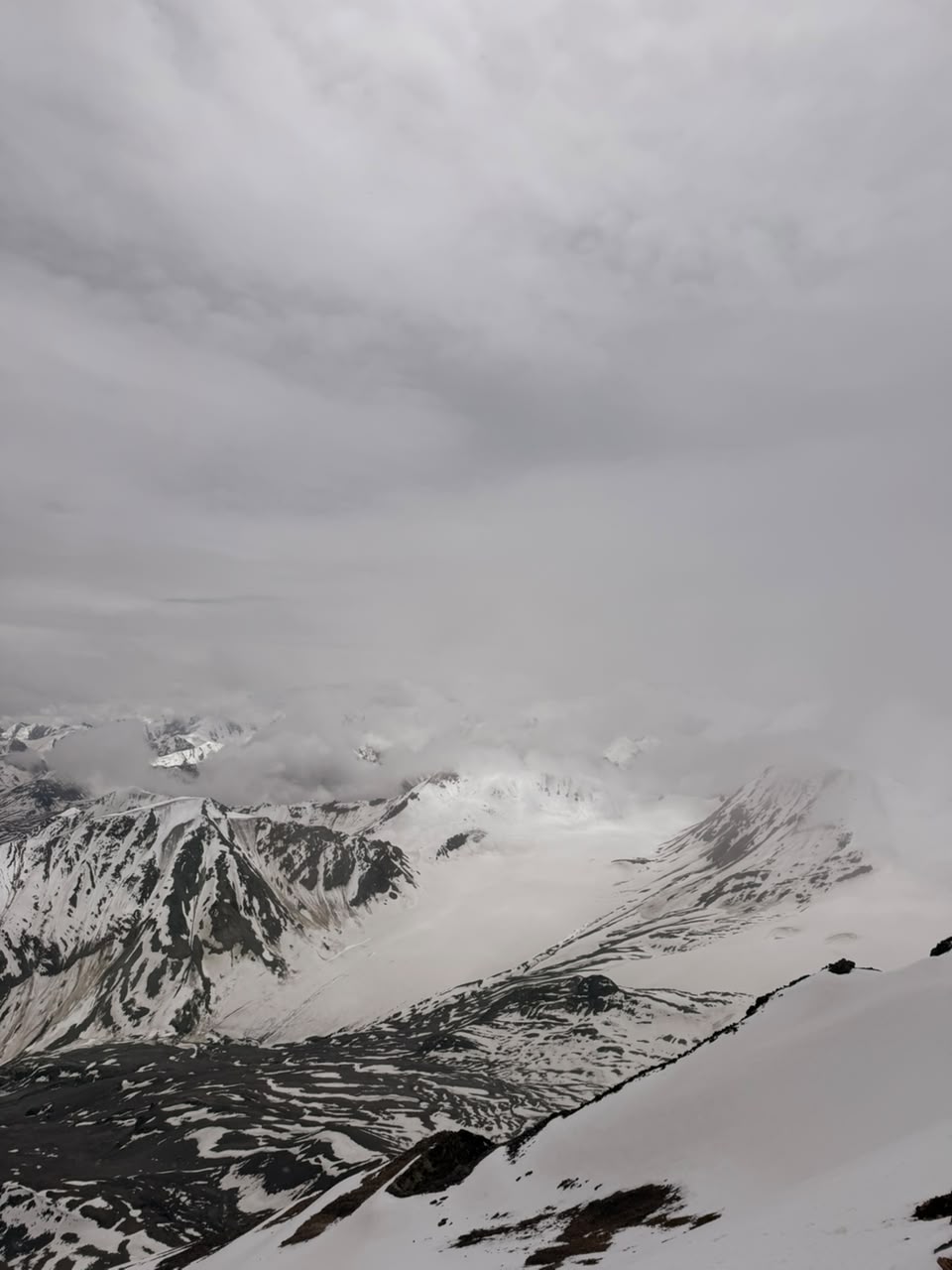
Best Time to Go
May–June & September–October — Pre-monsoon windows offer stable weather, long days, and firm snow conditions ideal for summit bids. The post-monsoon (September–October) period brings crystal-clear skies after the rains and is often preferred for photography and views. Avoid the monsoon months (July–August) for Garhwal/Kumaon objectives.
Approximate Cost
|
Package Type |
Approx. Cost (INR) |
Approx. Cost (USD) |
|
Solo / Small Group (2–4 pax) |
INR 1,85,000 – 2,40,000 pp |
USD 2,200 – 2,900 pp |
Note: Costs include IMF permit fees, liaison officer charges, Base Camp logistics, high-altitude kitchen crew, tents, fixed ropes, and guide fees. Flights, travel insurance, personal gear, and pre/post expedition hotel stays are additional.
Suggested Itinerary at a Glance
Days 1–2: Delhi → Dehradun → Gangotri (3,048 m) — acclimatisation
Days 3–5: Trek to Base Camp via Chirbasa & Bhojbasa (~4,200 m)
Days 6–8: Glacier orientation, snow & ice skills training, Camp 1 carry
Days 9–11: Establish Camp 1 (4,900 m) → Camp 2 (5,500 m)
Days 12–14: Rest / weather days; acclimatisation rotations
Days 15–17: Summit bid from Camp 2 → Summit (6,543 m) → descent
Days 18–19: Return to Gangotri; trek out
Days 20–22: Buffer days for weather + drive to Dehradun/Delhi
Climber's Pro Tips
Train on multi-pitch rock and alpine ice routes in the Alps or Himachal before attempting Shivling
Bring a 60 m dry-treated rope, cams, nuts, ice screws, and a v-thread kit
Start acclimatisation at Gangotri (3,048 m) at least 3 nights before the glacier approach
Weather windows are typically short — be ready to move fast when conditions allow
Shivling sees significant serac and rockfall on warmer afternoons; start summit bids by 1–2 AM
5,947 m (19,511 ft) · Garhwal Himalaya, Uttarakhand · Grade: PD+ (Moderate Glacier Trek)
|
Altitude |
5,947 m (19,511 ft) |
|
Region |
Garhwal Himalaya, Uttarakhand |
|
Grade / Difficulty |
PD+ (Moderate Glacier Trek) |
|
Duration |
14–18 Days |
|
Best Time |
May–June & September–October |
|
IMF Permit Required |
Yes — Inner Line / IMF permit required for glacier crossing |
Route Description
The Panpatia Col traverse links the Kedarnath Valley (beginning at Gaurikund or Kedarnath, 3,583 m) to the Badrinath Valley. The route crosses the Panpatia Glacier at 5,947 m, offering a deeply spiritual and physically demanding high-altitude passage revered in Hindu tradition as the path of the Pandavas.
From the Kedarnath side, the route ascends through Vasuki Tal (4,135 m), climbing steadily across moraines and glacial terrain to the Panpatia Glacier. The crossing of the col itself involves crevasse navigation, moderate ice slopes (30–40°), and potentially poor visibility. Descending into the Badrinath valley leads through the Satopanth Glacier moraine and the sacred Satopanth Tal to Badrinath (3,100 m).
This traverse is one of the most remote and spiritually charged routes in Uttarakhand mountaineering. Very few groups complete it each season, ensuring exceptional solitude.
Best Time to Go
May–June & September–October — Pre-monsoon windows offer stable weather, long days, and firm snow conditions ideal for summit bids. The post-monsoon (September–October) period brings crystal-clear skies after the rains and is often preferred for photography and views. Avoid the monsoon months (July–August) for Garhwal/Kumaon objectives.
Approximate Cost
|
Package Type |
Approx. Cost (INR) |
Approx. Cost (USD) |
|
Small Group |
INR 1,10,000 – 1,50,000 pp |
USD 1,300 – 1,800 pp |
Note: Costs include IMF permit fees, liaison officer charges, Base Camp logistics, high-altitude kitchen crew, tents, fixed ropes, and guide fees. Flights, travel insurance, personal gear, and pre/post expedition hotel stays are additional.
Suggested Itinerary at a Glance
Day 1–2: Delhi/Dehradun → Gaurikund (1,982 m)
Day 3–5: Trek Gaurikund → Kedarnath (3,583 m) — acclimatisation & puja
Day 6–8: Kedarnath → Vasuki Tal (4,135 m) → High Camp below col (~5,200 m)
Day 9: Cross Panpatia Col (5,947 m) — demanding glacier day
Day 10–11: Descend to Satopanth Tal (4,402 m) → Badrinath Base
Day 12–13: Badrinath darshan; trek out to motorable road
Day 14–16: Drive to Joshimath / Rishikesh / Delhi; buffer days
Climber's Pro Tips
Carry a comprehensive crevasse rescue kit — this is glacier terrain with hidden hazards
The route from Kedarnath involves pilgrim crowds early; proceed early morning for glacier sections
Both Kedarnath and Badrinath shrines are open May–November only — plan timing accordingly
Hire experienced local Garhwali high-altitude porters familiar with the glacier approach
Snow bridges over crevasses are strongest in early morning — cross before 9 AM
5,490 m (18,012 ft) · Garhwal Himalaya, Uttarakhand · Grade: Alpine D (Challenging Glacier Traverse)
|
Altitude |
5,490 m (18,012 ft) |
|
Region |
Garhwal Himalaya, Uttarakhand |
|
Grade / Difficulty |
Alpine D (Challenging Glacier Traverse) |
|
Duration |
16–20 Days |
|
Best Time |
May–June & September–October |
|
IMF Permit Required |
Yes — IMF permit and forest department entry permit |
Route Description
Auden's Col connects the Bhilangna Valley (Khatling Glacier approach) with the Gangotri basin via a remote col at 5,490 m, first crossed by geologist John Bicknell Auden in 1935. The approach from the Bhilangna side begins at Ghuttu (1,800 m), ascending through forests and meadows to the Khatling Glacier — one of the most beautiful and least-visited glaciers in the Garhwal Himalaya.
The Khatling Glacier approach involves 3–4 days of glacial travel with significant crevasse hazards and icefall sections. The col itself — the technical crux — requires steep ice climbing (up to 45–50°) and is subject to rockfall from the surrounding Jogin group peaks. Descent to the Gangotri basin leads to the village of Nala and onward to Gangotri.
The expedition is typically run one-way (Bhilangna to Gangotri) or as a loop. A two-way traverse is possible for expert teams with extended logistics.
Best Time to Go
May–June & September–October — Pre-monsoon windows offer stable weather, long days, and firm snow conditions ideal for summit bids. The post-monsoon (September–October) period brings crystal-clear skies after the rains and is often preferred for photography and views. Avoid the monsoon months (July–August) for Garhwal/Kumaon objectives.
Approximate Cost
|
Package Type |
Approx. Cost (INR) |
Approx. Cost (USD) |
|
Small Group |
INR 1,20,000 – 1,65,000 pp |
USD 1,440 – 1,980 pp |
Note: Costs include IMF permit fees, liaison officer charges, Base Camp logistics, high-altitude kitchen crew, tents, fixed ropes, and guide fees. Flights, travel insurance, personal gear, and pre/post expedition hotel stays are additional.
Suggested Itinerary at a Glance
Day 1–2: Delhi → Tehri → Ghuttu (1,800 m)
Day 3–5: Trek Ghuttu → Khatling Glacier snout (~3,800 m)
Day 6–8: Glacier travel; establish High Camp below col (~4,800 m)
Day 9: Cross Auden's Col (5,490 m) — technical ice/mixed day
Day 10–11: Descend Gangotri side → Nala village
Day 12–13: Trek to Gangotri; transport to Uttarkashi
Day 14–16: Drive Uttarkashi → Dehradun → Delhi; weather buffer days
Climber's Pro Tips
The Khatling Glacier icefall is best navigated early morning — avoid afternoon when seracs are unstable
Carry a full glacier travel kit: stakes, pickets, ice screws, pulleys, and prussiks
The col is subject to sudden weather changes; a tent and extra bivouac rations are mandatory
The Bhilangna Valley approach is very remote — carry satellite communication devices
Teams of fewer than 4 should hire additional experienced high-altitude Sherpas for safety on the col
04 Mount Yunam Peak Expedition
6,111 m (20,049 ft) · Lahaul-Spiti, Himachal Pradesh · Grade: F/PD (Non-Technical, Moderate)
|
Altitude |
6,111 m (20,049 ft) |
|
Region |
Lahaul-Spiti, Himachal Pradesh |
|
Grade / Difficulty |
F/PD (Non-Technical, Moderate) |
|
Duration |
10–14 Days |
|
Best Time |
June–September |
|
IMF Permit Required |
Yes — Himachal Pradesh Adventure Sports permit |
Route Description
Mount Yunam is accessed from the Manali–Leh Highway, specifically from the Baralacha La pass area (4,890 m) in Lahaul. The Base Camp is established at approximately 4,900 m near the Baralacha La, making this one of the most road-accessible 6,000-metre peaks in India.
The standard route follows broad, non-glaciated ridgelines to a high camp at ~5,600 m. From High Camp, climbers ascend a mix of scree, boulder, and snow slopes to the summit at 6,111 m. There is no technical ice or rock climbing on the normal route. The entire climb is essentially a very high-altitude trek on firm terrain in the pre-monsoon season.
The surrounding landscape of Lahaul — bare, ochre-coloured valleys, turquoise glacial streams, and vast sky — is extraordinary. The peak serves as an exceptional acclimatisation objective for teams preparing for more technical Ladakhi or Garhwali summits.
Best Time to Go
June–September — The Ladakh and Spiti rain-shadow zones remain accessible through summer (June–September). Himachal peaks can also be climbed in this window. Always check current season conditions with ThinAirExpedition before confirming dates.
Approximate Cost
|
Package Type |
Approx. Cost (INR) |
Approx. Cost (USD) |
|
Small Group |
INR 55,000 – 80,000 pp |
USD 660 – 960 pp |
Note: Costs include IMF permit fees, liaison officer charges, Base Camp logistics, high-altitude kitchen crew, tents, fixed ropes, and guide fees. Flights, travel insurance, personal gear, and pre/post expedition hotel stays are additional.
Suggested Itinerary at a Glance
Day 1–2: Delhi / Chandigarh → Manali (2,050 m) — acclimatisation
Day 3: Manali → Keylong (3,100 m) — acclimatisation
Day 4: Keylong → Baralacha La area / Base Camp (4,900 m)
Day 5–6: Rest and acclimatisation hikes; High Camp carry (5,600 m)
Day 7: Summit bid — High Camp to Summit (6,111 m) and return to BC
Day 8–9: Drive back to Manali; buffer day
Day 10–11: Manali → Delhi or extension activities
Climber's Pro Tips
This is the most accessible 6,000 m peak in India — ideal for first-timers aiming above 6,000 m
Acclimatise thoroughly in Manali and Keylong before driving to Base Camp
Carry warm layering — the Baralacha La area is extremely windswept and cold at night
The road to Baralacha La is typically open June to October only; confirm dates with ThinAirExpedition
Combine with the Chandratal Lake trek for a superb high-altitude Himachal itinerary
7,075 m (23,212 ft) · Garhwal Himalaya, Uttarakhand · Grade: Alpine D+ (Technical High-Altitude)
|
Altitude |
7,075 m (23,212 ft) |
|
Region |
Garhwal Himalaya, Uttarakhand |
|
Grade / Difficulty |
Alpine D+ (Technical High-Altitude) |
|
Duration |
20–24 Days |
|
Best Time |
May–June & September–October |
|
IMF Permit Required |
Yes — IMF Mountaineering Permit + Liaison Officer |
Route Description
The approach to Satopanth begins from the sacred town of Badrinath (3,100 m), ascending past the famed Satopanth Tal (lake) — a triangular, emerald-green lake at 4,402 m said to be associated with the Hindu Trinity. Beyond the lake, the route traverses the Satopanth Glacier to establish Base Camp at ~5,100 m.
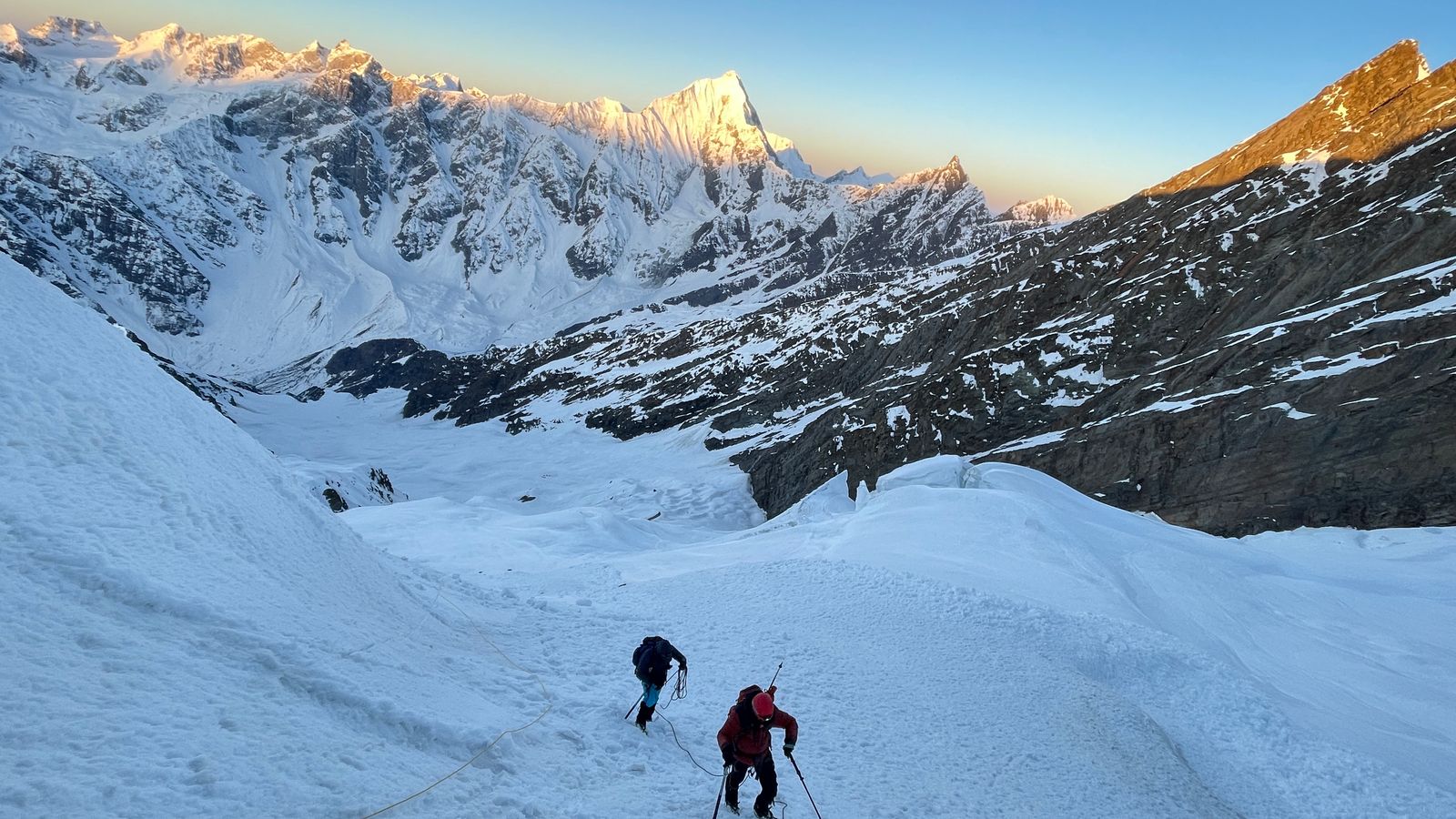
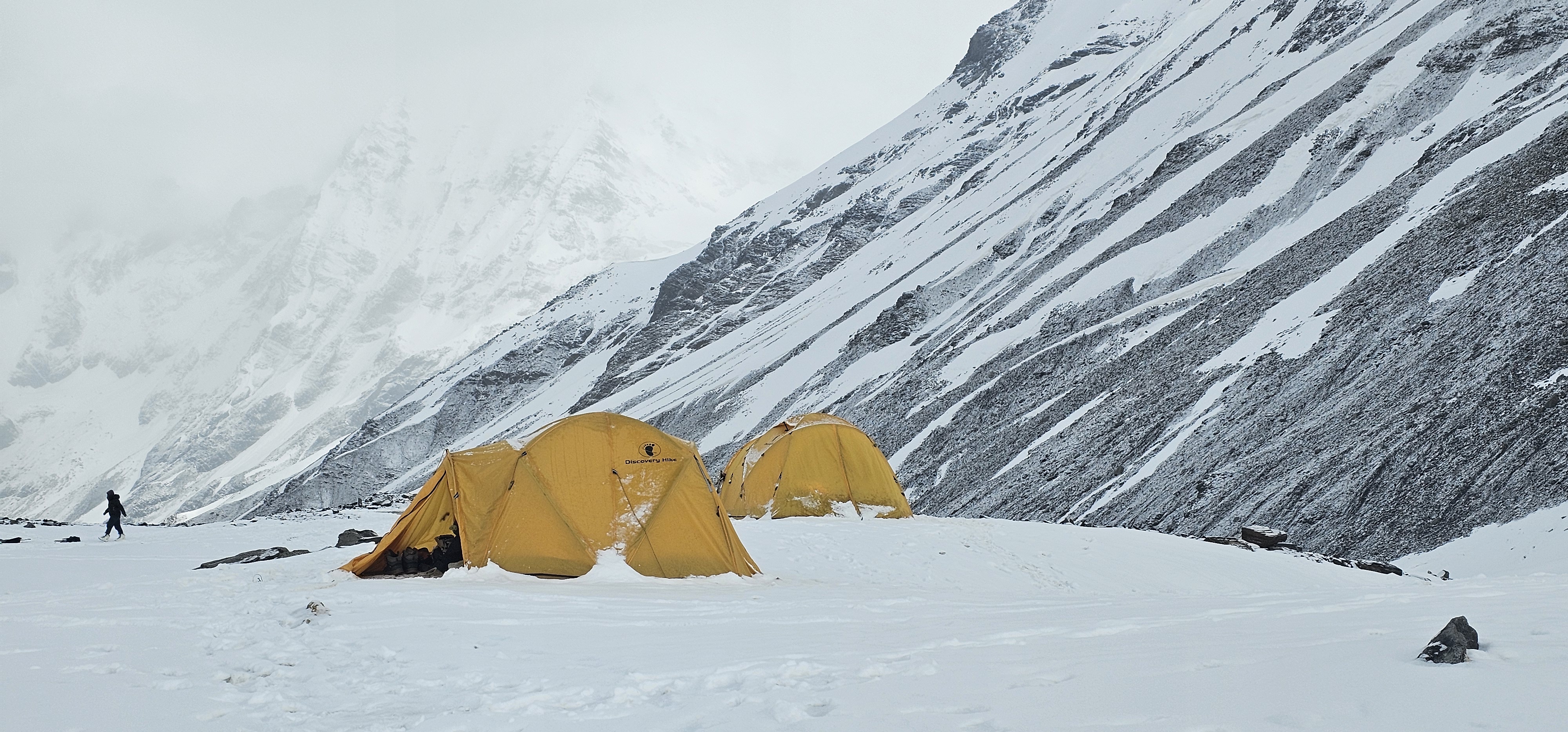
From Base Camp, the standard route establishes Camp 1 (~5,800 m) on a broad snow terrace and Camp 2 (~6,400 m) on the upper glacier plateau. The summit push from Camp 2 involves steep ice (35–45°), mixed sections, and exposed ridge travel below the summit pyramid. The summit at 7,075 m provides extraordinary views of Chaukhamba I–IV, Neelkanth, and the full Garhwal ice panorama.
The peak was first climbed in 1947 by the Swiss expedition. The route remains committing due to crevasse fields, serac hazard, and the extended time required at altitude above 6,000 m.
Best Time to Go
May–June & September–October — Pre-monsoon windows offer stable weather, long days, and firm snow conditions ideal for summit bids. The post-monsoon (September–October) period brings crystal-clear skies after the rains and is often preferred for photography and views. Avoid the monsoon months (July–August) for Garhwal/Kumaon objectives.
Approximate Cost
|
Package Type |
Approx. Cost (INR) |
Approx. Cost (USD) |
|
Small Group (2–4 pax) |
INR 2,50,000 – 3,50,000 pp |
USD 3,000 – 4,200 pp |
Note: Costs include IMF permit fees, liaison officer charges, Base Camp logistics, high-altitude kitchen crew, tents, fixed ropes, and guide fees. Flights, travel insurance, personal gear, and pre/post expedition hotel stays are additional.
Suggested Itinerary at a Glance
Day 1–2: Delhi → Joshimath → Badrinath (3,100 m)
Day 3–5: Acclimatisation; trek to Satopanth Tal (4,402 m) and back
Day 6–8: Trek to Base Camp (5,100 m) via glacier
Day 9–11: Camp 1 (5,800 m) carry and establish
Day 12–14: Camp 2 (6,400 m) carry; rest and weather days
Day 15–17: Summit bid (7,075 m) → return to Camp 1 → Base Camp
Day 18–20: Descent to Badrinath; drive to Joshimath/Rishikesh
Day 21–24: Buffer for weather; Delhi return
Climber's Pro Tips
Prior high-altitude experience above 6,000 m is essential — Satopanth is a serious 7,000 m objective
Spend at least 3 acclimatisation nights at Badrinath/Mana before the glacier approach
The Satopanth Glacier is heavily crevassed; travel roped at all times above 5,000 m
Down suit, double boots, and supplemental oxygen (optional but advisable) are critical above 6,500 m
Badrinath shrine can be visited as part of the cultural approach — arrange puja for team safety
6,816 m (22,362 ft) · Kinnaur, Himachal Pradesh · Grade: Alpine D (Technical, Remote)
|
Altitude |
6,816 m (22,362 ft) |
|
Region |
Kinnaur, Himachal Pradesh |
|
Grade / Difficulty |
Alpine D (Technical, Remote) |
|
Duration |
18–22 Days |
|
Best Time |
June & September–October |
|
IMF Permit Required |
Yes — IMF Permit + Inner Line Permit + Restricted Area Permit |
Route Description
Reo Purgyil, the highest peak of Himachal Pradesh, lies in the remote Kinnaur district on the Indo-Tibetan border. The approach is made from Nako village (3,662 m), reached via the Hindustan-Tibet road through the Spiti Valley. The approach follows the Ropa Nala and Charang glaciers through a remarkable trans-Himalayan landscape of bare ochre cliffs and high desert.
Base Camp is established at approximately 5,100 m. The standard route follows the Charang Glacier, establishing Camp 1 (~5,700 m) and Camp 2 (~6,200 m) before the final summit push on a broad snow and ice ridge to 6,816 m. The summit ridge is exposed and subject to high winds; the terrain on the upper mountain is mixed ice and loose rock.
The peak requires Inner Line Permits (due to proximity to the Tibet border) arranged well in advance. Its extreme remoteness, permit complexity, and technical demands make it one of the most exclusive objectives in Indian mountaineering.
Best Time to Go
June & September–October — The Ladakh and Spiti rain-shadow zones remain accessible through summer (June–September). Himachal peaks can also be climbed in this window. Always check current season conditions with ThinAirExpedition before confirming dates.
Approximate Cost
|
Package Type |
Approx. Cost (INR) |
Approx. Cost (USD) |
|
Small Group |
INR 2,20,000 – 3,00,000 pp |
USD 2,640 – 3,600 pp |
Note: Costs include IMF permit fees, liaison officer charges, Base Camp logistics, high-altitude kitchen crew, tents, fixed ropes, and guide fees. Flights, travel insurance, personal gear, and pre/post expedition hotel stays are additional.
Suggested Itinerary at a Glance
Day 1–3: Delhi → Shimla → Reckong Peo → Nako (3,662 m) — acclimatisation
Day 4–6: Trek Nako → Base Camp (5,100 m) via Ropa Nala
Day 7–9: Acclimatisation rotations; Camp 1 carry (5,700 m)
Day 10–12: Establish Camp 2 (6,200 m); weather days
Day 13–15: Summit bid (6,816 m) → return to Base Camp
Day 16–18: Trek out to Nako; drive to Shimla/Delhi
Day 19–22: Buffer for weather and permit logistics
Climber's Pro Tips
Inner Line Permits must be applied for 8–12 weeks in advance — ThinAirExpedition handles all documentation
The Kinnaur approach road is prone to landslides; build extra road-travel buffer days
High winds above 6,000 m are frequent — a lightweight but bombproof high-altitude tent is essential
The summit day is long (12–14 hours round trip from C2) — alpine start at midnight is standard
Carry PLB or satellite communicator — rescue logistics from this remote area are complex
6,596 m (21,640 ft) · Garhwal Himalaya, Uttarakhand · Grade: Alpine D+ (Technical Mixed)
|
Altitude |
6,596 m (21,640 ft) |
|
Region |
Garhwal Himalaya, Uttarakhand |
|
Grade / Difficulty |
Alpine D+ (Technical Mixed) |
|
Duration |
20–25 Days |
|
Best Time |
May–June & September–October |
|
IMF Permit Required |
Yes — IMF Mountaineering Permit required |
Route Description
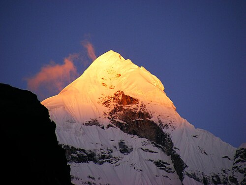
Neelkanth, the 'Queen of Garhwal', dominates the skyline above Badrinath and is visible from the temple as a soaring, fluted ice-and-rock summit. The approach mirrors the Satopanth route initially, branching off from the Satopanth Glacier toward the Neelkanth massif. Base Camp is established at approximately 4,800–5,000 m.
The standard route ascends the South Ridge via a complex series of icefalls, mixed rock-and-ice ramps, and exposed ridges. Camp 1 is placed at ~5,500 m and Camp 2 at ~6,000 m. The final 600 m from Camp 2 to the summit pyramid involves steep ice (45–55°), sections of loose high-altitude rock, and a dramatically narrow summit ridge. This is one of the most technically demanding peaks in the Garhwal Himalaya.
Neelkanth was first climbed in 1961 by an Indo-British expedition. Very few teams summit each season. The mountain's combination of technical difficulty, altitude, and aesthetic beauty makes it one of the most prized objectives in Indian climbing.
Best Time to Go
May–June & September–October — Pre-monsoon windows offer stable weather, long days, and firm snow conditions ideal for summit bids. The post-monsoon (September–October) period brings crystal-clear skies after the rains and is often preferred for photography and views. Avoid the monsoon months (July–August) for Garhwal/Kumaon objectives.
Approximate Cost
|
Package Type |
Approx. Cost (INR) |
Approx. Cost (USD) |
|
Small Group |
INR 2,40,000 – 3,20,000 pp |
USD 2,880 – 3,840 pp |
Note: Costs include IMF permit fees, liaison officer charges, Base Camp logistics, high-altitude kitchen crew, tents, fixed ropes, and guide fees. Flights, travel insurance, personal gear, and pre/post expedition hotel stays are additional.
Suggested Itinerary at a Glance
Day 1–2: Delhi → Badrinath (3,100 m) via Joshimath
Day 3–5: Acclimatisation at Badrinath; puja at temple
Day 6–9: Trek to Neelkanth Base Camp (~4,900 m) via Satopanth glacier branch
Day 10–12: Glacier orientation; Camp 1 carry (5,500 m)
Day 13–16: Establish Camp 1 → Camp 2 (6,000 m); rest/weather days
Day 17–19: Summit bid from Camp 2 → Summit (6,596 m) → full descent
Day 20–22: Trek out to Badrinath; drive to Joshimath
Day 23–25: Delhi return + buffer
Climber's Pro Tips
Neelkanth is strictly for experienced technical mountaineers — prior 6,000 m+ summits required
The mountain demands rock climbing skill (up to UIAA III/IV) in addition to ice proficiency
Loose rock on the upper mountain is a serious hazard — helmets must be worn above Camp 1 at all times
Afternoon avalanche risk is high on the south face — plan all upward movement for early morning
Two ice axes (one technical tool) are recommended for the steep summit headwall
08 Mount Trishul Peak Expedition
7,120 m (23,360 ft) · Kumaon Himalaya, Uttarakhand · Grade: Alpine D/D+ (Technical, High-Altitude)
|
Altitude |
7,120 m (23,360 ft) |
|
Region |
Kumaon Himalaya, Uttarakhand |
|
Grade / Difficulty |
Alpine D/D+ (Technical, High-Altitude) |
|
Duration |
22–26 Days |
|
Best Time |
May–June & September–October |
|
IMF Permit Required |
Yes — IMF Mountaineering Permit + Liaison Officer mandatory |
Route Description
Trishul is approached from the Kumaon town of Munsiyari or via the Ramni and Nanda Ghunti valleys in northern Uttarakhand. The Base Camp is established at approximately 4,800 m on the Trishul Glacier, approached through dense forests of rhododendron and oak — among the most scenic approach marches in Indian mountaineering.
The standard South Ridge route establishes Camp 1 (~5,500 m), Camp 2 (~6,200 m), and Camp 3 (~6,600 m) before the summit push to 7,120 m. The upper mountain is mixed terrain with steep ice (40–50°) and occasional sections of rock requiring crampon technique and ice axe proficiency. Above 6,500 m, altitude management becomes the primary challenge.
Trishul's historical significance is profound: it was the world's first peak above 7,000 m to be climbed (1907, Tom Longstaff's expedition). For any serious mountaineer, standing on Trishul's summit is a connection to the earliest golden age of Himalayan exploration.
Best Time to Go
May–June & September–October — Pre-monsoon windows offer stable weather, long days, and firm snow conditions ideal for summit bids. The post-monsoon (September–October) period brings crystal-clear skies after the rains and is often preferred for photography and views. Avoid the monsoon months (July–August) for Garhwal/Kumaon objectives.
Approximate Cost
|
Package Type |
Approx. Cost (INR) |
Approx. Cost (USD) |
|
Small Group |
INR 2,80,000 – 3,80,000 pp |
USD 3,360 – 4,560 pp |
Note: Costs include IMF permit fees, liaison officer charges, Base Camp logistics, high-altitude kitchen crew, tents, fixed ropes, and guide fees. Flights, travel insurance, personal gear, and pre/post expedition hotel stays are additional.
Suggested Itinerary at a Glance
Day 1–2: Delhi → Kathgodam → Munsiyari (2,200 m)
Day 3–5: Trek Munsiyari → Base Camp (4,800 m) through Ramni valley
Day 6–8: Acclimatisation; Camp 1 (5,500 m) carry and establish
Day 9–12: Camp 2 (6,200 m) carry; weather/rest days
Day 13–15: Camp 3 (6,600 m) establish; final acclimatisation
Day 16–18: Summit bid (7,120 m) → descend to Base Camp
Day 19–21: Trek out to Munsiyari; drive to Kathgodam/Delhi
Day 22–26: Buffer days for weather; debrief
Climber's Pro Tips
At 7,120 m, Trishul enters the 'death zone' — plan oxygen use strategy with your guide before departure
Camp 3 placement is critical — wind-scoured ridges require anchored tent platforms
The Kumaon approach through Munsiyari is beautiful but road conditions can delay transport
Altitude-related illness above 6,000 m can develop rapidly — carry DIAMOX and a portable altitude chamber
Weather windows on Trishul are shorter than on Garhwal peaks — be ready to move within hours of a clearance
7,756 m (25,446 ft) · Garhwal Himalaya, Uttarakhand · Grade: Alpine ED (Expedition Grade — Elite)
|
Altitude |
7,756 m (25,446 ft) |
|
Region |
Garhwal Himalaya, Uttarakhand |
|
Grade / Difficulty |
Alpine ED (Expedition Grade — Elite) |
|
Duration |
30–36 Days |
|
Best Time |
May–June |
|
IMF Permit Required |
Yes — IMF Permit + Inner Line Permit (Niti Valley) + Liaison Officer |
Route Description
Kamet, the third-highest peak in India and highest entirely within Indian territory, is approached from the Alaknanda valley via Joshimath and the restricted-access Niti Valley (Inner Line Permit required). The Base Camp at approximately 5,000 m is reached after a trek through remote high-altitude villages and glacial moraines near the Tibet border.
The standard route ascends the East Kamet Glacier to the Meade's Col (7,138 m) — itself a significant high-altitude landmark — before the final exposed ridge to the summit at 7,756 m. The route establishes Base Camp, Advance Base Camp (~5,600 m), Camp 1 (~6,100 m), Camp 2 (~6,700 m), Camp 3 (~7,100 m / Meade's Col), and the summit push. Fixed ropes are used on the steeper sections above Camp 2.
First climbed in 1931 by Frank Smythe, R.L. Holdsworth, and Lewa Sherpa, Kamet was then the highest peak ever climbed. The full expedition demands 30–36 days on the mountain with serious high-altitude acclimatisation, supplemental oxygen, and elite physical conditioning.
Best Time to Go
May–June — Pre-monsoon windows offer stable weather, long days, and firm snow conditions ideal for summit bids. The post-monsoon (September–October) period brings crystal-clear skies after the rains and is often preferred for photography and views. Avoid the monsoon months (July–August) for Garhwal/Kumaon objectives.
Approximate Cost
|
Package Type |
Approx. Cost (INR) |
Approx. Cost (USD) |
|
Full Expedition |
INR 5,50,000 – 8,00,000 pp |
USD 6,600 – 9,600 pp |
Note: Costs include IMF permit fees, liaison officer charges, Base Camp logistics, high-altitude kitchen crew, tents, fixed ropes, and guide fees. Flights, travel insurance, personal gear, and pre/post expedition hotel stays are additional.
Suggested Itinerary at a Glance
Day 1–3: Delhi → Joshimath (1,890 m); Inner Line Permit processing
Day 4–6: Joshimath → Niti Valley → Base Camp (5,000 m)
Day 7–10: Base Camp acclimatisation; Advance Base Camp carry (5,600 m)
Day 11–14: Establish ABC → Camp 1 (6,100 m); rotations
Day 15–18: Camp 2 (6,700 m) carry and establish
Day 19–22: Camp 3 / Meade's Col (7,100 m); weather wait
Day 23–25: Summit bid (7,756 m) → descend to Camp 2 → Base Camp
Day 26–30: Descent and trek out; drive to Joshimath/Delhi
Day 31–36: Weather buffer; debrief and celebration
Climber's Pro Tips
Kamet requires prior summits above 7,000 m — this is an elite expedition for experienced high-altitude climbers only
Supplemental oxygen (2 bottles minimum per climber above 7,100 m) is strongly recommended
The Niti Valley Inner Line Permit must be applied 10–12 weeks in advance
Use a Gamow bag at Base Camp and train your entire team in altitude illness recognition and response
Budget generously for Sherpa and high-altitude porter wages — minimum 6–8 experienced team members needed
6,535 m (21,440 ft) · Markha Valley, Ladakh · Grade: PD+/AD (Moderate–Technical)
|
Altitude |
6,535 m (21,440 ft) |
|
Region |
Markha Valley, Ladakh |
|
Grade / Difficulty |
PD+/AD (Moderate–Technical) |
|
Duration |
14–18 Days |
|
Best Time |
June–October |
|
IMF Permit Required |
Yes — Ladakh Adventure Sports permit required |
Route Description
Kang Yatse II is approached via the celebrated Markha Valley trek — one of India's finest high-altitude trekking routes. The journey begins at Spituk near Leh (3,500 m), crossing the Zingchen gorge and ascending through Buddhist villages — Skiu, Markha, Hankar — to the Base Camp at approximately 5,100 m below the mountain.
The standard route from Base Camp follows the Kang Yatse glacier to a high camp at ~5,600 m. From High Camp, the ascent to the summit (6,535 m) involves moderate glacier travel and snow slopes (25–35°). No technical rock climbing is required on the normal route, though crampons and ice axes are essential for the final 400 m.
The Markha Valley combines cultural immersion (ancient Buddhist monasteries, chortens, and prayer flags at every turn) with extraordinary mountain scenery. The combination of a superb cultural trek and a genuine 6,000-metre summit makes Kang Yatse II exceptional value among Ladakhi expeditions.
Best Time to Go
June–October — The Ladakh and Spiti rain-shadow zones remain accessible through summer (June–September). Himachal peaks can also be climbed in this window. Always check current season conditions with ThinAirExpedition before confirming dates.
Approximate Cost
|
Package Type |
Approx. Cost (INR) |
Approx. Cost (USD) |
|
Small Group |
INR 85,000 – 1,20,000 pp |
USD 1,020 – 1,440 pp |
Note: Costs include IMF permit fees, liaison officer charges, Base Camp logistics, high-altitude kitchen crew, tents, fixed ropes, and guide fees. Flights, travel insurance, personal gear, and pre/post expedition hotel stays are additional.
Suggested Itinerary at a Glance
Day 1–2: Leh (3,500 m) — mandatory acclimatisation; monastery visits
Day 3: Drive Leh → Spituk; trek into Zingchen gorge
Day 4–6: Trek Zingchen → Skiu → Markha → Hankar
Day 7–8: Hankar → Nimaling (~4,700 m) → Base Camp (5,100 m)
Day 9–10: Rest; High Camp carry (~5,600 m)
Day 11: Summit bid (6,535 m) → return to Base Camp
Day 12–14: Return trek through Markha Valley to Chokdo / Leh
Day 15–18: Leh sightseeing; flights back; buffer days
Climber's Pro Tips
Leh airport arrivals must spend a minimum of 48 hours resting at Leh altitude (3,500 m) before trekking
The Markha Valley has excellent homestay accommodation — immerse in Ladakhi culture on the approach
June and October can be cold at Base Camp (−10°C nights) — a 4-season sleeping bag is essential
Kang Yatse II can be combined with Kang Yatse I (6,400 m+, technical AD+) for ambitious teams
Hire Ladakhi ponies for load-carrying to Base Camp — reduces fatigue for the summit push
6,387 m (20,955 ft) · Gangotri Region, Uttarakhand · Grade: PD+ (Moderate)
|
Altitude |
6,387 m (20,955 ft) |
|
Region |
Gangotri Region, Uttarakhand |
|
Grade / Difficulty |
PD+ (Moderate) |
|
Duration |
14–17 Days |
|
Best Time |
May–June & September–October |
|
IMF Permit Required |
Yes — IMF Permit + Govind National Park Forest Permit |
Route Description
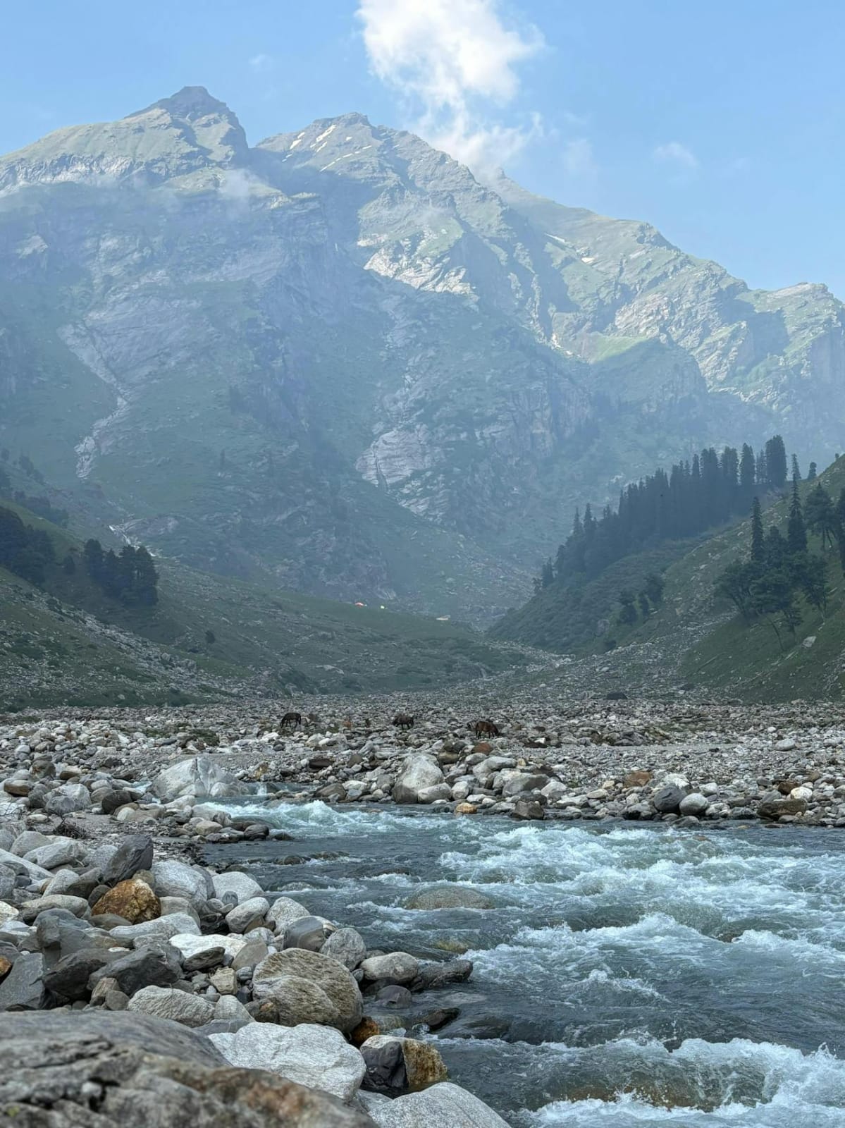
Black Peak (Kalanag) is approached via the Govind Pashu Vihar National Park, beginning at Sankri (1,920 m) in the Tons Valley. The approach follows the famous Har Ki Dun valley trail through dense forests and the glorious Ruinsara meadows (3,530 m) — one of the most scenic approach treks in the Garhwal Himalaya, passing beneath the Bandarpunch and Swargarohini massifs.
From Ruinsara, the route climbs to Base Camp at approximately 4,500 m. The summit route ascends a broad glacial plateau before steepening onto the northeast snow ridge leading to the summit at 6,387 m. The technical difficulty is moderate — crampons and ice axes are required for the upper 800 m, with some sections reaching 35–40° — but no highly technical ice or rock climbing is involved.
Black Peak's combination of superb approach scenery, manageable technical demands, and a rewarding 6,000-metre-plus summit makes it one of the most popular moderate peaks in Uttarakhand. It is ideal for trekkers making the transition to mountaineering.
Best Time to Go
May–June & September–October — Pre-monsoon windows offer stable weather, long days, and firm snow conditions ideal for summit bids. The post-monsoon (September–October) period brings crystal-clear skies after the rains and is often preferred for photography and views. Avoid the monsoon months (July–August) for Garhwal/Kumaon objectives.
Approximate Cost
|
Package Type |
Approx. Cost (INR) |
Approx. Cost (USD) |
|
Group |
INR 80,000 – 1,10,000 pp |
USD 960 – 1,320 pp |
Note: Costs include IMF permit fees, liaison officer charges, Base Camp logistics, high-altitude kitchen crew, tents, fixed ropes, and guide fees. Flights, travel insurance, personal gear, and pre/post expedition hotel stays are additional.
Suggested Itinerary at a Glance
Day 1–2: Delhi → Dehradun → Sankri (1,920 m) by road
Day 3–4: Sankri → Taluka → Osla → Har Ki Dun (3,566 m)
Day 5–6: Har Ki Dun → Ruinsara Tal (3,530 m) → Base Camp (4,500 m)
Day 7–8: Acclimatisation hikes; High Camp carry (~5,200 m)
Day 9: Summit bid — High Camp → Summit (6,387 m) → Base Camp
Day 10–12: Return trek to Sankri via Har Ki Dun
Day 13–14: Drive Sankri → Dehradun → Delhi; buffer day
Climber's Pro Tips
The Har Ki Dun valley is one of India's most beautiful approach treks — allow extra time to enjoy it
Entry to Govind Pashu Vihar National Park requires a forest department permit in addition to IMF permit
The summit day is non-technical but long (8–10 hours) — start no later than 4 AM from High Camp
September-October offers the most stable weather and clearest summit views
Black Peak is an excellent preparatory climb before attempting Kedarkantha, Bandarpunch, or Swargarohini
5,289 m (17,352 ft) · Kullu Valley, Himachal Pradesh · Grade: F/PD (Beginner–Moderate)
|
Altitude |
5,289 m (17,352 ft) |
|
Region |
Kullu Valley, Himachal Pradesh |
|
Grade / Difficulty |
F/PD (Beginner–Moderate) |
|
Duration |
8–12 Days |
|
Best Time |
May–June & October |
|
IMF Permit Required |
Yes — Himachal Pradesh Adventure Sports permit |
Route Description
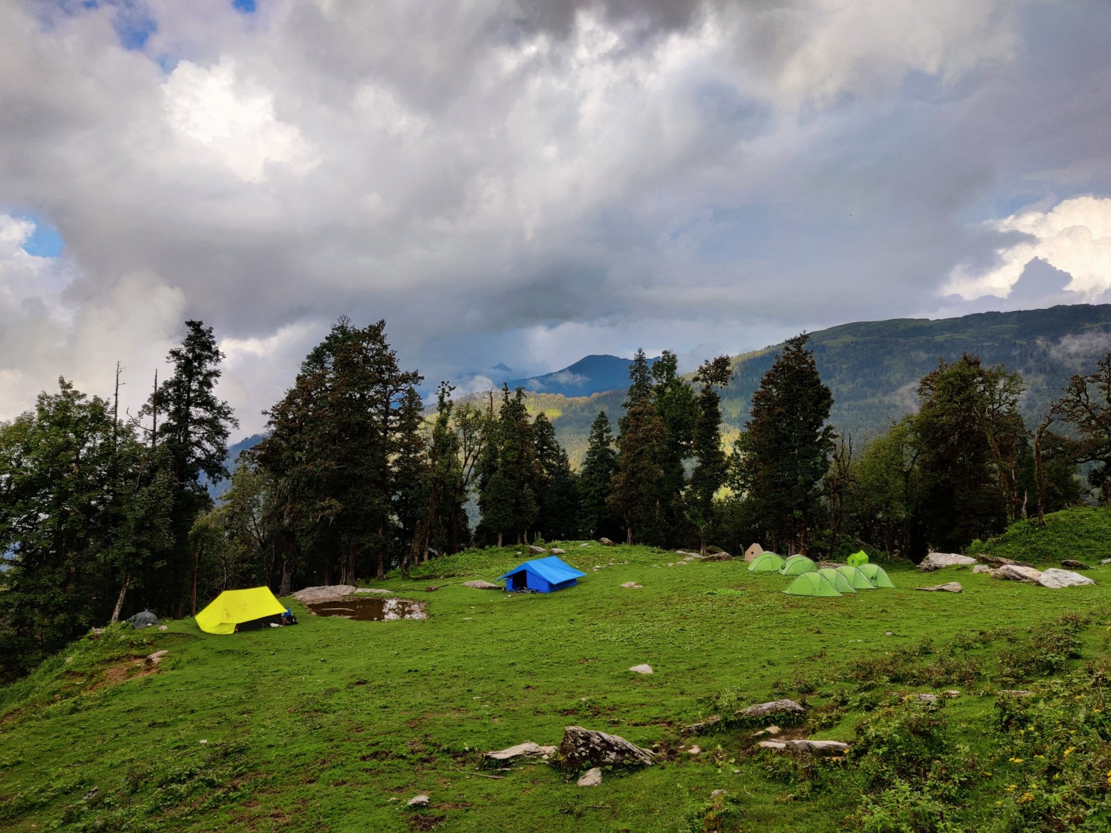
Friendship Peak is approached from Solang Valley (2,480 m), one of the most accessible high-altitude areas in Himachal Pradesh, just 14 km north of Manali. The trail ascends through pine and birch forests before entering the open glacial terrain above. Base Camp is established at approximately 3,900 m with views of the Beas Kund glacier and surrounding Kullu peaks.
The summit route from Base Camp passes through High Camp (~4,600 m) and ascends broad, snow-covered ridges with some steeper sections (25–35°) requiring basic crampon and ice axe technique. The summit at 5,289 m offers panoramic views of the Kullu and Lahaul valleys, the Rohtang Pass, Deo Tibba, and — on clear days — distant Ladakhi peaks.
ThinAirExpedition runs Friendship Peak as an introductory mountaineering expedition, incorporating a formal training day covering crampon technique, self-arrest, basic rope craft, and altitude awareness before the summit bid. It is the perfect first Himalayan mountain for fit adventurers with no prior technical experience.
Best Time to Go
May–June & October — Pre-monsoon windows offer stable weather, long days, and firm snow conditions ideal for summit bids. The post-monsoon (September–October) period brings crystal-clear skies after the rains and is often preferred for photography and views. Avoid the monsoon months (July–August) for Garhwal/Kumaon objectives.
Approximate Cost
|
Package Type |
Approx. Cost (INR) |
Approx. Cost (USD) |
|
Solo / Small Group (2–4 pax) |
INR 42,000 pp |
USD 505 pp |
Note: Costs include IMF permit fees, liaison officer charges, Base Camp logistics, high-altitude kitchen crew, tents, fixed ropes, and guide fees. Flights, travel insurance, personal gear, and pre/post expedition hotel stays are additional.
Suggested Itinerary at a Glance
Day 1–2: Delhi / Chandigarh → Manali (2,050 m) — acclimatisation & briefing
Day 3: Manali → Solang Valley → Base Camp (3,900 m)
Day 4: Rest day; Basic mountaineering skills training (crampons, ice axe, rope)
Day 5: Base Camp → High Camp (~4,600 m) — load carry
Day 6: Summit bid (5,289 m) → return to Base Camp
Day 7: Return to Solang Valley / Manali; celebration dinner
Day 8–10: Manali activities or return to Delhi; buffer days
Climber's Pro Tips
No prior mountaineering experience needed — just strong fitness and prior trekking above 3,500 m
May offers best snow conditions; October provides the clearest skies but colder temperatures
The skills training day is mandatory for all first-timers — do not rush past it
Combine with Manali sightseeing (Rohtang, Old Manali, Hadimba Temple) for a complete Himachal trip
Friendship Peak is the ideal entry point — after this summit, Yunam, Kang Yatse II, and Black Peak become realistic next objectives
Himalayan expedition costs vary considerably depending on peak altitude, permit fees, group size, season, and the level of support required. The costs quoted in each section above represent all-inclusive ThinAirExpedition packages covering:
IMF mountaineering permit and government fees
Liaison officer charges (mandatory for most peaks)
Experienced lead guide and high-altitude Sherpa wages
Base Camp logistics: dining tent, kitchen tent, sleeping tents, toilet tent
Professional kitchen crew and all meals from Base Camp onwards
Fixed ropes, ice screws, pickets and communal technical equipment
High-altitude porters for load ferrying between camps
Emergency first aid kit and portable altitude chamber (Gamow bag)
Not included: International / domestic flights, travel insurance (mandatory — helicopter rescue cover required), personal climbing gear and clothing, hotel stays in Delhi/Manali/Leh before and after the expedition, porter gratuities, and any personal expenses.
|
Season |
Months |
Best For |
Conditions |
|
Spring |
Apr–Jun |
Garhwal, Kumaon, HP |
Stable pre-monsoon windows; long days; firm snow; wildflowers on approach. Best all-round season for Uttarakhand peaks. |
|
Monsoon |
Jul–Aug |
Ladakh, Spiti only |
Heavy rain in Garhwal/Kumaon — avoid. Ladakh rain-shadow remains dry. Kang Yatse II, Yunam viable. |
|
Autumn |
Sep–Oct |
All regions except Kamet |
Crystal-clear skies post-monsoon. Best visibility and photography. Colder nights above 5,000 m. Preferred by many for summit views. |
|
Winter |
Nov–Mar |
Very limited access |
Extreme cold; access roads close. Special winter expeditions possible on a few peaks for experienced teams only. |
All mountaineering expeditions above a specified altitude in India require formal permits from the Indian Mountaineering Foundation (IMF) or equivalent state bodies. For border-area peaks (Kamet, Reo Purgyil), Inner Line Permits and Restricted Area Permits are additionally required from the Ministry of Home Affairs. ThinAirExpedition manages the complete permit process for all clients:
IMF permit applications require: passport copies, two photographs, medical fitness certificate, and expedition details
Permit processing takes 4–8 weeks for standard peaks; 10–14 weeks for restricted area peaks
Liaison Officer fees (approx. INR 25,000–40,000 per expedition) are included in ThinAirExpedition packages
Foreign nationals require Foreigners' Registration Office (FRO) compliance for restricted areas
All permits are non-transferable and peak-specific — ensure your selected peak matches your permit exactly
|
Grade |
Peaks |
Preparation Recommended |
|
Beginner |
Friendship Peak |
3+ months: daily cardio (running/cycling), loaded hiking on weekends, basic gym work. No prior climbing experience required but trekking above 3,500 m recommended. |
|
Moderate |
Yunam, Kang Yatse II, Black Peak, Panpatia Col |
4+ months: trail running with elevation, weighted pack hikes (15–20 kg), crampon practice on snow. Prior trek above 4,500 m required. |
|
Technical |
Shivling, Auden's Col, Neelkanth, Trishul, Satopanth, Reo Purgyil |
6+ months: Alpine training in Europe/Himachal, multi-pitch rock climbing, ice climbing, prior summit above 6,000 m required. Peak-specific fitness program provided. |
|
Expedition |
Kamet |
12+ months: full alpine fitness program, prior 7,000 m summit, supplemental oxygen training, extended acclimatisation trek planned as prerequisite. Elite mountaineers only. |
Footwear: Mountaineering double boots for technical peaks above 6,000 m; insulated trekking boots for moderate objectives. Gaiters essential for all snow approaches.
Insulation: Down suit for peaks above 7,000 m; down jacket + fleece mid-layer for 5,000–7,000 m objectives. Minimum −20°C rated sleeping bag for all expeditions.
Technical Gear: Crampons (12-point), ice axe (70 cm standard / 50 cm technical tool for harder peaks), harness, helmet, carabiners, prussiks, belay device. Two ice axes recommended for Neelkanth and Shivling.
Acclimatisation Aids: DIAMOX (125 mg twice daily for prevention — consult physician), pulse oximeter, headache and stomach medication, blister kit.
Communication: Personal Locator Beacon (PLB) or Garmin inReach satellite communicator mandatory for all technical and expedition-grade climbs.
ThinAirExpedition has guided climbers to the summits of all twelve peaks in this guide. Our reputation is built on three pillars: meticulous safety protocols, deeply experienced guides, and comprehensive logistical support that leaves nothing to chance. Here is why leading mountaineers and first-time Himalayan climbers choose us:
IMF-certified Indian lead guides with 15–30 years of high-altitude experience
Complete permit management — IMF, Inner Line, Forest, and Restricted Area permits all handled
Professional kitchen crew providing nutritious, hygienic hot meals at all camps
Supplemental oxygen systems available for all peaks above 6,500 m
Comprehensive medical protocols: trained first-aider at Base Camp, DIAMOX provision, Gamow bag
Satellite communication at Base Camp for all technical and expedition-grade climbs
24/7 emergency evacuation coordination and helicopter rescue facilitation
Responsible, eco-sensitive operations: leave-no-trace ethics, local community hiring
Flexible group sizes: private (solo or duo), semi-private (3–5 pax), and group (6–12 pax) formats
Transparent, all-inclusive pricing with no hidden fees
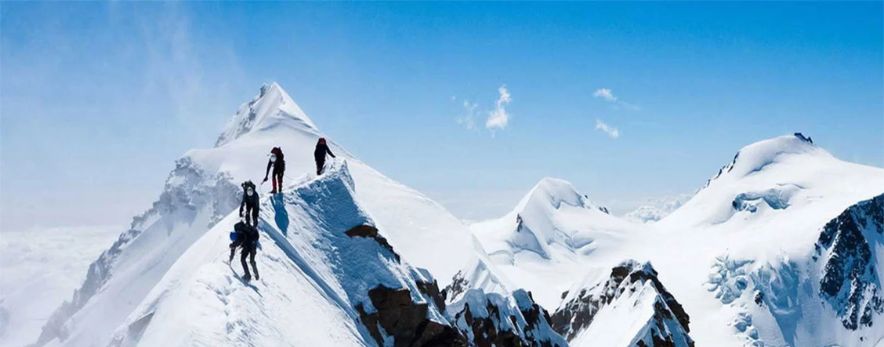
From the first snowy steps on Friendship Peak above Manali to the rarefied air of Kamet's summit at 7,756 metres, the twelve expeditions in this guide represent the full spectrum of Himalayan climbing and trekking available in India. Each mountain has its own character, its own rewards, and its own demands — and every single one of them is within reach with the right preparation, the right guide, and the right mindset.
The Indian Himalaya will not merely test your body. They will expand your understanding of what is possible, reconnect you with something ancient and profound, and leave you with memories and friendships that last a lifetime. The only question is: which summit calls to you first?
Contact ThinAirExpedition today to begin planning. Our team is ready to answer every question, customise every itinerary, and stand beside you every step of the way — from Base Camp briefing to summit celebration.