29
Jun

Black Peak rises to 6,387 m above the Garhwal Himalayas of Uttarakhand. Locally, it carries the name Kalanag — the Black Cobra — a name earned from the dark, serpentine ridge that defines its upper profile. This is not a high-altitude trek. It is a mountaineering expedition that requires rope work, crampon technique, and the mental composure to climb a near-vertical ice wall in subzero darkness.
If you're searching for a pre-Everest validation climb in India, or a genuine 6,000 m technical peak in the Garhwal, Black Peak expedition belongs on your list. But it will not accept unqualified climbers. Understand what it demands before you commit.
Kalanag sits within the Bandarpunch massif in Uttarkashi district, at coordinates 31°01'12"N, 78°34'12"E. It shares the massif with its sibling, Bandarpunch White Peak, but the two are distinct climbs with different technical profiles.
The summit elevation is 6,387 m (20,955 ft). Several commercial operators list it at
6,287 m — that figure is wrong by 100 metres. The Survey of India and Indian Mountaineering Foundation (IMF) records confirm the correct elevation.
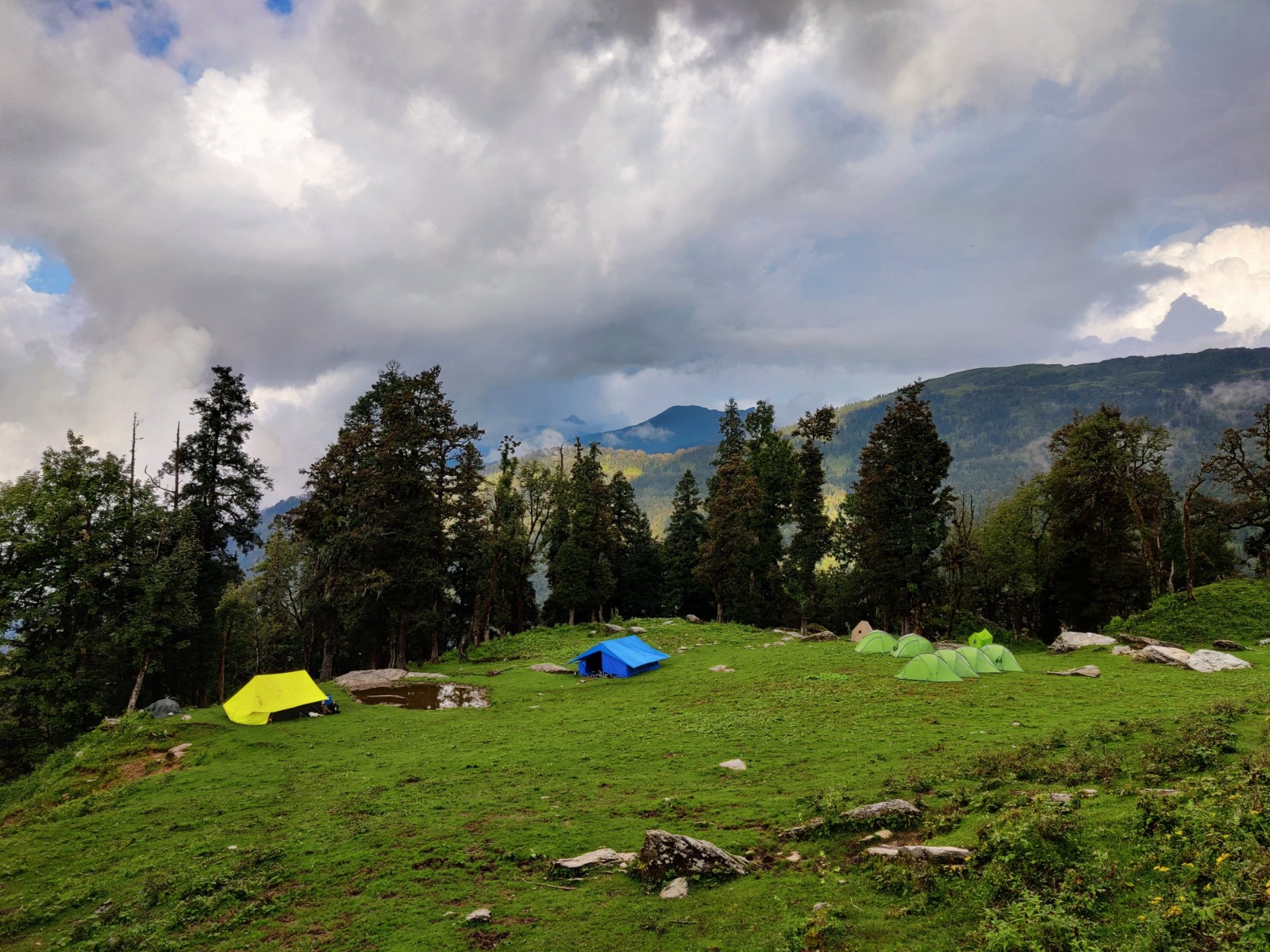
The expedition originates in Sankri village (1,920 m) in the Tons Valley, passes through the forests of the Govind Wildlife Sanctuary, skirts the glacial lake at Ruinsara Tal (3,350 m), and terminates at Kyarkoti Base Camp (4,045 m) before pushing onto the glacier.
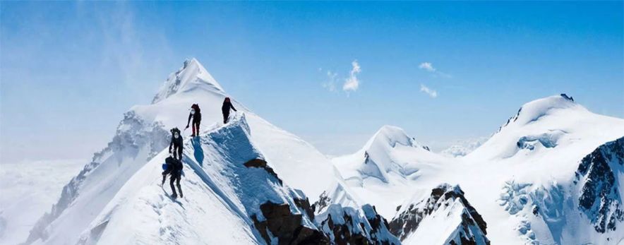
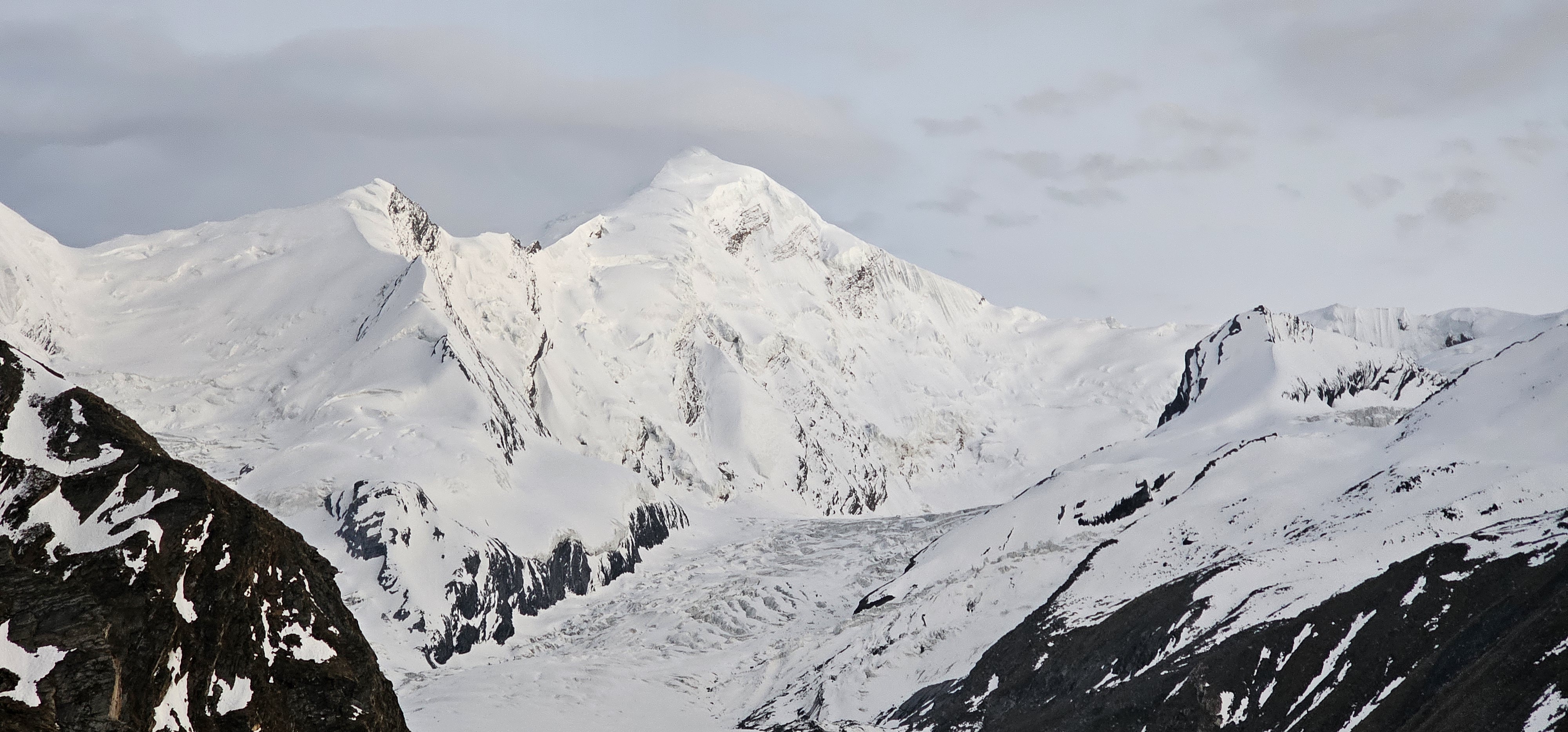
What sets Black Peak apart from standard Himalayan treks is the Shift of Atmosphere. You leave pine and birch forests behind and step onto raw glaciated terrain, crossing crevasse fields and gaining altitude fast. The final obstacle is a 75-foot snow-and-ice wall pitched at 70° to 75° — the kind of angle where fixed ropes are mandatory and falling is not survivable without arrest.
Black Peak is classified as a highly technical, difficult mountaineering expedition. It is not beginner territory. It is not suitable for trekkers who have only completed highaltitude trails like Roopkund or Pin Parvati.
Mandatory Prerequisite: A valid Basic Mountaineering Course (BMC) certificate from a nationally recognised institution — the Nehru Institute of Mountaineering (NIM) or the National Institute of Mountaineering and Allied Sports (NIMAS) are the standard references. Responsible operators require physical proof of this certification before accepting registration. The IMF enforces this at the permit level.
Beyond certification, climbers need demonstrable experience with crampons, ice axe self-arrest, rope coiling, glacier travel, and fixed-line ascending (Jumaring). If you have not practiced Jumar technique on steep snow or ice before this expedition, the summit headwall will not be a challenge — it will be a crisis.
Physical prerequisites are equally non-negotiable. Climbers must be capable of carrying a 10 to 11 kg summit pack at 5,500 m after ten consecutive days of altitude living. They must be comfortable with 2 AM starts, sub-zero temperatures, and operating under cognitive load while hypoxic.
If you are coming from a trekking background only — even strong trekking, including 5,000+ m passes — plan for an intermediate technical climbing experience first. Friendship Peak (5,289 m) or a structured alpine skills course are realistic stepping stones.
The standard expedition runs 10 days on trail from Sankri, following a four-camp structure: Base Camp at Kyarkoti (4,045 m), Advanced Base Camp (ABC) at 4,600 m, Camp 1 at approximately 5,100–5,200 m, and Summit Camp at 5,500 m.
Some operators abbreviate the camp sequence by skipping ABC and going directly to Camp 1 from Kyarkoti. The four-camp structure is the professional pacing standard and provides better acclimatization integrity.
|
Day |
Segment |
Distance (km) |
Target Elevation (m) |
Terrain |
Avg Duration (hrs) |
|
1 |
Dehradun to Sankri |
190 km road |
1,950 |
Tons River canyon, winding mountain roads |
8 |
|
2 |
Sankri to Seema |
14 |
2,600 |
Walnut and pine forests, Supin River bank |
6 |
|
3 |
Seema to Ruinsara Tal |
14 |
3,350 |
Alpine meadows, birch |
7 |
|
4 |
Ruinsara Tal to Kyarkoti |
6 |
4,050 |
Boulder fields, landslide zone, meadow clearing |
4 |
|
5 |
Acclimatization Day |
2 |
4,050 |
Gentle walks, crampon and gear check |
2 |
|
6 |
BC to ABC (Load Ferry) |
8 |
4,050 (return) |
Moraine trails, initial glacier ice |
6 |
|
7 |
Occupy ABC |
4 |
4,600 |
Glacier lateral moraine navigation |
4 |
|
8 |
ABC to Camp 1 |
3 |
5,200 |
Open glacier, crevasse-rich snow trails |
4 |
|
9 |
Camp 1 to Summit Camp |
2 |
5,500 |
Upper snow plateau, steep headwall approach |
3 |
|
10 |
Summit Push and Return |
5 |
6,387 |
75-foot vertical ice wall, narrow summit ridge |
12 |
The transition between Ruinsara Tal and Kyarkoti is where the landscape shifts without warning. The meadow serenity of the lake ends on a boulder field that demands careful footing. Kyarkoti Base Camp sits at the glacier's edge — the last point where mule transport is feasible.
Best Season and Weather Windows
Two windows exist for Black Peak: May to mid-June, and mid-September to October.
The pre-monsoon window (May–June) offers longer daylight hours and relatively consolidated snowpack on the upper slopes. The summit wall is more stable in firm spring snow than in the loose, unconsolidated autumn crust. However, late May can bring pre-monsoon instability, especially above 5,000 m.
The post-monsoon window (September–October) benefits from clearer skies and spectacular visibility. The Swargarohini, Bandarpunch, and Gangotri ranges are visible in full relief from the summit ridge on clear September mornings. The risk in October is cold. Night temperatures at Summit Camp can fall to -20°C or lower, and wind chill on the exposed ridge amplifies that significantly.
Avoid: July and August entirely. The Govind Wildlife Sanctuary and the trail sections through the Tons Valley receive heavy monsoon precipitation. Trail degradation, rockfall risk, and whiteout conditions on the glacier make summer attempts extremely dangerous.
Month-by-month logic in brief:
May: Good snow conditions, longer days, some pre-monsoon risk late month
June (first half): Often the most stable window, firm snow on upper slopes June (second half) to August: Monsoon. Do not attempt.
September: Excellent visibility, stable weather after monsoon withdrawal
October: Clear skies, but temperatures drop sharply above base camp
November onward: Route becomes technically hazardous; most operators close season
This is the most misunderstood part of the Black Peak Expedition. Most competitor guides say "permits are required" and stop there. The actual permitting architecture has multiple layers.
IMF Peak Permit: The Indian Mountaineering Foundation is the primary authority. Foreign nationals must register through an IMF-affiliated operator and currently pay approximately USD 500 for a team of two. Indian climbers benefit from recent Uttarakhand reforms that have waived several government expedition fees — confirm the exact current schedule directly with IMF, as this is time-sensitive.
UKMPS Single Window Portal: The Uttarakhand Mountaineering Permission System allows online processing of forest, camping, and environmental clearances for the Govind Wildlife Sanctuary. This is where most independent aspirants run into problems — the portal requires pre-registration and documentation that takes time to prepare.
Liaison Officer (LO): A mandatory Liaison Officer appointed through the IMF must accompany all registered foreign expeditions. This is not optional and not a formality — the LO is part of the legal clearance structure.
Govind National Park Entry Fees: Separate wildlife sanctuary entry fees apply. These are subject to seasonal adjustment.
Special Casual Leave (SCL): Government employees in India are legally entitled to up to 30 days of SCL per calendar year for IMF-registered mountaineering expeditions. SCL applications must be submitted at least 20 days in advance through IMF-affiliated partners — it is not an automatic benefit.
Practical sequence: Begin permit applications at minimum 60 days before your planned start. IMF processing timelines vary, and a delayed permit has no remedy.
The fitness requirement for Black Peak is not casual. You are expected to carry a 10 to 11 kg pack at 5,500 m after multiple days of altitude stress, then summit on day ten of continuous exertion.
Cardiovascular base: Run at least 5 km three to four times per week for eight weeks before departure. Add interval training — short bursts at maximum effort followed by recovery — because the summit push alternates between technical movement and rest on steep terrain.
Load-carrying: Train with a 10 to 12 kg backpack on hilly terrain. Progress from 8 km walks to 15 km hikes over two months. Your legs need to know how to carry weight across boulder fields and loose scree.
Strength: Focus on posterior chain — glutes, hamstrings, lower back. Squats, lunges, step-ups with a loaded pack. Shoulder and core strength matter for Jumar work on the headwall.
Technical skills practice: Arrange a pre-expedition day on a climbing wall or snow slope to practice crampon technique, ice axe arrest, and Jumar ascending before you arrive at Kyarkoti.
Altitude pre-adaptation: If available, a weekend at 3,500 m or higher before the expedition compresses the acclimatization curve in the early days. If not possible, build in an extra rest day at Ruinsara Tal.
Black Peak requires technical mountaineering gear. The climb above ABC involves crampons, fixed ropes, Jumars, and harness work. Below is the essential matrix.
|
Gear Item |
Recommended Specification |
Purpose |
Rent or Buy? |
|
Double Mountaineering Boots |
Rated to -30°C, integrated gaiter compatible |
Frostbite prevention, rigid crampon attachment |
Rent at Sankri |
|
Jumar (Ascender) |
Ergonomic handle, self-cleaning tooth- cam |
Climbing the 75-foot summit headwall |
Rent (usually operatorincluded) |
|
Ice Axe |
Classic T-rated mountaineering axe |
Self-arrest and stepcutting on verglas |
Rent (usually operatorincluded) |
|
Padded Harness |
CE/UIAA certified, adjustable leg loops |
Glacier roping, fixedline security |
Rent (usually operatorincluded) |
|
Crampons |
12-point steel, compatible with your boots |
Traction on glacier and headwall |
Rent at Sankri |
|
Polarized Sunglasses |
Category 4 UV protection, side shields |
Preventing snow blindness on open glacier |
Buy — nonnegotiable |
|
Down Sleeping Bag |
Rated to -20°C comfort |
Summit Camp nights |
Buy or rent |
|
4-Season Tent |
Geodesic design, snow-rated |
High camps in wind and snowfall |
Operatorprovided |
|
Layering System |
Base, mid, insulation, shell |
Temperature management from 0 to -25°C |
Buy |
|
Summit Pack |
25–30 L, minimal frame |
Carries essentials within 11 kg cap |
Bring your own |
Rent vs. buy logic: Technical hardware — boots, Jumars, axes, crampons, harnesses — can be rented in Sankri or through your operator. Quality varies. If you are doing multiple technical expeditions, owning your boots is strongly recommended; fit is critical for a twelve-hour summit day.
Pack weight discipline: The maximum allowed summit pack is 10 to 11 kg. This is not a comfort guideline — it is a safety parameter. Every gram above that weight costs oxygen and decision-making capacity at 6,000 m. Audit your pack ruthlessly.
Verglas note: Carry microspikes separately in your summit day pack for the lower approach sections where verglas — hard, slick black ice coating wet rocks — forms near the summit ridge. Verglas is more treacherous than deep snow and is not welldiscussed in most gear guides.
Getting to Sankri: Dehradun is the standard gateway. Jolly Grant Airport serves Dehradun with regular flights from Delhi, Mumbai, and other major cities. From Dehradun ISBT, shared taxis and private vehicles cover the 190 km to Sankri in approximately 8 hours via Purola and Mori. The road follows the Tons River canyon — scenic but demanding in monsoon season.
Sankri: This is the last point for resupply, gear rental, and final equipment checks. Operators typically conduct a gear inspection here. ATMs are unreliable; carry cash from Dehradun.
Mule transport: Mules can carry equipment from Sankri to Kyarkoti Base Camp (4,045
m). At Kyarkoti, animal transit ends. The terrain above — boulders, glacier moraine, and ice — makes animal movement impossible. From this point forward, all equipment is carried by high-altitude porters (HAPs) or the climbing team.
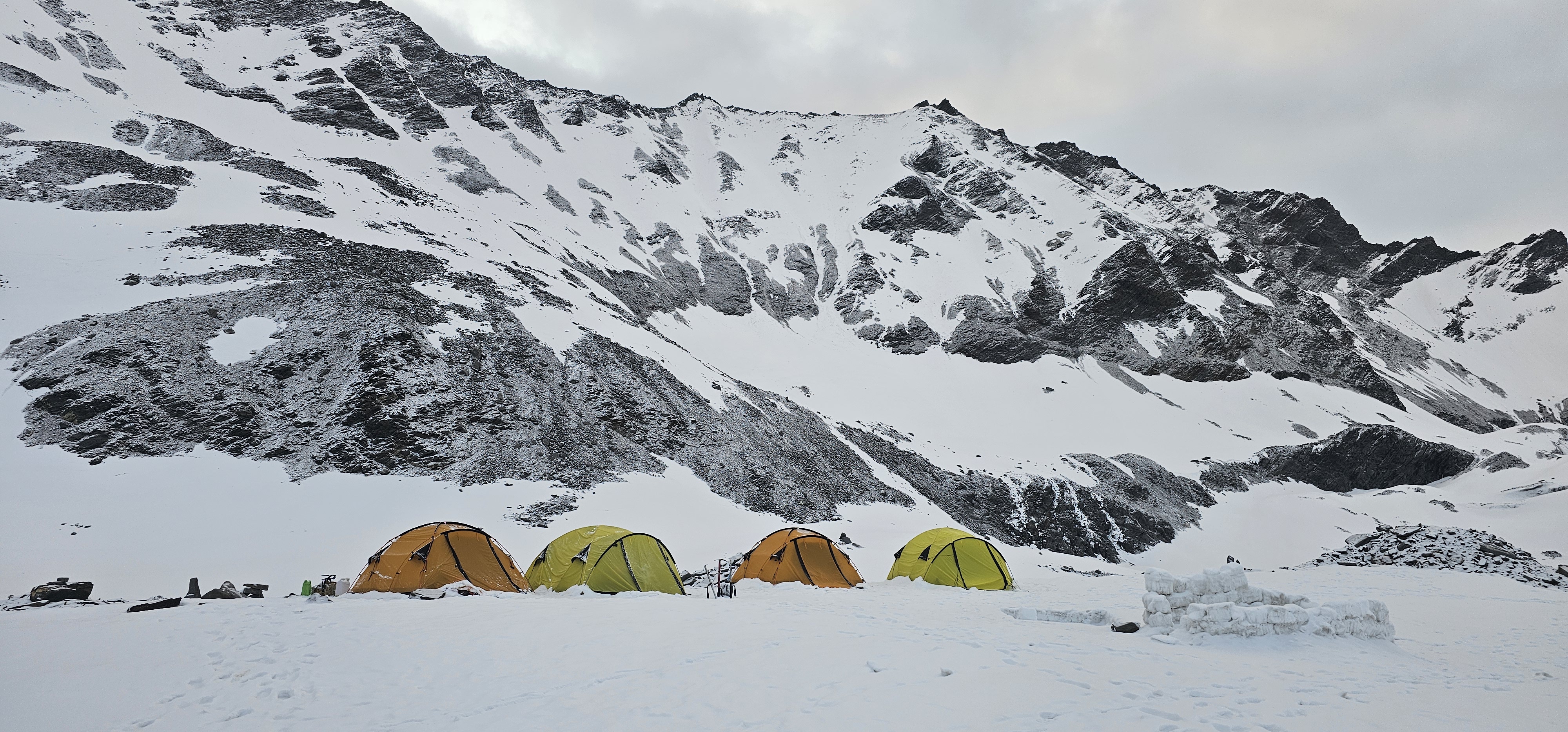
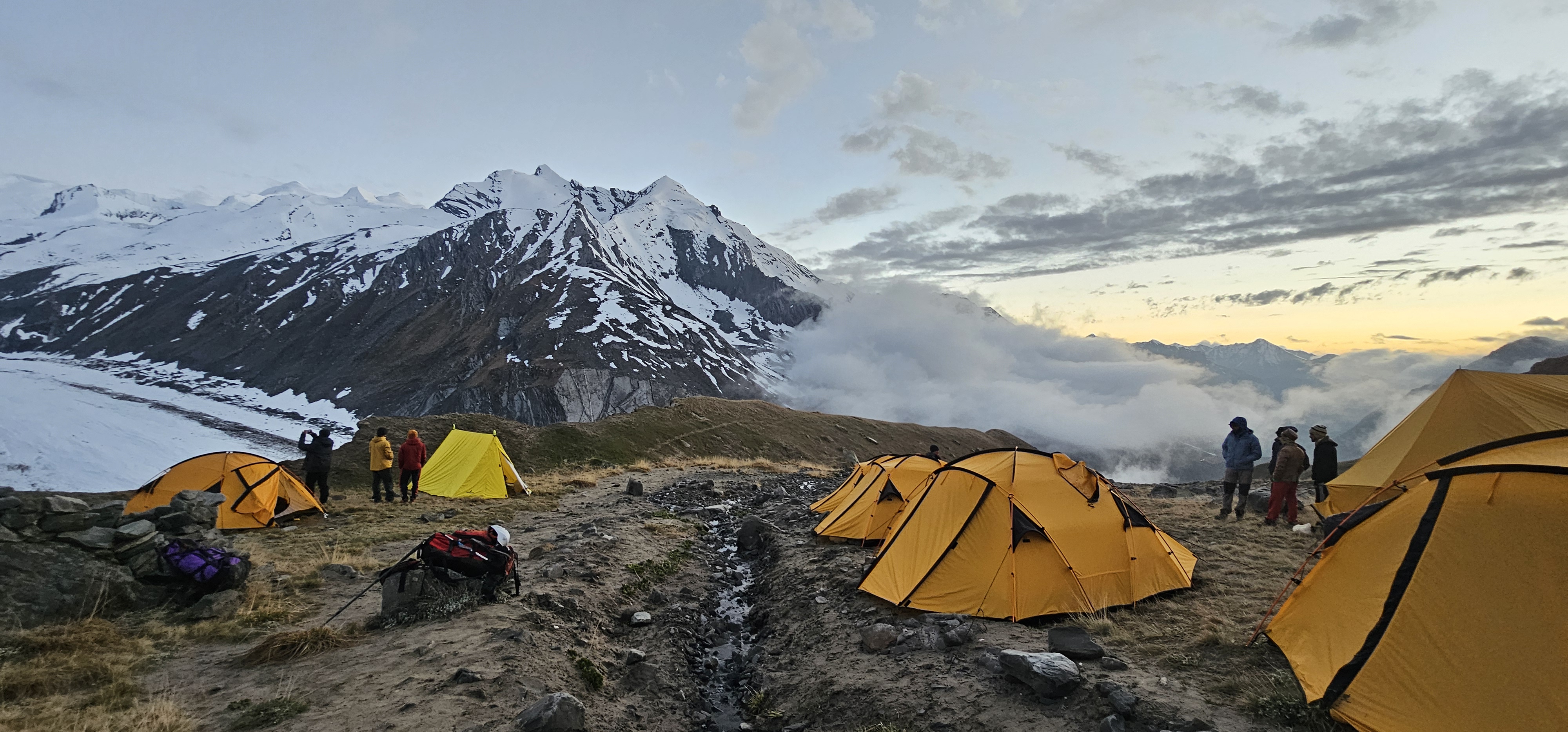
Kyarkoti Base Camp: Sits at 4,045 m on a boulder basin at the glacier's edge. Camp infrastructure typically includes sleeping tents, a dining tent, and a toilet tent. Water comes from glacial melt streams nearby. Mobile network coverage is limited or absent — operators carry satellite communication devices.
Food: Operators provide cooked meals through base camp. Above ABC, caloric needs are high and appetite is suppressed by altitude. Energy bars, nuts, chocolate, and thermos-carried hot liquids are standard summit day fuel.
Acclimatization is not an aspect to be dealt carelessly — it is the mechanism that determines whether your body can function at 6,387 m. Black Peak's ascent profile requires a deliberate rotation strategy.
The sleep-low, climb-high principle applies above Kyarkoti. The load ferry on Day 6 — carrying equipment from Base Camp to ABC and returning to sleep at 4,045 m — is physically exhausting but physiologically essential. Your body produces more red blood cells during sleep at lower altitudes after the exertion of higher exposure.
Between Camp 1 (5,100–5,200 m) and Summit Camp (5,500 m), most climbers spend only one acclimatization night before the summit push. This is a short window. If your acclimatization has been incomplete in the lower rotations, you will feel it on summit day.
Signs that your acclimatization is failing: persistent headache that does not resolve with the Triple One protocol (1 Disprin, 1 litre of water, 1 hour of rest), loss of appetite beyond normal altitude suppression, coordination difficulty, confusion, or any sign of cerebral edema (HACE). At any of these points, descent is the only correct response. Do not summit.
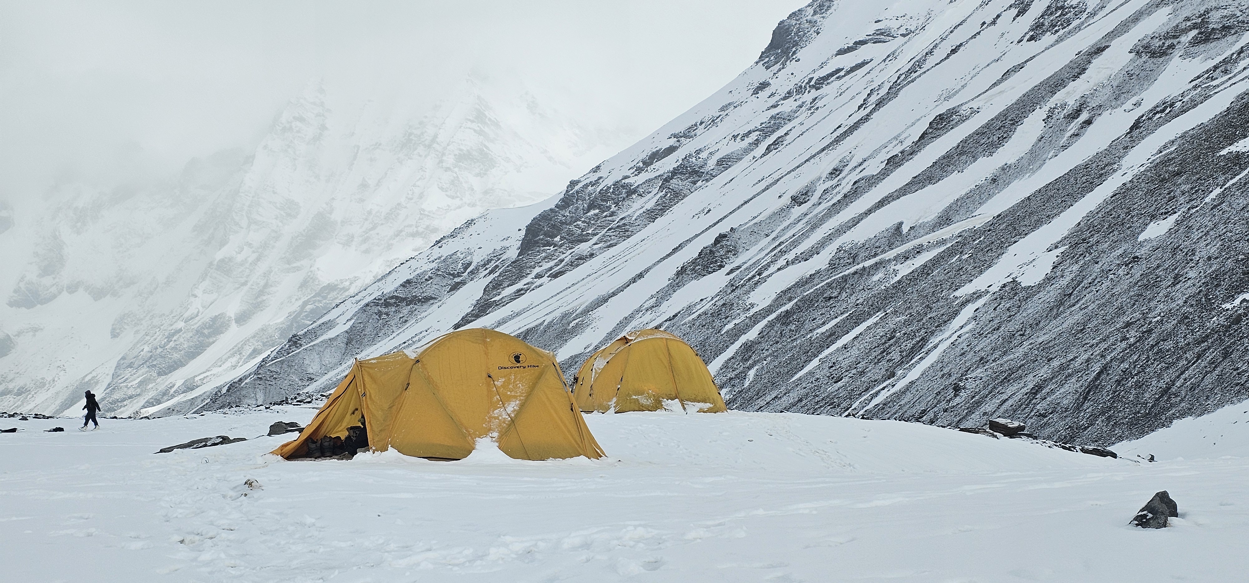
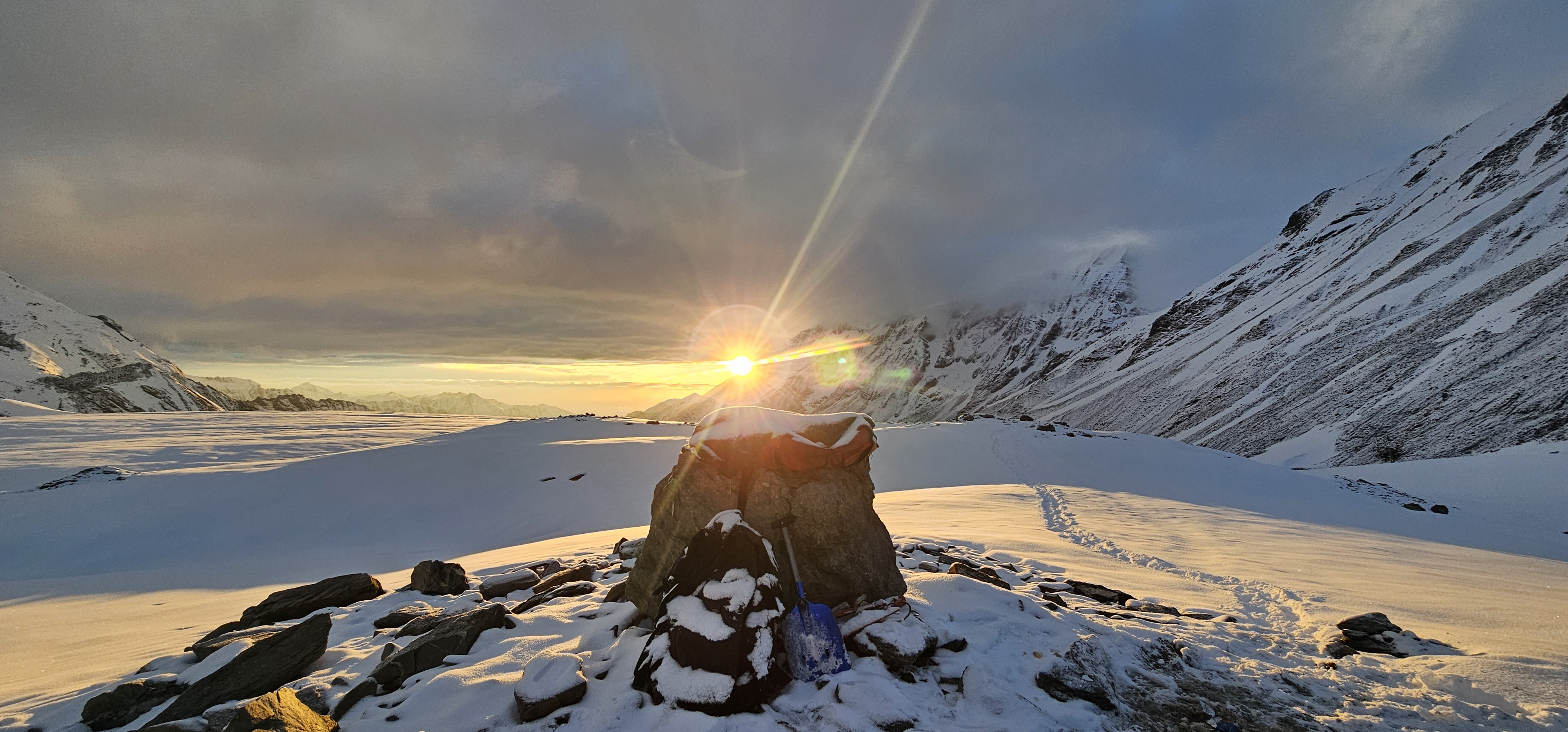
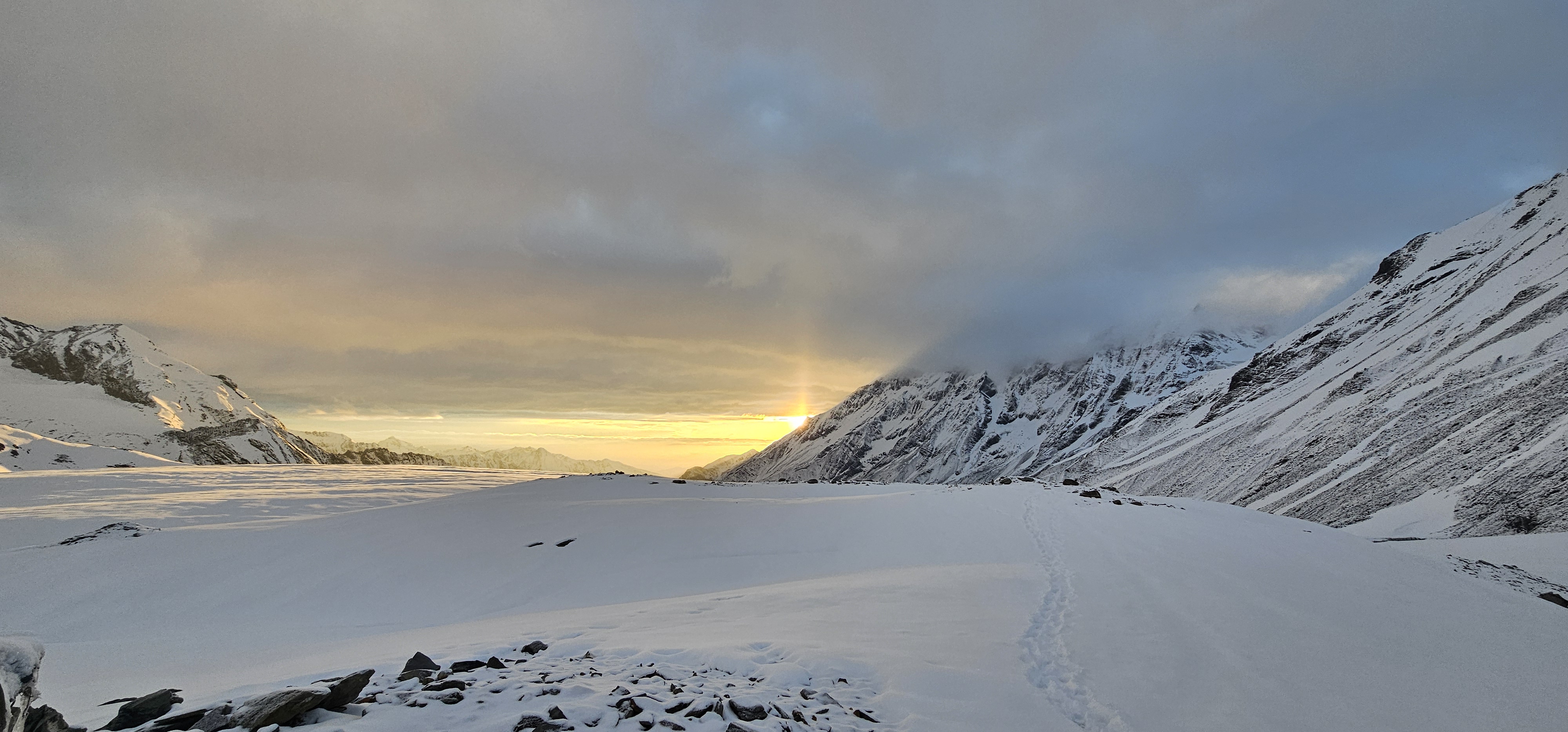
Summit day begins at approximately 2 AM. You dress in darkness at Summit Camp (5,500 m), in air that bites through every layer. The ground outside the tent is frozen hard — verglas-coated in places.
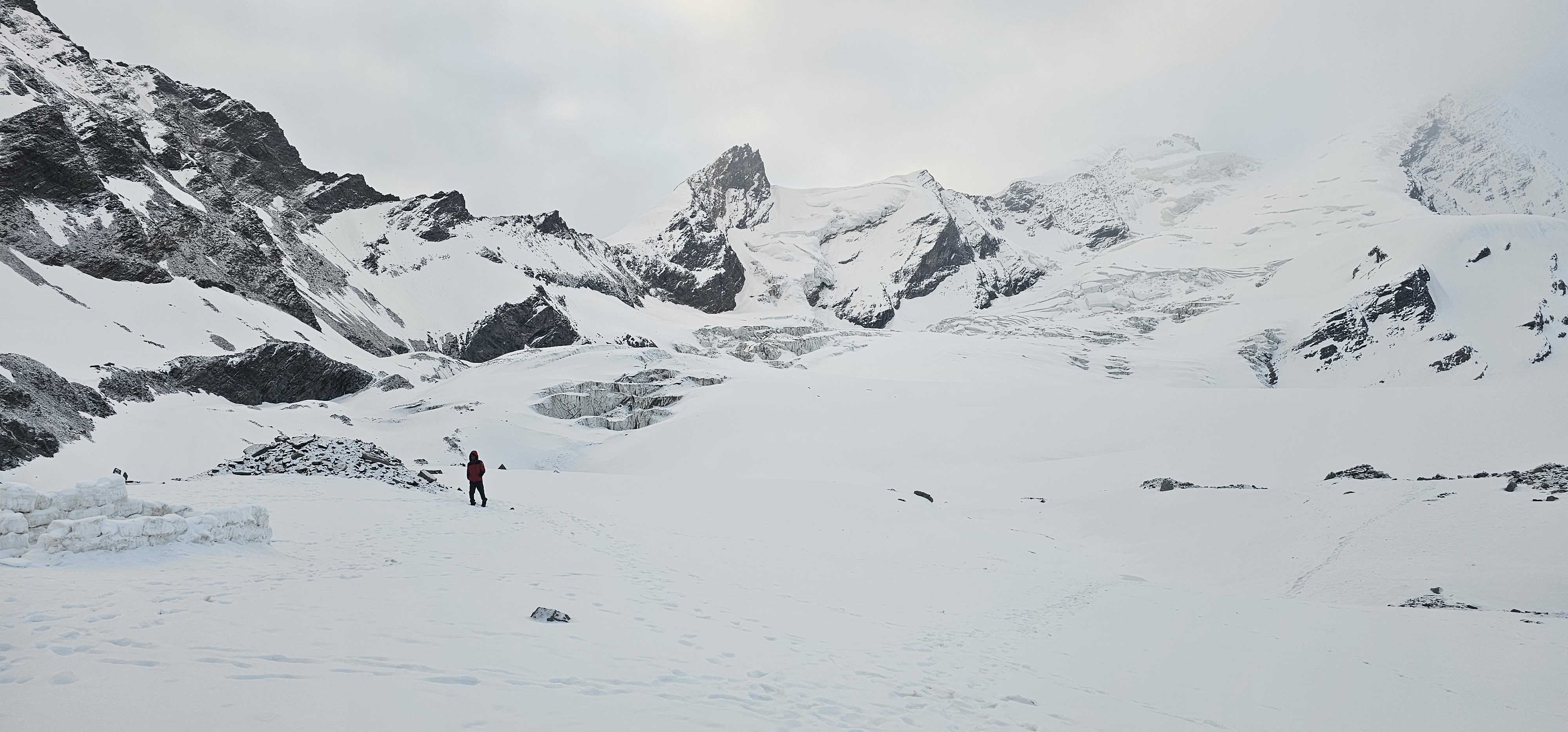
The initial movement is across the upper snow plateau. The snow may be firm or windcrusted depending on the night temperature. You move roped to your team, probing for hidden crevasses on the approach to the headwall.
The headwall is the expedition's crux. It is approximately 75 feet of snow and ice pitched at 70° to 75° — close to vertical by most climbers' experiential standards. Fixed ropes are pre-placed by your guide team. You clip in with your Jumar and ascend in controlled steps, weight on the ascender, feet front-pointing with crampons.
The Jumar technique here is not forgiving. You must maintain a rhythm: engage the Jumar, weight it, move your feet, breathe. Fatigue at this point is real — you have been climbing for several hours at over 6,000 m. The wall demands focus precisely when your body wants to quit.
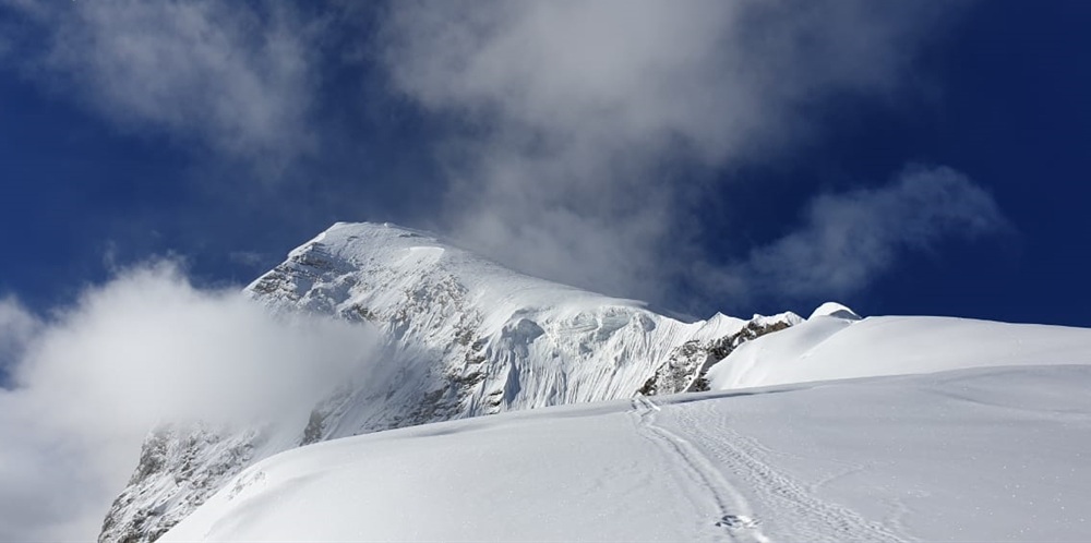
Above the headwall, you cross the bergschrund — a crevasse gap between the headwall ice and the upper glacier — and gain the summit ridge. The ridge is narrow in places.
You move carefully.
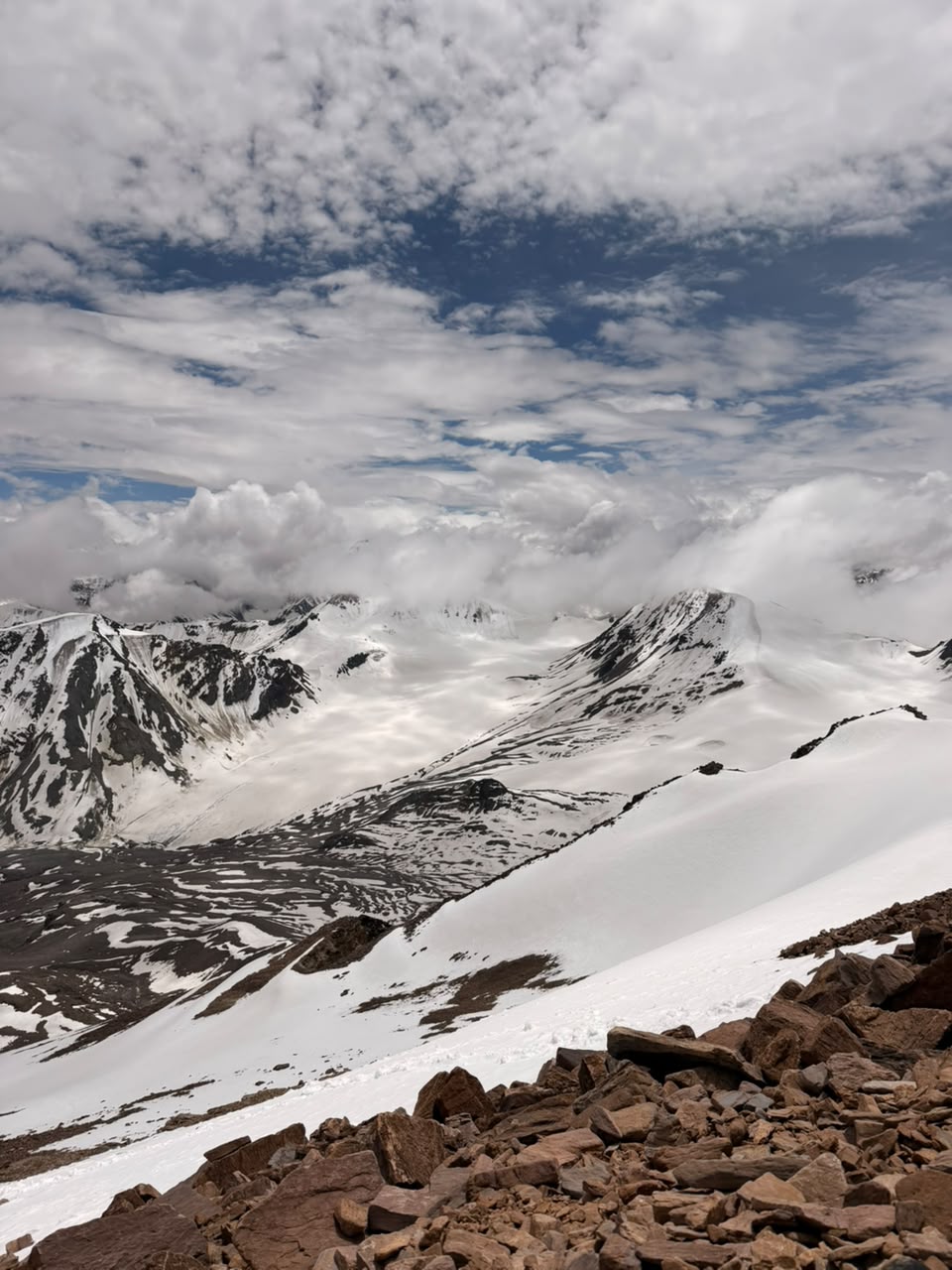
The summit is a snow hump at 6,387 m. From here, on a clear morning, you can see Swargarohini, Bandarpunch, and the peaks of the Gangotri group. The Tons Valley spreads green and impossibly distant below.
Descent is the most dangerous phase. Downclimbing the headwall on fixed ropes requires control. Fatigue is at its peak. Your guide team will coordinate the descent sequence. Follow instructions precisely.
Altitude sickness is the primary medical risk. Acute Mountain Sickness (AMS) symptoms typically appear above 3,500 m and can progress to High-Altitude Pulmonary Edema (HAPE) or High-Altitude Cerebral Edema (HACE) if ignored.
The Triple One protocol for early AMS: 1 Disprin (aspirin), 1 litre of water, 1 hour of complete rest. If symptoms persist or worsen after this, the expedition descends. There is no negotiation.
Diamox (Acetazolamide): Many climbers begin Diamox prophylactically from 3,000 m.
This is a medical decision — consult a physician before the expedition and carry a prescription.
Verglas and crevasse danger: The glacier between Camp 1 and Summit Camp contains hidden crevasses under soft snow. Move roped at all times on this section. Never cross the glacier without a guide.
Emergency contacts:
|
Emergency Agency |
Primary Contact |
Role |
|
District Emergency Operation Centre |
1077 |
Local police and administrative coordination |
|
SDRF Uttarakhand HQ |
9411112985 |
High-altitude search, rescue, and medical evacuation |
|
AIIMS Rishikesh Air Ambulance |
0135-2462945 |
Helicopter evacuation and trauma response |
|
Uttarkashi District Control Room |
01374-222626 |
Local administrative and search team coordination |
Helicopter evacuation from the Black Peak area requires coordination between private helicopter operators (such as Himalayan Heli) and the State Disaster Response Force (SDRF). This coordination is managed through the Uttarkashi District Control Room. No competitor guide currently details this process — in a real emergency, understanding the chain matters.
Verify all emergency contact numbers before departure. Phone numbers and service availability change.
Black Peak is not a budget expedition. The IMF permit, mandatory guide structure, highaltitude porter costs, and specialized gear requirements create a substantial financial floor.
|
Cost Component |
Approximate Range (INR) |
Notes |
|
IMF Peak Permit (Indian nationals) |
Fee waived under recent Uttarakhand reforms |
Verify current status with IMF directly |
|
IMF Peak Permit (foreign nationals) |
~USD 500 per team of two |
Payable through registered operator |
|
Govind National Park entry |
Seasonal — confirm at time of booking |
Subject to active adjustment |
|
Operator package (allinclusive) |
₹35,000–₹70,000 per person |
Varies by operator, group size, inclusions |
|
Dehradun to Sankri transport |
₹800–₹2,500 per person |
Shared taxi or private vehicle |
|
Gear rental (Sankri) |
₹3,000–₹8,000 |
Boots, crampons, ice axe, harness |
|
Porter/mule charges (Sankri to BC) |
₹15,000–₹25,000 per mule |
Varies by load and season |
|
High-altitude porter (HAP) above BC |
₹1,500–₹2,500 per day per HAP |
Load ferrying above Kyarkoti |
|
Liaison Officer (mandatory, foreign) |
Included in operator fee |
Cannot be avoided |
Hidden costs to anticipate: Acclimatization trekking shoes separate from summit boots, high-quality polarized sunglasses (non-negotiable), thermos flasks, personal medical kit including Diamox prescription, and travel insurance that explicitly covers helicopter evacuation at altitude. Many standard travel policies do not cover mountaineering — read the policy.
Self-planned vs. operator: Climbing Black Peak independently is not legally or practically feasible. IMF permit clearance and the mandatory Liaison Officer requirement make unregistered independent ascents non-compliant. Additionally, the glaciated terrain above BC requires guide expertise that cannot be safely improvised. Work with a registered operator.
|
Peak |
Altitude |
Technical Difficulty |
Key Crux |
BMC Required? |
Best Comparison |
|
6,387 m |
High — technical glaciated |
75-ft ice wall (70– 75°) |
Yes |
Pre-Everest validation climb |
|
|
5,289 m |
Moderate — snow slopes |
Glacier crevasse fields |
Recommended |
First 5,000 m objective |
|
|
Stok Kangri |
6,153 m |
Moderate — steep snow |
Long summit ridge |
Recommended |
High altitude, less technical |
|
6,102 m |
High — same massif |
Ridge navigation |
Yes |
Sibling peak, easier profile |
|
|
7,075 m |
Extreme |
Multiple ice faces |
Yes |
Post-Black Peak objective |
Who should choose Black Peak: Climbers with a completed BMC who have trekked to
5,000 m and want their first genuine 6,000 m technical summit. Aspiring Himalayan climbers who need a structured pre-Everest data point.
Who should choose Friendship Peak first: Those with strong trekking backgrounds but no formal mountaineering training. Friendship Peak provides a gateway experience on glacier and snow without the technical demand of the headwall.
Who comes to Black Peak after: Climbers who have completed Black Peak often progress to Satopanth, Shivling, or similar Grade TD/D routes in the Garhwal. Black Peak is a credentialing climb.
At 2 AM at Summit Camp when the temperature is -18°C and the headwall is waiting above you in the dark. It is not panic — panic is loud. This is quiet. It is the recognition that you are genuinely somewhere serious.
Black Peak earns its devotion precisely because of that seriousness. The mountain does not offer consolation prizes. You either summit or you descend. The glacier does not care about your training plan or your ambitions. It responds only to technique, acclimatization, and judgment.
Climbers who complete the expedition describe a specific quality of silence on the summit ridge. Not the silence of emptiness — but the silence of things that do not need explaining. The Swargarohini massif across the valley. The Gangotri peaks white against the horizon. The Tons Valley impossibly green and small below.
The local mythology carries weight too. Ruinsara Tal — the glacial lake the route passes — is said to be connected to the exile journey of the Pandavas in the Mahabharata, an ancient trade and pilgrimage passage through the Garhwal. The shepherd routes that predate the expedition community by centuries are still visible in the lower valley.
Walking them adds a register to the experience that purely technical routes lack.
What Black Peak gives is not just altitude. It is the earned knowledge that you can function under real pressure, in real terrain, at real consequence. That is what the "preEverest validation" label actually means in lived terms.
Q1: Can I climb Black Peak (Kalanag) without a Basic Mountaineering Course (BMC) certificate?
No. Climbing Black Peak (6,387 m) requires a valid BMC certificate from a recognised national mountaineering institute such as NIM or NIMAS. Responsible operators require physical proof of certification before accepting your registration. The IMF enforces this standard at the permit level, and the technical demands of the glaciated crevasse crossings and the vertical summit headwall make non-certified climbing genuinely dangerous.
Q2: What is the difference in difficulty between Black Peak and Satopanth?
Black Peak (6,387 m) is a highly technical peak featuring a 75-foot vertical ice wall at approximately 70° slope angle near the summit. Satopanth stands at 7,075 m — a full 700 m higher — and is an extreme-altitude peak by classification. Black Peak is the correct transition objective for climbers moving past 5,000 m trekking peaks who want to build technical credentials before attempting the altitude and sustained difficulty of Satopanth.
Q3: How do I obtain forestry permits and IMF permissions for the Kalanag expedition?
Permits must be filed in advance via the Indian Mountaineering Foundation (IMF) and the Uttarakhand Mountaineering Permission System (UKMPS) online Single Window portal. For Indian citizens, Uttarakhand has recently waived several forest, camping, and environmental fees — confirm current status with IMF before booking. Foreign nationals must register through an IMF-affiliated local operator who handles the Liaison Officer appointment.
Q4: How do porter and animal logistics work above Kyarkoti Base Camp?
Mule and animal transit ends entirely at Kyarkoti (4,045 m). The terrain above — boulder moraine transitioning to glaciated slopes — makes animal movement impossible. From Kyarkoti upward, all equipment, tents, and rations are manually ferried by high-altitude porters (HAPs) or the climbing team during acclimatization rotations. Budget and plan for HAP costs from Base Camp upward.
Q5: What is the maximum allowed weight for the summit day backpack?
The maximum recommended summit pack weight is 10 to 11 kg (approximately 22 to 24 lbs). At 6,000 m, every additional kilogram accelerates energy expenditure and reduces your margin for the technical headwall. A summit pack should contain only essential safety gear, insulation layers, water in a thermos, energy food, a first aid kit, and communication device.
Black Peak is not the hardest mountain in the Garhwal. But it is among the most honest. It does not pretend to be accessible. It requires certification, permit navigation, acclimatization discipline, and the specific technical skill to ascend a near-vertical ice wall at 6,000 m in the dark.
The most important caution: do not compress the acclimatization schedule. Every hour of adequate acclimatization below 5,000 m is an investment in summit day performance and safety. Operators who rush the lower stages to accommodate tighter itineraries are cutting a margin that belongs to you.
Your next action: Contact an IMF-registered expedition operator at least 60 to 90 days before your intended start date. Request documentation of their Liaison Officer status, emergency communication equipment (satellite phone, VHF radio), and oxygen cylinder availability. Confirm their BMC certificate verification process. Then start running with a pack.
Contradiction 1 — Elevation discrepancy:
Several commercial operators (including Trekup India) list Black Peak at 6,287 m. The correct elevation, per IMF and Survey of India records, is 6,387 m (20,955 ft). This article uses 6,387 m throughout. The discrepancy is 100 metres — significant enough to affect permit documentation. Operators using 6,287 m should be treated as a quality signal about their data rigour generally.
Contradiction 2 — Camp sequence variation:
Operator itineraries differ on whether ABC (4,600 m) is a distinct camp or folded into a
Camp 1 designation. Some operators run directly from Kyarkoti to Camp 1 at 4,600 m
(others label this ABC). This article uses the four-camp professional structure: BC (4,045 m), ABC (4,600 m), Camp 1 (5,100–5,200 m), Summit Camp (5,500 m) as the safest and most complete acclimatization architecture. When choosing an operator, clarify their exact camp structure.
Freshness Risk 1 — IMF permit fees:
The USD 500 figure for foreign nationals and the fee waiver for Indian nationals reflect information current at time of research. IMF fee structures are reviewed periodically.
Verify directly with IMF (www.indmount.org) before committing.
Freshness Risk 2 — UKMPS portal:
The Uttarakhand Single Window system for mountaineering permissions has been subject to administrative updates. The portal URL and processing timelines should be confirmed at time of booking. Direct source: www.exploreuttarkashi.com (Tier 2 source per research packet).
Freshness Risk 3 — Emergency contact numbers:
SDRF and district control room contact numbers are operational as of research date but should be independently verified before departure. Include emergency contacts in a physical document carried on the expedition, not only on a phone.
Freshness Risk 4 — SCL rules:
Special Casual Leave eligibility and the 20-day advance application window is governed by Central Government Pay Commission guidelines, which are subject to administrative revision. Government employees planning to use SCL should confirm current rules with their IMF-affiliated operator and their own HR department.