
21
Mar

The Himalayas are not merely a mountain range — they are a world unto themselves, a vertical kingdom of ice, rock, and sky that has drawn explorers, seekers, and adventurers from every corner of the earth since the first ropes were coiled and the first crampons were strapped. In 2026, Himalayan expeditioning has never been more organized, more accessible, or more compelling, with a generation of new climbers discovering that the heights once reserved for elite alpinists are now achievable through expert guidance, quality equipment, and well-structured packages.
This guide covers 12 of the finest Himalayan and Himalayan-adjacent expedition objectives available in 2026 — ranging from the accessible high-altitude peaks of Himachal Pradesh to the elite technical challenges of Uttarakhand's Garhwal giants. Whether you are stepping onto your first glaciated summit with Pangarchulla, embarking on the technical adventure of Auden's Col, or setting your sights on the 7,000+ metre giants of Satopanth, Trishul, and the towering Kamet — this is your complete guide.
|
Expedition |
Height |
Duration |
Difficulty |
Region |
Grade |
Best Season |
2026 Cost (₹) |
|---|---|---|---|---|---|---|---|
|
Black Peak |
6,387 m |
18 Days |
Moderate+ |
Uttarakhand |
PD+ |
May–Jun / Sep–Oct |
85,000–1,20,000 |
|
Friendship Peak |
5,289 m |
12–14 Days |
Moderate |
Himachal |
PD |
May–Jun / Sep–Oct |
40,000–65,000 |
|
Kang Yatse 2 |
6,250 m |
16–18 Days |
Moderate+ |
Ladakh |
PD+ |
Jun–Sep |
75,000–1,10,000 |
|
Pangarchulla |
4,700 m |
6–8 Days |
Moderate |
Uttarakhand |
F/PD |
Apr–Jun / Oct |
18,000–30,000 |
|
Mt. Shivling |
6,543 m |
24 Days |
Hard/Tech |
Uttarakhand |
D |
May–Jun / Sep |
1,50,000–2,50,000 |
|
Panpatia Col |
5,500 m |
14–16 Days |
Moderate+ |
Uttarakhand |
PD+ |
May–Jun / Sep–Oct |
55,000–85,000 |
|
Auden's Col |
5,490 m |
16 Days |
Hard |
Uttarakhand |
AD |
Jun / Sep–Oct |
70,000–1,05,000 |
|
Mt. Yunam Peak |
6,111 m |
14–16 Days |
Moderate |
Himachal |
PD |
Jun–Sep |
60,000–90,000 |
|
Mt. Satopanth |
7,075 m |
28–30 Days |
Very Hard |
Uttarakhand |
D+ |
May–Jun |
2,50,000–4,00,000 |
|
Deo Tibba |
6,001 m |
14–16 Days |
Moderate+ |
Himachal |
PD+ |
Jun / Sep–Oct |
65,000–95,000 |
|
Kamet Peak |
7,756 m |
30–35 Days |
Extreme |
Uttarakhand |
D+/TD |
May–Jun |
4,50,000–7,00,000 |
|
Mt. Trishul |
7,120 m |
28 Days |
Very Hard |
Uttarakhand |
D |
May–Jun / Sep |
2,80,000–4,50,000 |
|
Grade |
Description |
|---|---|
|
F (Facile) |
Easy — walking/scrambling, no glacier/technical skills needed |
|
PD (Peu Difficile) |
Moderate — basic glacier travel, crevasse awareness, some fixed rope |
|
PD+ |
Moderate-Plus — steeper snow/ice, crampon and ice-axe competence essential |
|
AD (Assez Difficile) |
Hard — sustained snow/ice slopes, belaying, experience on alpine terrain |
|
D (Difficile) |
Very Hard — serious technical climbing, prior alpine/Himalayan experience mandatory |
|
D+ |
Very Hard-Plus — sustained technical ground, high-altitude experience required |
|
TD (Très Difficile) |
Extreme — top-level technical mountaineering, elite climber territory |
"The Dark Crown of the Gangotri — A Magnificent Alpine Challenge"
|
📍 Region |
Uttarkashi District, Uttarakhand (Gangotri National Park) |
|
🏔 Summit Altitude |
6,387 m (20,955 ft) |
|
⏱ Duration |
18 Days (Haridwar to Haridwar) |
|
📊 Difficulty |
Moderate-Plus (PD+) — prior glacier experience required |
|
📅 Best Season |
May–June & September–October |
|
💰 Package Cost |
₹85,000 – ₹1,20,000 per person (2026) |
|
🎽 Required Skills |
Basic ice-axe and crampon use; trekking at altitude above 5,000 m |
|
🚀 Base Camp |
Tapovan Meadow, Gangotri |
|
🗺 Key Passes |
Glacier approach via Gangotri Glacier — technical summit day |
|
🏛 IMF Permit |
Required — included in all 2026 licensed packages |
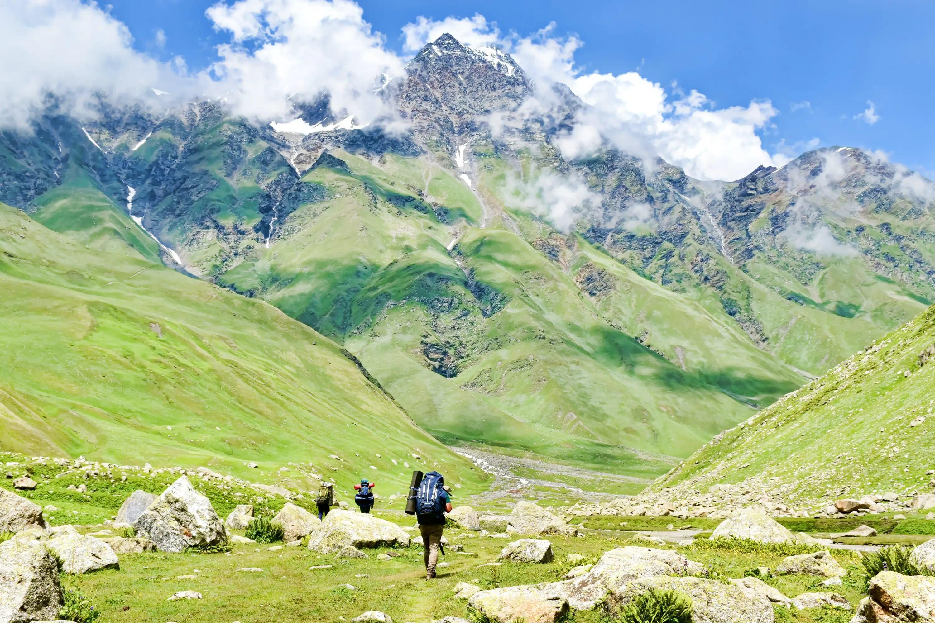
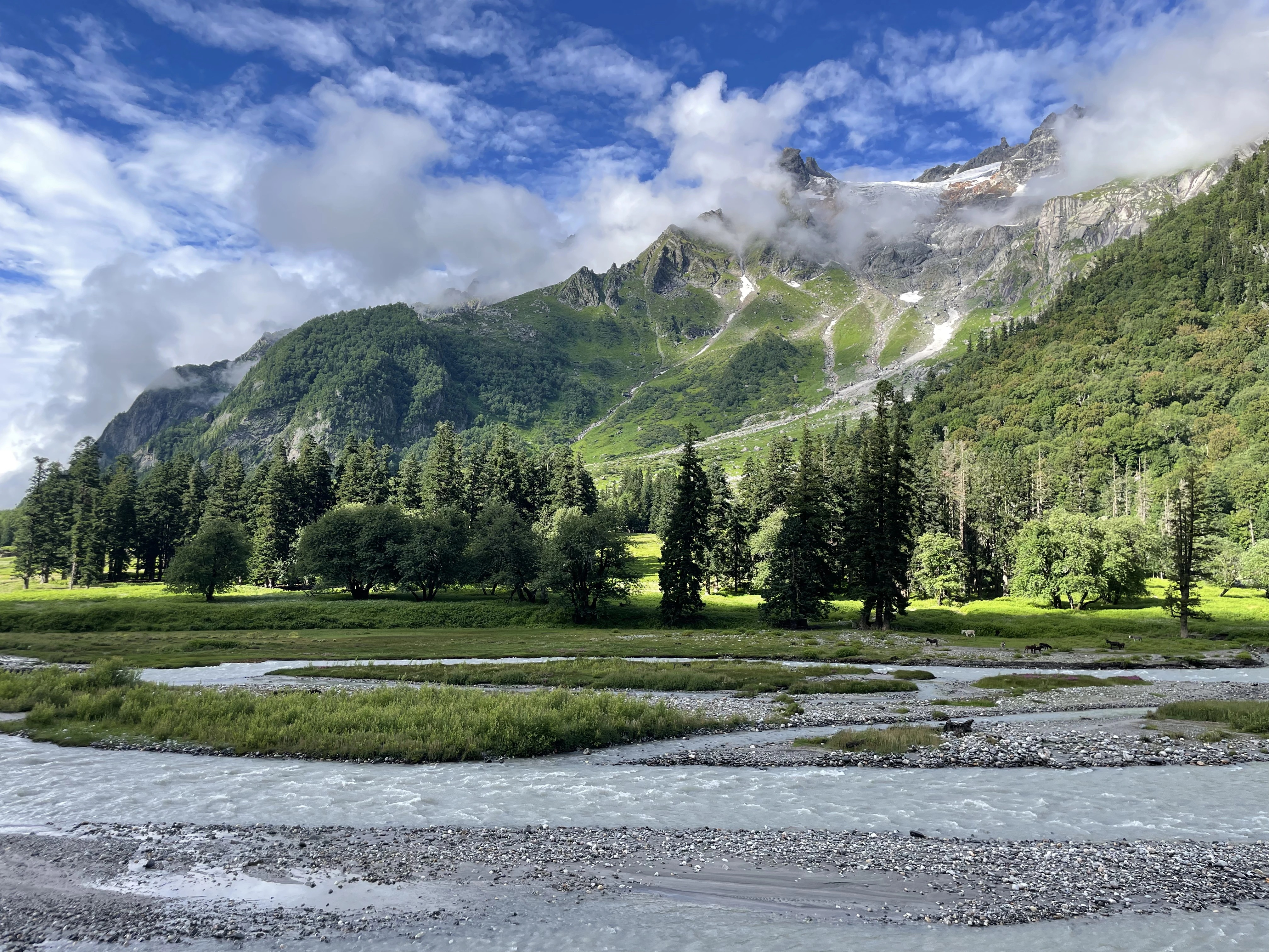
Black Peak — known locally as Kalanag — stands as one of the most rewarding and scenically spectacular summit objectives in the entire Gangotri region, a majestic pyramid of dark rock and snow that rises dramatically above the celebrated Tapovan meadow at the snout of the Gangotri Glacier. At 6,387 m, it sits precisely at the threshold between serious high-altitude trekking and genuine mountaineering, making it the perfect first Himalayan summit for aspirants who have mastered glacier travel and are ready to push into true expedition territory.
The approach to Black Peak is itself an experience of rare beauty. The trail follows the legendary Gangotri Glacier for several days, passing alongside the towering rock spires of the Bhagirathi group and traversing the most dramatic glacier scenery in the Garhwal Himalaya. Tapovan base camp, set on a raised moraine platform overlooking the confluence of glaciers and framed by the extraordinary Shivling (6,543 m) above, is widely considered one of the most beautiful campsites in the world.
The summit route traverses mixed snow and rock terrain, with a steep final ridge section that demands competent use of technical equipment. The summit panorama encompasses Shivling, the Bhagirathi trio, Meru, and — on clear days — the distant giants of the Nanda Devi sanctuary. In 2026, Black Peak expeditions are organised by several licensed Uttarakhand operators with strong safety protocols, fixed rope installation on technical sections, and certified high-altitude guides.
One of the most scenic summit approaches in all of India — Gangotri Glacier and Tapovan
Perfect 'next step' expedition after high-altitude trekking experience
Summit panorama includes Shivling, Bhagirathi I/II/III, and Meru
Tapovan base camp — widely regarded as India's most spectacular base camp setting
Manageable technical difficulty with excellent guide support in 2026
IMF-permitted objective with well-established route and good rescue access
Combines beautifully with pre-expedition Gangotri Valley exploration
"The Perfect Himalayan First Summit — 5,289 m Above the Kullu Valley"
|
📍 Region |
Kullu District, Himachal Pradesh (Solang Valley, Manali) |
|
🏔 Summit Altitude |
5,289 m (17,352 ft) |
|
⏱ Duration |
12–14 Days (Manali to Manali) |
|
📊 Difficulty |
Moderate (PD) — suitable for motivated first-timers |
|
📅 Best Season |
May–June & September–October |
|
💰 Package Cost |
₹40,000 – ₹65,000 per person (2026) |
|
🎽 Required Skills |
Good physical fitness; basic crampon use; no technical climbing required |
|
🚀 Base Camp |
Friendship Peak Base Camp via Dhundi / Bakarthach |
|
🏛 IMF Permit |
Required — handled by registered operators |
|
👥 Ideal For |
First-time mountaineers, trekkers graduating to peaks |
Friendship Peak near Manali in Himachal Pradesh is arguably the finest introductory mountaineering objective in all of India — a 5,289 m summit that delivers a genuine Himalayan peak experience without requiring advanced technical skills, making it the dream 'first summit' for thousands of aspiring mountaineers who visit the Kullu Valley each year.
The route climbs from the Solang Valley via the beautiful Beas Kund glacier basin, through a series of progressively higher camps across snowfields and glaciated terrain, to a summit that crowns a ridge with stupendous views across the Kullu and Rohtang ranges. The ascent involves snow walking, crampon use, and basic rope travel — all taught and managed by experienced guides — but requires no prior technical climbing background.
What makes Friendship Peak special in 2026 is the combination of genuine mountaineering achievement with relative accessibility. Starting just 14 km from Manali, the peak is reachable without a lengthy approach, and its summit view — encompassing Hanuman Tibba, Deo Tibba, the Rohtang range, and deep into the Spiti on clear days — is a defining Himalayan experience. The expedition is strongly recommended as a confidence-building objective before attempting higher, more technical peaks.
India's premier 'first mountaineering summit' — ideal for the transition from trekker to climber
Close proximity to Manali — no lengthy high-altitude approach march
Teaches essential mountaineering skills: crampon technique, rope management, glacier travel
Summit views spanning Kullu, Rohtang, and Spiti on clear days
Excellent 2026 package options including skills training workshops
High success rates with experienced guide teams and good weather windows
Pairs beautifully with a Spiti Valley or Rohtang road trip
"Ladakh's Most Accessible Alpine Summit — High Altitude, High Reward"
|
📍 Region |
Markha Valley, Ladakh (near Hemis National Park) |
|
🏔 Summit Altitude |
6,250 m (20,505 ft) |
|
⏱ Duration |
16–18 Days (Leh to Leh) |
|
📊 Difficulty |
Moderate-Plus (PD+) |
|
📅 Best Season |
June–September |
|
💰 Package Cost |
₹75,000 – ₹1,10,000 per person (2026) |
|
🎽 Required Skills |
Glacier experience, ice axe/crampon competency; some fixed-rope |
|
🚀 Base Camp |
Nimaling Plateau, Markha Valley, Ladakh |
|
🏛 Permit |
Inner Line Permit + IMF Peak Permit required |
|
🌡 Altitude Note |
Mandatory 5–7 day Ladakh acclimatisation before trek begins |
Kang Yatse 2 has established itself as the premier 6,000+ metre expedition objective in Ladakh — a technically approachable high-altitude summit set in the heart of the magnificent Markha Valley, surrounded by the extraordinary high-desert landscapes of the Trans-Himalayan zone. At 6,250 m, it is one of the highest peaks accessible to well-prepared recreational mountaineers in the entire Ladakh region.
The approach follows the legendary Markha Valley trek route through ancient Buddhist villages, dramatic gorges, and high plateaus — the Nimaling Plateau base camp at 4,900 m is one of the most beautiful camping locations in all of Ladakh, a vast grassland ringed by dramatic peaks with the Kang Yatse massif dominating the skyline. The summit route involves glacier travel and a steep final headwall requiring fixed rope and team belaying, delivering a genuine alpine challenge at extreme altitude.
In 2026, Kang Yatse 2 expeditions have attracted significant interest from the global mountaineering community as Ladakh's trekking infrastructure has improved. The combination of exceptional landscape, cultural richness (Buddhist villages, monasteries, Ladakhi hospitality), and genuine mountaineering challenge makes this one of India's most complete expedition experiences. Packages now include thorough acclimatisation protocols, high-altitude medicine, and highly experienced Ladakhi and Nepali guide teams.
Premier 6,000+ m summit in Ladakh — among the finest high-altitude objectives in India
Markha Valley approach — one of India's most celebrated trekking routes
Nimaling Plateau base camp (4,900 m) — spectacular Ladakhi alpine scenery
Technical summit with fixed ropes — excellent preparation for higher Himalayan objectives
Rich Buddhist culture throughout the approach: villages, monasteries, prayer flags
Snow leopard habitat — wildlife sightings reported by expedition teams
Best combined with Ladakh sightseeing: Leh Palace, Pangong, Nubra Valley
"Uttarakhand's Crowd Favourite — A High-Altitude Summit for Every Adventurer"
|
📍 Region |
Chamoli District, Uttarakhand (Joshimath / Auli) |
|
🏔 Summit Altitude |
4,700 m (15,420 ft) |
|
⏱ Duration |
6–8 Days (Joshimath to Joshimath) |
|
📊 Difficulty |
Moderate (F/PD) — accessible to fit trekkers with basic training |
|
📅 Best Season |
April–June & October |
|
💰 Package Cost |
₹18,000 – ₹30,000 per person (2026) |
|
🎽 Required Skills |
Good fitness; basic crampon use taught during expedition |
|
🚀 Base Camp |
Tugasi / Khullara, above Auli ski slopes |
|
🏛 Forest Permit |
Required — arranged by operator |
|
👥 Group Size |
6–20 trekkers — ideal introduction to summit objectives |
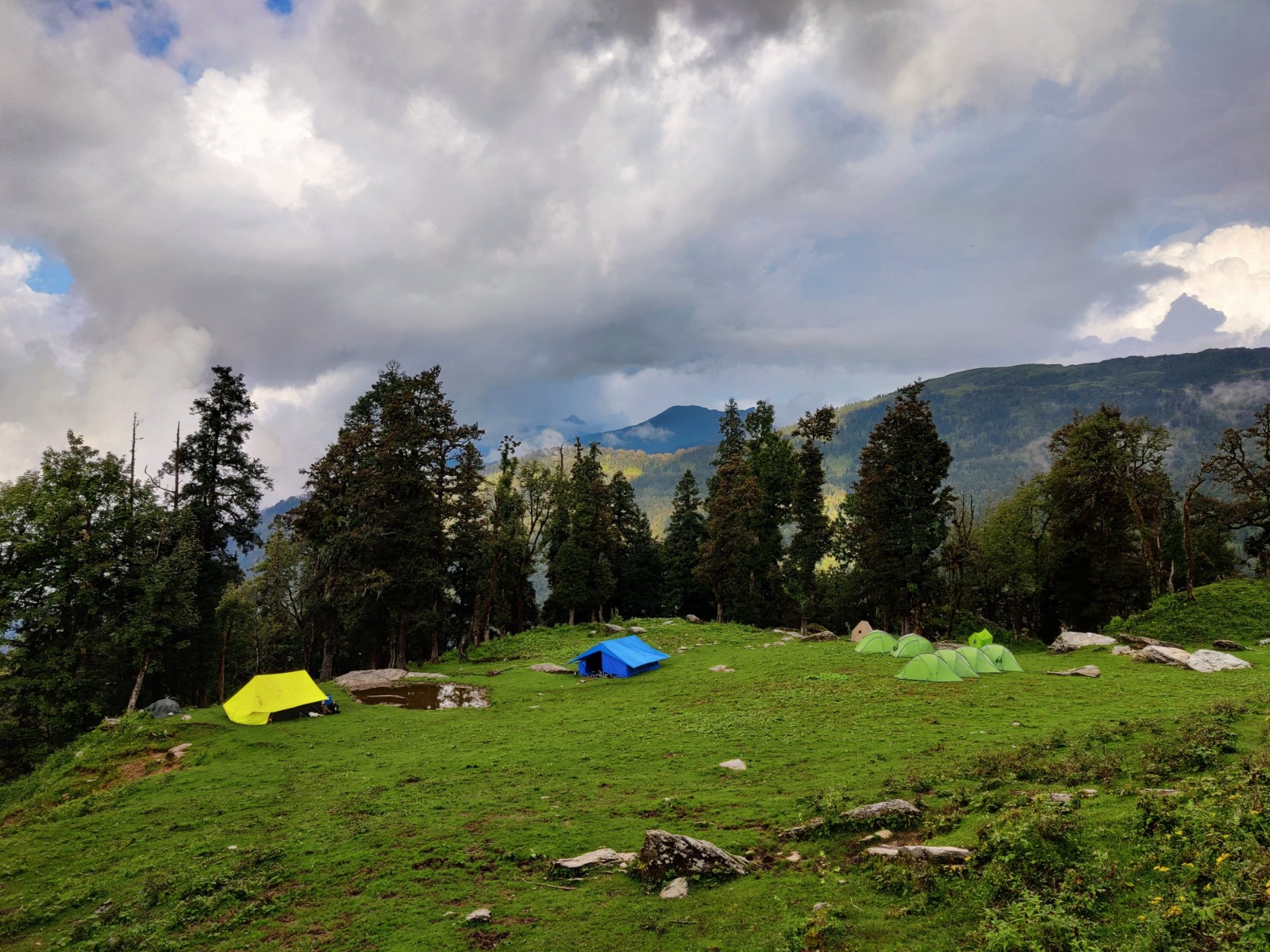
Pangarchulla Peak near Auli in Uttarakhand has become one of the most popular high-altitude summit treks in India — and for excellent reason. At 4,700 m, it occupies the sweet spot between demanding high-altitude trek and genuine summit expedition, offering spectacular Himalayan views that rival peaks twice its height, with a difficulty level accessible to any fit, motivated trekker willing to spend a week in the mountains.
The route from Joshimath climbs through dense rhododendron and oak forests, past the famous Auli ski meadows, and into progressively more dramatic snow-covered terrain above the treeline. The ridge leading to the summit provides perhaps the finest panoramic viewpoint in the accessible Garhwal region — the entire Nanda Devi sanctuary massif unfolds to the east, while Kamet, Mana Peak, Nilgiri Parvat, and the Hathi-Ghoda peaks fill the northern horizon.
In 2026, the Pangarchulla Peak Expedition is offered by dozens of Uttarakhand operators and has been refined into a superbly organized experience. The short duration makes it ideal for those with limited vacation time, while April-May timing offers the added spectacle of rhododendron blooms blazing along the lower slopes. First-time summit aspirants consistently describe the Pangarchulla experience as life-changing — a genuine mountain summit with panoramic rewards completely disproportionate to its modest technical demands.
Most accessible Himalayan summit objective in Uttarakhand — ideal first peak
Jaw-dropping panorama of Nanda Devi, Kamet, Nilgiri Parvat, and Mana
April–May bloom season: rhododendron forests in full colour on lower slopes
Short 6–8 day duration — perfect for limited vacation windows
Auli ski meadow base — one of India's most beautiful alpine launch points
Frequently combined with Kuari Pass Trek for a 10-day mountain adventure
Excellent guide and safety infrastructure with strong operator competition in 2026
"The Matterhorn of the Himalayas — An Icon of World Mountaineering"
|
📍 Region |
Uttarkashi District, Uttarakhand (Gangotri National Park) |
|
🏔 Summit Altitude |
6,543 m (21,467 ft) |
|
⏱ Duration |
24 Days (Haridwar to Haridwar) |
|
📊 Difficulty |
Hard / Technical (D) — serious alpine mountaineering experience required |
|
📅 Best Season |
May–June & September |
|
💰 Package Cost |
₹1,50,000 – ₹2,50,000 per person (2026) |
|
🎽 Required Skills |
Multi-pitch rock/ice climbing; prior Himalayan summit 6,000+ m; full technical gear |
|
🚀 Base Camp |
Tapovan, 4,463 m (Gangotri Glacier) |
|
🏛 IMF Permit |
Mandatory — applied 6+ months in advance |
|
⚠ Note |
Considered one of the most beautiful and challenging peaks in India |
Mount Shivling is one of the most photographed and instantly recognizable summits in the entire Himalayan range — a soaring granite spire of almost supernatural elegance that rises above the Tapovan meadow in a single dramatic sweep to 6,543 m. Named for its resemblance to the sacred Shivalinga, it is simultaneously one of India's holiest mountains and one of its most technically demanding expedition objectives, commanding deep respect from the world mountaineering community.
Unlike the trekking peaks that dominate most expedition packages, Shivling is a genuine alpinist's mountain — its routes involve sustained technical rock climbing, steep ice faces, mixed ground at extreme altitude, and rapidly changing Himalayan weather. The standard Southeast Ridge route — considered the most achievable line — still involves pitches of UIAA grade IV rock at over 6,000 m, requiring confident multi-pitch climbing experience, high-altitude bivouac competence, and exceptional physical fitness.
The approach through Gangotri and across the Gangotri Glacier to Tapovan is itself one of the great mountain journeys — the base camp at Tapovan, set on a meadow platform with Shivling's north face rearing directly overhead and Meru's Shark's Fin visible to the east, is a place of extraordinary power. In 2026, Shivling expeditions are organised exclusively by highly experienced mountaineering outfitters, with mandatory pre-expedition skill assessment and detailed rescue plans. For qualified alpinists, this remains among the most coveted summits in Asia.
One of the world's most beautiful and iconic mountain objectives
The legendary Tapovan base camp — among the finest in the Himalaya
Technical challenge rivalling European alpine classics at extreme altitude
Revered in Hindu tradition — a spiritually charged mountain experience
Summit views encompassing Gangotri's greatest peaks: Bhagirathi, Meru, Kedarnath Dome
Expedition serves as benchmark alpine objective for serious Indian mountaineers
2026 packages include pre-expedition rock and ice climbing skills camps
"The High Glacier Crossing — An Epic Traverse Above the Badrinath Valley"
|
📍 Region |
Chamoli District, Uttarakhand (Badrinath / Kedarnath divide) |
|
🏔 Max Altitude |
5,500 m (Panpatia Col / Pass) |
|
⏱ Duration |
14–16 Days (Badrinath to Kedarnath area) |
|
📊 Difficulty |
Moderate-Plus (PD+) — glacier travel, crevasse navigation |
|
📅 Best Season |
May–June & September–October |
|
💰 Package Cost |
₹55,000 – ₹85,000 per person (2026) |
|
🎽 Required Skills |
Glacier experience; ice axe, crampon and rope skills essential |
|
🚀 Base Camp |
Satopanth Tal / Alaknanda basin, above Badrinath |
|
🏛 Permits |
Forest & restricted area permits — operator handled |
|
🌟 Unique Feature |
Crosses the sacred Badrinath-Kedarnath divide on glacier |
The Panpatia Col expedition is one of Uttarakhand's most extraordinary high-altitude adventures — a demanding glacier traverse that crosses the watershed between the Badrinath and Kedarnath sacred zones across a remote high pass at 5,500 m, linking two of Hinduism's holiest pilgrimage sites through a route that few beyond serious mountaineers have ever experienced.
The approach from Badrinath climbs through the spectacular Satopanth Tal basin — home to the sacred glacial lake of Satopanth at 4,400 m — before ascending onto the main Satopanth-Bhagirath Kharak glacier system. The glacier travel here is complex and beautiful: a vast icefall world of crevasse fields, seracs, and moraine ridges, with views of towering 7,000 m peaks (Satopanth, Chaukhamba, Kedarnath Dome) on all sides.
Crossing Panpatia Col itself — at 5,500 m on a dramatic glaciated saddle — is a profound alpine moment, with the descent toward the Kedarnath valley on the far side adding a powerful sense of journey and completion. In 2026, this expedition is gaining recognition as one of the finest medium-grade mountaineering adventures in India, offering true glacier expedition experience without the extreme technical demands of the region's bigger peaks.
Rare crossing of the sacred Badrinath-Kedarnath divide on glacier terrain
Sacred Satopanth Lake base camp — high-altitude pilgrimage atmosphere
Complex glacier navigation — serious skill development expedition
Spectacular views of Chaukhamba, Satopanth, and Kedarnath Dome (7,000+ m)
One of India's finest medium-grade glacier traverses with genuine route-finding challenge
Deep spiritual resonance — crossing between two Char Dham pilgrimage sites
2026 packages include glacier travel skills workshops at base camp
"The Legendary Hidden Crossing — One of the Himalaya's Great Technical Traverses"
|
📍 Region |
Rudraprayag / Uttarkashi Districts, Uttarakhand |
|
🏔 Max Altitude |
5,490 m (Auden's Col Pass) |
|
⏱ Duration |
16 Days (Gangotri to Kedarnath / Triyuginarayan) |
|
📊 Difficulty |
Hard (AD) — sustained technical terrain, alpine experience mandatory |
|
📅 Best Season |
June & September–October |
|
💰 Package Cost |
₹70,000 – ₹1,05,000 per person (2026) |
|
🎽 Required Skills |
Strong glacier/technical mountaineering experience; multi-day high camps |
|
🚀 Start Point |
Gangotri Village, Uttarkashi |
|
🏛 Permits |
Multiple restricted-area permits — all operator-managed |
|
📖 Named After |
Geologist J.B. Auden who first explored the col in 1938 |
Auden's Col is one of the great legendary routes of the Indian Himalaya — a demanding, rarely-travelled glacier crossing between the Gangotri and Kedarnath massifs that takes its name from British geologist J.B. Auden, who explored this remote terrain in 1938. It represents one of the most committing and scenically extraordinary adventures available to mountaineers in Uttarakhand: a true end-to-end traverse linking the sacred headwaters of the Ganga.
The route begins at Gangotri and ascends the Khatling Glacier system through progressively wilder and more remote terrain, involving multiple high camps, complex crevasse navigation, and the dramatic crossing of the col itself at 5,490 m — a narrow glaciated notch between massive peaks with sheer drops on both sides. The descent toward the Kedarnath valley on the far side involves steep ice and snow slopes requiring full technical rope management.
What makes Auden's Col genuinely special is its combination of remoteness, technical challenge, historical resonance, and extraordinary visual beauty. The route passes through terrain that sees very few expeditions each season, traversing some of the most untouched glacier wilderness in Garhwal. In 2026, licensed operators offer this expedition with highly experienced lead guides, satellite communication, and medical evacuation protocols — but the route retains its genuine wilderness character and demands full team commitment.
One of the Himalaya's great historical traverses — named for 1938 British exploration
Genuine technical alpine expedition — sustained glacier and snow/ice terrain
Among the most remote and uncommercialised routes in Uttarakhand
Dramatic col crossing at 5,490 m with sheer views on both sides
Links the sacred Gangotri and Kedarnath zones — profound spiritual geography
Khatling Glacier — vast, wild, and barely-visited by expedition teams
2026 teams report exceptional solitude and wildlife (musk deer, snow leopard signs)
"Spiti's High-Altitude Giant — Lahaul's Underrated 6,000 m Crown"
|
📍 Region |
Lahaul District, Himachal Pradesh (near Baralacha La) |
|
🏔 Summit Altitude |
6,111 m (20,049 ft) |
|
⏱ Duration |
14–16 Days (Manali to Manali) |
|
📊 Difficulty |
Moderate (PD) — non-technical but high altitude demands serious preparation |
|
📅 Best Season |
June–September |
|
💰 Package Cost |
₹60,000 – ₹90,000 per person (2026) |
|
🎽 Required Skills |
Good altitude experience (5,000+ m); basic crampon use; strong fitness |
|
🚀 Base Camp |
Baralacha La region, Lahaul Valley |
|
🏛 Permit |
IMF Peak Permit required — operator arranged |
|
🚗 Road Access |
Drive Manali–Leh highway to Baralacha — dramatic approach |
Mount Yunam Peak is one of Himachal Pradesh's finest and most underappreciated expedition objectives — a 6,111 m summit in the Lahaul region that offers serious high-altitude mountaineering on a relatively non-technical route, making it an excellent target for experienced trekkers ready to cross the 6,000 m threshold for the first time.
The dramatic approach drives the iconic Manali-Leh highway to the Baralacha La region — one of the highest motor-able roads in the world — passing through the extraordinary high-desert landscapes of Lahaul where the Himalayan ranges transition toward the Trans-Himalayan zone. Base camp sits in one of the wildest and most spacious mountain environments in Himachal, with 360-degree views of the Lahaul peaks and the distant Zanskar range.
The summit route ascends gradual snowfields and glaciated ridges without significant technical ground — the challenge is primarily altitude management, as 6,111 m demands serious acclimatisation and physical reserves. The summit view encompasses a stunning panorama of Lahaul, Spiti, and — on exceptional days — across toward the Zanskar peaks and Ladakh. In 2026, Yunam is increasingly popular as the 'first 6,000 m peak' for trekkers based in the Manali-Spiti corridor.
Excellent 'first 6,000 m peak' — non-technical route with spectacular high-altitude scenery
Dramatic Manali-Leh highway approach — a legendary road journey in itself
Summit panorama spans Lahaul, Spiti, and distant Zanskar Range
Lahaul base camp — wild, spacious, and utterly unspoiled high-desert environment
Combines well with Spiti Valley cultural tour and Chandratal Lake visit
Relatively short technical section — altitude management is the primary challenge
2026 packages include thorough acclimatisation profiles with high camps
"The 7,000 m Sacred Pyramid — Garhwal's Towering High-Altitude Challenge"
|
📍 Region |
Chamoli District, Uttarakhand (Badrinath, Alaknanda Basin) |
|
🏔 Summit Altitude |
7,075 m (23,211 ft) |
|
⏱ Duration |
28–30 Days (Haridwar to Haridwar) |
|
📊 Difficulty |
Very Hard (D+) — serious technical mountaineering at extreme altitude |
|
📅 Best Season |
May–June (pre-monsoon) |
|
💰 Package Cost |
₹2,50,000 – ₹4,00,000 per person (2026) |
|
🎽 Required Skills |
Multiple prior Himalayan summits above 6,500 m; full technical alpinism |
|
🚀 Base Camp |
Satopanth Tal (Sacred Triangular Lake), 4,400 m, above Badrinath |
|
🏛 IMF Permit |
Mandatory — 8–10 months advance application recommended for 2026 |
|
🌟 Sacred |
One of Hinduism's most revered high peaks — Brahma, Vishnu, Mahesh |
Mount Satopanth is one of the most sacred and most demanding expedition objectives in the Indian Himalaya — a massive 7,075 m peak above Badrinath that takes its name from the three sacred triangular lakes at its base, each associated with one member of the Hindu trinity: Brahma, Vishnu, and Mahesh (Shiva). Rising in a great pyramid of rock and ice above the Satopanth Glacier, it commands one of the most awe-inspiring presences of any mountain in the Garhwal Himalaya.
The approach from Badrinath to base camp at the sacred Satopanth lake is itself a profound journey through some of the most spiritually charged and visually spectacular terrain in India. The lake at 4,400 m — perfectly triangular, perfectly still, perfectly clear — is considered among the holiest natural bodies of water in the Himalaya and draws Hindu pilgrims alongside mountaineers to its shores. The mountain above rises through complex glacier terrain, steep ice ridges, and high-altitude mixed ground that demands the full range of technical alpinism.
In 2026, Satopanth expeditions are undertaken by only a handful of highly experienced teams each season — its demanding grade, extended duration, and remote character ensure it remains one of the more challenging objectives accessible to non-professional mountaineers with exceptional track records. Operators offering this peak in 2026 include only India's most experienced high-altitude expedition companies with dedicated Sirdar (lead Sherpa) support.
One of the Garhwal Himalaya's great 7,000 m objectives
Sacred Satopanth Lake base camp — a triangular lake of extraordinary spiritual significance
Summit panorama at 7,075 m: Chaukhamba, Nilkanth, the Gangotri peaks
Complex glacier approach with sustained technical challenge throughout
Profound spiritual dimension — Badrinath Dham proximity and Hindu sacred tradition
2026 packages include full Sherpa support, supplemental oxygen protocol, and base camp comforts
Among the finest '7,000 m without Sherpa' objectives in India for elite mountaineers
"The God Peak of Kullu — A Magnificent 6,000 m Alpine Objective Above Manali"
|
📍 Region |
Kullu District, Himachal Pradesh (Jagatsukh / Manali) |
|
🏔 Summit Altitude |
6,001 m (19,688 ft) |
|
⏱ Duration |
14–16 Days (Manali to Manali) |
|
📊 Difficulty |
Moderate-Plus (PD+) — glacier travel and some technical section |
|
📅 Best Season |
June & September–October |
|
💰 Package Cost |
₹65,000 – ₹95,000 per person (2026) |
|
🎽 Required Skills |
Glacier experience; crampon, ice-axe and basic rope skills essential |
|
🚀 Base Camp |
Deo Tibba Base Camp via Jagatsukh / Chanderkhani approach |
|
🏛 IMF Permit |
Required — handled by licensed operators |
|
🌟 Distinction |
Summit just over 6,000 m — first '6er' for many Himachal climbers |
Deo Tibba — the 'God Peak' of the Kullu Valley — is one of Himachal Pradesh's most respected and beautiful 6,000 m summits, a pyramid of rock and ice that presides over the upper Manali valley with commanding authority. At 6,001 m, it holds the distinction of being just over the psychologically significant 6,000 m mark, making it a natural first '6er' objective for climbers who have already completed Friendship Peak and are ready for a more sustained glacier expedition.
The approach from the ancient village of Jagatsukh below Manali is one of the most varied and beautiful expedition approaches in Himachal — climbing through terraced farmland, dense deodar forests, high meadows blazing with summer wildflowers, and finally into the stark and magnificent upper glacier basin beneath the peak's south faces. The route involves significant glacier travel, a steep col crossing, and a summit ridge that provides an exhilarating final push.
In 2026, Deo Tibba has consolidated its reputation as the natural progression from Friendship Peak — the 'second step' on the Himachal Pradesh mountaineering ladder, demanding more technical skill, greater altitude management, and longer glacier time. The summit view is exceptional, encompassing the full Kullu panorama including Indrasan, Deo Tibba's higher twin at 6,221 m, and deep into the high ranges above the Rohtang divide.
Natural 'second expedition' after Friendship Peak — perfect skills progression route
Summit just above 6,000 m — the first '6er' for hundreds of Himachal climbers annually
Jagatsukh village approach — ancient Himachali culture at the start of the expedition
Beautiful mixed forest-to-glacier approach through varied Himalayan terrain
Summit view of Indrasan, Kullu Valley, and the Rohtang-Spiti ranges
Well-established route with excellent guide teams from Manali-based operators
October window offers exceptional post-monsoon clarity and snow conditions
"The Second Highest Peak in India — A True Himalayan Giant at 7,756 m"
|
📍 Region |
Chamoli District, Uttarakhand (Joshimath, restricted Niti Valley) |
|
🏔 Summit Altitude |
7,756 m (25,446 ft) — 2nd highest in India, 30th highest in world |
|
⏱ Duration |
30–35 Days (Haridwar to Haridwar) |
|
📊 Difficulty |
Extreme (D+/TD) — elite Himalayan mountaineering only |
|
📅 Best Season |
May–June (pre-monsoon only) |
|
💰 Package Cost |
₹4,50,000 – ₹7,00,000 per person (2026) |
|
🎽 Required Skills |
Multiple 7,000+ m summits; full expedition mountaineering; supplemental O₂ |
|
🚀 Base Camp |
Purbi Kamet Glacier, via Niti Valley, approx. 4,800 m |
|
🏛 IMF Permit |
Mandatory + Inner Line Permit for Niti Valley border zone |
|
📅 Booking |
2026 expedition slots must be booked by October 2025 minimum |
Kamet stands as one of the true giants of the Indian Himalaya — the second highest peak entirely within India at 7,756 m, a massive and complex summit that was first climbed in 1931 by Frank Smythe's team, making it the highest summit reached by mankind at that time. In the decades since, it has been climbed relatively rarely and remains one of the most serious and committing high-altitude objectives in the country, requiring the full resources of an elite expedition.
The approach through the restricted Niti Valley — close to the Tibetan border — is itself an expedition within an expedition: a journey through some of the most remote and least-visited Himalayan terrain in Uttarakhand, past ancient border villages and across high-altitude desert plateaus that transition toward the Tibetan landscape. The peak itself rises above the Purbi Kamet Glacier in a series of demanding ice ridges, high camps, and summit snowfields that top out at an altitude where supplemental oxygen is strongly recommended.
In 2026, Kamet expeditions are offered by only two or three of India's most experienced high-altitude outfitters, in collaboration with elite international mountain guides. The expedition requires a team of minimum 4 climbers, full supplemental oxygen logistics, high-altitude porters, and detailed medical protocols. For those who have systematically built their Himalayan experience to this level, Kamet represents the pinnacle of what Indian mountaineering can offer — a summit view at 7,756 m encompassing the full sweep of the Western Himalaya.
Second highest peak in India — 7,756 m — the pinnacle of Indian mountaineering
Historical significance: first climbed 1931 by Smythe — then world altitude record
Remote Niti Valley approach — among the most restricted and pristine in Uttarakhand
True 8,000 m preparation objective — comparable challenge at a more manageable height
Full expedition logistics: 4+ high camps, Sherpa support, supplemental oxygen
Summit panorama at 7,756 m: Nanda Devi, Kamet satellites, Tibet plateau visible
2026 slots extremely limited — early booking (before October 2025) essential
"The Trident of Shiva — A Sacred 7,120 m Giant on the Kumaon Horizon"
|
📍 Region |
Chamoli / Bageshwar Districts, Uttarakhand (Kumaon Himalaya) |
|
🏔 Summit Altitude |
7,120 m (23,360 ft) |
|
⏱ Duration |
28 Days (Haridwar to Haridwar) |
|
📊 Difficulty |
Very Hard (D) — sustained technical terrain at extreme altitude |
|
📅 Best Season |
May–June & September |
|
💰 Package Cost |
₹2,80,000 – ₹4,50,000 per person (2026) |
|
🎽 Required Skills |
Himalayan summits above 6,500 m; sustained glacier and ice-ridge climbing |
|
🚀 Base Camp |
South Trishul Glacier, via Wan Village, Kumaon |
|
🏛 IMF Permit |
Mandatory — 8+ months advance application for 2026 season |
|
🌟 Sacred |
Trishul = Shiva's trident — profoundly sacred in Hindu tradition |
|
📅 First Ascent |
1907 — first Himalayan summit above 7,000 m ever climbed |
Mount Trishul holds a unique place in the history of world mountaineering: first climbed in 1907 by Tom Longstaff, it was the first summit above 7,000 m ever reached by humankind — a record that stood for 21 years. This historical distinction, combined with its extraordinary visual presence above the Kumaon Himalaya and its deep significance in Hindu tradition (Trishul means Shiva's trident), makes it one of the most meaningful and storied expedition objectives in all of Asia.
The three summits of the Trishul massif — Trishul I (7,120 m), Trishul II (6,690 m), and Trishul III (6,007 m) — form a dramatic trio above the Nanda Devi Biosphere Reserve, visible from as far as the Kumaon plains and dominating the skyline above the Pindar and Rishiganga valleys. The standard route approaches from the south via Wan village through dense rhododendron forests and high shepherds' meadows, establishing a sequence of glacier camps before the technical upper mountain.
The upper section of Trishul involves sustained steep ice climbing, high-altitude ridge navigation, and the management of extreme cold and altitude fatigue at over 7,000 m. In 2026, Trishul expeditions are being organised by Uttarakhand's top mountaineering companies with full Sherpa support, supplemental oxygen options, and complete acclimatisation programs. For the serious Himalayan mountaineer, a Trishul summit represents one of India's most historically resonant achievements.
Historical: first 7,000+ m summit ever climbed in history (1907, Tom Longstaff)
Sacred Shiva's Trident — one of India's most religiously significant high peaks
Dramatic Kumaon Himalaya setting — visible from the plains on clear winter days
Technical upper mountain with sustained ice ridge climbing at 7,000+ m
Approaches through beautiful Kumaon rhododendron forests and shepherds' meadows
Full Sherpa support and supplemental oxygen available in 2026 packages
Strong pre-expedition acclimatisation protocol via Roopkund/Nanda Ghunti base
EXPEDITION PLANNING GUIDE 2026
Selecting the correct expedition objective is the single most important decision you will make as an aspiring Himalayan climber. An expedition that is too easy will leave you under-stimulated; one that is too hard will be dangerous and demoralising. Use the framework below to make an honest, informed choice.
|
Your Background |
Recommended 2026 Objective |
Next Step After Success |
|---|---|---|
|
Fit trekker, no summit experience |
Pangarchulla (4,700 m) or Friendship Peak (5,289 m) |
Deo Tibba or Kang Yatse 2 |
|
1–2 trekking peaks, basic glacier |
Friendship Peak, Yunam, Kang Yatse 2 |
Black Peak or Deo Tibba |
|
3–4 summits up to 6,000 m |
Black Peak, Panpatia Col, Deo Tibba |
Shivling, Auden's Col |
|
6,000–6,500 m experience, technical skills |
Auden's Col, Panpatia Col, Shivling |
Satopanth, Trishul |
|
7,000 m experience, elite level |
Satopanth, Trishul, Kamet |
Kamet, then 8,000 m objectives |
Begin your expedition training a minimum of 4–6 months before departure for moderate peaks, and 6–12 months for hard and very hard objectives. Training should combine cardiovascular endurance, strength and power, high-altitude simulation (where possible), and technical skills practice.
Cardiovascular base: 5 sessions per week — running, cycling, swimming, rowing. Build to 90-minute continuous effort sessions by month 3.
Weighted hiking: 2–3 sessions per week carrying a 12–15 kg pack. Increase elevation gain progressively — target 800–1,000 m of ascent per training hike.
Strength training: Focus on legs (squats, lunges, step-ups), core stability, and upper body pulling movements. 3 sessions per week.
Technical skills: Book a mountaineering skills course covering crampon technique, ice axe self-arrest, glacier roping, and crevasse rescue — ideally on actual glacier terrain.
Altitude exposure: Prior to hard/very hard expeditions, undertake at least one acclimatisation trek above 5,000 m within 6 months of the expedition.
Rest and recovery: Adequate sleep (8+ hours), anti-inflammatory diet, and progressive overload with planned rest weeks are essential to avoid injury before expedition departure.
The following gear is required for all expedition grades. Technical expeditions (AD/D/D+) require additional specialist equipment provided through your operator — always confirm the full equipment list at the time of booking.
Mountaineering boots: Double-plastics or similar high-altitude boot with crampon compatibility — NOT trekking boots
12-point crampons: Step-in or hybrid binding compatible with your boots — tested before departure
Ice axe: 60–70 cm technical ice axe for all glacier/snow objectives
Harness, helmet, and belay/rappel device — all CE/UIAA certified
Sleeping bag: Rated to -20°C or below for all 6,000+ m objectives
Layering system: Moisture-wicking base, fleece mid-layer, down insulation layer, Gore-Tex or equivalent hardshell outer
Down suit: Required for all objectives above 6,500 m — operator may provide for rent
High-altitude gloves: Three-layer system — liner gloves, insulating gloves, expedition overmitts
Goggles: Certified glacier goggles (category 4) for snow and glacier terrain
Trekking poles: Adjustable, with snow baskets
Headlamp: High-output with spare batteries — essential for summit push starts (typically 1–2 AM)
Water purification: Chemical or UV — streams not safe on glacier approaches
Personal medication: Diamox (acetazolamide) for altitude sickness prevention — consult your doctor before departure
Personal first aid kit: Blister treatment, ibuprofen/paracetamol, rehydration salts, bandages
All peaks listed in this guide require an Indian Mountaineering Foundation (IMF) Peak Permit. The permit fee varies by peak altitude, season, and team size. For 2026, the IMF has streamlined its online application process, but lead times remain long for the most popular peaks. Key requirements include:
Completed IMF peak permit application (online at imfindia.com) — submit at minimum 3 months before, 8–10 months for 7,000+ m peaks
Valid government photo ID for all team members (passport for foreign nationals; Aadhar/passport for Indian nationals)
Medical fitness certificate from a registered physician dated within 6 months of expedition start
Trip insurance with high-altitude mountaineering and helicopter evacuation coverage — minimum coverage of ₹50 lakh recommended
Inner Line Permit (ILP): Required for Kamet (Niti Valley), Kang Yatse 2 (Ladakh), and certain Ladakh objectives — arranged through your operator
Liaison Officer deposit: The IMF assigns a Liaison Officer to expeditions above 6,500 m — operator manages all LO logistics
All licensed 2026 expedition operators are required to carry satellite communication devices, maintain a comprehensive base camp medical kit, have a detailed emergency evacuation plan, and carry liability insurance. Helicopter rescue services operate in most Himalayan regions but weather windows can be extremely limited — prevention through correct acclimatisation, route assessment, and turnaround discipline is always the primary safety strategy. Always follow your guide team's turnaround decisions without argument — summit success rates matter far less than returning safely.