28
Jun

🏔
The Complete High-Altitude Expedition Reference
Satopanth • Kang Yatse II • Shivling • Kamet • Trishul • Neelkanth
Reo Purgyil • Papsura • Nun • Kun
Permits | IMF Fees | Route Profiles | Fitness Framework | Safety Protocols
India's Himalayan and Karakoram ranges contain some of the most spectacular and demanding 7,000-metre peaks on Earth. These mountains occupy the critical zone between accessible 6,000m objectives and the brutal 8,000m giants — demanding full expedition commitment, high-altitude physiology, advanced technical skills, and considerable logistical planning. Yet they remain among the most rewarding summits a mountaineer can achieve.
The Indian Mountaineering Foundation (IMF) classifies and regulates access to these peaks. This guide covers ten of India's most celebrated 7,000m-class climbable peaks: Satopanth (7,075 m), Kang Yatse II (6,250 m — included for its 7,000m-class approach character and logistics), Shivling (6,543 m), Kamet (7,756 m), Trishul (7,120 m), Neelkanth (6,979 m), Reo Purgyil (6,816 m), Papsura (6,451 m), Nun (7,135 m), and Kun (7,077 m).
Note: Several peaks in this guide (Shivling, Neelkanth, Papsura, Kang Yatse II) are technically below 7,000 m but are universally treated by the IMF and expedition community as 7,000m-class objectives due to their technical difficulty, expedition logistics, permit structure, and summit environment. They are included here for completeness.
Altitude: 7,075 m (23,212 ft) State: Uttarakhand Range: Garhwal Himalaya
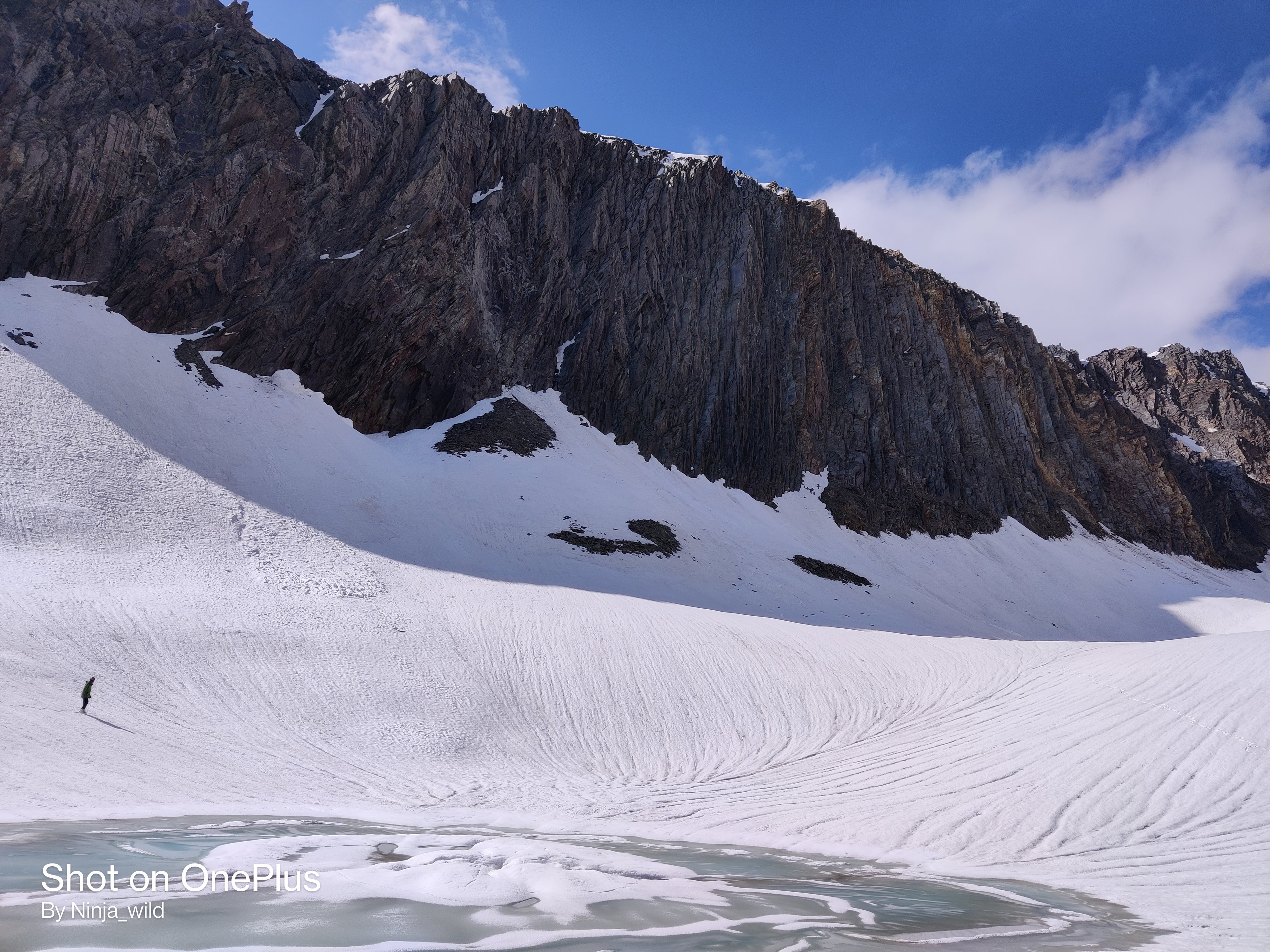
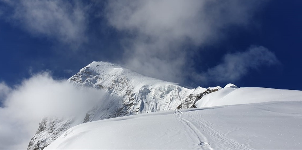
Satopanth (also written Satopath) is a revered 7,075-metre peak in the Garhwal Himalaya, located in the Chamoli district of Uttarakhand. The mountain rises magnificently above the Satopanth Glacier and the sacred Satopanth Lake, a turquoise glacial lake at 4,400 m that is a major pilgrimage destination for Hindus (believed to be where Brahma, Vishnu, and Shiva meditate). The name itself means 'Path of Truth' in Sanskrit.
Satopanth is a serious high-altitude objective with significant objective hazard from seracs and crevasses on its southern and western faces. The normal route follows the Satopanth Glacier before tackling steep snow and ice slopes to reach the summit pyramid. It demands full expedition infrastructure, reliable weather forecasting, and an experienced team.
• Day 1–2: Haridwar → Joshimath (1,890 m) — acclimatisation, permit check
• Day 3: Joshimath → Badrinath (3,133 m) — drive via Vishnuprayag
• Day 4: Badrinath → Mana village (3,220 m) → Laxmivan camp (3,500 m)
• Day 5: Laxmivan → Chakratirtha (4,000 m)
• Day 6: Chakratirtha → Satopanth Lake / Base Camp (4,400 m)
• Day 7–8: Acclimatisation at Base Camp; load carries
• Day 9: Base Camp → Camp I (5,200 m) — glacier entry, crevasse navigation
• Day 10: Camp I → Camp II (6,000 m) — steep snowfield, serac avoidance
• Day 11: Camp II → Camp III / High Camp (6,500 m)
• Day 12: Summit Push → 7,075 m summit → return to Camp II
• Day 13–16: Descent and return to Joshimath
|
Parameter |
Details |
|
Alpine Grade |
D (Difficile) — Serious Alpine |
|
Max Slope Angle |
50–60° on summit pyramid; 40° on upper glacier |
|
Glacier Travel |
Extensive — Satopanth Glacier with severe crevasse and serac hazard |
|
Rock Character |
Mixed granite/gneiss; compact but exposed upper ridge |
|
Fixed Ropes |
Fixed ropes mandatory on summit pyramid (200–400 m) |
|
Rappel Required |
2–3 rappels on descent (25–40 m each) |
• Pre-Monsoon: May to mid-June — best snow conditions, acceptable weather
• Post-Monsoon: Mid-September to October — clearest skies, cold temperatures
• Avoid: July–August (heavy monsoon, avalanche risk, floods on approach road)
• Nearest Railhead: Haridwar / Rishikesh
• Nearest Airport: Jolly Grant Airport, Dehradun (~300 km from Badrinath)
• Road: Haridwar → Rishikesh → Devprayag → Rudraprayag → Chamoli → Joshimath → Badrinath (300 km, 10–12 hrs)
• Trek: Badrinath → Mana → Base Camp: 2 days on foot
• IMF Mountaineering Permit — mandatory for all expeditions
• National Park Entry Permit — Nanda Devi Biosphere Reserve buffer zone (applicable for some approach variations)
• Uttarakhand Forest Department — for camping within sanctuary limits
• ITBP/Army Check Post at Mana village — identity verification and expedition log
• Foreign Nationals — no Restricted Area Permit (RAP) needed; standard IMF foreign permit applies
|
Fee Category |
Indian Nationals (₹) |
Foreign Nationals (USD) |
|
Peak Royalty (per team) |
₹ 8,000 – ₹ 15,000 |
$300 – $600 |
|
Per Climber Royalty |
₹ 3,000 – ₹ 5,000 |
$120 – $200 |
|
Rescue Deposit |
₹ 75,000 – ₹ 1,00,000 |
$1,500 – $2,000 |
|
Environment / Garbage |
₹ 1,000/person |
$20/person |
★★★★★ Expert | Fitness Level: Expert Alpinist
• Prior summits above 6,500 m mandatory — 7,000 m experience preferred
• Full technical alpine competence: leading mixed terrain, serac navigation, crevasse rescue
• Expedition fitness: 10–12 hour summit days with 12–18 kg load
• Mental resilience for multi-day exposure above 6,000 m
• High-altitude physiology: understanding of acclimatisation and HACE/HAPE treatment
Altitude: 6,250 m (20,505 ft) State: Ladakh (J&K UT) Range: Zanskar Range
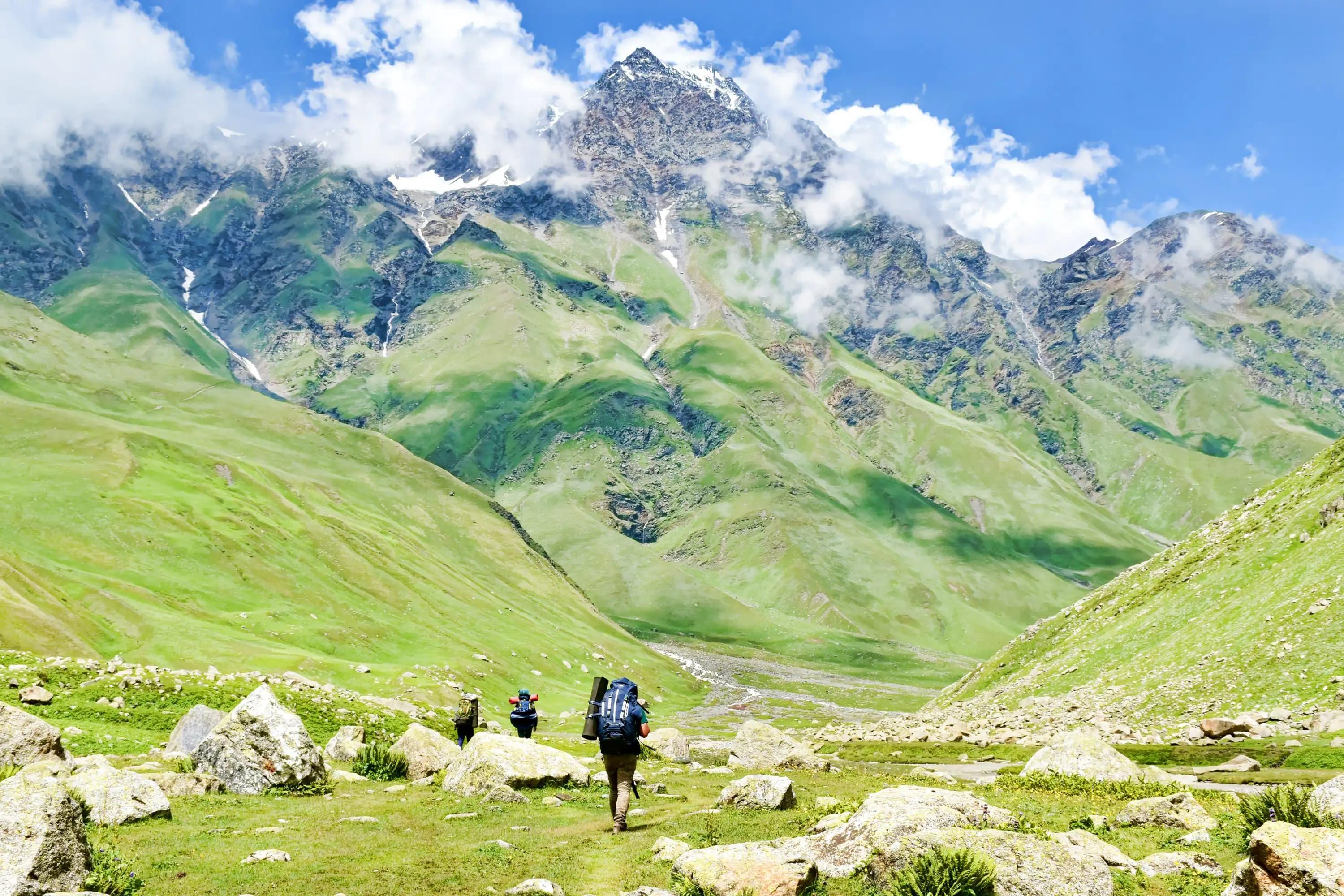
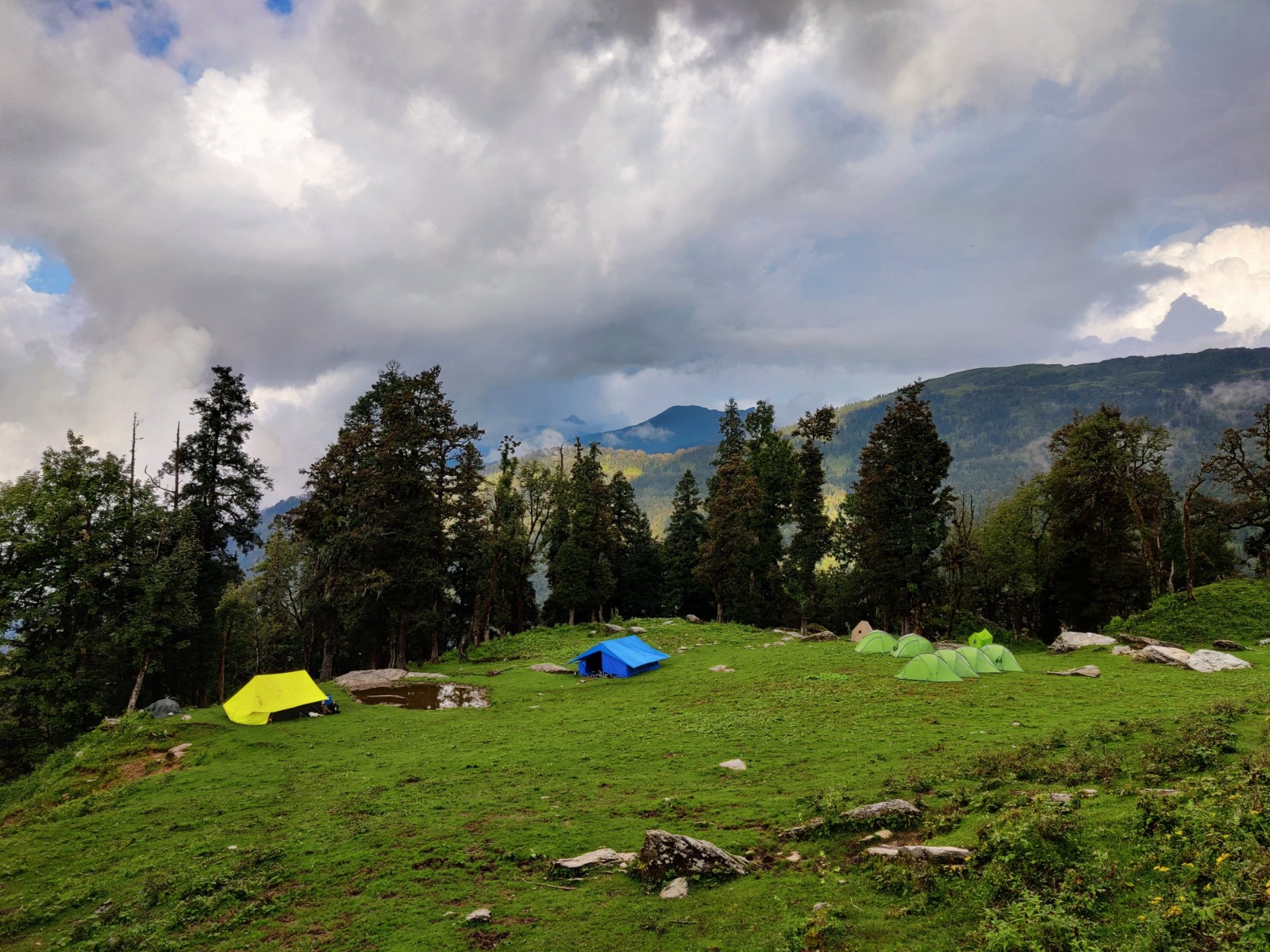
Kang Yatse II is the accessible twin of Kang Yatse I (6,400 m) in the Markha Valley of Ladakh. Though it stands at 6,250 m, it is consistently classified alongside 7,000m-class expedition objectives due to the extreme high-altitude environment of Ladakh (base camps start at 4,800 m), challenging approach through the Markha Valley, and the technical nature of the upper mountain. It is one of the most popular high-altitude objectives in India's trans-Himalayan region.
The Markha Valley approach itself is a classic high-altitude trek, passing through Hemis National Park with chances of spotting snow leopard, bharal (blue sheep), and Tibetan wolves. The summit provides a jaw-dropping 360° panorama of Stok Kangri, Karakoram peaks, and the Zanskar range.
• Day 1–2: Arrive Leh (3,500 m) — mandatory acclimatisation (do NOT trek on arrival)
• Day 3: Short acclimatisation hike to Leh viewpoints (3,800–4,000 m)
• Day 4: Leh → Chilling (3,150 m) by vehicle → trek to Skiu (3,350 m)
• Day 5: Skiu → Markha village (3,770 m)
• Day 6: Markha → Hankar (4,000 m)
• Day 7: Hankar → Nimaling Plateau (4,700 m) — Base Camp vicinity
• Day 8–9: Base Camp / Advanced Base Camp (4,900–5,100 m); acclimatisation and route fixing
• Day 10: ABC → Camp I (5,500 m) — steep moraine and snow
• Day 11: Camp I → Summit (6,250 m) → descend to Base Camp — 6–9 hr round trip from Camp I
• Day 12–14: Return via Markha Valley or Kongmaru La to Leh
|
Parameter |
Details |
|
Alpine Grade |
PD+ to AD (Moderate-Serious) |
|
Max Slope Angle |
40–50° on summit ridge; 30–35° on approach snowfields |
|
Glacier Travel |
Moderate — snow and ice couloir; some crevasse risk |
|
Rock Character |
Granite boulders on approach; compact snow on upper ridge |
|
Fixed Ropes |
Fixed ropes on final 200 m summit couloir |
|
Rappel Required |
1 rappel on descent (~20 m) |
• June to mid-October — Markha Valley and Leh region accessible
• July–August: Trek is open but snow conditions on peak may be softer
• Best Summit Window: Late September to mid-October — cold, clear, firm snow
• Avoid: November to May (valley snowbound, extreme cold)
• Nearest Airport: Kushok Bakula Rimpochee Airport, Leh (direct flights from Delhi, Mumbai, Srinagar)
• Road: Manali–Leh Highway (2 days, seasonal) or Srinagar–Leh Highway (2 days)
• Markha Valley Trek Start: Chilling (drive from Leh ~2 hrs via Zingchen road)
• Inner Line Permit (ILP): Not required for Markha Valley core route
• IMF Mountaineering Permit — mandatory
• Hemis National Park Entry Permit — required (obtained at Leh or Spituk checkpost)
• Ladakh Forest Department Wildlife Camping Permit — for camping within HNP
• Protected Area Permit: NOT required for standard Markha Valley approach
• Foreign Nationals: No RAP required; IMF permit + HNP entry covers access
|
Fee Category |
Indian Nationals (₹) |
Foreign Nationals (USD) |
|
Peak Royalty (per team) |
₹ 4,000 – ₹ 7,000 |
$150 – $300 |
|
Per Climber Royalty |
₹ 1,500 – ₹ 3,000 |
$60 – $120 |
|
Rescue Deposit |
₹ 30,000 – ₹ 50,000 |
$600 – $1,000 |
|
Environment / Garbage |
₹ 1,000/person |
$20/person |
★★★☆☆ Intermediate-Advanced | Fitness Level: Intermediate-Advanced
• BMC/AMC course graduate or equivalent practical experience
• Prior high-altitude trekking to 5,000–5,500 m strongly recommended
• Comfortable with crampons, ice axe, and glacier travel in a roped team
• Ladakh's high base altitude (3,500 m) makes acclimatisation critical — minimum 3 nights in Leh before trek
• Good general fitness: 8–10 hr summit days carrying 10–14 kg
Altitude: 6,543 m (21,467 ft) State: Uttarakhand Range: Gangotri Group, Garhwal Himalaya
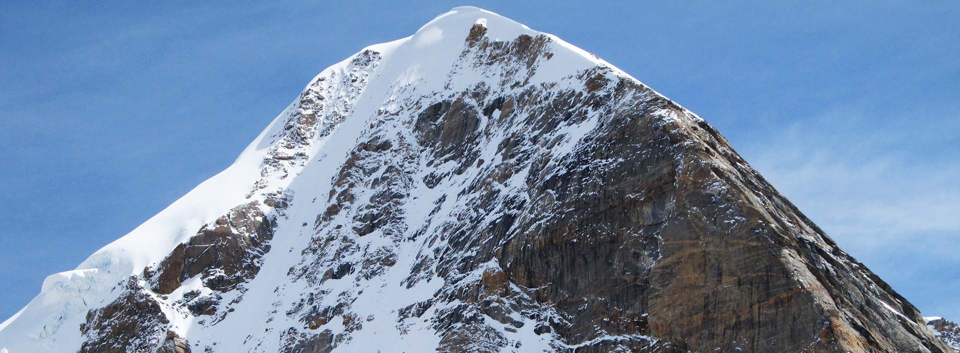
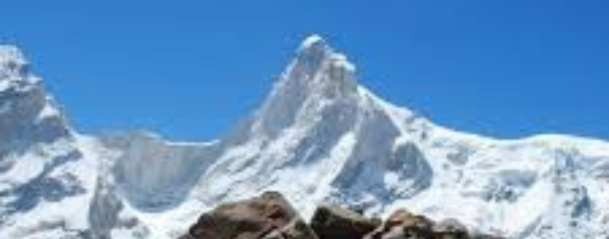
Shivling is arguably the most beautiful mountain in the Indian Himalaya. Its razor-sharp granite spire, soaring above the Gangotri Glacier and the sacred town of Gangotri (the source of the Ganges), has made it one of the most photographed and desired summits in Asia. Shivling is named for its resemblance to a Shivalinga — the sacred symbol of Lord Shiva — and holds deep religious significance for Hindus.
Technically, Shivling is one of the most demanding peaks of its height class anywhere in the world. Its summit ridges are narrow, corniced, and severely exposed. Routes involve high-quality granite rock climbing, sustained ice work, and mixed terrain. It has attracted mountaineers of the calibre of Chris Bonington, Doug Scott, and India's finest alpinists. Only experienced and well-equipped teams should attempt it.
• Day 1–2: Haridwar / Rishikesh → Uttarkashi (1,150 m) — acclimatisation rest
• Day 3: Uttarkashi → Gangotri (3,100 m) — drive (~100 km, 4–5 hrs)
• Day 4: Gangotri → Chirbasa (3,600 m) — trek begins
• Day 5: Chirbasa → Bhojbasa (3,800 m)
• Day 6: Bhojbasa → Tapovan (4,460 m) — Shivling Base Camp, spectacular meadow
• Day 7–9: Acclimatisation at Tapovan, glacier reconnaissance, load carries
• Day 10: Tapovan → Camp I (5,200 m) — moraine and Meru Glacier crossing
• Day 11: Camp I → Camp II (5,800 m) — NW Ridge, increasingly technical
• Day 12: Camp II → High Camp (6,200 m) — narrow exposed ridge, mixed terrain
• Day 13: Summit Day (6,543 m) — summit ridge, knife-edge traverse, return to Camp II
• Day 14–17: Descent and return to Uttarkashi
|
Parameter |
Details |
|
Alpine Grade |
TD (Très Difficile) — Very High Technical Demand |
|
Max Slope Angle |
55–70° on upper ridges; 45–55° on approach ice slopes |
|
Glacier Travel |
Extensive glacier travel; crevasse and serac hazard on Meru/Gangotri Glacier |
|
Rock Character |
Excellent quality Garhwal granite — UIAA IV–VI on rock sections |
|
Fixed Ropes |
300–600 m of fixed ropes on standard route; more on technical variations |
|
Rappel Required |
Multiple rappels on descent (up to 5–6, 30–50 m each) |
|
Special Hazards |
Corniced summit ridge, stone and icefall from upper faces, sudden weather changes |
• Pre-Monsoon: Mid-May to mid-June — classic window, good rock conditions
• Post-Monsoon: September to mid-October — clearer weather, colder temperatures
• Avoid: Monsoon season entirely — extreme precipitation, dangerous glacier conditions
• Nearest Railhead: Haridwar / Rishikesh
• Nearest Airport: Jolly Grant Airport, Dehradun (~220 km from Gangotri)
• Road: Dehradun → Uttarkashi → Harsil → Gangotri (~220 km, 8–9 hrs)
• Trek: Gangotri → Tapovan Base Camp: 3 days (20 km one way)
• IMF Mountaineering Permit — mandatory; apply well in advance (peak is in high demand)
• Gangotri National Park Entry — required; obtained at Gangotri
• Forest Department Camping Permit — for Tapovan and beyond
• Uttarakhand Tourism Department Registration — at Gangotri checkpost
• Foreign Nationals — no RAP; IMF foreign expedition permit applies
• Note: Certain higher and steeper technical routes on Shivling may require additional environmental impact assessment submissions to IMF
|
Fee Category |
Indian Nationals (₹) |
Foreign Nationals (USD) |
|
Peak Royalty (per team) |
₹ 10,000 – ₹ 20,000 |
$400 – $800 |
|
Per Climber Royalty |
₹ 4,000 – ₹ 6,000 |
$150 – $250 |
|
Rescue Deposit |
₹ 1,00,000 – ₹ 1,50,000 |
$2,000 – $3,000 |
|
Environment / Garbage |
₹ 1,000/person |
$20/person |
★★★★★ Expert Alpinist | Fitness Level: Elite Technical Mountaineer
• Minimum: 3 prior Himalayan expeditions with summits above 6,000 m
• Rock climbing ability: UIAA IV+ / 5.8 at altitude is essential
• Ice and mixed climbing competence: WI3–WI4 class ice work required
• Self-sufficient alpine skills: route-finding on technical terrain, independent rope management
• Psychological readiness for extreme exposure and commitment at altitude
• 10–14 hour summit days at 6,000+ m with full technical rack
Altitude: 7,756 m (25,446 ft) State: Uttarakhand Range: Garhwal Himalaya (Zaskar Range)
Kamet is the third-highest peak in India and the highest peak entirely within Indian territory open for commercial expeditions. At 7,756 m, it was first climbed in 1931 by Frank Smythe's expedition — the highest peak climbed at that time. It dominates the Chamoli district of Uttarakhand, near the India-China (Tibet) border, and is visible from as far as Joshimath on a clear day.
Kamet is a true 7,000m+ expedition requiring full high-altitude logistics: multiple camps, supplemental oxygen protocols (recommended above 7,000 m), experienced high-altitude guides, and detailed weather forecasting. The mountain is less crowded than Everest or Kangchenjunga but demands the same level of preparation. Its normal route via the Meade's Col is long but relatively non-technical compared to its formidable-looking faces.
• Day 1–3: Delhi → Joshimath (1,890 m) — drive via Haridwar, acclimatise
• Day 4: Joshimath → Niti village (3,600 m) — drive on Inner Line (permit required)
• Day 5–6: Niti → Base Camp at Vasudhara Tal (4,800 m) — 2-day trek
• Day 7–10: Acclimatisation rotations; establish Camp I (5,600 m)
• Day 11–13: Camp I rotations; establish Camp II at Meade's Col (6,100 m)
• Day 14–16: Camp II rotations; establish Camp III (6,800 m)
• Day 17–18: Camp III → High Camp (7,100 m)
• Day 19: Summit Day — High Camp to 7,756 m summit — 10–14 hrs round trip
• Day 20–24: Descent and return to Joshimath
|
Parameter |
Details |
|
Alpine Grade |
PD to AD — Moderate for altitude class; serious high-altitude commitment |
|
Max Slope Angle |
35–50° on upper slopes; significant altitude makes all terrain harder |
|
Glacier Travel |
Extensive — Purbi Kamet and Meade's Glacier; serious crevasse zones |
|
Rock Character |
Compact gneiss; mostly snow/ice above Camp II |
|
Fixed Ropes |
Fixed ropes on steeper sections above Meade's Col |
|
Rappel Required |
2–3 rappels on descent route |
|
Supplemental O2 |
Strongly recommended above 7,200 m; mandatory for summit push for most climbers |
• May to mid-June: Pre-monsoon — primary window; established route in good condition
• September to mid-October: Post-monsoon — cold but clear; harder conditions above 7,000 m
• Expedition duration: Plan for 25–30 days minimum including buffer for weather
• Nearest Railhead: Haridwar (320 km)
• Nearest Airport: Jolly Grant, Dehradun
• Road: Haridwar → Joshimath → Niti village (border road, restricted access — Inner Line Permit required)
• Special Note: Niti village is in an Inner Line Permit zone near the India-China border — advance clearance from Joshimath SDM is mandatory
• IMF Mountaineering Permit — mandatory; expeditions must apply via IMF with full team details
• Inner Line Permit (ILP) — mandatory for all members (Indian and foreign) for Niti Valley access
• Uttarakhand Government clearance — via ILP from SDM Joshimath
• Ministry of Defence clearance — for foreign nationals (expeditions near the border)
• Liaison Officer — mandatory for all foreign expeditions
• Satellite phone and GPS registration — required for all expeditions above 7,000 m
|
Fee Category |
Indian Nationals (₹) |
Foreign Nationals (USD) |
|
Peak Royalty (per team) |
₹ 25,000 – ₹ 50,000 |
$1,000 – $2,000 |
|
Per Climber Royalty |
₹ 8,000 – ₹ 15,000 |
$300 – $600 |
|
Rescue Deposit |
₹ 2,00,000 – ₹ 3,00,000 |
$5,000 – $10,000 |
|
Environment / Garbage |
₹ 2,000/person |
$20/person |
★★★★★ Elite / 7000m+ Expedition | Fitness Level: Elite High-Altitude Mountaineer
• Mandatory: Prior summits of at least two 6,500+ m peaks
• Understanding of and capacity to manage supplemental oxygen systems
• Full expedition logistics experience: managing multiple camps, weather windows, team coordination
• Physical capacity for 12–15 hour days at 7,000+ m
• Medical: Recent VO2 max test; cardiac and pulmonary clearance recommended
Altitude: 7,120 m (23,360 ft) State: Uttarakhand Range: Kumaon Himalaya
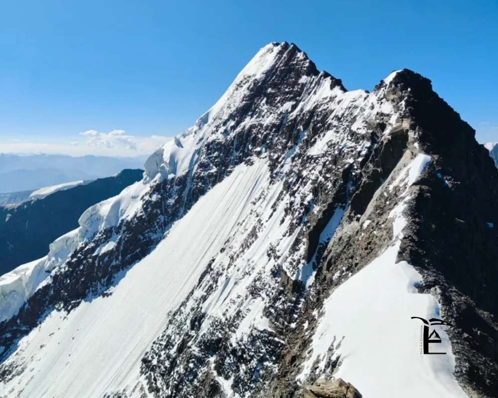
Trishul (meaning 'Trident' in Sanskrit, named for its three peaks resembling Lord Shiva's weapon) is a magnificent massif in the Kumaon Himalaya of Uttarakhand. The highest of its three summits, Trishul I at 7,120 m, was the first peak over 7,000 metres to be climbed in the world — by T.G. Longstaff's expedition in 1907. This historic achievement makes Trishul one of the most storied mountains in Himalayan history.
Trishul rises above the Pindar and Nandakini valleys, forming the western walls of the Nanda Devi Sanctuary. The mountain presents enormous faces on all sides, with the most feasible normal route approaching via the southeast ridge. It is a serious expedition requiring multiple high camps, careful weather management, and technical competence on mixed terrain.
• Day 1–3: Delhi → Almora → Bageshwar → Wan village (2,400 m)
• Day 4: Wan → Sutol (2,700 m)
• Day 5: Sutol → Didna (2,800 m)
• Day 6: Didna → Bedni Bugyal (3,354 m) — famous high-altitude meadow
• Day 7: Bedni Bugyal → Pathar Nachauni (3,700 m)
• Day 8–9: Pathar Nachauni → Base Camp (4,700 m) — Trishul Glacier approach
• Day 10–12: Acclimatisation; establish Camp I (5,500 m)
• Day 13–15: Camp I rotations; establish Camp II (6,200 m)
• Day 16–17: Camp II → Camp III / High Camp (6,700 m)
• Day 18: Summit day — High Camp → 7,120 m → return to Camp II
• Day 19–23: Descent to Wan; return to Almora/Delhi
|
Parameter |
Details |
|
Alpine Grade |
AD to D (Assez Difficile to Difficile) |
|
Max Slope Angle |
45–55° on upper face; 35–40° on SE Ridge |
|
Glacier Travel |
Trishul Glacier with moderate-serious crevasse hazard |
|
Rock Character |
Mixed rock and ice; compact gneiss above 6,000 m |
|
Fixed Ropes |
Fixed ropes above Camp II on steeper sections (400–600 m) |
|
Rappel Required |
2–3 rappels on descent |
|
Altitude Sickness Risk |
High — sustained time above 6,500 m; supplemental O2 recommended for summit day |
• May to mid-June: Pre-monsoon primary window
• September to October: Post-monsoon — cold but stable; Kumaon sees less post-monsoon precipitation than Garhwal
• Avoid: July–August entirely
• Nearest Railhead: Kathgodam (Haldwani) — 250 km from Wan
• Nearest Airport: Pantnagar Airport, Uttarakhand
• Road: Kathgodam → Almora → Bageshwar → Tharali → Wan (250 km, 9–11 hrs)
• IMF Mountaineering Permit — mandatory
• Nanda Devi Biosphere Reserve Permit — via Wildlife Institute of India/Forest Department
• Uttarakhand Forest Department permit for camping within reserve limits
• Note: Approach via Bedni Bugyal is within protected reserve — strict LNT protocols enforced
• Foreign Nationals — no RAP required; IMF foreign permit applies
|
Fee Category |
Indian Nationals (₹) |
Foreign Nationals (USD) |
|
Peak Royalty (per team) |
₹ 15,000 – ₹ 30,000 |
$600 – $1,200 |
|
Per Climber Royalty |
₹ 5,000 – ₹ 8,000 |
$200 – $350 |
|
Rescue Deposit |
₹ 1,50,000 – ₹ 2,00,000 |
$3,000 – $5,000 |
|
Environment / Garbage |
₹ 1,000/person |
$20/person |
★★★★★ Elite | Fitness Level: Expert High-Altitude Alpinist
• Prior 7,000 m expedition experience strongly preferred
• Technical competence on mixed terrain essential; ice work above 6,500 m
• Full expedition mentality: patient acclimatisation, weather window assessment, team management
• Supplemental oxygen training and equipment operation recommended
Altitude: 6,979 m (22,900 ft) State: Uttarakhand Range: Garhwal Himalaya
Neelkanth (also spelled Nilkantha) is one of the most sacred mountains in the Indian Himalaya, visible from the holy town of Badrinath as a stunning pyramid of rock and ice. Its name translates to 'Blue Throat,' one of Lord Shiva's epithets. Standing at 6,979 m, it sits just below the 7,000 m mark but is universally considered a 7,000m-class expedition due to its extreme technical difficulty — arguably the hardest mountain in this guide.
The mountain's four faces are uniformly steep and exposed. The normal route via the South Ridge is considered one of the most technically demanding 'normal routes' in the Indian Himalaya, involving sustained mixed climbing above 6,000 m. Neelkanth has repulsed many strong teams and should only be attempted by elite technical alpinists.
• Day 1–3: Delhi → Haridwar → Joshimath → Badrinath (3,133 m)
• Day 4: Badrinath → Pandukeshwar → trail to Neelkanth base
• Day 5–6: Trek to Base Camp (4,800 m) via Laxmivan and lateral moraine
• Day 7–9: Acclimatisation; reconnaissance of South Ridge approach
• Day 10: Base Camp → Camp I (5,600 m) — sustained rock and snow
• Day 11: Camp I → Camp II (6,200 m) — increasingly mixed, exposed ridge
• Day 12: Camp II → High Camp (6,600 m) — knife-edge ridge sections
• Day 13: Summit Push → 6,979 m summit → return (14–18 hour round trip from High Camp)
• Day 14–17: Descent and return to Badrinath
|
Parameter |
Details |
|
Alpine Grade |
ED (Extrêmement Difficile) — Extreme Technical |
|
Max Slope Angle |
60–75° on upper ridges; near-vertical rock steps |
|
Glacier Travel |
Moderate — Neelkanth Glacier approach; serious crevasse hazard |
|
Rock Character |
Superb Garhwal granite; UIAA V–VI rock pitches on ridge |
|
Fixed Ropes |
Extensive fixed ropes required on all approaches (500–800 m on South Ridge) |
|
Rappel Required |
4–6 rappels on descent (some 40–60 m on vertical sections) |
|
Special Note |
Considered by Indian alpinists as one of the most dangerous 6,000–7,000 m peaks in the Himalaya due to rockfall, ice, and weather exposure |
• Late May to mid-June: Only viable pre-monsoon window (short but best snow conditions)
• September to early October: Post-monsoon — rock drier but extremely cold at high camp
• Expedition duration: 20–25 days minimum
• Same approach as Satopanth: Haridwar → Joshimath → Badrinath
• From Badrinath: Trek to Neelkanth Base Camp (2 days, separate from Satopanth trail)
• Nearest Airport: Jolly Grant, Dehradun
• IMF Mountaineering Permit — mandatory (Neelkanth is a restricted peak requiring full expedition permit)
• Gangotri/Badrinath National Park permit — via Forest Department Chamoli
• Uttarakhand Tourism registration — at Badrinath checkpost
• Foreign Nationals — Ministry of Defence clearance may be required (proximity to Tibetan border)
|
Fee Category |
Indian Nationals (₹) |
Foreign Nationals (USD) |
|
Peak Royalty (per team) |
₹ 12,000 – ₹ 25,000 |
$500 – $1,000 |
|
Per Climber Royalty |
₹ 5,000 – ₹ 8,000 |
$200 – $350 |
|
Rescue Deposit |
₹ 1,50,000 – ₹ 2,00,000 |
$3,000 – $5,000 |
|
Environment / Garbage |
₹ 1,000/person |
$20/person |
★★★★★ Elite — Top 5% of Indian Alpinists | Fitness Level: Elite Technical Alpinist
• Rock climbing ability: UIAA V / 5.10 at altitude — not negotiable
• Ice climbing: WI4–WI5 class; ability to place and use ice screws for protection
• Multiple prior 6,500 m+ summits; ideally one 7,000 m summit
• Ability to function in a team of 3–4 over 15+ days above 5,000 m
Altitude: 6,816 m (22,362 ft) State: Himachal Pradesh Range: Kinnaur Himalaya / Zanskar Range
Reo Purgyil is the highest peak in Himachal Pradesh and one of the highest in the trans-Himalayan Kinnaur district. It sits near the India-China (Tibet) border at the triple junction of the Spiti, Kinnaur, and Tibetan regions. The name translates roughly to 'Great Lord' or 'Highest of the Gods' in local Kinnauri language. The peak is a restricted area mountain requiring special permits in addition to the standard IMF clearance.
Reo Purgyil offers spectacular views across the Spiti Valley, Pin Parvati Pass region, and deep into Tibet on clear days. The approach through the Kinnaur valleys is one of the most scenic in all of India. The mountain itself is a high-altitude snow and mixed peak with moderate technical difficulty relative to its height.
• Day 1–3: Delhi → Shimla → Rampur → Reckong Peo (2,670 m) — obtain ILP
• Day 4: Reckong Peo → Nako village (3,662 m) — base town
• Day 5: Nako → Khab (2,960 m) → approach trailhead
• Day 6–8: Trek to Base Camp (5,000 m) via Reo Purgyil Glacier approach
• Day 9–10: Acclimatisation; establish Camp I (5,700 m)
• Day 11–12: Camp I → Camp II (6,200 m)
• Day 13: Camp II → Summit (6,816 m) → return to Camp I (8–12 hr round trip)
• Day 14–16: Descent to Nako; return to Reckong Peo/Shimla
|
Parameter |
Details |
|
Alpine Grade |
PD+ to AD (Moderate-Serious) |
|
Max Slope Angle |
40–50° on summit snowfield; 30° on glacier approach |
|
Glacier Travel |
Reo Purgyil Glacier — moderate crevasse risk |
|
Rock Character |
High-altitude granite with compact snow and ice above 6,000 m |
|
Fixed Ropes |
Fixed ropes on summit snowfield (200–300 m) |
|
Rappel Required |
1–2 rappels on descent |
• June to mid-October: Kinnaur valley road is open
• Best Window: Late June to late September — stable high-altitude conditions
• Avoid: October onwards (severe cold and early winter snowfall at 6,800 m+); before June (border road closed)
• Nearest Airport: Shimla Airport (Jubbarhatti) or Bhuntar Airport, Kullu
• Nearest Railhead: Shimla (Kalka-Shimla narrow gauge) or Chandigarh
• Road: Shimla → National Highway 5 → Rampur → Jeori → Reckong Peo → Nako (~310 km from Shimla)
• Inner Line Permit mandatory — available at Reckong Peo or Shimla
• IMF Mountaineering Permit — mandatory
• Inner Line Permit (ILP) — mandatory for all (Indian and foreign nationals) for Kinnaur district border areas
• Protected Area Permit (PAP) — may be required depending on exact approach route and proximity to LAC
• HP Forest Department — camping permit for approach valleys
• Ministry of Home Affairs clearance — for foreign nationals (border area peak)
|
Fee Category |
Indian Nationals (₹) |
Foreign Nationals (USD) |
|
Peak Royalty (per team) |
₹ 10,000 – ₹ 20,000 |
$400 – $800 |
|
Per Climber Royalty |
₹ 4,000 – ₹ 7,000 |
$150 – $300 |
|
Rescue Deposit |
₹ 1,00,000 – ₹ 1,50,000 |
$2,000 – $3,500 |
|
Environment / Garbage |
₹ 1,000/person |
$20/person |
★★★★☆ Advanced | Fitness Level: Advanced Alpinist
• Prior summits of 6,000–6,500 m with glacier travel required
• High-altitude expedition experience: multi-day camps above 5,500 m
• Comfortable with crampons, ice axe, and roped glacier travel
• Good high-altitude acclimatisation capacity — critical given the remote approach and limited rescue infrastructure
Altitude: 6,451 m (21,165 ft) State: Himachal Pradesh Range: Kullu Himalaya / Bara Shigri area
Papsura (nicknamed 'The Peak of Evil' for its relentless reputation of difficulty) is a formidable peak in the Kullu district of Himachal Pradesh, located in the Kullu-Spiti watershed near the Bara Shigri Glacier. Despite its 6,451 m altitude placing it below the strict 7,000 m threshold, Papsura is consistently classed as a 7,000m-expedition-class objective due to the extreme technical demands of its routes, the remoteness of its base camp, and the challenging glacier approach.
The Papsura traverse and summit require sustained mixed climbing on some of the most demanding terrain in the Indian Himalaya. Routes are serious alpine undertakings with significant objective hazard from seracs and cornices. The mountain is famous for its near-vertical east face and the spectacular Papsura Glacier cirque.
• Day 1–2: Manali → Chandra Tal (4,270 m) — drive via Rohtang Pass or Atal Tunnel → Gramphu
• Day 3: Chandra Tal → Topko Gongma camp (4,600 m) — approach begins
• Day 4–5: Trek across Bara Shigri Glacier ablation zone to Papsura Base Camp (4,900 m)
• Day 6–8: Acclimatisation; glacier reconnaissance, establish Camp I (5,500 m)
• Day 9–10: Camp I → Camp II (6,000 m) — SW ridge steepens significantly
• Day 11: Summit Push → 6,451 m → return to Camp I (10–14 hr round trip)
• Day 12–14: Descent to Manali
|
Parameter |
Details |
|
Alpine Grade |
TD (Très Difficile) — Very Technical |
|
Max Slope Angle |
55–65° on SW Ridge; near-vertical on east face routes |
|
Glacier Travel |
Extensive Bara Shigri Glacier approach — serious crevasse and serac hazard |
|
Rock Character |
Compact Kullu granite; excellent rock quality but heavily iced in places |
|
Fixed Ropes |
300–500 m fixed ropes on SW Ridge standard route |
|
Rappel Required |
3–4 rappels on descent (30–50 m each) |
• May to mid-June: Road opens; good snow and ice conditions
• September to early October: Best post-monsoon window; cold and stable
• Avoid: July–August (heavy snowfall on approach road and glacier), late October (road closes)
• Nearest Airport: Bhuntar Airport, Kullu (Manali gateway)
• Road: Manali → Rohtang La (or Atal Tunnel) → Gramphu → Chandra Tal (~80 km from Manali)
• Trek: Chandra Tal → Bara Shigri Glacier → Papsura Base Camp: 2–3 days
• Note: Bara Shigri is the largest glacier in the Indian Himalaya outside of Ladakh — route-finding on the glacier requires experience
• IMF Mountaineering Permit — mandatory
• HP Forest/Wildlife Department permit — for travel through protected zones near Kullu-Spiti sanctuary
• District Administration permit — from SDM Kullu or Manali
• Foreign Nationals — no RAP required; standard IMF foreign permit applies
|
Fee Category |
Indian Nationals (₹) |
Foreign Nationals (USD) |
|
Peak Royalty (per team) |
₹ 8,000 – ₹ 15,000 |
$300 – $600 |
|
Per Climber Royalty |
₹ 3,000 – ₹ 5,000 |
$120 – $220 |
|
Rescue Deposit |
₹ 75,000 – ₹ 1,25,000 |
$1,500 – $2,500 |
|
Environment / Garbage |
₹ 1,000/person |
$20/person |
★★★★★ Expert Technical Alpinist | Fitness Level: Expert Alpinist
• Advanced technical rock and ice climbing: UIAA IV–V, WI3–WI4
• Multi-day high-altitude technical route experience mandatory
• Self-rescue capability: crevasse rescue, prussik ascent, anchor building on snow and ice
• Proven capacity on routes of this technical seriousness
Altitude: 7,135 m (23,409 ft) State: Ladakh (J&K UT) Range: Zanskar Range
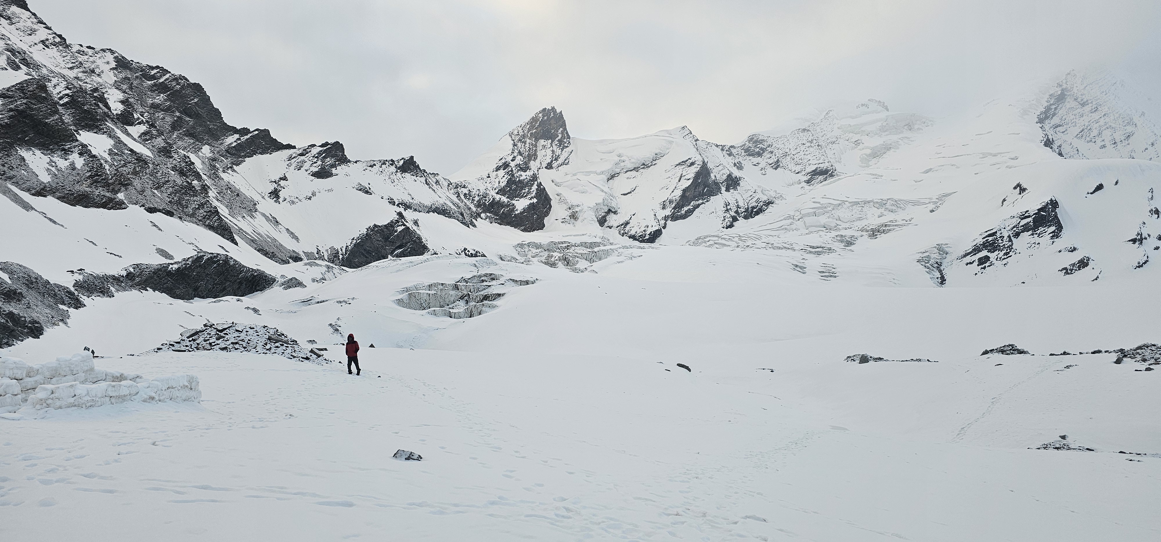
Mount Nun is the highest peak in the Zanskar Range and the highest peak in the Indian Himalaya outside of the Karakoram and Garhwal regions. At 7,135 m, it forms a twin massif with its neighbour Kun (7,077 m), the two peaks together known as the Nun-Kun massif. Nun was first climbed in 1953 by a French expedition, the same year as Everest's first ascent.
Nun is a serious but attainable 7,000m peak for well-prepared expedition teams. Its normal route via the western approach is technically moderate by 7,000m standards — mostly snow and ice with some crevassed glacier sections. The summit views encompass Karakoram, Zanskar, Ladakh, and on clear days even the Karakoram giants. It is considered the most accessible 7,000m peak in the western Himalaya.
• Day 1–3: Delhi → Srinagar → Kargil (2,676 m) — fly or drive; acclimatise in Kargil
• Day 4: Kargil → Parkachik village (2,900 m) — drive via Suru Valley
• Day 5–6: Parkachik → Base Camp at Shafat Glacier (4,000 m) — 2-day approach trek
• Day 7–9: Acclimatisation rotations; establish Camp I (5,000 m) on Shafat Glacier
• Day 10–12: Camp I rotations; establish Camp II (5,800 m)
• Day 13–14: Camp II → Camp III (6,400 m)
• Day 15: Camp III → Camp IV / High Camp (6,800 m)
• Day 16: Summit Day — High Camp to 7,135 m → return to Camp III (10–14 hrs)
• Day 17–20: Descent to Parkachik; return to Kargil/Srinagar
|
Parameter |
Details |
|
Alpine Grade |
PD to AD — Moderate for altitude class |
|
Max Slope Angle |
40–50° on upper snowfield; 30–35° on glacier approach |
|
Glacier Travel |
Extensive — Shafat and Nun Glacier; moderate crevasse hazard |
|
Rock Character |
Compact Zanskar gneiss; mostly snow and ice above Camp II |
|
Fixed Ropes |
Fixed ropes on upper snowfield (300–400 m) |
|
Rappel Required |
2–3 rappels on descent |
|
Supplemental O2 |
Recommended for summit day above 6,800 m; some strong climbers summit without, but risky |
• June to mid-October: Suru Valley accessible; Base Camp free of deep snow
• Best Summit Window: Late June to mid-September — before severe autumn cold sets in
• Avoid: October onwards (Kargil–Suru road may close due to early snowfall); before June (Zoji La pass may be closed)
• Nearest Airport: Sheikh ul-Alam Airport, Srinagar
• Road: Srinagar → Kargil via National Highway 1 (Zoji La, 200 km, 5–6 hrs)
• Kargil → Parkachik via Suru Valley road (50 km, 2 hrs)
• No Inner Line Permit required for Suru Valley approach (standard IMF permit sufficient)
• IMF Mountaineering Permit — mandatory
• J&K UT Forest Department camping permit — for approach and base camp
• District Administration registration — Kargil SDM office
• Foreign Nationals — no RAP required for standard approach; IMF foreign permit applies
• Liaison Officer — mandatory for foreign expeditions per IMF norms
|
Fee Category |
Indian Nationals (₹) |
Foreign Nationals (USD) |
|
Peak Royalty (per team) |
₹ 20,000 – ₹ 40,000 |
$800 – $1,600 |
|
Per Climber Royalty |
₹ 6,000 – ₹ 12,000 |
$250 – $500 |
|
Rescue Deposit |
₹ 1,50,000 – ₹ 2,50,000 |
$4,000 – $7,000 |
|
Environment / Garbage |
₹ 1,000/person |
$20/person |
★★★★★ Expert High-Altitude | Fitness Level: Expert High-Altitude Mountaineer
• Prior summits of 6,500–7,000 m required — at minimum one 6,800 m+ summit
• Full expedition fitness: 12–15 hour summit days, multi-week commitment
• Supplemental oxygen training and familiarity with oxygen systems recommended
• Team logistics capability: managing 4 camps, rotation schedules, weather assessment
Altitude: 7,077 m (23,219 ft) State: Ladakh (J&K UT) Range: Zanskar Range
Kun is the twin of Nun and second-highest peak of the Nun-Kun massif in the Zanskar Range of Ladakh. Standing at 7,077 m, Kun was first climbed in 1913 by an Italian team led by Mario Piacenza — making it one of the earliest 7,000m summits in the Indian Himalaya. Kun shares a similar approach and base camp with Nun, making joint Nun-Kun expeditions a popular objective for experienced 7,000m teams.
Compared to Nun, Kun is technically slightly more demanding, with a steeper and more exposed summit ridge. However, both peaks are approached via the Shafat Glacier and follow parallel routes to their respective summits. Kun rewards its summiteers with the same magnificent Zanskar panorama as Nun, with the added satisfaction of a slightly less-climbed and more technical achievement.
The approach is identical to Nun (Kargil → Parkachik → Shafat Glacier Base Camp). Route diverges above Camp II.
• Day 1–9: As per Nun itinerary to Camp II (5,800 m)
• Day 10: Camp II → Camp III Kun route (6,500 m) — diverges from Nun route at upper glacier
• Day 11: Camp III → High Camp (6,900 m) — exposed ridge; technical mixed terrain
• Day 12: Summit Day → 7,077 m → return to Camp II (12–16 hr round trip)
• Day 13–16: Descent to Parkachik; return to Kargil
|
Parameter |
Details |
|
Alpine Grade |
AD to D — More technical than Nun |
|
Max Slope Angle |
50–60° on summit ridge; 40–45° on upper slopes |
|
Glacier Travel |
Shared with Nun — Shafat Glacier; similar crevasse exposure |
|
Rock Character |
Zanskar gneiss; steeper ice sections near summit compared to Nun |
|
Fixed Ropes |
Fixed ropes on upper face (400–600 m; more than Nun) |
|
Rappel Required |
3–4 rappels on descent (some on near-vertical ice) |
|
Supplemental O2 |
More critical than Nun due to steeper summit push — strongly recommended above 6,900 m |
Identical to Nun — June to mid-September, via Kargil and Suru Valley (Parkachik trailhead). Kun teams often share base camp and acclimatisation schedules with Nun expeditions.
Identical to Nun: IMF Mountaineering Permit + J&K UT Forest camping permit + Kargil district registration. Foreign nationals: IMF foreign permit + Liaison Officer. No RAP required.
|
Fee Category |
Indian Nationals (₹) |
Foreign Nationals (USD) |
|
Peak Royalty (per team) |
₹ 20,000 – ₹ 40,000 |
$800 – $1,600 |
|
Per Climber Royalty |
₹ 6,000 – ₹ 12,000 |
$250 – $500 |
|
Rescue Deposit |
₹ 1,50,000 – ₹ 2,50,000 |
$4,000 – $7,000 |
|
Environment / Garbage |
₹ 1,000/person |
$20/person |
★★★★★ Expert High-Altitude (Harder than Nun) | Fitness Level: Expert High-Altitude Mountaineer
• All requirements as Nun, plus greater technical ice experience (WI3+ class)
• Experience with sustained mixed climbing at altitude (6,500–7,000 m)
• Supplemental oxygen operation experience strongly recommended
The following table provides a comprehensive side-by-side comparison across all critical parameters to help expedition planners select the appropriate objective.
|
Parameter |
Satopanth |
Kang Yatse II |
Shivling |
Kamet |
Trishul |
Neelkanth |
Reo Purgyil |
Papsura |
Nun |
Kun |
|
Alt. (m) |
7,075 |
6,250 |
6,543 |
7,756 |
7,120 |
6,979 |
6,816 |
6,451 |
7,135 |
7,077 |
|
State |
UK |
Ladakh |
UK |
UK |
UK |
UK |
HP |
HP |
Ladakh |
Ladakh |
|
Grade |
D |
PD+ |
TD |
AD |
AD-D |
ED |
PD+ |
TD |
PD-AD |
AD-D |
|
Duration |
20-25d |
12-14d |
20-25d |
28-35d |
22-27d |
20-25d |
15-20d |
14-18d |
22-28d |
22-28d |
|
Tech Climb |
Yes |
Basic |
Advanced |
Moderate |
Yes |
Extreme |
Moderate |
Advanced |
Moderate |
Yes |
|
Suppl. O2 |
Optional |
No |
No |
Recommended |
Recommended |
No |
No |
No |
Recommended |
Recommended |
|
Fitness |
★★★★★ |
★★★☆☆ |
★★★★★ |
★★★★★ |
★★★★★ |
★★★★★ |
★★★★☆ |
★★★★★ |
★★★★★ |
★★★★★ |
|
ILP Reqd |
No |
No |
No |
Yes |
No |
Maybe |
Yes |
No |
No |
No |
|
IMF Fees Indian |
₹11k+ |
₹5.5k+ |
₹14k+ |
₹33k+ |
₹20k+ |
₹17k+ |
₹14k+ |
₹11k+ |
₹26k+ |
₹26k+ |
|
Base Camp Alt |
4,400 m |
4,900 m |
4,460 m |
4,800 m |
4,700 m |
4,800 m |
5,000 m |
4,900 m |
4,000 m |
4,000 m |
|
Ideal For |
7000m aspirants |
Intermediate |
Elite alpinists |
8000m prep |
7000m exp |
Top alpinists |
HP border exp |
Technical exp |
First 7000m |
7000m experts |
UK = Uttarakhand | HP = Himachal Pradesh | ILP = Inner Line Permit | Fees shown as minimum (royalty + climber fee combined)
The Indian Mountaineering Foundation (IMF), established in 1958 and headquartered in New Delhi, is the apex statutory body regulating all mountaineering in India. No expedition to an IMF-listed peak is legal without an IMF permit. Here is the complete process.
• Visit www.indmount.gov.in — check the current list of open peaks and their seasonal windows
• Confirm your target peak is listed and open for your intended season
• For peaks near the India-China or India-Pakistan border (Kamet, Reo Purgyil, Kun, Nun) — check for additional Ministry of Defence or Home Affairs requirements
• Peaks within National Parks (Gangotri NP for Shivling, Nanda Devi BR for Satopanth/Trishul) require additional forest clearances beyond IMF permit
• Minimum team size: 4 members for most 7,000m+ peaks
• Appoint an official Team Leader (TL) — all correspondence with IMF goes via TL
• IMF Membership: All members must hold valid IMF membership (annual: ₹300; life: ₹2,000)
• Documents required per member: (a) Medical fitness certificate from MBBS doctor; (b) Prior mountaineering experience proof — summit certificates, NIM/HIM/ABVIMAS course certificates; (c) 2 passport-size photographs; (d) Copy of Aadhaar/Passport
• For 7,000m+ peaks: Proof of prior 6,000 m+ summits required; for Kamet and Trishul: 6,500 m+ experience documentation expected
• All team members must carry comprehensive mountaineering insurance
• Coverage must include: High-altitude rescue (helicopter), medical evacuation, repatriation of remains
• For Indian nationals: Minimum ₹15–25 lakh coverage recommended (varies by peak)
• For Foreign nationals: Minimum USD 50,000 rescue/evacuation coverage mandated by IMF
• Recommended insurers (India): United India Insurance, Oriental Insurance, Star Health — adventure sports rider
• International: AIG, Ripcord, World Nomads — confirm they explicitly cover altitude rescue above 6,500 m
• Complete the IMF Expedition Application Form (download from www.indmount.gov.in)
• Form includes: Peak name, dates, route description, team details, equipment list, communication devices
• Submit the form in person or by registered post to IMF, New Delhi
• For expeditions to peaks above 7,000 m — submit at least 4–6 months in advance; popular windows fill up
• Foreign expeditions: Submit 6–8 months in advance with all required government clearances
• Processing time: Domestic teams 3–5 weeks; Foreign teams 6–10 weeks
• Pay via Demand Draft (DD) in favour of 'Indian Mountaineering Foundation' payable at New Delhi
• Alternatively, NEFT/RTGS transfer — get bank details from IMF accounts section
• Fee components: (1) Peak royalty; (2) Per-climber fee; (3) Rescue deposit (refundable); (4) Environment/garbage deposit (refundable on submission of clean expedition report)
• Liaison Officer fee: Government staff salary (₹8,000–15,000/month); all logistics (food, equipment, transport) covered by the expedition
|
Peak |
State/Local Permit |
Issuing Authority |
|
Satopanth |
Forest + NP entry |
DFO Chamoli, Uttarakhand |
|
Kang Yatse II |
Hemis NP entry |
Leh Wildlife Warden, Ladakh |
|
Shivling |
Gangotri NP entry |
DFO Uttarkashi, Uttarakhand |
|
Kamet |
ILP + MoD clearance |
SDM Joshimath + MoD, New Delhi |
|
Trishul |
Nanda Devi BR permit |
DFO Chamoli + WII |
|
Neelkanth |
National Park entry |
DFO Chamoli |
|
Reo Purgyil |
ILP mandatory |
SDM Reckong Peo, Kinnaur HP |
|
Papsura |
Forest camping permit |
DFO Kullu / SDM Manali, HP |
|
Nun |
J&K UT Forest permit |
DFO Kargil, UT Ladakh |
|
Kun |
J&K UT Forest permit |
DFO Kargil, UT Ladakh |
• Collect the official IMF permit letter from IMF headquarters in New Delhi (or receive by post for expeditions applying from outside Delhi)
• Attend mandatory pre-expedition briefing with IMF liaison officer if applicable
• Carry originals + 3 certified copies of the permit — leave one with contact at home, carry two on expedition
• Show permit at all checkposts (forest gate, army checkpost, ITBP post) — failure to show can result in forced descent
• Submit post-expedition report within 60 days of return (required to claim environment deposit refund)
|
Detail |
Information |
|
Address |
Benito Juarez Marg, New Delhi – 110 021 |
|
Phone |
011-24119055 / 011-24110310 |
|
|
imfnewdelhi@gmail.com |
|
Website |
www.indmount.gov.in |
|
Hours |
Mon–Fri: 9:00 AM – 5:30 PM (IST) |
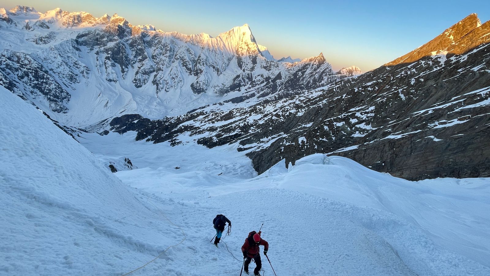
Expeditions to 7,000m peaks enter a physiological zone where the human body cannot permanently acclimatise. The death zone begins at approximately 8,000 m, but serious physiological deterioration starts well below 7,000 m with prolonged exposure. The following precautions are non-negotiable.
• Extended rotation schedule: Multiple ascents and descents between camps over 2–3 weeks — never rush
• The 300 m rule: Sleep no more than 300 m higher than previous night above 3,000 m altitude
• Rest day after every 3 days of gain — minimum one full day at each camp level
• Rotation to Camp I and back before sleeping at Camp I — essential for high-altitude adaptation
• Monitor resting SpO2 (blood oxygen saturation) daily with a pulse oximeter — values below 75% at a given altitude warrant a rest day; below 60% consider descent
• Typical acclimatisation SpO2 benchmarks: Base Camp (~4,500 m) 85–92%; Camp I (~5,500 m) 78–86%; Camp II (~6,000 m) 72–80%
• Lake Louise AMS Score: Headache (mandatory symptom) PLUS any of — nausea/vomiting, fatigue, dizziness, poor sleep
• Mild AMS (Score 3–5): Rest at current altitude; increase fluid intake; Ibuprofen 400 mg for headache; NO further ascent until asymptomatic
• Moderate AMS (Score 6–9): Mandatory descent of at least 500 m; consider Acetazolamide (Diamox 250 mg BD) under medical supervision; supplemental O2 if available
• Severe AMS: Immediate descent regardless of conditions — this is an emergency, not a tactical decision
• Signs: Severe refractory headache + ataxia (stumbling, loss of coordination) + altered consciousness
• The Tandem Gait Test: Ask the patient to walk heel-to-toe in a straight line — inability to do so is diagnostic of HACE
• Action: (1) IMMEDIATE descent — minimum 1,000 m; (2) Dexamethasone 8 mg IV/IM STAT, then 4 mg every 6 hrs; (3) Supplemental oxygen at 2–4 L/min; (4) Gamow bag if descent delayed; (5) Emergency helicopter evacuation
• HACE can progress from confusion to coma in hours — do not wait for morning
• Signs: Breathlessness at rest (not just on exertion); dry cough progressing to gurgling sounds; pink or frothy sputum; reduced exercise tolerance; cyanosis (blue lips)
• HAPE is the leading cause of high-altitude death — more common than HACE and faster in onset
• Action: (1) IMMEDIATE descent — even 500 m can be life-saving; (2) Nifedipine 30 mg slow-release; (3) Supplemental oxygen at 4–6 L/min; (4) Gamow bag; (5) Immediate helicopter evacuation
• Do not allow a HAPE patient to exert — if necessary, lower by stretcher or improvised sled
• Mild (32–35°C core temp): Shivering, confusion, poor coordination — insulate, add hot fluids, remove from wind
• Moderate (28–32°C): Rigid muscles, semi-consciousness — handle gently (cardiac risk), horizontal rescue only, warm IV fluids if available
• Severe (<28°C): No shivering, unconscious — do not assume death until 'warm and dead'; rewarming in hospital
• Prevention: Layer system with expedition-grade down (rated -30°C), vapour barrier liners for feet in extreme cold, chemical heat packs for hands and core in emergency
• Prevention: Never allow skin exposure above 5,500 m in wind; 3-layer hand system; toe warmers on summit day; regular buddy checks for white/grey skin patches
• Field treatment of superficial frostbite: Rewarm against warm skin (axilla, groin) — do NOT rub, do NOT use fire or stove
• Deep frostbite: Do NOT rewarm in field unless refreezing is impossible — partial thaw followed by refreezing causes massive tissue destruction
• Ibuprofen 400 mg + Aspirin 325 mg on evacuation — reduces thromboxane and improves microvascular perfusion
• Mark frostbitten digits with felt-tip pen and photograph for medical reference; evacuate to hospital for definitive care including possible iloprost infusion
• Terrain assessment: Most dangerous zones — 30–45° slopes, convex rollers, below cornices, in gullies and couloirs after snowfall
• Timing: Travel on steep terrain in early morning (before solar warming softens snow bonds) and in stable conditions only
• Each team member must carry: ABS transceiver (switched to 'transmit' at all times), 240 cm+ avalanche probe, shovel
• Burial protocol: (1) All beacons to 'search'; (2) Grid search by multiple rescuers; (3) Probe to locate depth; (4) Dig from downhill; (5) Clear airway immediately upon exposure
• At 7,000m avalanche rescues are extraordinarily difficult — prevention is paramount. If in doubt, wait.
• Satellite phone: Iridium (global coverage) or BGAN terminal — mandatory for all 7,000m expeditions
• Personal Locator Beacon (PLB): 406 MHz PLB per team — activates global satellite rescue system
• Emergency contacts to pre-register: (1) IMF Emergency: 011-24119055; (2) High Altitude Warfare School, Gulmarg: +91-1954-253190; (3) SDRF Uttarakhand: 1070; (4) HP Police (Manali): +91-1902-252340; (5) Kargil Police: +91-1985-232225
• Helicopter base camps: Gauchar (Garhwal); Chinyalisaur (Uttarkashi); Leh; Kullu — know which is nearest to your area
• Weather forecasting: Subscribe to expedition weather forecasts (MeteoGroup, Mountain Forecast, Meteoblue) — 3-day summit window minimum
• Flow rates: Sleeping 0.5–1 L/min; rest/eating 1–2 L/min; climbing 2–4 L/min; medical emergency 4–6 L/min
• Oxygen systems: Open circuit (most common — Poisk, Summit Oxygen); closed circuit (rarely used)
• Regulator and mask: Test system 2 days before summit push; have backup regulator
• Carry calculation: For Kamet/Nun/Kun — plan 4–6 bottles per climber for summit push; add 20% buffer
• Sherpa/guide oxygen: Ensure your team's support guides also have adequate oxygen — their safety enables your safety
7,000m peak expeditions demand peak physical conditioning, technical skill, and psychological resilience across multiple domains. Below is the comprehensive framework used by India's top mountaineering institutes.
|
Level |
Rating |
Description |
|
Beginner |
★★☆☆☆ |
Regular trekker; 3,500–4,500 m experience; no technical skills. Suitable for 5,500–6,000 m non-technical peaks only. |
|
Intermediate |
★★★☆☆ |
BMC/AMC graduate; 4,500–5,500 m experience; glacier travel, crampons, ice axe. Suitable for Kang Yatse II and similar. |
|
Advanced |
★★★★☆ |
Prior 6,000–6,500 m summits; glacier competence; basic mixed climbing. Suitable for Reo Purgyil, Satopanth approach. |
|
Expert Alpinist |
★★★★★ |
Multiple 6,500+ m summits; full technical ice/mixed; expedition logistics. Kamet, Trishul, Nun, Kun, Papsura, Satopanth. |
|
Elite / 7k+ |
★★★★★+ |
7,000 m summit experience; supplemental O2 competence; technical 7,000 m rock/ice. Shivling, Neelkanth, Kamet. |
|
Fitness Metric |
Intermediate (Kang Yatse II) |
Advanced (Reo Purgyil) |
Expert (Nun/Kun/Satopanth) |
Elite (Kamet/Shivling) |
|
10 km run time |
< 70 min |
< 60 min |
< 55 min |
< 50 min |
|
Pack weight |
10–12 kg |
12–15 kg |
14–18 kg |
16–20 kg |
|
Daily hr at altitude |
7–9 hrs |
8–11 hrs |
10–14 hrs |
12–16 hrs |
|
Prior summit altitude |
5,000–5,500 m |
6,000–6,500 m |
6,500–7,000 m |
7,000 m+ |
|
Rock climbing grade |
Not required |
UIAA II–III |
UIAA III–IV |
UIAA V–VI |
|
Ice climbing |
Basic (WI1) |
WI2–WI3 |
WI3–WI4 |
WI4–WI5 |
|
Expedition length |
10–14 days |
15–20 days |
20–28 days |
28–35 days |
• Cardio: 4 sessions/week — 45–60 min at 65–75% max HR. Running, cycling, rowing, swimming
• Strength: 3 sessions/week — full body focus. Squats, deadlifts, lunges, pull-ups, rows
• Weekly long hike: 1 hike with 600–800 m elevation gain, 5–6 hrs, light pack (8–10 kg)
• Flexibility and mobility: 15–20 min daily stretching — hip flexors, hamstrings, ankles, shoulders
• Increase cardio to 5 sessions/week; introduce interval training (4×8 min at 85% HR with 3 min rest)
• Strength: Add weighted pack training (12–16 kg); step-ups on 50 cm box, 4×15 reps each leg
• Weekly hike: Increase to 800–1,200 m gain over 7–9 hrs; practice in mountaineering boots
• Technical training: Enrol in BMC/AMC at NIM, HIM, or ABVIMAS; practice crampon walks, ice axe arrest
• Introduce cross-training for high-altitude: Yoga (breathing, body awareness); altitude simulation masks optional
• Long hikes: 10–12 hrs with 1,200–1,500 m gain and 15–18 kg pack — mimics summit day
• 2-day backpack: Overnight camp with full expedition weight — physical and mental simulation
• VO2 max test at accredited sports clinic — aim for VO2 max above 48 mL/kg/min for 7,000m objectives
• Technical skills: Multi-pitch rock, glacier travel with crevasse rescue, roped team movement on steep snow
• Altitude simulation stay: If possible, spend a weekend at 3,500–4,000 m (Leh, Keylong, Munsiyari)
• Reduce volume 30–40% while maintaining quality and intensity — avoid fatigue entering expedition
• Final gear check and packing; full equipment dry-run with all technical and camping gear
• Medical check: Dental exam, ECG, spirometry, blood count, thyroid panel
• Mental preparation: Team briefing, emergency plan rehearsal, summit day rehearsal in mind
|
Institute |
Location |
Courses |
Contact |
|
NIM |
Uttarkashi, Uttarakhand |
BMC, AMC, SOC, MOC |
www.nimindia.net |
|
HIM |
Darjeeling, West Bengal |
BMC, AMC, Search & Rescue |
www.himdarjeeling.com |
|
ABVIMAS |
Manali, Himachal Pradesh |
BMC, AMC, Winter Skiing |
abvimas.hp.gov.in |
|
JIM |
Pahalgam, J&K |
BMC, AMC, River Rafting |
jimsport.jk.gov.in |
|
SIMSAS |
Leh, Ladakh |
BMC, High-Altitude Trekking |
Leh Sports Office |
BMC = Basic Mountaineering Course (14–28 days); AMC = Advanced Mountaineering Course; SOC = Search & Rescue Observer Course; MOC = Method of Instruction Course (for guides)
• Double plastic mountaineering boots (rated -40°C minimum) — essential above 6,000 m
• 12-point steel crampons (step-in, bail binding) — must be compatible with double boots
• Ice axe: Standard 60–65 cm for glaciers; technical axe (50 cm drooped pick) for steep ice
• 2 ice axes for peaks with Grade TD and above (Shivling, Papsura, Neelkanth)
• Ice screws: 4–6 per team (19 cm and 22 cm); warthog screws for marginal ice
• Helmet — CE EN 12492 certified alpine climbing helmet
• Harness — lightweight alpine harness with foam waist belt
• Belay/rappel device (ATC or Reverso) + large HMS carabiner
• 6–8 locking carabiners + 6–8 non-locking; 2–3 pulleys for crevasse rescue
• Slings: 4 × 120 cm + 2 × 60 cm per person
• Prussik cords: 2 × 6 mm × 5 m per person
• Rope: 60 m × 9–10 mm dry-treated (team equipment; 1 per 3 climbers)
• Avalanche transceiver (beacon), 240 cm probe, lightweight shovel — mandatory on glaciated peaks
• Oxygen bottles: 4–6 per climber for summit push on Kamet, Nun, Kun, Trishul
• Summit oxygen mask and regulator — test 48 hrs before summit day
• Sleeping mask for overnight use at high camp (reduces AMS risk significantly)
• Backup regulator — critical in case of primary failure
• Expedition down suit (one-piece or jacket + pants) rated -40°C — for summit day above 6,500 m
• Down jacket (primary) rated -20°C — for camp use and approaches above 5,500 m
• Hardshell jacket and bibs — Gore-Tex Pro or equivalent (20,000 mm waterproofing minimum)
• Fleece mid-layer (heavy) + light puffy vest — for camp insulation layering
• Moisture-wicking base layer (top + bottom) — merino wool or Polartec Power Dry
• Expedition mitts (outer) + insulated inner gloves + liner gloves — 3-layer hand system
• Balaclava (fleece) + windstopper balaclava + warm beanie + sun hat
• Goggles (Category 4 for glacier) + Category 4 sunglasses + spare pair
• Neoprene toe covers / electric heated insoles — for extreme cold on summit pushes
• 4-season expedition tent: rated to -40°C and 100+ km/h wind (Hilleberg, Mountain Hardwear, Black Diamond)
• Sleeping bag: -35°C rated down fill (900+ fill power) — essential for 7,000 m high camps
• Sleeping bag liner: VBL (vapour barrier) liner prevents moisture loss and adds 5–10°C warmth
• Foam sleeping pad + inflatable pad (R-value 5.0+) — two-pad system for extreme cold
• Stove system: MSR Whisperlite or Jetboil (pre-heat cartridge in sleeping bag); at least 3 fuel canisters per camp per day
• Pressure cooker: Speeds cooking and reduces fuel consumption at altitude
|
Category |
Contents |
|
AMS Management |
Ibuprofen 400 mg, Paracetamol 500 mg, Aspirin 325 mg (antiplatelet at altitude) |
|
HACE Emergency |
Dexamethasone 4 mg and 8 mg vials (IV/IM); Gamow bag (team equipment) |
|
HAPE Emergency |
Nifedipine 30 mg SR; portable oxygen concentrator (2L/min); Salmeterol inhaler |
|
Infection / GI |
Ciprofloxacin 500 mg; Azithromycin 500 mg; ORS sachets; Domperidone (anti-nausea) |
|
Frostbite |
Ibuprofen 400 mg; Aspirin; sterile gauze; Betadine; Aloe vera gel; non-adhesive dressings |
|
Monitoring |
Pulse oximeter (2 units); digital thermometer; blood pressure cuff; glucometer |
|
First Aid |
SAM splint; Israeli bandage; triangular bandage; medical tape; blister kit; suture kit (sterile) |
• 12 months before: Choose peak; begin fitness training; obtain IMF membership; contact reputable expedition operator or form team
• 10 months before: Begin IMF permit application process; book flights and travel logistics
• 8 months before: Confirm team; begin collecting technical gear; obtain insurance quotes
• 6 months before: Begin structured 6-month training program; attend mountaineering course if needed
• 4 months before: Submit all permit applications; finalize equipment list; arrange liaison officer logistics
• 3 months before: Medical examinations complete; gear testing at local altitude if possible
• 2 months before: Final gear purchase; team training weekend; emergency plan finalized
• 1 month before: Final medical check; final gear pack and weight test; travel documents ready
• 2 weeks before: Pre-expedition briefing; satellite phone tested; route info updated from recent expedition reports
• Helicopter rescue companies pre-contacted: Himalayan Heli Services (Dehradun); Pawan Hans Helicopters; Air Zermatt India; Global Rescue (for international SOS)
• Nearest hospitals for high-altitude emergencies: AIIMS Rishikesh (Garhwal peaks); SNM Hospital Leh (Ladakh peaks); Deen Dayal Upadhyay Hospital Shimla (HP peaks)
• Telemedicine: AIIMS Delhi high-altitude telemedicine service — available 24/7 for satellite consultation
• Evacuation fund: Hold minimum ₹5–10 lakh liquid emergency reserve per expedition accessible within 24 hours
• Carry all non-biodegradable waste back to Base Camp; contract a waste management operator for disposal
• Human waste: Establish a WAG bag system or designated latrine trench minimum 200 m from water source
• Fixed ropes: Remove all fixed ropes after expedition (IMF clean expedition protocol — deposit forfeit if not complied)
• Fuel: Use clean-burning stoves; never use wood fires above tree line; carry all fuel canisters back
• Post-expedition report: Mandatory within 60 days; include environmental assessment, waste management log, and summit report
The mountains do not care for your ambition — only your wisdom, preparation, and respect.
Climb high. Sleep low. Descend alive.